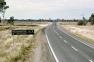
Clarke Creek, Queensland

Last updated

Clarke Creek
Queensland
Australia Queensland location map.svg
Red pog.svg
Clarke Creek
Coordinates 22°43′30″S149°18′50″E / 22.725°S 149.3138°E / -22.725; 149.3138 (Clarke Creek (centre of locality)) Coordinates: 22°43′30″S149°18′50″E / 22.725°S 149.3138°E / -22.725; 149.3138 (Clarke Creek (centre of locality))
Population32 (SAL 2021) [1]
Postcode(s) 4705
Area626.7 km2 (242.0 sq mi)
Time zone AEST (UTC+10:00)
LGA(s) Isaac Region
State electorate(s) Mirani
Federal division(s) Capricornia
Suburbs around Clarke Creek:
May Downs Lotus Creek St Lawrence
May Downs Clarke Creek Ogmore
Mackenzie River Mackenzie Mount Gardiner

Clarke Creek is a locality in the Isaac Region, Queensland, Australia. [2] It is situated between Mackay and Rockhampton on the Old Bruce Highway. In the 2021 census, Clarke Creek had a population of 32 people. [3]

Contents

History

Clarke Creek State School opened on 17 May 1971. [4] [5]

At the 2011 census, Clarke Creek was counted within the area of Valkyrie which had a population of 307. [6]

In the 2016 census, Clarke Creek had a population of 30 people. [7]

In the 2021 census, Clarke Creek had a population of 32 people. [3]

Economy

Most of the citizens in the area own or work on cattle stations for a living. There is a service station which many car and truck drivers rely on. At the service station there is also a caravan park used by many temporary road workers in the area.[ citation needed ]

Education

Clarke Creek State School is a government primary (Prep-6) school for boys and girls at May Downs Road ( 22°38′11″S149°15′10″E / 22.6365°S 149.2529°E / -22.6365; 149.2529 (Clarke Creek State School) ). [8] [9] In 2018, the school had an enrolment of 15 students with 3 teachers (2 full-time equivalent) and 6 non-teaching staff (2 full-time equivalent). [10] The school has a tennis court, swimming pool, oval, playground facilities and amenities.[ citation needed ]

There are no secondary schools in Clarke Creek nor nearby. Distance education and boarding school are options. [11]

Attractions

Clarke Creek is known for its campdrafting and many come to see this event.[ citation needed ]

Related Research Articles

<span class="mw-page-title-main">Walkerston, Queensland</span> Town in Queensland, Australia

Walkerston is a town and locality in Mackay Region, Queensland, Australia. The town is situated on the Peak Downs Highway 14 kilometres (8.7 mi) south-west of Mackay. In the 2016 census, Walkerston had a population of 3,403 people.

Bakers Creek is a rural town and coastal locality in the Mackay Region, Queensland, Australia. In the 2016 census, the locality of Bakers Creek had a population of 1,161 people.

Te Kowai is a rural locality in the Mackay Region, Queensland, Australia. In the 2016 census Te Kowai had a population of 218 people.

<span class="mw-page-title-main">Karara, Queensland</span> Town in Queensland, Australia

Karara is a rural town and locality in the Southern Downs Region, Queensland, Australia. In the 2016 census, the locality of Karara had a population of 123 people.

<span class="mw-page-title-main">Kobble Creek</span> Suburb of Moreton Bay Region, Queensland, Australia

Kobble Creek is a rural locality in the Moreton Bay Region, Queensland, Australia. In the 2016 census, Kobble Creek had a population of 632 people.

<span class="mw-page-title-main">Glenmorgan, Queensland</span> Town in Queensland, Australia

Glenmorgan is a rural town in the Western Downs Region and a locality split between the Western Downs Region and the Maranoa Region, Queensland, Australia. In the 2016 census the locality of Glenmorgan had a population of 148 people.

Coowonga is a rural locality in the Shire of Livingstone, Central Queensland, Australia. In the 2021 census, Coowonga had a population of 255 people.

Kurwongbah is a rural locality in the Moreton Bay Region, Queensland, Australia. In the 2016 census, Kurwongbah had a population of 1,430 people.

Racecourse is a suburb of Mackay in the Mackay Region, Queensland, Australia. In the 2016 census Racecourse had a population of 184 people.

<span class="mw-page-title-main">Bauhinia, Queensland</span> Suburb of Central Highlands Region, Queensland, Australia

Bauhinia is a rural town in the Central Highlands Region and a rural locality split between the Central Highlands Region and the Aboriginal Shire of Woorabinda, both in Queensland, Australia.

<span class="mw-page-title-main">Winwill, Queensland</span> Suburb of Lockyer Valley Region, Queensland, Australia

Winwill is a rural locality in the Lockyer Valley Region, Queensland, Australia. In the 2016 census, Winwill had a population of 149 people.

<span class="mw-page-title-main">Gogango</span> Town in Queensland, Australia

Gogango is a rural town and locality in the Rockhampton Region, Queensland, Australia. In the 2016 census the locality of Gogango had a population of 111 people.

<span class="mw-page-title-main">Alexandra, Queensland</span> Suburb of Mackay, Queensland, Australia

Alexandra is a suburb of Mackay in the Mackay Region, Queensland, Australia. In the 2016 census, Alexandra had a population of 193 people.

Richmond is a suburb of Mackay in the Mackay Region, Queensland, Australia. In the 2016 census Richmond had a population of 486 people.

New Auckland is an urban locality in Gladstone in the Gladstone Region, Queensland, Australia. In the 2016 census, New Auckland had a population of 5,085 people. It is on the outskirts of the Gladstone urban area, but, as at December 2020, is experiencing high levels of suburban development.

<span class="mw-page-title-main">Bungunya, Queensland</span> Suburb of Goondiwindi Region, Queensland, Australia

Bungunya is a rural town and locality in the Goondiwindi Region, Queensland, Australia. The locality is on the border of Queensland and New South Wales. In the 2016 census, Bungunya had a population of 75 people.

Kennedy is a coastal locality in the Cassowary Coast Region, Queensland, Australia. In the 2016 census, Kennedy had a population of 161 people.

Ooralea is a southern suburb of Mackay in the Mackay Region, Queensland, Australia. In the 2016 census, Ooralea had a population of 3,366 people.

Paget is a coastal suburb of Mackay in the Mackay Region, Queensland, Australia. In the 2016 census, Paget had a population of 273 people.

<span class="mw-page-title-main">Dolphin Heads, Queensland</span> Town in Queensland, Australia

Dolphin Heads is a coastal town and suburb of Mackay in the Mackay Region, Queensland, Australia. In the 2016 census, the suburb of Dolphin Heads had a population of 388 people.

References

  1. Australian Bureau of Statistics (28 June 2022). "Clarke Creek (Suburb and Locality)". Australian Census 2021 QuickStats. Retrieved 28 June 2022.  OOjs UI icon edit-ltr-progressive.svg
  2. "Clarke Creek (entry 47008)". Queensland Place Names. Queensland Government . Retrieved 6 May 2014.
  3. 1 2 Australian Bureau of Statistics (28 June 2022). "Clarke Creek (SAL)". 2021 Census QuickStats. Retrieved 28 February 2023. OOjs UI icon edit-ltr-progressive.svg
  4. "Opening and closing dates of Queensland Schools". Queensland Government . Retrieved 6 May 2014.
  5. Queensland Family History Society (2010), Queensland schools past and present (Version 1.01 ed.), Queensland Family History Society, ISBN   978-1-921171-26-0
  6. Australian Bureau of Statistics (31 October 2012). "Valkyrie (State Suburb)". 2011 Census QuickStats. Retrieved 7 May 2014. OOjs UI icon edit-ltr-progressive.svg
  7. Australian Bureau of Statistics (27 June 2017). "Clarke Creek (SSC)". 2016 Census QuickStats. Retrieved 20 October 2018. OOjs UI icon edit-ltr-progressive.svg
  8. "State and non-state school details". Queensland Government. 9 July 2018. Archived from the original on 21 November 2018. Retrieved 21 November 2018.
  9. "Clarke Creek State School" . Retrieved 21 November 2018.
  10. "ACARA School Profile 2018". Australian Curriculum, Assessment and Reporting Authority . Retrieved 28 January 2020.
  11. "Queensland Globe". State of Queensland . Retrieved 7 March 2023.