St Lawrence, Queensland

Last updated

St Lawrence
Queensland
StLawrence Qld01.jpg
View along St Lawrence's main street
Australia Queensland location map.svg
Red pog.svg
St Lawrence
Coordinates 22°20′44″S149°32′07″E / 22.3455°S 149.5352°E / -22.3455; 149.5352 (St Lawrence (town centre)) Coordinates: 22°20′44″S149°32′07″E / 22.3455°S 149.5352°E / -22.3455; 149.5352 (St Lawrence (town centre))
Population235 (2016 census) [1]
 • Density0.1701/km2 (0.4405/sq mi)
Postcode(s) 4707
Elevation18 m (59 ft)
Area1,381.8 km2 (533.5 sq mi)
Time zone AEST (UTC+10:00)
Location
LGA(s) Isaac Region
State electorate(s) Mirani
Federal division(s) Capricornia
Mean max tempMean min tempAnnual rainfall
31.8 °C
89 °F
10.9 °C
52 °F
1,018.6 mm
40.1 in
Localities around St Lawrence:
Collaroy Clairview The Percy Group
Lotus Creek St Lawrence The Percy Group
Clarke Creek Ogmore Ogmore

St Lawrence is a rural town and locality in the Isaac Region, Queensland, Australia. [2] [3] In the 2016 census the locality of St Lawrence had a population of 235 people. [1]

Contents

Geography

St Lawrence is located 802 kilometres (498 mi) north of Brisbane and 6 kilometres (3.7 mi) off the Bruce Highway.The town is located south of St Lawrence Creek, which flows into a vast bay known as Broad Sound, a waterway noted for its large tidal range (up to 9 metres (30 ft) in the summer).

The North Coast railway line passes through the town, which is served by St Lawrence railway station.

Newport is a neighbourhood within the locality, about 5 kilometres (3.1 mi) south-east of the town ( 22°22′07″S149°33′57″E / 22.3686°S 149.5658°E / -22.3686; 149.5658 (Newport) ). [4]

History

British settlement in the area began circa 1860 when John Arthur Macartney established Waverley pastora station. [5] The township of St Lawrence was originally established to maintain the Customs Office for the Port of St Lawrence. [6] It takes its name from one of the blocks on the Waverley pastoral station. [2]

The St Lawrence State School opened on 28 May 1871. [7]

Anglican services were held quarterly in the St Lawrence Courthouse (now the St Lawrence Police Station) until the opening of the meatworks in 1893 attracted sufficient residents to establish a church. In March 1898, Vicar Arthur Henry Julius purchased 5 acres (2.0 ha) of land at the end of Macartney Street (the main street through the town) where he said the church would be "conspicuous". The foundation block for Christ Church Anglican was laid on Saturday 21 May 1898 by Thomas Byrnes, the new Queensland Premier (and Queensland's first Roman Catholic Premier). [8] The church was designed by Rockhampton architect, Alfred Mowbray Hutton, to seat around 100 people with a classroom for Sunday School and a bedroom for visiting clergy. The contractors were Newman Bros of Rockhampton. [9] [5]

The St Lawrence Library opened in 2001. [10]

At the 2006 census, St Lawrence and the surrounding area had a population of 195. [11]

Offices of the Isaac Regional Council (formerly Broadsound Shire Council Chambers), 2016 Closeup, former Broadsound Shire Council Chambers, now offices of the Isaac Regional Council, St Lawrence, 2016.jpg
Offices of the Isaac Regional Council (formerly Broadsound Shire Council Chambers), 2016

St Lawrence was the administrative centre of the Shire of Broadsound until 2008, when the shire was amalgamated with the Shire of Belyando and the Shire of Nebo to form the Isaac Region local government area. Moranbah is the administrative centre of the new region but the former Broadsound Shire offices at 36 Macartney Street are still used as the local offices of the Isaac Regional Council. [12] The building was described in 2004 as "a disarmingly elegant building which seems quite out of place in this otherwise undistinguished town". [13]

In the 2011 census, St Lawrence had a population of 396 people. [14]

In the 2016 census the locality of St Lawrence had a population of 235 people. [1]

Once a prosperous port town, exporting cattle from the hinterland, many residents are now DIDO coal miners. [15]

Heritage listings

Christ Church Anglican, 2009 Christ Church Anglican Church, St Lawrence, 2009.jpg
Christ Church Anglican, 2009

St Lawrence has a number of heritage-listed sites, including:

Education

St Lawrence State School is a government primary (Prep-6) school for boys and girls at Macartney Street ( 22°20′42″S149°31′47″E / 22.3449°S 149.5297°E / -22.3449; 149.5297 (St Lawrence State School) ). [18] [19] In 2015, it had an enrolment of 10 students with 2 teachers (1 equivalent full-time). [20] In 2018, the school had an enrolment of 9 students with 2 teachers (1 full-time equivalent) and 6 non-teaching staff (2 full-time equivalent). [21] The school motto is 'Knowledge, Truth, Honesty'. [19]

The original school was opened on 28 May 1871 but it was completely destroyed by a cyclone on 22 January 1874 and had to be rebuilt. [22] A new school building was officially opened on 17 June 1938. [23] The school was completely destroyed by fire on 30 October 2007. [24] A mobile classroom was transported from Brisbane as the school's permanent replacement. [25] A wishing well handcrafted by Jack Dempsey was installed at the site and dedicated in 2008 in remembrance of the previous school building. [26]

St Lawrence State School celebrated its 150th anniversary in 2021. [22]

There is no secondary school in St Lawrence nor nearby. [27] Distance education and boarding school are options.

Amenities

The Isaac Regional Council operates a public library at 22 Railway Parade ( 22°21′04″S149°31′24″E / 22.3510°S 149.5233°E / -22.3510; 149.5233 (St Lawrence public library) ). [28]

Christ Church Anglican is on Cannon Street at the junction with Macartney Street ( 22°20′45″S149°32′16″E / 22.3458°S 149.5378°E / -22.3458; 149.5378 (Christ Church Anglican) ). It is part of the Parish of North Rockhampton (also known as the All Saints Anglican Community) within the Anglican Church of Central Queensland. [29]

Events

Each June, an annual eco festival called "Wetlands Weekend" is held in St Lawrence to celebrate the wetlands and local produce. [30] First held in 2008 to raise awareness of the importance of wetland conservation, the event incorporates various cultural activities, workshops, environmental art, musical performances as well as a 'Welcome to Wetlands' evening, a 'farm to plate' seafood lunch and a bush dinner. [30] [31] [32] [33] There are also celebrity appearances from personalities such as Gardening Australia presenter Costa Georgiadis and celebrity chef Matt Golinski. [34] [35] Isaac Regional Council credited the 2019 event for adding $121,000 to the local economy. [30]

See also

Related Research Articles

Rockhampton Town in Queensland, Australia

Rockhampton is a city in the Rockhampton Region of Central Queensland, Australia. The population of Rockhampton in June 2018 was 78,592, making it the fourth-largest city in the state outside of the cities of South East Queensland, and the 22nd-largest city in Australia.

Yeppoon Town in Queensland, Australia

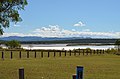
Yeppoon is a coastal town and locality in the Shire of Livingstone, Queensland, Australia. Yeppoon is renowned for its beaches, tropical climate, and the islands out on the bay. Twenty-five minutes from the city of Rockhampton, Yeppoon is the principal town on the Capricorn Coast, a string of seaside communities stretching more than 150 kilometres (93 mi) from north to south. The beaches and shallow coves provide a destination both for tourists and retirees settling down in Central Queensland. Offshore, there are 27 islands including Great Keppel Island which is 20 kilometres (12 mi) from Yeppoon.

Sarina, Queensland Town in Queensland, Australia

Sarina is a rural town and coastal locality in the Mackay Region, Queensland, Australia. In the 2016 census, Sarina had a population of 5,522 people.

Marlborough, Queensland Town in Queensland, Australia

Marlborough is a small town and locality in the Shire of Livingstone, Queensland, Australia. At the 2016 census, Marlborough had a population of 149.

Thargomindah Town in Queensland, Australia

Thargomindah is a rural town and locality in the Shire of Bulloo, Queensland, Australia. The town of Thargomindah is the administrative centre for the Shire of Bulloo. In the 2016 census, Thargomindah had a population of 270 people. It was founded on Wongkumara and Kalali territory.

Baralaba, Queensland Town in Queensland, Australia

Baralaba is a rural town and locality in the Shire of Banana in central Queensland, Australia. In the 2016 census, Baralaba had a population of 314 people.

Carmila, Queensland Town in Queensland, Australia

Carmila is a rural town and coastal locality in the Isaac Region, Queensland, Australia. In the 2016 census, the locality of Carmila had a population of 333 people.

Shire of Broadsound Local government area in Queensland, Australia

Shire of Broadsound was a local government area in the Capricornia region of Queensland, Australia. The Shire, administered from the town of St Lawrence, covered an area of 18,546.0 square kilometres (7,160.7 sq mi), and existed as a local government entity from 1879 until 2008, when it was amalgamated with the Shires of Belyando and Nebo to form the Isaac Region.

Shire of Nebo Local government area in Queensland, Australia

The Shire of Nebo was a local government area in Central Queensland, Queensland, Australia, about 80 kilometres (50 mi) south-west of the regional city of Mackay. The Shire, administered from the town of Nebo, covered an area of 10,034.6 square kilometres (3,874.4 sq mi), and existed as a local government entity from 1883 until 2008, when it was amalgamated with the Shires of Belyando and Broadsound to form the Isaac Region.

Nebo, Queensland Town in Queensland, Australia

Nebo is a rural town and locality in the Isaac Region, Queensland, Australia. In the 2016 census the locality of Nebo had a population of 753 people.

Isaac Region Local government area in Queensland, Australia

The Isaac Region is a local government area located in Central Queensland, Queensland, Australia created in March 2008 as a result of the report of the Local Government Reform Commission released in July 2007.

Wowan, Queensland Town in Queensland, Australia

Wowan is a rural town and locality in the Shire of Banana, Queensland, Australia. The town of Deeford is also within the locality. In the 2016 census, the locality of Wowan had a population of 216 people.

Meandarra Town in Queensland, Australia

Meandarra is a rural town and locality in the Western Downs Region, Queensland, Australia. In the 2016 census the locality of Meandarra had a population of 262 people.

Glenden, Queensland Town in Queensland, Australia

Glenden is a mining town and rural locality in the Isaac Region, Queensland, Australia. In the 2016 census the locality of Glenden had a population of 620 people.

Christ Church Anglican Church, St Lawrence

Christ Church Anglican Church is a heritage-listed church at Cannon Street, St Lawrence, Isaac Region, Queensland, Australia. It was designed by Alfred Mowbray Hutton and built in 1898 by Newman Brothers. It was added to the Queensland Heritage Register on 27 October 2000.

Meatworks and Wharf Site, St Lawrence

Meatworks and Wharf Site is a heritage-listed former abattoir and wharf at Settlement Road, St Lawrence, Isaac Region, Queensland, Australia. It was built from 1870s to 1890s. It is also known as Broadsound Meat Company, Broadsound Packing Co Ltd, and Newport Meatworks Company. It was added to the Queensland Heritage Register on 23 February 2001.

South Mackay, Queensland Suburb of Mackay, Queensland, Australia

South Mackay is a coastal suburb of Mackay in the Mackay Region, Queensland, Australia.

Lakes Creek, Queensland Suburb of Rockhampton Region, Queensland, Australia

Lakes Creek is a suburb split between Rockhampton Region and Shire of Livingstone, Queensland, Australia. In the 2016 census Lakes Creek had a population of 552 people.

Lawgi Dawes Suburb of Shire of Banana, Queensland, Australia

Lawgi Dawes is a rural locality in the Shire of Banana, Queensland, Australia. In the 2016 census Lawgi Dawes had a population of 144 people. It contains the neighbourhood of Lawgi, a former town.

Kunwarara, Queensland Suburb of Livingstone Shire, Queensland, Australia

Kunwarara is a rural locality in the Livingstone Shire, Queensland, Australia. In the 2016 census Kunwarara had a population of 71 people.

References

  1. 1 2 3 Australian Bureau of Statistics (27 June 2017). "St Lawrence (SSC)". 2016 Census QuickStats. Retrieved 20 October 2018. OOjs UI icon edit-ltr-progressive.svg
  2. 1 2 "St Lawrence – town in Isaac Region (entry 32101)". Queensland Place Names. Queensland Government . Retrieved 27 December 2020.
  3. "St Lawrence – locality in Isaac Region (entry 47035)". Queensland Place Names. Queensland Government . Retrieved 27 December 2020.
  4. "Newport – locality unbounded in Isaac Regional (entry 24168)". Queensland Place Names. Queensland Government . Retrieved 27 December 2020.
  5. 1 2 3 "Christ Church Anglican Church (entry 601661)". Queensland Heritage Register . Queensland Heritage Council. Retrieved 10 July 2013.
  6. "St Lawrence - Isaac Regional Council". www.isaac.qld.gov.au. Archived from the original on 6 January 2016. Retrieved 30 December 2015.
  7. Queensland Family History Society (2010), Queensland schools past and present (Version 1.01 ed.), Queensland Family History Society, ISBN   978-1-921171-26-0
  8. "THE PREMIER'S VISIT". The Capricornian . 24 (23). Queensland, Australia. 4 June 1898. p. 12. Archived from the original on 3 October 2021. Retrieved 2 October 2021 via National Library of Australia.
  9. "Christ Church Anglican Church". Churches Australia. Archived from the original on 3 October 2021. Retrieved 2 October 2021.
  10. "Queensland Public Libraries Statistical Bulletin" (PDF). Public Libraries Connect. State Library of Queensland. November 2017. p. 13. Archived (PDF) from the original on 30 January 2018. Retrieved 26 January 2018.
  11. Australian Bureau of Statistics (25 October 2007). "St Lawrence (Broadsound Shire) (State Suburb)". 2006 Census QuickStats. Retrieved 25 July 2009.
  12. "Contact Us - Isaac Regional Council". www.isaac.qld.gov.au. Archived from the original on 27 January 2016. Retrieved 30 December 2015.
  13. "St Lawrence". Sydney Morning Herald . 8 February 2004. Archived from the original on 4 November 2012. Retrieved 27 July 2016.
  14. Australian Bureau of Statistics (31 October 2012). "St Lawrence". 2011 Census QuickStats. Retrieved 30 December 2015. OOjs UI icon edit-ltr-progressive.svg
  15. Hooker, Amber. "Huge new mine project to hire 450 workers". Morning Bulletin. Archived from the original on 2 August 2019. Retrieved 2 August 2019.
  16. "Police Station and former Courthouse and Cell Block (entry 601152)". Queensland Heritage Register . Queensland Heritage Council. Retrieved 10 July 2013.
  17. "Meatworks and Wharf Site (former) (entry 601173)". Queensland Heritage Register . Queensland Heritage Council. Retrieved 10 July 2013.
  18. "State and non-state school details". Queensland Government. 9 July 2018. Archived from the original on 21 November 2018. Retrieved 21 November 2018.
  19. 1 2 "St Lawrence State School". Archived from the original on 27 February 2021. Retrieved 12 March 2021.
  20. "2015 School Annual Report" (PDF). St Lawrence State School. Archived (PDF) from the original on 16 August 2016. Retrieved 27 July 2016.
  21. "ACARA School Profile 2018". Australian Curriculum, Assessment and Reporting Authority. Archived from the original on 27 August 2020. Retrieved 28 January 2020.
  22. 1 2 Petith, Heidi (13 June 2021). "St Lawrence State School celebrates 150 years". Daily Mercury . Archived from the original on 13 June 2021. Retrieved 14 June 2021.
  23. "New state school at St Lawrence". Daily Mercury. 22 June 1938. Archived from the original on 14 June 2021. Retrieved 14 June 2021.
  24. "Town loses school but not its spirit". Daily Mercury. 1 November 2007. Archived from the original on 12 June 2021. Retrieved 14 June 2021.
  25. "Fire-hit St Lawrence school get new mobile classroom". ABC News . 1 November 2007. Archived from the original on 29 October 2016. Retrieved 14 June 2021.
  26. "St Lawrence School". Monument Australia. Archived from the original on 14 June 2021. Retrieved 14 June 2021.
  27. "Queensland Globe". State of Queensland . Retrieved 12 March 2021.
  28. "St Lawrence Library". Public Libraries Connect. State Library of Queensland. 21 June 2017. Archived from the original on 26 January 2018. Retrieved 26 January 2018.
  29. "Parish of North Rockhampton". Anglican Church of Central Queensland . Archived from the original on 3 March 2021. Retrieved 2 October 2021.
  30. 1 2 3 Charles, Caitlyn (29 August 2019). "How one weekend pumped $121,000 into rural economy" . Daily Mercury. Archived from the original on 14 June 2021. Retrieved 14 June 2021.
  31. Lees, Chris (14 April 2016). "St Lawrence wetlands a hidden gem for wildlife". Daily Mercury. Archived from the original on 14 June 2021. Retrieved 14 June 2021.
  32. Cassidy, Tara (22 May 2017). "St Lawrence Wetlands Weekend returns". Daily Mercury. Archived from the original on 8 March 2021. Retrieved 14 June 2021.
  33. Watkins, Lillian (11 June 2021). "Artists descend on St Lawrence for Wetlands Weekend" . Daily Mercury. Archived from the original on 11 June 2021. Retrieved 14 June 2021.
  34. Wilson, Rae (13 June 2021). "A foodie date with Matt Golinski in St Lawrence" . Daily Mercury. Archived from the original on 14 June 2021. Retrieved 14 June 2021.
  35. Wilson, Rae (23 March 2019). "Popular TV presenter gives a green thumbs up to Isaac" . Daily Mercury. Archived from the original on 14 June 2021. Retrieved 14 June 2021.