Wowan, Queensland

Last updated

Wowan
Queensland
StateLibQld 1 297927 Outside the bank in Wowan, Queensland, 1931.jpg
Streetscape, Wowan, 1931
Australia Queensland location map.svg
Red pog.svg
Wowan
Coordinates 23°54′25″S150°11′44″E / 23.9069°S 150.1955°E / -23.9069; 150.1955 (Wowan (town centre))
Population170 (2021 census) [1]
 • Density0.732/km2 (1.90/sq mi)
Postcode(s) 4702
Area232.3 km2 (89.7 sq mi)
Time zone AEST (UTC+10:00)
Location
LGA(s) Shire of Banana
State electorate(s) Callide
Federal division(s) Flynn
Localities around Wowan:
Pheasant Creek Pheasant Creek Dululu
Dumpy Creek Wowan Dixalea
Dumpy Creek Goovigen Goovigen

Wowan is a rural town and locality in the Shire of Banana, Queensland, Australia. [2] [3] In the 2021 census, the locality of Wowan had a population of 170 people. [1]

Contents

The town of Deeford is also within the locality. [4]

Geography

The Dee River forms part of the eastern boundary. [5]

Both towns are located in the north-east of the locality with Deeford at 23°55′03″S150°13′33″E / 23.9175°S 150.2258°E / -23.9175; 150.2258 (Deeford, Queensland) near a crossing point of the Dee River. [2] [4] [6] There are also a number of neighbourhoods within the location:

The Leichhardt Highway runs through from north to south through the localityl, passing through the town of Wowan. [6]

History

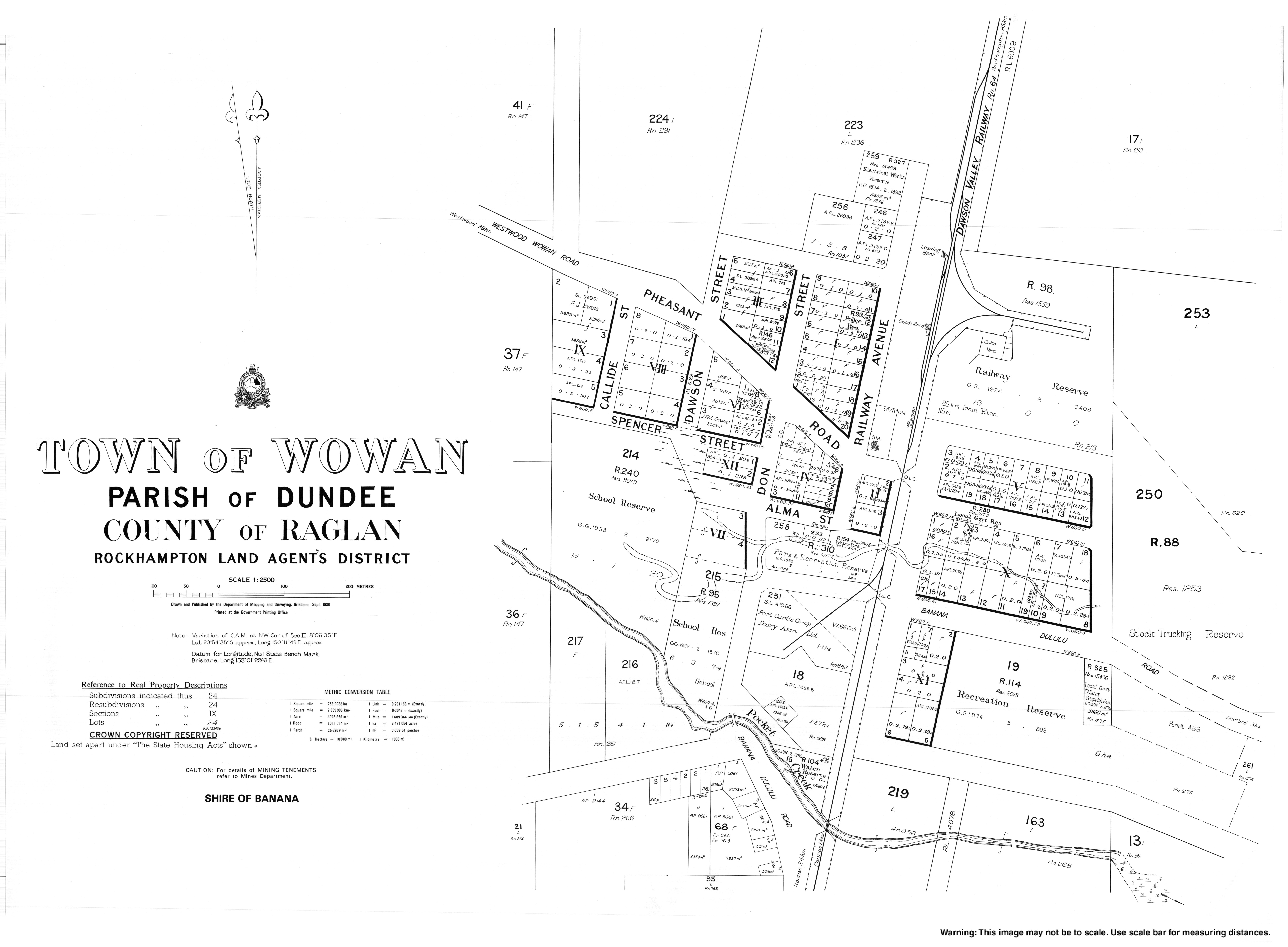
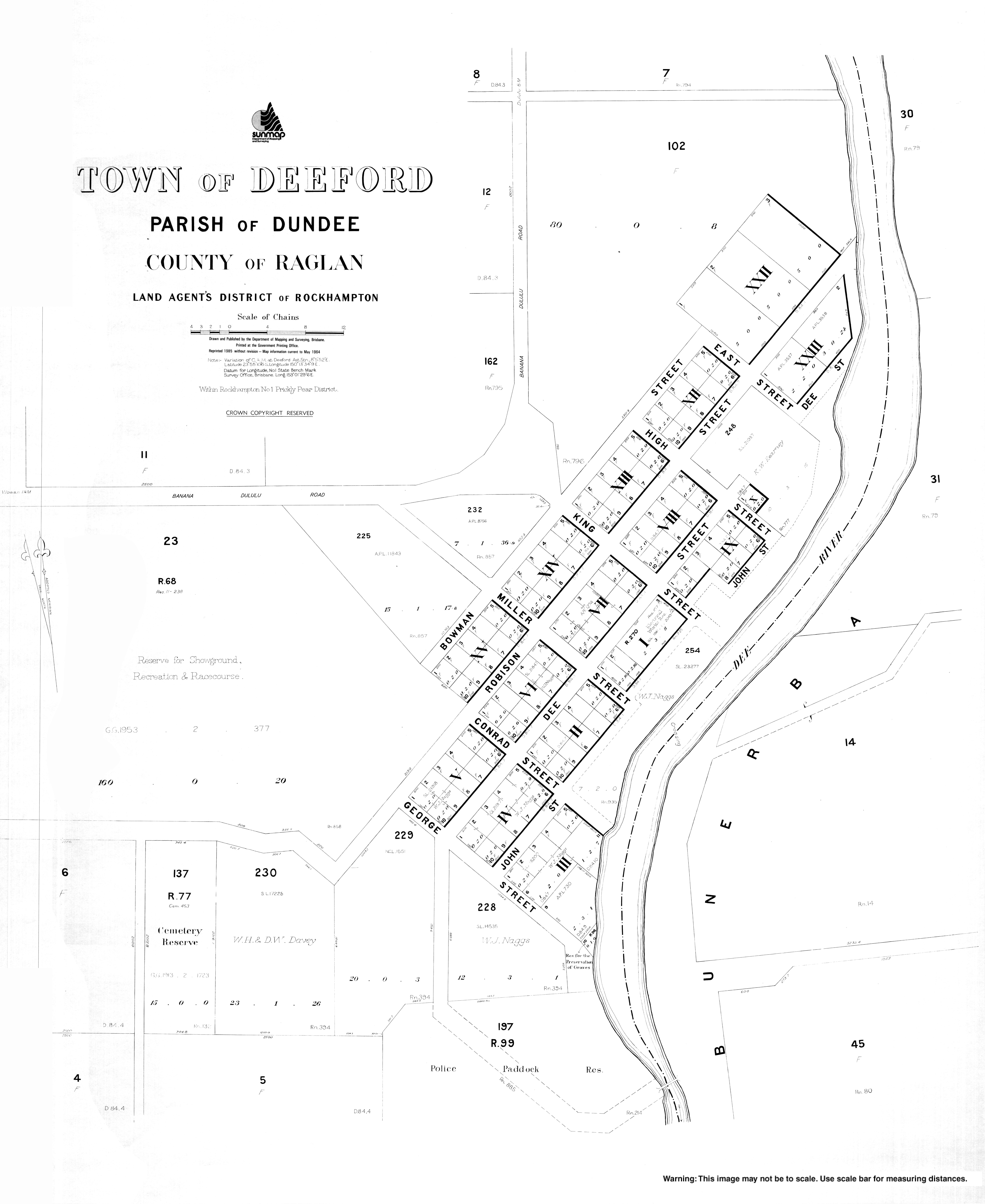
Wowan takes its name from the Wowan railway station, which in turn was named from the Aboriginal word for Australian brush-turkey. [2] [3] Deeford was originally known as Dundee, but was renamed Deeford on 6 November 1913 by the Queensland Surveyor-General. [4]

Dundee Provisional School opened on 1 June 1900. It closed in 1904 but reopened in 1905. On 1 January 1909 it became Dundee State School. It closed in 1911. [10]

Wowan railway station, 1931 StateLibQld 1 297915 Wowan Railway Station, Queensland, 1931.jpg
Wowan railway station, 1931

The Dawson Valley railway line was built from 1910 and by 1912 its first stage of construction had reached the area, terminating at the Wowan railway station ( 23°54′21″S150°11′53″E / 23.9057°S 150.1980°E / -23.9057; 150.1980 (Wowan railway station) ) on 16 October 1912. [11] [12]

In 1912, two schools opened. One was Dundee Camp Provisional School (in the area that became the town of Wowan), presumably to provide education to the children of the railway workers living in the camp during the construction of the railway. The other was Dundee State School (in what is now Deeford). In 1915 Dundee Camp Provisional School was renamed Wowan Provisional School and on 1 May 1916 became Wowan State School. In 1917 Dundee State School was renamed Deeford State School. Deeford State School closed in 1941. [10]

Woman was settled in 1912. The butter factory opened on 1 April 1919; it was operated by the Dawson Valley Co-operative Company. [13]

The second stage of the Dawon Valley railway line opened on 2 February 1915 and extended the line from the town of Wowan via other stations within the locality:

and then onto Rannes. [11]

Buneru State School opened on 5 October 1918 on the south-western corner of Portion 100 on the (now) Leichhardt Highway ( 23°58′06″S150°09′51″E / 23.96828°S 150.16419°E / -23.96828; 150.16419 (Buneru State School (1918 site)) ). [10] [14] [15] Following flooding in 1928, [16] [17] the decision was made to relocate and enlarge the school. [18] [19] In 1934, the school was relocated to the south-west corner of Buneru Road and Buneru School Road ( 23°57′27″S150°08′57″E / 23.9576°S 150.1492°E / -23.9576; 150.1492 (Buneru State School (1934 site)) ). [20] [21] The school closed in 1962. [10]

Wowan Methodist Church was the first church built in the district at 13 Caroline Street ( 23°54′39″S150°11′48″E / 23.9109°S 150.1968°E / -23.9109; 150.1968 (Wowan Uniting Church) ). [22] A stump-capping ceremony was held on 20 October 1923 and the church and opened on 13 January 1924. Following the amalgamation of the Methodist Church into the Uniting Church in Australia in 1977, it became Wowan Uniting Church. The church building was damaged in the 2012 floods. The community decided to relocate it to the Wowan Museum and refurbish the building. The Woman Uniting Church amalgamated with the Biloela Uniting Church to form the Callide Valley Uniting Church which holds its Wowan services in All Souls Anglican Church. [23]

On 1 August 1987, the railway line from Kabra to Wowan was closed. [24]

Buildings at Wowan Museum, 2017 Wowan2017f.jpg
Buildings at Wowan Museum, 2017

The Wowan Museum was originally established in the former butter factory after the site was transformed into a caravan park in the 1980's. [25] After the museum outgrew the butter factory, it was relocated to the former railway station and the new Wowan Museum was officially opened by Deputy Premier Jeff Seeney on 13 October 2012, as part of the community celebrations commemorating the 100th anniversary of the railway being opened in 1912. [25] [26]

Demographics

In the 2006 census, the locality of Wowan and the surrounding area had a population of 338. [27]

In the 2016 census, the locality of Wowan had a population of 216 people. [28]

In the 2021 census, the locality of Wowan had a population of 170 people. [1]

Economy

Farm produce from the area includes beef, hay, grain, pork and eggs. [29]

Education

Wowan State School, 1931 StateLibQld 1 297923 Wowan State School, Queensland 1931.jpg
Wowan State School, 1931

Wowan State School is a government primary (Prep-6) school for boys and girls at Don Street ( 23°54′37″S150°11′38″E / 23.9104°S 150.1938°E / -23.9104; 150.1938 (Wowan State School) ). [30] [31] In 2017, the school had an enrolment of 33 students with 4 teachers (3 full-time equivalent) and 5 non-teaching staff (3 full-time equivalent). [32] In 2018, the school had an enrolment of 30 students with 4 teachers (3 full-time equivalent) and 4 non-teaching staff (2 full-time equivalent). [33] State Library of Queensland holds a copy of Wowan State School : student registry 1900–1991 in the John Oxley Library. [34]

There are no secondary schools in Wowan. The nearest government secondary school is Baralaba State School (to Year 10) in Baralaba to the south-west. For secondary education to Year 12, the nearest government secondary school is Mount Morgan State High School in Mount Morgan to the north-east. [6]

Amenities

The Callide Valley Uniting Church meets at All Souls Anglican Church at 19 Don Street ( 23°54′21″S150°11′43″E / 23.9058°S 150.1954°E / -23.9058; 150.1954 (Callide Valley Uniting Church) ). [35]

Attractions

The Wowan and District Museum is in the old butter factory and former railway station at 2A Dee River Road (corner of Leichhardt Highway, 23°54′36″S150°11′45″E / 23.9099°S 150.1958°E / -23.9099; 150.1958 (Wowan and District Museum) ). [36] [37] [38]

Events

Wowan holds its annual agricultural show in August. [39] [40]

Related Research Articles

<span class="mw-page-title-main">Biloela</span> Town in Queensland, Australia

Biloela is a rural town and locality in the Shire of Banana, Central Queensland, Australia. It is the administrative centre of the shire. In the 2021 census, the locality of Biloela had a population of 5,692 people.

<span class="mw-page-title-main">Banana, Queensland</span> Town in Queensland, Australia

Banana is a rural town and locality in the Shire of Banana, Queensland, Australia. In the 2021 census, the locality of Banana had a population of 348 people.

<span class="mw-page-title-main">Westwood, Queensland</span> Town in Queensland, Australia

Westwood is a town in the Rockhampton Region and a locality split between the Rockhampton Region and the Shire of Banana in Queensland, Australia. It was the first town that was gazetted by the Queensland Government. In the 2021 census, the locality of Westwood had a population of 199 people.

<span class="mw-page-title-main">Eidsvold, Queensland</span> Town in Queensland, Australia

Eidsvold is a rural town and locality in the North Burnett Region, Queensland, Australia. The town is the self-proclaimed Beef Capital of the Burnett and is a hub for the regional cattle industry. In the 2021 census, the locality of Eidsvold had a population of 538 people.

<span class="mw-page-title-main">Landsborough, Queensland</span> Town in Queensland, Australia

Landsborough is a town and a locality in the Sunshine Coast Region, Queensland, Australia. In the 2021 census, the locality of Landsborough had a population of 4,446 people.

<span class="mw-page-title-main">Dululu</span> Town in Queensland, Australia

Dululu is a rural town and locality in the Shire of Banana, Queensland, Australia. In the 2021 census, the locality of Dululu had a population of 97 people.

<span class="mw-page-title-main">Thangool</span> Town in Queensland, Australia

Thangool is a rural town and locality in the Shire of Banana, Queensland, Australia. In the 2021 census, the locality of Thangool had a population of 685 people.

<span class="mw-page-title-main">Goovigen</span> Town in Queensland, Australia

Goovigen is a rural town and locality in the Shire of Banana, Queensland, Australia. In the 2021 census, the locality of Goovigen had a population of 349 people.

<span class="mw-page-title-main">Rannes, Queensland</span> Town in Queensland, Australia

Rannes is a rural town in the west of the locality of Goovigen in the Shire of Banana, Queensland, Australia.

<span class="mw-page-title-main">Jambin, Queensland</span> Town in Queensland, Australia

Jambin is a rural town and locality in the Shire of Banana, Queensland, Australia. In the 2021 census, the locality of Jambin had a population of 207 people.

<span class="mw-page-title-main">Mount Murchison, Queensland</span> Suburb of Shire of Banana, Queensland, Australia

Mount Murchison is a rural locality in the Shire of Banana, Queensland, Australia.

<span class="mw-page-title-main">Mount Chalmers, Queensland</span> Town in Queensland, Australia

Mount Chalmers is a rural town and locality in the Livingstone Shire, Queensland, Australia. In the 2021 census, the locality of Mount Chalmers had a population of 226 people.

<span class="mw-page-title-main">The Caves, Queensland</span> Town in Queensland, Australia

The Caves is a rural town and locality in the Livingstone Shire, Queensland, Australia. In the 2021 census, the locality of The Caves had a population of 680 people.

Callide is a rural town and locality in the Shire of Banana, Queensland, Australia. In the 2021 census, the locality of Callide had a population of 80 people.

<span class="mw-page-title-main">Valentine Plains</span> Suburb of Shire of Banana, Queensland, Australia

Valentine Plains is a rural locality in the Shire of Banana, Queensland, Australia. In the 2021 census, Valentine Plains had a population of 373 people.

<span class="mw-page-title-main">Lawgi Dawes</span> Suburb of Shire of Banana, Queensland, Australia

Lawgi Dawes is a rural locality in the Shire of Banana, Queensland, Australia. It contains the neighbourhood of Lawgi, a former town.

Dixalea is a rural locality in the Shire of Banana, Queensland, Australia. In the 2021 census, Dixalea had a population of 102 people.

Dakenba is a rural locality in the Shire of Banana, Queensland, Australia. In the 2021 census, Dakenba had a population of 127 people.

<span class="mw-page-title-main">Kianga, Queensland</span> Suburb of Shire of Banana, Queensland, Australia

Kianga is a rural locality in the Shire of Banana, Queensland, Australia. In the 2021 census, Kianga had a population of 219 people.

References

  1. 1 2 3 Australian Bureau of Statistics (28 June 2022). "Wowan (SAL)". 2021 Census QuickStats. Retrieved 28 February 2023. OOjs UI icon edit-ltr-progressive.svg
  2. 1 2 3 "Wowan – town in Shire of Banana (entry 38177)". Queensland Place Names. Queensland Government . Retrieved 6 March 2022.
  3. 1 2 "Wowan – locality in Shire of Banana (entry 49581)". Queensland Place Names. Queensland Government . Retrieved 6 March 2022.
  4. 1 2 3 "Deeford – town in Shire of Banana (entry 43961)". Queensland Place Names. Queensland Government . Retrieved 25 October 2019.
  5. Google (15 September 2021). "Wowan, Queensland" (Map). Google Maps . Google. Retrieved 15 September 2021.
  6. 1 2 3 "Queensland Globe". State of Queensland . Retrieved 24 November 2022.
  7. "Buneru – locality unbounded in Shire of Banana (entry 5237)". Queensland Place Names. Queensland Government . Retrieved 6 March 2022.
  8. "Cooneel – locality unbounded in Shire of Banana (entry 8223)". Queensland Place Names. Queensland Government . Retrieved 6 March 2022.
  9. "Muruguran – locality unbounded in Shire of Banana (entry 23644)". Queensland Place Names. Queensland Government . Retrieved 6 March 2022.
  10. 1 2 3 4 Queensland Family History Society (2010), Queensland schools past and present (Version 1.01 ed.), Queensland Family History Society, ISBN   978-1-921171-26-0
  11. 1 2 Kerr, John (1990). Triumph of narrow gauge : a history of Queensland Railways. Boolarong Publications. p. 224. ISBN   978-0-86439-102-5.
  12. 1 2 3 4 "Railway stations and sidings - Queensland". Queensland Open Data. Queensland Government. 2 October 2020. Archived from the original on 5 October 2020. Retrieved 5 October 2020.
  13. "THE DAWSON VALLEY. WOWAN BUTTER FACTORY". The Morning Bulletin . Rockhampton, Qld. 26 February 1924. p. 10. Archived from the original on 28 August 2021. Retrieved 8 June 2014 via National Library of Australia.
  14. "Queensland Two Mile series sheet 2m202 Rannes" (Map). Queensland Government. 1933. Retrieved 24 November 2022.
  15. "STATE SCHOOL AT BUNERU". Morning Bulletin . No. 16621. Queensland, Australia. 8 December 1917. p. 4. Retrieved 24 November 2022 via National Library of Australia.
  16. "WALLS OF WATER". The Brisbane Courier . No. 21, 922. Queensland, Australia. 1 May 1928. p. 17. Retrieved 24 November 2022 via National Library of Australia.
  17. "Appalling losses". Queensland Times . Vol. LXVIII, no. 13, 034. Queensland, Australia. 1 May 1928. p. 7. Retrieved 24 November 2022 via National Library of Australia.
  18. "BUNERU". Morning Bulletin . No. 21, 165. Queensland, Australia. 25 May 1934. p. 7. Retrieved 24 November 2022 via National Library of Australia.
  19. "BUNERU". The Central Queensland Herald . Vol. 6, no. 232. Queensland, Australia. 7 June 1934. p. 39. Retrieved 24 November 2022 via National Library of Australia.
  20. "Deeford" (Map). Queensland Government. 1944. Archived from the original on 18 January 2022. Retrieved 11 April 2022.
  21. "Queensland Two Mile series sheet 2m202" (Map). Queensland Government. 1939. Retrieved 24 November 2022.
  22. Google (28 August 2021). "Wowan Uniting Church" (Map). Google Maps . Google. Retrieved 28 August 2021.
  23. "Wowan Uniting Church - Former". Churches Australia. Archived from the original on 28 August 2021. Retrieved 28 August 2021.
  24. Kerr, John (1990). Triumph of narrow gauge : a history of Queensland Railways. Boolarong Publications. p. 189. ISBN   978-0-86439-102-5.
  25. 1 2 "History rallies to the fore!". Sandstone Wonders. Banana Shire Council. Archived from the original on 11 December 2021. Retrieved 27 July 2022.
  26. Wowan Museum (plaque outside museum). Wowan, Queensland. 13 October 2012. Wowan Museum opened on 13th October, 2012 by the Honourable Jeff Seeney MP...
  27. Australian Bureau of Statistics (25 October 2007). "Wowan (Banana Shire) (State Suburb)". 2006 Census QuickStats. Retrieved 28 October 2007.
  28. Australian Bureau of Statistics (27 June 2017). "Wowan (SSC)". 2016 Census QuickStats. Retrieved 20 October 2018. OOjs UI icon edit-ltr-progressive.svg
  29. "Our Town Wowan" (PDF). Retrieved 19 April 2019.[ permanent dead link ]
  30. "State and non-state school details". Queensland Government. 9 July 2018. Archived from the original on 21 November 2018. Retrieved 21 November 2018.
  31. "Wowan State School". Archived from the original on 8 March 2022. Retrieved 11 April 2022.
  32. "ACARA School Profile 2017". Archived from the original on 22 November 2018. Retrieved 22 November 2018.
  33. "ACARA School Profile 2018". Australian Curriculum, Assessment and Reporting Authority. Archived from the original on 27 August 2020. Retrieved 28 January 2020.
  34. "One Search-State Library of Queensland's catalogue". Archived from the original on 8 May 2018. Retrieved 21 January 2018.
  35. "Contacts". – Callide Valley Uniting Church. Archived from the original on 19 March 2021. Retrieved 28 August 2021.
  36. "Wowan and District Museum" . Retrieved 24 November 2022.
  37. "The Town of Wowan in the Banana Shire". Sandstone Wonders. Retrieved 24 November 2022.
  38. Google (24 November 2022). "Wowan and District Museum" (Map). Google Maps . Google. Retrieved 24 November 2022.
  39. "Simple Pleasures: Banana Shire" (PDF). The Gladstone Region. Tourism Queensland. p. 3. Archived (PDF) from the original on 15 July 2014. Retrieved 8 June 2014.
  40. "Wowan Show". Archived from the original on 26 January 2014. Retrieved 8 June 2014.

Further reading