Cracow, Queensland

Last updated

Cracow
Queensland
Cracow Third Ave.png
Third Avenue, Cracow, 2022
Australia Queensland location map.svg
Red pog.svg
Cracow
Coordinates 25°17′48″S150°18′17″E / 25.2967°S 150.3047°E / -25.2967; 150.3047 (Cracow (town centre))
Population114 (2021 census) [1]
 • Density0.1579/km2 (0.4090/sq mi)
Established1931
Postcode(s) 4719
Area721.9 km2 (278.7 sq mi)
Time zone AEST (UTC+10:00)
Location
LGA(s) Shire of Banana
State electorate(s) Callide
Federal division(s) Flynn
Localities around Cracow:
Isla Camboon Eidsvold West
Spring Creek Cracow Eidsvold West
Glebe Cockatoo Eidsvold West

Cracow is a rural town and locality in the Shire of Banana, Queensland, Australia. [2] [3] In the 2021 census, the locality of Cracow had a population of 114 people. [1]

Contents

Historically, Cracow is a gold mining town, with some recent mines opening. [4]

Geography

The town is located on the Eidsvold–Theodore Road, 494 kilometres (307 mi) by road north-west of the state capital, Brisbane. [5]

Cracow has the following mountains:

History

Third Avenue of Cracow, 1961 Cracow Main Street 1961.png
Third Avenue of Cracow, 1961

The town was named after a pastoral run, which was in turn named by pastoralist John Ross, in 1851, for the Polish city of Kraków, which had recently been the centre for a fight for Polish national independence. [2] [11] However, some believe it to have gotten the name sound of cracking stock whips echoing throughout the ranges.[ citation needed ]

Gold was first discovered in Cracow in 1875 by itinerant fossickers and a further discovery of a nugget was made by an Aboriginal stockman, Johnny Nipps in 1916. In 1931, the Golden Plateau mine was established and it operated continuously until 1976. [12] A total of 592,578 ounces of ore was mined from the Golden Plateau, which at the time of its closure was an equivalent of $60mil.[ citation needed ]

Cracow Post Office opened on 1 October 1932 [13] and was destroyed in a fire in 2006.[ citation needed ]

Cracow State School opened on 12 June 1933. [14] It was moved in 1935 after a young boy drowned in a nearby creek.[ citation needed ] The school remained there until its closure on 12 December 1997. [14] [15] It was at 11-17 Third Avenue ( 25°17′36″S150°18′04″E / 25.2933°S 150.3010°E / -25.2933; 150.3010 (Cracow State School (former)) ). [16] The school building was moved to a nearby cattle station.[ citation needed ]

At its gold mining peak, the town included five cafes, barber shop, billiard saloon, two butchers, a picture theatre and a soft drink factory. The closure of the mine led to Cracow becoming a ghost town with many deserted houses and shops. [17]

Circa 2000, Fred Brophy and wife Sandi purchased the Cracow Hotel. [18] He operated his famous boxing tent as an annual event in Cracow. [19]

In 2004, Newcrest Mining reestablished gold mining in the town, leading to hopes the town may recover. [17] This mine is now operated by Aeris Resources. [20] The shops are vacant although the hotel remains open.[ citation needed ]

The 2019 horror-comedy film Two Heads Creek was filmed on location in Cracow. [21] [22]

Demographics

In the 2011 census, the locality of Cracow and the surrounding area had a population of 196 people. [23]

In the 2016 census, the locality of Cracow had a population of 89 people. [24]

In the 2021 census, the locality of Cracow had a population of 114 people. [1]

Facilities

Cracow Hotel, est 1937 Cracow pub 2021.jpg
Cracow Hotel, est 1937
The Cracow Pub Bar, 2022 Cracow pub 2022.jpg
The Cracow Pub Bar, 2022

The Cracow Hotel at 30 Third Avenue (corner Tenth Avenue, 25°17′43″S150°18′09″E / 25.2954°S 150.3026°E / -25.2954; 150.3026 (Cracow Hotel) ) [25] is the only remaining business in the township, as it attracts a lot of tourists due to its array of antique and unusual artifacts adorning the ceilings and walls. [20]

The Cracow community centre is at 57-63 Tenth Avenue ( 25°17′43″S150°18′06″E / 25.2953°S 150.3018°E / -25.2953; 150.3018 (Cracow Community Centre) ) and is operated by the Banana Shire Council. [26]

There is also a caravan park located at 11 Third Avenue, next to the old court house which has been turned into a museum.[ citation needed ]

Education

There are no schools in Cracow. The nearest government schoola is Theodore State School in Theodore to the north-west and Taroom State School in Taroom to the south-west; it provides primary education and secondary education to Year 10. There is no nearby school providing secondary education to Year 12; options are distance education and boarding school. [27]

Related Research Articles

<span class="mw-page-title-main">Westwood, Queensland</span> Town in Queensland, Australia

Westwood is a town in the Rockhampton Region and a locality split between the Rockhampton Region and the Shire of Banana in Queensland, Australia. It was the first town that was gazetted by the Queensland Government. In the 2021 census, the locality of Westwood had a population of 199 people.

<span class="mw-page-title-main">Inkerman, Queensland</span> Town in Australia

Inkerman is a rural town and locality in the Shire of Burdekin, Queensland, Australia. In the 2021 census, the locality of Inkerman had a population of 119 people.

<span class="mw-page-title-main">Dululu</span> Town in Queensland, Australia

Dululu is a rural town and locality in the Shire of Banana, Queensland, Australia. In the 2021 census, the locality of Dululu had a population of 97 people.

<span class="mw-page-title-main">Thangool</span> Town in Queensland, Australia

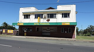
Thangool is a rural town and locality in the Shire of Banana, Queensland, Australia. In the 2021 census, the locality of Thangool had a population of 685 people.

<span class="mw-page-title-main">Goovigen</span> Town in Queensland, Australia

Goovigen is a rural town and locality in the Shire of Banana, Queensland, Australia. In the 2021 census, the locality of Goovigen had a population of 349 people.

<span class="mw-page-title-main">Wowan, Queensland</span> Town in Queensland, Australia

Wowan is a rural town and locality in the Shire of Banana, Queensland, Australia. In the 2021 census, the locality of Wowan had a population of 170 people.

<span class="mw-page-title-main">Jambin, Queensland</span> Town in Queensland, Australia

Jambin is a rural town and locality in the Shire of Banana, Queensland, Australia. In the 2021 census, the locality of Jambin had a population of 207 people.

Camboon is a rural locality in the Shire of Banana, Queensland, Australia. In the 2021 census, Camboon had a population of 76 people.
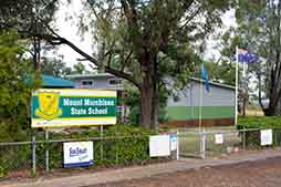
<span class="mw-page-title-main">Mount Chalmers, Queensland</span> Town in Queensland, Australia

Mount Chalmers is a rural town and locality in the Livingstone Shire, Queensland, Australia. In the 2021 census, the locality of Mount Chalmers had a population of 226 people.

<span class="mw-page-title-main">The Caves, Queensland</span> Town in Queensland, Australia

The Caves is a rural town and locality in the Livingstone Shire, Queensland, Australia. In the 2021 census, the locality of The Caves had a population of 680 people.

Prospect is a rural locality in the Shire of Banana, Queensland, Australia. In the 2021 census, Prospect had a population of 289 people.

Spring Creek is a rural locality in the Shire of Banana, Queensland, Australia. In the 2021 census, Spring Creek had a population of 20 people.

Callide is a rural town and locality in the Shire of Banana, Queensland, Australia. In the 2021 census, the locality of Callide had a population of 80 people.

<span class="mw-page-title-main">Valentine Plains</span> Suburb of Shire of Banana, Queensland, Australia

Valentine Plains is a rural locality in the Shire of Banana, Queensland, Australia. In the 2021 census, Valentine Plains had a population of 373 people.

Dakenba is a rural locality in the Shire of Banana, Queensland, Australia. In the 2021 census, Dakenba had a population of 127 people.

Orange Creek is a rural locality in the Shire of Banana, Queensland, Australia. In the 2021 census, Orange Creek had a population of 197 people.

<span class="mw-page-title-main">Kianga, Queensland</span> Suburb of Shire of Banana, Queensland, Australia

Kianga is a rural locality in the Shire of Banana, Queensland, Australia. In the 2021 census, Kianga had a population of 219 people.

Kinnoul is a rural locality in the Shire of Banana, Queensland, Australia. In the 2021 census, Kinnoul had a population of 80 people.

Greenlake is a rural locality in the Livingstone Shire, Queensland, Australia. In the 2021 census, Greenlake had "no people or a very low population".

Kunwarara is a rural locality in the Livingstone Shire, Queensland, Australia. In the 2021 census, Kunwarara had a population of 69 people.

References

  1. 1 2 3 Australian Bureau of Statistics (28 June 2022). "Cracow (SAL)". 2021 Census QuickStats. Retrieved 28 February 2023. OOjs UI icon edit-ltr-progressive.svg
  2. 1 2 "Cracow – town in Shire of Banana (entry 8648)". Queensland Place Names. Queensland Government . Retrieved 18 July 2021.
  3. "Cracow – locality in Shire of Banana (entry 49544)". Queensland Place Names. Queensland Government . Retrieved 18 July 2021.
  4. "Cracow Gold Operations". Aeris Resources. Archived from the original on 22 April 2021. Retrieved 11 December 2021.
  5. Google (11 December 2021). "Brisbane to Cracow" (Map). Google Maps . Google. Retrieved 11 December 2021.
  6. 1 2 3 4 "Mountain peaks and capes - Queensland". Queensland Open Data. Queensland Government. 12 November 2020. Archived from the original on 25 November 2020. Retrieved 25 November 2020.
  7. "Mount Edwards – mountain in Banana Shire (entry 11235)". Queensland Place Names. Queensland Government . Retrieved 25 November 2020.
  8. "Mount Elvinia – mountain in Banana Shire (entry 11585)". Queensland Place Names. Queensland Government . Retrieved 25 November 2020.
  9. "Mount Irving – mountain in Banana Shire (entry 16851)". Queensland Place Names. Queensland Government . Retrieved 25 November 2020.
  10. "Mount Steel – mountain in Banana Shire (entry 32315)". Queensland Place Names. Queensland Government . Retrieved 25 November 2020.
  11. "NOMENCLATURE OF QUEENSLAND—100". The Courier-Mail . Brisbane: National Library of Australia. 24 January 1936. p. 12. Archived from the original on 11 December 2021. Retrieved 20 May 2014.
  12. Beattie, Ross. "Cracow". Ross Beattie's Localities pages. Archived from the original on 23 October 2009. Retrieved 2007-07-20.
  13. Premier Postal History. "Post Office List". Premier Postal Auctions. Archived from the original on 19 August 2008. Retrieved 10 May 2014.
  14. 1 2 Queensland Family History Society (2010), Queensland schools past and present (Version 1.01 ed.), Queensland Family History Society, ISBN   978-1-921171-26-0
  15. "Queensland state school - centre closures" (PDF). Queensland Government . 20 August 2013. Archived (PDF) from the original on 20 March 2022. Retrieved 7 April 2022.
  16. "Environs of Cracow" (Map). Queensland Government. 1963. Archived from the original on 11 December 2021. Retrieved 11 December 2021.
  17. 1 2 Lee, Tim (23 February 2006). "Old gold town revels in resources boom". Landline . Australian Broadcasting Corporation. Archived from the original on 30 April 2022. Retrieved 28 December 2018.
  18. Ross, Shelley (November–December 2007). "Meet you at The Cracow" (PDF). Flying. pp. 60–63. Archived (PDF) from the original on 20 March 2022. Retrieved 30 April 2022.
  19. "Simple Pleasures: Banana Shire" (PDF). The Gladstone Region. Tourism Queensland. p. 3. Archived from the original (PDF) on 15 July 2014. Retrieved 8 June 2014.
  20. 1 2 "The Town of Cracow in the Banana Shire". Sandstone Wonders. Archived from the original on 23 April 2021. Retrieved 11 December 2021.
  21. Burt, Jemima; Stünzner, Inga. "Two Heads Creek is the cannibal movie that could put the tiny Queensland town of Cracow back on the map". ABC News. Australian Broadcasting Corporation. Archived from the original on 2 December 2019. Retrieved 2 December 2019.
  22. "Two Heads Creek (2019)". IMDB. Archived from the original on 21 May 2020. Retrieved 2 December 2019.
  23. Australian Bureau of Statistics (31 October 2012). "Cracow (Banana Shire) (State Suburb)". 2011 Census QuickStats. Retrieved 3 April 2016. OOjs UI icon edit-ltr-progressive.svg
  24. Australian Bureau of Statistics (27 June 2017). "Cracow (SSC)". 2016 Census QuickStats. Retrieved 20 October 2018. OOjs UI icon edit-ltr-progressive.svg
  25. "Cracow Hotel". Google Maps . Archived from the original on 16 November 2020. Retrieved 10 November 2020.
  26. "Halls". Banana Shire Council. Archived from the original on 10 November 2020. Retrieved 10 November 2020.
  27. "Queensland Globe". State of Queensland . Retrieved 30 April 2022.