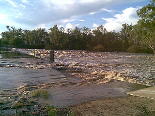
Expedition National Park Queensland | |
---|---|
IUCN category II (national park) | |
Coordinates | 25°07′44″S148°51′56″E / 25.12889°S 148.86556°E Coordinates: 25°07′44″S148°51′56″E / 25.12889°S 148.86556°E |
Established | 1991 |
Area | 1,080 km2 (417.0 sq mi) |
Managing authorities | Queensland Parks and Wildlife Service |
Website | Expedition National Park |
See also | Protected areas of Queensland |
Expedition is a national park in Queensland, Australia, 490 km northwest of Brisbane. It is named for the Expedition Range of mountains.
A national park is a park in use for conservation purposes. Often it is a reserve of natural, semi-natural, or developed land that a sovereign state declares or owns. Although individual nations designate their own national parks differently, there is a common idea: the conservation of 'wild nature' for posterity and as a symbol of national pride. An international organization, the International Union for Conservation of Nature (IUCN), and its World Commission on Protected Areas (WCPA), has defined "National Park" as its Category II type of protected areas.
Queensland is the second-largest and third-most populous state in the Commonwealth of Australia. Situated in the north-east of the country, it is bordered by the Northern Territory, South Australia and New South Wales to the west, south-west and south respectively. To the east, Queensland is bordered by the Coral Sea and Pacific Ocean. To its north is the Torres Strait, with Papua New Guinea located less than 200 km across it from the mainland. The state is the world's sixth-largest sub-national entity, with an area of 1,852,642 square kilometres (715,309 sq mi).
Australia, officially the Commonwealth of Australia, is a sovereign country comprising the mainland of the Australian continent, the island of Tasmania and numerous smaller islands. It is the largest country in Oceania and the world's sixth-largest country by total area. The neighbouring countries are Papua New Guinea, Indonesia and East Timor to the north; the Solomon Islands and Vanuatu to the north-east; and New Zealand to the south-east. The population of 25 million is highly urbanised and heavily concentrated on the eastern seaboard. Australia's capital is Canberra, and its largest city is Sydney. The country's other major metropolitan areas are Melbourne, Brisbane, Perth and Adelaide.
The park is part of the Brigalow Belt bioregion. [1]
The Brigalow Belt is a wide band of acacia wooded grassland that runs between tropical rainforest of the coast and the semi-arid interior of Queensland, Australia. See Interim Biogeographic Regionalisation for Australia for the IBRA definitions of the Brigalow Belt South (BBS) and the Brigalow Belt North (BBN) bioregions. The Northern and Southern Brigalow Belts are two of the 85 bioregions across Australia and the 15 bioregions in Queensland. Together they form most of the Brigalow tropical savanna ecoregion.
Robinson Gorge was the first section to be declared a national park in 1951. [1]
Wollumbin National Park is a national park located in northern New South Wales, Australia, 642 kilometres (399 mi) north of Sydney near the border with the state of Queensland. It surrounds Mount Warning, part of a remnant caldera of a much larger extinct volcano. The park is administered by the NSW National Parks and Wildlife Service. The park is part of the Scenic Rim Important Bird Area, identified as such by BirdLife International because of its importance in the conservation of several species of threatened birds.
Blackdown Tableland is a national park in the Central Highlands Region, Queensland, Australia.
Cape Melville is a national park in the Shire of Cook, Queensland, Australia.
Lizard Island is an island on the Great Barrier Reef in Queensland (Australia), 1624 km northwest of Brisbane and part of the Lizard Island Group that also includes Palfrey Island. It is part of the Lizard Island National Park. Lizard Island is within Cook Shire.
Sir Augustus Charles Gregory was an English-born Australian explorer. Between 1846 and 1858 he undertook four major expeditions. He was appointed a Member of the Queensland Legislative Council.
Kuranda is a town and locality on the Atherton Tableland in the Shire of Mareeba, Far North Queensland, Australia. The town of Myola is also located within the locality of Kuranda. It is 25 kilometres (16 mi) from Cairns, via the Kuranda Range road. It is surrounded by tropical rainforest and adjacent to the Wet Tropics World Heritage listed Barron Gorge National Park. It is within the local government area of Shire of Mareeba.
The Dawson River is a river located in Central Queensland, Australia.
Expedition Range is a mountain range within the Central Highlands sandstone region of Queensland, Australia. Robinson Creek cuts a 100 metres deep gorge through sandstone clifflines. Many spectacular side gorges add to the appeal of the area, which is included in the Expedition National Park.
The Mackenzie River is a river located in Central Queensland, Australia. The Mackenzie River is a major tributary of the Fitzroy River, part of the largest river catchment flowing to the eastern coast of Australia.
The Shire of Bauhinia was a local government area in Central Queensland, Queensland, Australia. The Shire, administered from the town of Springsure, covered an area of 23,649.6 square kilometres (9,131.2 sq mi), and existed as a local government entity from 1879 until 2008, when it was amalgamated with the Shires of Duaringa, Emerald and Peak Downs to form the Central Highlands Region.
The Shire of Diamantina is a local government area in Central West Queensland, bordering South Australia and the Northern Territory. Its administrative centre is in the town of Bedourie.
The Jardine River is the largest river of the Cape York Peninsula in Far North Queensland, Australia.
The Johnstone River, comprising the North Johnstone River and the South Johnstone River, is a river system located in Far North and North Queensland, Australia.
The Comet River is a river located in Central Queensland, Australia.
South West Queensland is a remote region in the Australian state of Queensland which covers 319,808 km2 (123,479 sq mi). The region lies to the south of Central West Queensland and west of the Darling Downs and includes the Maranoa district and parts of the Channel Country. The area is noted for its cattle grazing, cotton farming, opal mining and oil and gas deposits.
Central West Queensland is a remote region in the Australian state of Queensland which covers 396 650.2 km². The region lies to the north of South West Queensland and south of the Gulf Country.
The Lynd River is a river located on the Cape York Peninsula in Far North Queensland, Australia.
The Baffle Creek is a creek located in Central Queensland, Australia.
The Jackey Jackey Creek, also often called Jacky Jacky Creek, is a creek located in the Cape York Peninsula region of Far North Queensland, Australia.
This Queensland protected areas related article is a stub. You can help Wikipedia by expanding it. |