
The Daintree National Park is located in Far North Queensland, Australia, 1,757 km (1,092 mi) northwest of Brisbane and 100 km (62 mi) northwest of Cairns. It was founded in 1981 and is part of the Wet Tropics of Queensland. In 1988, it became a World Heritage Site. The park consists of two sections—Mossman Gorge and Cape Tribulation, with a settled agricultural area between them which includes the towns of Mossman and Daintree Village.
Girramay is a national park in Queensland, Australia, 1269 km northwest of Brisbane. The national park is part of the Wet Tropics World Heritage Area.
Grey Peaks is a national park in Far North Queensland, Australia, 1,374 km northwest of Brisbane. It is part of the Coastal Wet Tropics Important Bird Area, identified as such by BirdLife International because of its importance for the conservation of lowland tropical rainforest birds.
Hull River is a national park in Queensland (Australia), 1275 km northwest of Brisbane. GIS mapping data from Queensland Department of Natural Resources (2002) showed an area of 3,240 hectares, of which about 2,100 hectares are estuarine mangroves, with the remainder being swamp forests dominated by Melaleuca and specialist Eucalypt species. Rainfall averages 3,600 mm per year. The park is part of the Coastal Wet Tropics Important Bird Area, identified as such by BirdLife International because of its importance for the conservation of lowland tropical rainforest birds.
Girringun National Park is a national park in Queensland, Australia, approximately 50 kilometres (31 mi) southwest of Ingham, 110 kilometres (68 mi) north of Townsville and 1,290 kilometres (800 mi) northwest of Brisbane. The park is one of the Wet Tropics World Heritage Area series of national parks, and is a gazetted World Heritage Site.

Tropical and subtropical moist broadleaf forests (TSMF), also known as tropical moist forest, is a subtropical and tropical forest habitat type defined by the World Wide Fund for Nature.

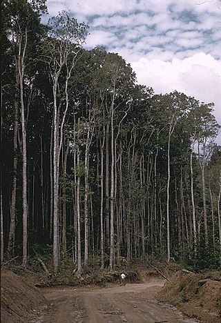
The Queensland tropical rain forests ecoregion covers a portion of the coast of Queensland in northeastern Australia and belongs to the Australasian realm. The forest contains the world's best living record of the major stages in the evolutionary history of the world's land plants, including most of the world's relict species of plants from the ancient supercontinent of Gondwana. The history of the evolution of marsupials and songbirds is also well represented.

Mount Bartle Frere is the highest mountain in Queensland at an elevation of 1,611 metres (5,285 ft). The mountain was named after Sir Henry Bartle Frere, a British colonial administrator and then president of the Royal Geographical Society by George Elphinstone Dalrymple in 1873. Bartle Frere was British Governor of Cape Colony at the outset of the Anglo-Zulu War.

The Wet Tropics of Queensland World Heritage Site consists of approximately 8,940 km2 of Australian wet tropical forests growing along the north-east Queensland portion of the Great Dividing Range. The Wet Tropics of Queensland meets all four of the criteria for natural heritage for selection as a World Heritage Site. World Heritage status was declared in 1988, and on 21 May 2007 the Wet Tropics were added to the Australian National Heritage List.
The Shoalwater Bay Military Training Area is a heritage-listed military installation at Byfield Road, Byfield, Shire of Livingstone, Queensland, Australia. It is a large, relatively undisturbed and intact natural system with a wide variety of coastal landforms and a high level of biodiversity. It contains a diverse range of marine and coastal wetland landscapes, vegetation types and ecosystems. It was added to the Australian Commonwealth Heritage List on 22 June 2004.

Mabi forests are a type of ecological community found in the Australian state of Queensland which is considered to be critically endangered and which consists of remnant patches found only either in North Queensland's Atherton Tablelands or at Shiptons Flat along the Annan River.

The Eastern Australian temperate forests is a broad ecoregion of open forest on uplands starting from the east coast of New South Wales in the South Coast to southern Queensland, Australia. Although dry sclerophyll and wet sclerophyll eucalyptus forests predominate within this ecoregion, a number of distinguishable rainforest communities are present as well.

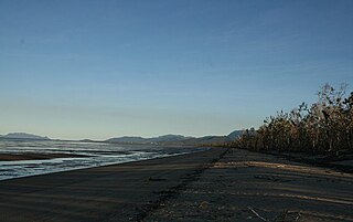
The Coastal Wet Tropics Important Bird Area comprises a disjunct 521 km2 stretch of coastal and subcoastal land in tropical Far North Queensland, Australia. It extends from just south of Cairns in the north for about 150 km to Cardwell in the south. It is important for the conservation of lowland rainforest birds, especially southern cassowaries.

Seasonal tropical forest, also known as moist deciduous, semi-evergreen seasonal, tropical mixed or monsoon forest, typically contains a range of tree species: only some of which drop some or all of their leaves during the dry season. This tropical forest is classified under the Walter system as (i) tropical climate with high overall rainfall and (ii) having a very distinct wet season with dry season. These forests represent a range of habitats influenced by monsoon (Am) or tropical wet savannah (Aw) climates. Drier forests in the Aw climate zone are typically deciduous and placed in the Tropical dry forest biome: with further transitional zones (ecotones) of savannah woodland then tropical and subtropical grasslands, savannas, and shrublands.

James Peter Stanton is an Australian landscape ecologist, fire ecologist, botanist and biogeographer who individually conducted systematic environmental resource surveys throughout Queensland whilst working for the National Parks department of Forestry (Qld.) from 1967–1974. He carried out his assessments in a range of dissimilar landscapes leading to the identification and protection of many critically threatened ecosystems across the state during a period of rapid and widespread land development under the Joh Bjelke-Petersen government. For this work he became the first Australian to receive the IUCN Fred M. Packard Award in 1982.
Tully Training Area is a heritage-listed rainforest in a military training area at Tully-Cardstone Road, Tully, Queensland, Australia. It was added to the Australian Commonwealth Heritage List on 22 June 2004.
John Geoffrey Tracey was an Australian ecologist and botanist whose pioneering research work in partnership with Dr. Leonard Webb within the Rainforest Ecology Unit of the CSIRO in the 1950s led to the publication of the first systematic classification of Australian rainforest vegetation in the Journal of Ecology in 1959. By the early 80's, after decades of ongoing research, Tracey and Webb had accumulated a significant corpus of scientific evidence in support of the theory that Australian tropical rainforests had evolved in Gondwana over 100 million years ago and were not, as previously believed, relatively recent arrivals from South East Asia. This evidence, in combination with Tracey and Webb's 1975 publication of a collection of 15 vegetation maps entitled "Vegetation of the Humid Tropical Region of North Queensland", and Tracey's 1982 paper "The Vegetation of the Humid Tropical Region of North Queensland", helped to establish the scientific basis for a number of major conservation campaigns across Queensland and paved the way for the subsequent successful World Heritage nomination of the Wet Tropics of Queensland by Aila Keto in 1988.

Leonard James Webb was a widely awarded Australian ecologist and ethnobotanist who was the author or joint-author of over 112 scientific papers throughout the course of his professional career. His pioneering work as Senior Principal Research Scientist alongside Geoff Tracey in the CSIRO Rainforest Ecology Research Unit in the 1950s led to the publication of the first systematic classification of Australian rainforest vegetation in the Journal of Ecology in 1959.
Camptochaete monolina is a species of moss found in the Wet Tropics of Australia.

Rainforests and vine thickets are a major vegetation group in Australia. It consists of temperate to tropical rainforests, monsoon forests, and vine thickets. Rainforests and vine thickets are generally found in small pockets across the eastern and northern portions of the continent, including western Tasmania, eastern New South Wales, eastern Queensland, the northern portion of the Northern Territory, and the Kimberley Region of northeastern Western Australia.

