Davies Creek National Park

Last updated

Davies Creek National Park
Queensland
IUCN category II (national park)

Davies creek NP.jpg

Waterfall in the national park, 2004
Australia Queensland relief location map.jpg
Red pog.svg
Davies Creek National Park
Nearest town or city Mareeba
Coordinates 17°00′35″S145°34′54″E / 17.00972°S 145.58167°E / -17.00972; 145.58167 Coordinates: 17°00′35″S145°34′54″E / 17.00972°S 145.58167°E / -17.00972; 145.58167
Established 1971
Area 4.86 km2 (1.9 sq mi)
Managing authorities Queensland Parks and Wildlife Service
Website Davies Creek National Park
See also Protected areas of Queensland

Davies Creek National Park is in Far North Queensland, Australia, 1,392 km northwest of Brisbane, 20 km south west of Cairns. The park is located on the Atherton Tableland within the Barron River water catchment. It lies within the Einasleigh Uplands and Wet Tropics of Queensland bioregions. [1]

Far North Queensland Region in Queensland, Australia

Far North Queensland is the northernmost part of the state of Queensland, Australia. Centered on the city of Cairns, the region stretches north to the Torres Strait, and west to the Gulf Country. The region has Australia's only international border, with the independent nation of Papua New Guinea.

Brisbane capital city of Queensland, Australia

Brisbane is the capital of and the most populated city in the Australian state of Queensland, and the third most populous city in Australia. Brisbane's metropolitan area has a population of 2.5 million, and the South East Queensland region, centred on Brisbane, encompasses a population of more than 3.5 million. The Brisbane central business district stands on the historic European settlement and is situated inside a peninsula of the Brisbane River, about 15 kilometres from its mouth at Moreton Bay. The metropolitan area extends in all directions along the floodplain of the Brisbane River Valley between Moreton Bay and the Great Dividing Range, sprawling across several of Australia's most populous local government areas (LGAs)—most centrally the City of Brisbane, which is by far the most populous LGA in the nation. The demonym of Brisbane is "Brisbanite".

Cairns City in Queensland, Australia

Cairns is a city in the Cairns Region, Queensland, Australia. It is on the east coast of Far North Queensland. The city is the 5th-most-populous in Queensland and ranks 14th overall in Australia.

Contents

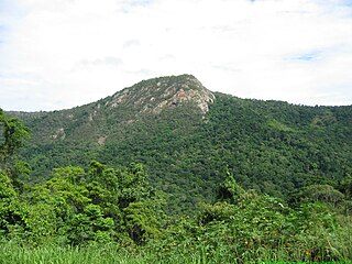
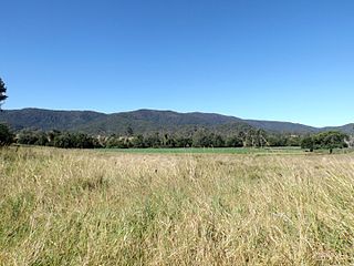
It is picturesque with its granite outcrops, the Davies Creek Falls and open eucalypt woodland. Davies Creek raises in the Lamb Range and eventually flows into the Barron River. The park is important as a preserve of the northern bettong, an endangered species. A total of five rare or threatened species have been identified in the park. [1]

Davies Creek Falls

The Davies Creek Falls is a cascade waterfall on the Davies Creek in the Far North region of Queensland, Australia.

Barron River (Queensland) river in Australia

The Barron River is located on the Atherton Tablelands inland from Cairns in northern Queensland, Australia. With its headwaters below Mount Hypipamee, the 165-kilometre (103 mi)-long river with a catchment area of approximately 2,138 square kilometres (825 sq mi) forms through run off from the Mount Hypipamee National Park, flows through Lake Tinaroo, and eventually empties into the Coral Sea near Smithfield.

Northern bettong species of mammal

The northern bettong is a small potoroid marsupial which is restricted to some areas of mixed open Eucalyptus woodlands and Allocasuarina forests bordering rainforests in far northeastern Queensland, Australia. They are known as "rat kangaroos" and move about in a slow hopping manner. There are five different species in Australia of this particular animal. It is about the size of a rabbit with a large tail dragging behind.

Access

The park can be reached on the Kennedy Highway 21 km southwest of Kuranda.

Kennedy Highway highway in Queensland

The Kennedy Highway is a highway in northern Queensland, Australia. It runs as National Route 1 for approximately 243 km from Smithfield, on the northern outskirts of Cairns, to the Gulf Developmental Road in the vicinity of Forty Mile Scrub and Undara Volcanic national parks. South of this junction, the road continues as the Kennedy Developmental Road to Boulia about 936 kilometres away, via Hughenden. West of the junction, National Route 1 continues as the Gulf Developmental Road to Normanton.

Kuranda, Queensland Town in Queensland, Australia

Kuranda is a town and locality on the Atherton Tableland in the Shire of Mareeba, Far North Queensland, Australia. The town of Myola is also located within the locality of Kuranda. It is 25 kilometres (16 mi) from Cairns, via the Kuranda Range road. It is surrounded by tropical rainforest and adjacent to the Wet Tropics World Heritage listed Barron Gorge National Park. It is within the local government area of Shire of Mareeba.

Facilities

There is a picnic area beside the creek with toilets available. The water of the creek must be boiled for at least five minutes before drinking it. There is a two km walking trail upstream that leads to the base of Davies Creek Falls.

Camping is permitted. Permits must be obtained and fees paid before arrival. [2]

See also

Related Research Articles

Queensland is the second largest state in Australia. It contains 472 separate protected areas with a total land area of 69,388 km2 (26,791 sq mi). 223 of these are National parks, which is the highest number of any Australian state or territory, totalling 65,871 km2 (25,433 sq mi). Seven others are Scientific National Parks, totalling 522 km2 (202 sq mi).

Drysdale River National Park Protected area in Western Australia

Drysdale River National Park is a national park in the Kimberley region of Western Australia, 2,168 kilometres (1,347 mi) northeast of Perth.

Barron Gorge National Park Protected area in Queensland, Australia

Barron Gorge National Park is a protected area in the Cairns Region, Queensland, Australia. It is predominantly within the locality of Barron Gorge.

Bendidee National Park Protected area in Queensland, Australia

Bendidee is a national park in the Goondiwindi Region, Queensland, Australia.

Bowling Green Bay National Park Protected area in Queensland, Australia

Bowling Green Bay is a national park in the City of Townsville and Shire of Burdekin, Queensland, Australia, 1,103 km northwest of Brisbane, and 28 km south of Townsville and 59 km north of Ayr. It is a Ramsar Convention listed site. The park protects diverse range of habitats including the rugged, forested landscape surrounding Mount Elliot and Saddle Mountain as well as coastal estuaries between Cape Cleveland and Cape Bowling Green.

Cape Palmerston National Park Protected area in Queensland, Australia

Cape Palmerston is a national park in the Mackay Region, Queensland, Australia.

Goodnight Scrub National Park Protected area in Queensland, Australia

Goodnight Scrub is a national park in Queensland, Australia, 274 km northwest of Brisbane. It is located in the locality of Goodnight which is split between the North Burnett Region and Bundaberg Region local government areas. The park covers an area of 66.7 km2 of land within the Burnett River water catchment and the South East Queensland bioregions. At the southern extent of the park is Paradise Dam.

Kondalilla National Park Protected area in Queensland, Australia

Kondalilla is a national park in the Blackall Range of South East Queensland, Australia, 91 km north of Brisbane. William Skene founded this area on his property while searching for lost cattle. He named it Bon Accord before giving it to the Queensland Government who, during the fifties, renamed it Kondalilla which is an Aboriginal word for running water. The area was first officially protected in 1906 as a recreational area, becoming a national park in 1945.

Lamington National Park Protected area in Queensland, Australia

The Lamington National Park is a national park, lying on the Lamington Plateau of the McPherson Range on the Queensland/New South Wales border in Australia. From Southport on the Gold Coast the park is 85 kilometres (53 mi) to the southwest and Brisbane is 110 kilometres (68 mi) north. The 20,600 hectares Lamington National Park is known for its natural environment, rainforests, birdlife, ancient trees, waterfalls, walking tracks and mountain views.

Ravensbourne National Park Protected area in Queensland, Australia

This article is about Ravensbourne National Park, Australia. For other places named Ravensbourne, see Ravensbourne.

Springbrook National Park Protected area in Queensland, Australia

The Springbrook National Park is a protected national park that is located in the Gold Coast hinterland of Queensland, Australia. The 6,197-hectare (15,310-acre) park is situated on the McPherson Range, near Springbrook, approximately 100 kilometres (62 mi) south of Brisbane. The park is part of the Shield Volcano Group of the UNESCO World Heritage–listed Gondwana Rainforests of Australia.

Tamborine National Park Protected area in Queensland, Australia

Tamborine is a national park in the Gold Coast hinterland and is a part of the Scenic Rim Regional Council of South East Queensland, Australia, 45 km (28 mi) south of Brisbane.

Wondul Range National Park Protected area in Queensland, Australia

Wondul Range is a national park in Queensland, Australia, 209 km west of Brisbane. It is located in the Toowoomba Region local government area of the Darling Downs. The park aims to conserve open woodland species typical of the Western Downs.

Wooroonooran National Park Protected area in Queensland, Australia

Wooroonooran [Aboriginal - "Black Rock"] is a national park in Queensland (Australia), 1367 km northwest of Brisbane, between Innisfail and Cairns.

Tinaroo Dam

The Tinaroo Dam, officially the Tinaroo Falls Dam, is a major ungated concrete gravity dam with a central ogee spillway across the Barron River located on the Atherton Tableland in Far North Queensland, Australia. The dam's purpose includes irrigation for the Mareeba-Dimbulah Irrigation Scheme, water supply, hydroelectricity, and recreation. Completed between 1953 and 1958, the dam creates the impounded reservoir, Lake Tinaroo.

Herbert River river located in Far North Queensland, Australia

The Herbert River is a river located in Far North Queensland, Australia. The southernmost of Queensland's wet tropics river systems, it was named in 1864 by George Elphinstone Dalrymple explorer, after Robert George Wyndham Herbert, the first Premier of Queensland.

Ohiopyle State Park

Ohiopyle State Park is a Pennsylvania state park on 19,052 acres (7,710 ha) in Dunbar, Henry Clay and Stewart Townships, Fayette County, Pennsylvania in the United States. The focal point of the park is the more than 14 miles (23 km) of the Youghiogheny River Gorge that passes through the park. The river provides some of the best whitewater boating in the Eastern United States. Ohiopyle State Park is bisected by Pennsylvania Route 381 south of the Pennsylvania Turnpike. The park opened to the public in 1965, but was not officially dedicated until 1971.

Bellthorpe National Park Protected area in Queensland, Australia

Bellthorpe National Park is a national park located in Bellthorpe, Booroobin and Sandy Creek in both the Moreton Bay Region and Somerset Region of South East Queensland, Australia. The park preserves eucalypt forest and rainforest of the southern Conondale Range. Parts of the national park were previously known as Bellthor.

References

  1. 1 2 "Davies Creek National Park". Wetlandinfo. Department of Environment and Heritage Protection. Retrieved 25 April 2015.
  2. "Davies Creek National Park and Dinden National Park". Department of National Parks, Sport and Racing. 18 December 2014. Retrieved 25 April 2015.