Mount Jim Crow National Park

Last updated

Mount Jim Crow National Park
Queensland
IUCN category II (national park)

Billabong, Mt Jim Crow.jpg

Australia Queensland location map.svg
Red pog.svg
Mount Jim Crow National Park
Nearest town or city Rockhampton
Coordinates 23°12′53″S150°37′43″E / 23.21472°S 150.62861°E / -23.21472; 150.62861 Coordinates: 23°12′53″S150°37′43″E / 23.21472°S 150.62861°E / -23.21472; 150.62861
Established 1977
Area 1.44 km2 (0.56 sq mi)
Managing authorities Queensland Parks and Wildlife Service
See also Protected areas of Queensland

Mount Jim Crow National Park is a national park in Queensland, Australia, 531 kilometres (330 mi) northwest of Brisbane.

National park park used for conservation purposes of animal life and plants

A national park is a park in use for conservation purposes. Often it is a reserve of natural, semi-natural, or developed land that a sovereign state declares or owns. Although individual nations designate their own national parks differently, there is a common idea: the conservation of 'wild nature' for posterity and as a symbol of national pride. An international organization, the International Union for Conservation of Nature (IUCN), and its World Commission on Protected Areas (WCPA), has defined "National Park" as its Category II type of protected areas.

Queensland North-east state of Australia

Queensland is the second-largest and third-most populous state in the Commonwealth of Australia. Situated in the north-east of the country, it is bordered by the Northern Territory, South Australia and New South Wales to the west, south-west and south respectively. To the east, Queensland is bordered by the Coral Sea and Pacific Ocean. To its north is the Torres Strait, with Papua New Guinea located less than 200 km across it from the mainland. The state is the world's sixth-largest sub-national entity, with an area of 1,852,642 square kilometres (715,309 sq mi).

Australia Country in Oceania

Australia, officially the Commonwealth of Australia, is a sovereign country comprising the mainland of the Australian continent, the island of Tasmania and numerous smaller islands. It is the largest country in Oceania and the world's sixth-largest country by total area. The neighbouring countries are Papua New Guinea, Indonesia and East Timor to the north; the Solomon Islands and Vanuatu to the north-east; and New Zealand to the south-east. The population of 25 million is highly urbanised and heavily concentrated on the eastern seaboard. Australia's capital is Canberra, and its largest city is Sydney. The country's other major metropolitan areas are Melbourne, Brisbane, Perth and Adelaide.

It lies just beside the main road between Rockhampton and Yeppoon. Camping is not permitted in the park and there are no facilities. [1]

The main feature of the park is Mount Jim Crow, a trachyte plug which is a remnant of an extinct volcano. [1]
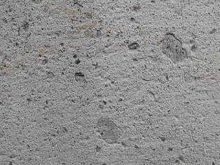
Trachyte igneous rock

Trachyte is an igneous volcanic rock with an aphanitic to porphyritic texture. It is the volcanic equivalent of syenite. The mineral assemblage consists of essential alkali feldspar; relatively minor plagioclase and quartz or a feldspathoid such as nepheline may also be present.. Biotite, clinopyroxene and olivine are common accessory minerals.

Volcanic plug Volcanic object created when magma hardens within a vent on an active volcano

A volcanic plug, also called a volcanic neck or lava neck, is a volcanic object created when magma hardens within a vent on an active volcano. When present, a plug can cause an extreme build-up of pressure if rising volatile-charged magma is trapped beneath it, and this can sometimes lead to an explosive eruption. Glacial erosion can lead to exposure of the plug on one side, while a long slope of material remains on the opposite side. Such landforms are called crag and tail. If a plug is preserved, erosion may remove the surrounding rock while the erosion-resistant plug remains, producing a distinctive upstanding landform.

The Darumbal people have traditionally regarded Mount Jim Crow as a significance place in their Dreamtime stories. [1]

The Darumbal are the Indigenous Australians that have traditionally occupied Central Queensland, speaking dialects of the Darumbal language. Darumbal people of the Keppel Islands and surrounding regions are sometimes also known as Woppaburra or Ganumi, and the terms are sometimes used interchangeably.

Dreamtime sacred era in Australian Aboriginal mythology

Dreamtime is a term devised by early anthropologists to refer to a religio-cultural worldview attributed to Australian Aboriginal beliefs. It was originally used by Francis Gillen, quickly adopted by his colleague Baldwin Spencer and thereafter popularised by A. P. Elkin, who, however, later revised his views. The Dreaming is used to represent Aboriginal concepts of "time out of time" or "everywhen", during which the land was inhabited by ancestral figures, often of heroic proportions or with supernatural abilities. These figures were often distinct from "gods" as they did not control the material world and were not worshipped, but only revered. The concept of the dreamtime has subsequently become widely adopted beyond its original Australian context and is now part of global popular culture.

See also

Related Research Articles

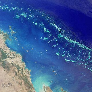
Great Barrier Reef Coral reef system off the east coast of Australia, World Heritage Site

The Great Barrier Reef is the world's largest coral reef system composed of over 2,900 individual reefs and 900 islands stretching for over 2,300 kilometres (1,400 mi) over an area of approximately 344,400 square kilometres (133,000 sq mi). The reef is located in the Coral Sea, off the coast of Queensland, Australia. The Great Barrier Reef can be seen from outer space and is the world's biggest single structure made by living organisms. This reef structure is composed of and built by billions of tiny organisms, known as coral polyps. It supports a wide diversity of life and was selected as a World Heritage Site in 1981. CNN labelled it one of the seven natural wonders of the world. The Queensland National Trust named it a state icon of Queensland.

Great Barrier Reef Marine Park Protected area in Queensland, Australia

The Great Barrier Reef Marine Park protects a large part of Australia's Great Barrier Reef from damaging activities. It is a vast multiple-use Marine Park which supports a wide range of uses, including commercial marine tourism, fishing, ports and shipping, recreation, scientific research and Indigenous traditional use. Fishing and the removal of artefacts or wildlife is strictly regulated, and commercial shipping traffic must stick to certain specific defined shipping routes that avoid the most sensitive areas of the park. The Great Barrier Reef is the largest and best known coral reef ecosystem in the world. Its reefs, almost 3000 in total, represent about 10 per cent of all the coral reef areas in the world. It supports an amazing variety of biodiversity, providing a home to thousands of coral and other invertebrate species, bony fish, sharks, rays, marine mammals, marine turtles, sea snakes, as well as algae and other marine plants.

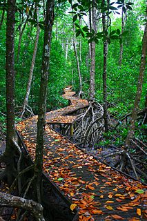
Cedar Bay National Park Protected area in Queensland, Australia

Cedar Bay was a 56.5 km2 (21.8 sq mi) national park in the Shire of Cook, Queensland, Australia. In 2015, it became part of the Mangkalba section of the Ngalba Bulal National Park.

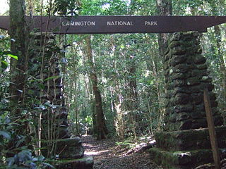
Lamington National Park Protected area in Queensland, Australia

The Lamington National Park is a national park, lying on the Lamington Plateau of the McPherson Range on the Queensland/New South Wales border in Australia. From Southport on the Gold Coast the park is 85 kilometres (53 mi) to the southwest and Brisbane is 110 kilometres (68 mi) north. The 20,600 hectares Lamington National Park is known for its natural environment, rainforests, birdlife, ancient trees, waterfalls, walking tracks and mountain views.

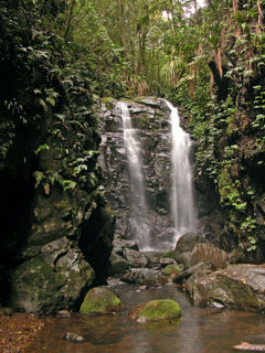
Main Range National Park Protected area in Queensland, Australia

The Main Range is a mountain range and national park in Queensland, Australia, located predominantly in Tregony, Southern Downs Region, 85 kilometres (53 mi) southwest of Brisbane. It is part of the World Heritage Site Gondwana Rainforests of Australia. It protects the western part of a semicircle of mountains in South East Queensland known as the Scenic Rim. This includes the largest area of rainforest in South East Queensland. The park is part of the Scenic Rim Important Bird Area, identified as such by BirdLife International because of its importance in the conservation of several species of threatened birds.

Mount Bauple National Park Protected area in Queensland, Australia

Mount Bauple is a scientific national park in Queensland, Australia, 190 km north of Brisbane.

Rathdowney, Queensland Town in Queensland, Australia

Rathdowney is a small town in south-eastern Queensland, Australia. It is on the Mount Lindesay Highway 32 kilometres (20 mi) south of Beaudesert at the base of the McPherson Range. It is located in the Scenic Rim local government area. At the 2011 census, Rathdowney had a population of 434.

Gondwana Rainforests area of subtropical rainforest in Australia

The Gondwana Rainforests of Australia, formerly known as the Central Eastern Rainforest Reserves, are the most extensive area of subtropical rainforest in the world. Collectively, the rainforests are a World Heritage Site with fifty separate reserves totalling 366,500 hectares from Newcastle to Brisbane.

Central Queensland Region in Queensland, Australia

Central Queensland is an ambiguous geographical division of Queensland that centres on the eastern coast, around the Tropic of Capricorn. Its major regional centre is Rockhampton. The region extends from the Capricorn Coast west to the Central Highlands at Emerald, north to the Mackay Regional Council southern boundary, and south to Gladstone. The region is also known as Capricornia. It is one of Australia's main coal exporting regions.

Shire of Livingstone Local government area in Queensland, Australia

The Shire of Livingstone is a local government area located in the Capricornia region of Central Queensland, Queensland, Australia, to the immediate north and east of the regional city of Rockhampton. The shire, administered from the coastal town of Yeppoon, covers an area of 11,776.3 square kilometres (4,546.9 sq mi), and existed as a local government entity from 1879 until 2008, when it amalgamated with several other councils to become the Rockhampton Region. The Shire was re-established on 1 January 2014 following a successful de-amalgamation referendum in 2013.

Mount Gravatt, Queensland Suburb of Brisbane, Queensland, Australia

Mount Gravatt is the name of both a major suburb of Brisbane, Queensland, Australia and a prominent hill in this suburb. The suburb is situated in the south-east of the city and was one of Brisbane's largest. This was before it was divided into Mount Gravatt East, Upper Mount Gravatt and Mount Gravatt South; the last being changed to Wishart in the early 1990s. At the 2016 Australian Census, the suburb recorded a population of 3,366.

Holland Park is a suburb of Brisbane, Australia.

Mount Molloy, Queensland Town in Queensland, Australia

Mount Molloy is a historic mining and timber town and locality lying 55 kilometres (34 mi) north of Cairns in Queensland, Australia. It is within the local government area of Shire of Mareeba. At the 2011 census, the town and surrounding area had a population of 273.

Beerburrum, Queensland Town in Queensland, Australia

Beerburrum is a small town and coastal locality in the Sunshine Coast Region, Queensland, Australia. In the 2016 census, Beerburrum had a population of 763 people.

Mackenzie River, Queensland Suburb of Isaac Region, Queensland, Australia

Mackenzie River is a locality in the Isaac Region, Queensland, Australia. In the 2016 census, Mackenzie River had a population of 71 people.

Marcoola, Queensland Suburb of Sunshine Coast Region, Queensland, Australia

Marcoola is a coastal town and locality in the Sunshine Coast Region, Queensland, Australia. It includes part of the pristine Mount Coolum national park, borders with the Maroochy River and is part of the Maroochy River Catchment Area and includes urban developments of Town of Seaside and Mount Coolum Shores. The name Marcoola was a coined name and reflects its location between MARoochydore and COOLum.

Gulf Country Region in Queensland, Australia

The Gulf Country is the region of woodland and savanna grassland surrounding the Gulf of Carpentaria in north western Queensland and eastern Northern Territory on the north coast of Australia. The region is also called the Gulf Savannah. It contains large reserves of zinc, lead and silver. The Gulf Country is crossed by the Savannah Way highway.

Julatten, Queensland Town in Queensland, Australia

Julatten is a town and a locality in the Shire of Mareeba, Queensland, Australia.

Porcupine, Queensland Suburb of Shire of Flinders, Queensland, Australia

Porcupine is a locality in the Shire of Finders, Queensland, Australia. In the 2016 census, Porcupine had a population of 49 people.

Eungella Hinterland, Queensland Suburb of Mackay Region, Queensland, Australia

Eungella Hinterland is a rural locality in the Mackay Region, Queensland, Australia. In the 2016 census, Eungella Hinterland had a population of 3 people.

References

  1. 1 2 3 "About Mount Jim Crow". Department of National Parks, Recreation, Sport and Racing. 9 June 2011. Retrieved 12 July 2013.