
The Gemfields is a former locality in the Central Highlands Region, Queensland, Australia. In the 2016 census, The Gemfields had a population of 1,449 people.

Anakie Siding is a rural locality in the Central Highlands Region, Queensland, Australia. It contains the town of Anakie. It is a sapphire mining area. In 2021 census, the locality of Anakie Siding had a population of 155 people.

Duaringa is a rural town in the Central Highlands Region and a locality split between the Central Highlands Region and the Aboriginal Shire of Woorabinda in Central Queensland, Australia. In the 2021 census, the locality of Duaringa had a population of 262 people.

Carmila is a rural town and coastal locality in the Isaac Region, Queensland, Australia. In the 2021 census, the locality of Carmila had a population of 340 people.

The Shire of Duaringa was a local government area in the Capricornia region of Queensland, Australia. Duaringa Shire covered an area of 18,201 square kilometres and had a population of 6,744 according to the 2006 census. On 15 March 2008 the shires of Duaringa, Emerald, Bauhinia and Peak Downs were amalgamated to form the Central Highlands Region.
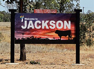
Jackson is a rural town and locality in the Maranoa Region, Queensland, Australia. In the 2021 census, the locality of Jackson had a population of 55 people.
Diddillibah is a semi-rural locality in the Sunshine Coast Region, Queensland, Australia. In the 2021 census, Diddillibah had a population of 1,703 people.

Central Highlands Region is a local government area in Queensland, Australia. In the 2021 census, the Central Highlands Region had a population of 27,836 people.
Comet is a historically-rich rural town and locality in the Central Highlands Region, Queensland, Australia. In the 2021 census, the locality of Comet had a population of 360 people.
Koumala is a rural town and coastal locality in the Mackay Region, Queensland, Australia. In the 2021 census, the locality of Koumala had a population of 772 people.
Gogango is a rural town and locality in the Rockhampton Region, Queensland, Australia. In the 2021 census, the locality of Gogango had a population of 184 people.

Clairview is a coastal town and locality in the Isaac Region, Queensland, Australia. In the 2021 census, the locality of Clairview had a population of 167 people.

Willows is a rural locality in the Central Highlands Region, Queensland, Australia. In the 2021 census, Willows had a population of 139 people.

Boolburra is a rural town and locality in the Central Highlands Region, Queensland, Australia. In the 2021 census, the locality of Boolburra had a population of 34 people.

Lawgi Dawes is a rural locality in the Shire of Banana, Queensland, Australia. It contains the neighbourhood of Lawgi, a former town.

Kianga is a rural locality in the Shire of Banana, Queensland, Australia. In the 2021 census, Kianga had a population of 219 people.
Minerva is a rural locality in the Central Highlands Region, Queensland, Australia. In the 2021 census, Minerva had a population of 55 people.
Mantuan Downs is a rural locality in the Central Highlands Region, Queensland, Australia. In the 2021 census, Mantuan Downs had a population of 23 people.
Bingegang is a rural locality in the Central Highlands Region, Queensland, Australia. In the 2021 census, Bingegang had "no people or a very low population".

Goowarra is a rural locality in the Central Highlands Region, Queensland, Australia. In the 2021 census, Goowarra had a population of 27 people.

