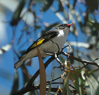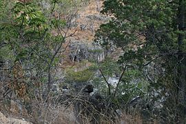
Bendidee is a national park in the Goondiwindi Region, Queensland, Australia.

Bowling Green Bay is a national park in the City of Townsville and Shire of Burdekin, Queensland, Australia, 1,103 km northwest of Brisbane, and 28 km south of Townsville and 59 km north of Ayr. It is a Ramsar Convention listed site. The park protects diverse range of habitats including the rugged, forested landscape surrounding Mount Elliot and Saddle Mountain as well as coastal estuaries between Cape Cleveland and Cape Bowling Green.

Cape Palmerston is a national park in the Mackay Region, Queensland, Australia.

The Culgoa Floodplain National Park is a protected national park that is located in the South West region of Queensland in eastern Australia. The 42,859-hectare (105,910-acre) national park is situated at the western extent of Hebel in the Shire of Balonne and in the east of Jobs Gate in the Paroo Shire, approximately 630 kilometres (390 mi) west of Brisbane. The park occupies the former pastoral and grazing property of Byra Station. The park's southern boundary is defined by part of the state border between Queensland and New South Wales.

The Daintree rainforest is a national park in Far North Queensland, Australia, 1,757 km (1,092 mi) northwest of Brisbane and 100 km (62 mi) northwest of Cairns. It was founded in 1981 and is part of the Wet Tropics of Queensland. In 1988 it became a World Heritage Site. The park consists of two sections, with a settled agricultural area between them which includes the towns of Mossman and Daintree Village.

Dularcha is a national park in Queensland, Australia, 78 km north of Brisbane. The park occupies a north east portion of Landsborough. It is bisected by the North Coast railway line. The park covers an area of 4.64 km2 (1.79 sq mi). It lies within the Mooloolah River water catchment area of the South East Queensland bioregion.

Mariala National Park is a national park in South West Queensland, Australia, 810 km west of Brisbane. Mariala lies within the Mulga Lands bioregion and the Shire of Quilpie local government area. It is located with the water catchment areas of the Bulloo, Paroo and Warrego rivers. Mariala covers 269.2 km2 (104 sq mi).

Mount Pinbarren is a national park in Queensland, Australia, 129 km north of Brisbane. It is located in Pinbarren, a locality in the Shire of Noosa. Mount Pinbarren lies within the South East Queensland bioregion and the Mary River catchment area.

The Springbrook National Park is a protected national park that is located in the Gold Coast hinterland of Queensland, Australia. The 6,197-hectare (15,310-acre) park is situated on the McPherson Range, near Springbrook, approximately 100 kilometres (62 mi) south of Brisbane. The park is part of the Shield Volcano Group of the UNESCO World Heritage–listed Gondwana Rainforests of Australia.

The Wet Tropics of Queensland World Heritage Site consists of approximately 8,940 km2 of Australian wet tropical forests growing along the north-east Queensland portion of the Great Dividing Range. The Wet Tropics of Queensland meets all four of the criteria for natural heritage for selection as a World Heritage Site. World Heritage status was declared in 1988, and on 21 May 2007 the Wet Tropics were added to the Australian National Heritage List.

The Daintree Rainforest is a region on the northeast coast of Queensland, Australia, north of Mossman and Cairns. At around 1,200 square kilometres (460 sq mi), the Daintree is a part of the largest continuous area of tropical rainforest on the Australian continent. The Daintree Rainforest is a part of the Wet Tropics of Queensland Rainforest, that spans across the Cairns Region. The Wet Tropics Rainforest is the oldest continually surviving tropical rainforest in the world. Along the coastline north of the Daintree River, tropical forest grows right down to the edge of the sea.

Cape Tribulation is a headland and coastal locality in the Shire of Douglas in northern Queensland, Australia. In the 2016 census, Cape Tribulation had a population of 118 people.

Mossman Gorge is a rural locality in the Shire of Douglas, Queensland, Australia. In the 2016 census, Mossman Gorge had a population of 246 people.

Mossman is a town and a locality in Far North Queensland, Australia, on the Mossman River. It is within the local government area of Shire of Douglas. In the 2016 census, Mossman had a population of 1,937 people.

Alwal National Park is a national park in the Shire of Cook on the Cape York Peninsula in Far North Queensland, Australia.

Annan River National Park is a national park on Cape York Peninsula in Far North Queensland, Australia. The Annan River from which the park gets its name, marks the northern and western extent of the park. To the east of the park is Walker Bay in the Coral Sea. The park was gazetted in 2006.

Kuranda National Park is a national park in Far North Queensland, Australia. Like many national parks in the area it belongs to the Wet Tropics World Heritage Area. The park protects an important wildlife corridor in which rainforest and open eucalypt forest predominate. Walking, mountain biking and four-wheel driving are popular recreational activities.

Mount Binga National Park is a national park at Mount Binga in the Toowoomba Region of the Darling Downs region in southern Queensland, Australia. The park lies within the catchment area of Emu Creek, a tributary of the Brisbane River and belongs to the South East Queensland bioregion.

The Mossman River is a river located in the Cape York Peninsula of Far North Queensland, Australia.

The Windsor Tablelands are a series of plateaus located in Far North Queensland, Australia. The Windsor Tableland and surrounding rainforest area are contained as part of the Wet Tropics of Queensland, sitting between the Daintree Rainforest and Mount Lewis National Park. Additionally, the region is contained in the state electorate of Cook and situated in the greater Tablelands Region of North Queensland. The Tablelands hug the mountain ranges of the Great Dividing Range with the nearest town being Wujal Wujal. The Tableland area is a larger part of the Mount Windsor Forest Reserve which represents 44,000 hectares of land in the Wet Tropic region and is a conserved nature area, as proclaimed by the Government of Queensland in 2005. Predominately the majority of the Mount Windsor Tableland is closed off for any form of public use and access to the area is often only given on request. There is currently no residential population in the Mount Windsor Tableland region as a majority of the area is national park.


