Aboriginal Shire of Hope Vale

Last updated

Hope Vale Aboriginal Shire
Queensland
Hopevale LGA Qld.png
Location within Queensland
Coordinates 15°17′46″S145°06′43″E / 15.296°S 145.112°E / -15.296; 145.112
Population976 (2021 census) [1]
 • Density0.8660/km2 (2.2430/sq mi)
Established1986
Area1,127 km2 (435.1 sq mi) [2]
MayorJason Grant Woibo
Council seat Hope Vale
Region Far North Queensland
State electorate(s) Cook
Federal division(s) Leichhardt
Hope Vale Aboriginal Shire Council Logo.png
Website Hope Vale Aboriginal Shire
LGAs around Hope Vale Aboriginal Shire:
Cook Cook Cook
Cook Hope Vale Aboriginal Shire Coral Sea
Cook Cook Coral Sea

The Aboriginal Shire of Hope Vale is a local government area in Far North Queensland, Queensland, Australia, north of the town of Cooktown. The majority of the Shire consists of Deed of Grant land that is held for the benefit of Aboriginal people particularly concerned with the land and their ancestors and descendants.

Contents

In the 2021 census, the Hope Vale Aboriginal Shire had a population of 976 people, of whom 863 (88.4%) are Indigenous Australians. [1]

History

Guugu Yimithirr (also known as Koko Yindjir, Gugu Yimidhirr, Guguyimidjir) is an Australian Aboriginal language of Hope Vale and the Cooktown area. The language region includes the local government area of the Aboriginal Shire of Hope Vale and the Shire of Cook, particularly the localities of Cape Bedford, Battle Camp and sections of the Normanby River and Annan River. [3]

The area originally was set up as a German Lutheran mission in 1885 by missionaries, at what came to be known as the Cape Bedford Mission, 25 kilometres (16 mi) from what is now Hope Vale. The residents were evacuated to Woorabinda during World War II in 1942, and the land was used by the army. Many of the people died, and the survivors were not allowed to return until 1949. In September 1952, the land was formally gazetted as an Aboriginal reserve.

In 1986, under the Community Services (Aborigines) Act 1984, a Deed of Grant in Trust was given to the Hope Vale community. Like other DOGIT communities of the time, Hope Vale had a Community Council elected by Aboriginal people living in the community.

Demographics

In the 2016 census, the Hope Vale Aboriginal Shire had a population of 918 people, of whom 897 (92.0% are Indigenous Australians. [4]

In the 2021 census, the Hope Vale Aboriginal Shire had a population of 976 people, of whom 863 (88.4%) are Indigenous Australians. [1]

Responsibilities

The Hope Vale Aboriginal Shire Council operates under the requirements set out in the Queensland Local Government Act. However, in the township of Hope Vale the council is also the Trustee of the land and as such has added responsibilities that are quite different from a typical local government body. This includes responsibility for fisheries, alcohol management and employment initiatives.

The Hope Vale Aboriginal Shire Council operates an Indigenous Knowledge Centre (Nganthaanun-Milbi\Guugu Magubadaaygu), at the Jack Bambie Memorial Centre, in Hope Vale. [5]

Mayors

See also

Related Research Articles

<span class="mw-page-title-main">Guugu Yimithirr people</span> Indigenous Australian people of Queensland

The Guugu Yimithirr, also spelt Gugu Yimithirr and also known as Kokoimudji, are an Aboriginal Australian people of Far North Queensland, many of whom today live at Hopevale, which is the administrative centre of Hopevale Shire. At the 2011 census, Hopevale had a population of 1,005 people. It is about 46 kilometres (29 mi) from Cooktown by road. It is also the name of their language. They were both a coastal and inland people, the former clans referring to themselves as a "saltwater people".

Guugu Yimithirr, also rendered Guugu Yimidhirr, Guguyimidjir, and many other spellings, is an Australian Aboriginal language, the traditional language of the Guugu Yimithirr people of Far North Queensland. It belongs to the Pama-Nyungan language family. Most of the speakers today live at the community of Hope Vale, about 46 kilometres (29 mi) from Cooktown. However, as of June 2020 only about half of the Guugu Yimithirr nation speak the language. As such, efforts are being made to teach it to children. Guugu Yimithirr is the source language of the word kangaroo.

<span class="mw-page-title-main">Laura, Queensland</span> Town in Queensland, Australia

Laura is a rural town and locality in the Shire of Cook, Queensland, Australia. In the 2021 census, the locality of Laura had a population of 133 people.

<span class="mw-page-title-main">Hope Vale, Queensland</span> Town in Queensland, Australia

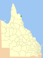
Hope Vale is a town within the Aboriginal Shire of Hope Vale and a coastal locality split between the Aboriginal Shire of Hope Vale and the Shire of Cook, both in Queensland, Australia. It is an Aboriginal community. In the 2021 census, the locality of Hope Vale had a population of 1,004 people.

<span class="mw-page-title-main">Shire of McKinlay</span> Local government area in Queensland, Australia

The Shire of McKinlay is a local government area in outback north-western Queensland, Australia.

<span class="mw-page-title-main">Shire of Flinders (Queensland)</span> Local government area in Queensland, Australia

The Shire of Flinders is a local government area in north-western Queensland, Australia.

<span class="mw-page-title-main">Shire of Cook</span> Local government area in Queensland, Australia

The Shire of Cook is a local government area in Far North Queensland, Australia. The Shire covers most of the eastern and central parts of Cape York Peninsula, the most northerly section of the Australian mainland.

<span class="mw-page-title-main">Shire of Mornington (Queensland)</span> Local government area in Queensland, Australia

The Shire of Mornington is a local government area in northwestern Queensland, Australia. The shire covers the Wellesley Islands, which includes Mornington Island; the South Wellesley Islands; Bountiful Islands; and West Wellesley / Forsyth Islands groups in the Gulf of Carpentaria.

<span class="mw-page-title-main">Normanby River</span> River in northern Queensland, Australia

The Normanby River, comprising the East Normanby River, the West Normanby River, the East Normanby River North Branch, the East Normanby River South Branch and the Granite Normanby River, is a river system in Far North Queensland, Australia.

<span class="mw-page-title-main">Aboriginal Shire of Palm Island</span> Local government area in Queensland, Australia

The Aboriginal Shire of Palm Island is a special local government area of Queensland, Australia, managed by the Palm Island Aboriginal Shire Council under a Deed of Grant in Trust granted to the community on 27 October 1986. The local council was previously the Palm Island Community Council, which had far fewer powers. The shire is located on the Palm Island group, off the north Queensland coast near the city of Townsville.

<span class="mw-page-title-main">Aboriginal Shire of Doomadgee</span> Local government area in Queensland, Australia

The Aboriginal Shire of Doomadgee is a special local government area in North West Queensland, Queensland, Australia. It is managed under a Deed of Grant in Trust under the Local Government Act 2004.

<span class="mw-page-title-main">Maranoa Region</span> Local government area in Queensland, Australia

Maranoa Region is a local government area in South West Queensland, Australia. The town of Roma is the administrative headquarters of the region.

<span class="mw-page-title-main">Charters Towers Region</span> Local government area in Queensland, Australia

The Charters Towers Region is a local government area in North Queensland, Australia southwest of, and inland from the city of Townsville, based in Charters Towers. Established in 2008, it was preceded by two previous local government areas which dated back to the 1870s.

The Torres Strait Island Region is a local government area in Far North Queensland, Australia, covering part of the Torres Strait Islands. It was created in March 2008 out of 15 autonomous Island Councils during a period of statewide local government reform. It has offices in each of its 15 communities, and satellite services in Thursday Island and in Cairns.

<span class="mw-page-title-main">Aboriginal Shire of Kowanyama</span> Local government area in Queensland, Australia

The Aboriginal Shire of Kowanyama is a special local government area which is located on western Cape York Peninsula in Queensland, Australia. It is managed under a Deed of Grant in Trust under the Local Government Act 2004.

<span class="mw-page-title-main">Aboriginal Shire of Pormpuraaw</span> Local government area in Queensland, Australia

The Aboriginal Shire of Pormpuraaw is a special local government area which is located on western Cape York Peninsula in Queensland, Australia. It is managed under a Deed of Grant in Trust under the Local Government Act 2004.

<span class="mw-page-title-main">Aboriginal Shire of Yarrabah</span> Local government area in Queensland, Australia

The Aboriginal Shire of Yarrabah is a special local government area in Far North Queensland, Queensland, Australia, east and southeast of Cairns on Cape Grafton. It is managed under a Deed of Grant in Trust under the Local Government Act 2004.

<span class="mw-page-title-main">Cape Bedford Mission</span> Christian mission in Queensland, Australia

The Cape Bedford Mission was the first Christian mission on the Cape York Peninsula of Queensland, Australia. It is the oldest surviving mission in northern Queensland. It is at South Cape Bedford within the present-day locality of Hope Vale.

<span class="mw-page-title-main">Cooktown, Queensland</span> Town in Queensland, Australia

Cooktown is a coastal town and locality in the Shire of Cook, Queensland, Australia. Cooktown is at the mouth of the Endeavour River, on Cape York Peninsula in Far North Queensland where James Cook beached his ship, the Endeavour, for repairs in 1770. Both the town and Mount Cook which rises up behind the town were named after James Cook.

Eric Deeral was an Australian politician who was the second Australian Aboriginal person elected to an Australian parliament and the first to a state parliament.

References

  1. 1 2 3 Australian Bureau of Statistics (28 June 2022). "Hope Vale Aboriginal Shire (LGA)". 2021 Census QuickStats. Retrieved 28 February 2023. OOjs UI icon edit-ltr-progressive.svg
  2. "Layers: Locality; Local government". Queensland Globe. Queensland Government. Archived from the original on 19 December 2017. Retrieved 10 July 2024.
  3. CC BY icon-80x15.png This Wikipedia article incorporates CC BY 4.0 licensed text from: "Guugu Yimithirr". Queensland Aboriginal and Torres Strait Islander languages map. State Library of Queensland . Retrieved 28 January 2020.
  4. Australian Bureau of Statistics (27 June 2017). "Hope Vale Aboriginal Shire (LGA)". 2016 Census QuickStats. Retrieved 20 October 2018. OOjs UI icon edit-ltr-progressive.svg
  5. "Hope Vale Aboriginal Shire Council". Public Libraries Connect. State Library of Queensland. 20 September 2016. Archived from the original on 3 February 2018. Retrieved 2 February 2018.
  6. "2008 Hope Vale Aboriginal Shire Council - Mayoral Election - Election Summary". results.ecq.qld.gov.au. Archived from the original on 27 April 2018. Retrieved 4 December 2017.
  7. "2012 Hope Vale Aboriginal Shire Council - Mayoral Election - Election Summary". results.ecq.qld.gov.au. Archived from the original on 1 April 2018. Retrieved 4 December 2017.
  8. "2016 Hope Vale Aboriginal Shire Council - Mayoral Election - Election Summary". results.ecq.qld.gov.au. Archived from the original on 27 March 2018. Retrieved 4 December 2017.
  9. "2020 Local Government Elections: Saturday, 28 March 2020". Electoral Commission of Queensland. 2020. Archived from the original on 23 December 2020. Retrieved 16 June 2020.