Shire of Murweh

Last updated

Shire of Murweh
Queensland
Murweh LGA Qld.png
Location of the shire within Queensland
Population4,318 (2018) [1]
 • Density0.10609/km2 (0.2748/sq mi)
Established1879
Area40,700 km2 (15,714.4 sq mi) [1]
MayorShaun Radnedge
Council seat Charleville
Region South West Queensland
State electorate(s) Warrego
Federal division(s) Maranoa
Website Shire of Murweh
LGAs around Shire of Murweh:
Blackall-Tambo Blackall-Tambo Central Highlands
Quilpie Shire of Murweh Maranoa
Paroo Paroo Paroo

The Shire of Murweh is a local government area in the Maranoa district, which is part of South West Queensland, Australia. The administrative centre and largest town in the shire is Charleville. In June 2018, the Shire of Murweh had a population of 4,318. [1]

Contents

History

Map of Murweh Division and adjacent local government areas, March 1902 Murweh Division, March 1902.jpg
Map of Murweh Division and adjacent local government areas, March 1902

Bidjara (Bidyara, Pitjara, Peechara) is an Australian Aboriginal language spoken by the Bidjara people. The Bidjara language region includes the landscape within the local government boundaries of the Murweh Shire Council, particularly the towns of Charleville, Augathella and Blackall as well as the properties of Nive Downs and Mount Tabor. [2]

Murweh Division was created on 11 November 1879 as one of 74 divisions of Queensland under the Divisional Boards Act 1879 with a population of 1286. [3]

On 11 October 1883, there was an adjustment of boundaries between Tambo Division and Murweh Division. [4] [5]

On 5 February 1889, the western part of Murweh Division was separated to create the new Adavale Division. [6] [7] [8]

On 21 March 1894, under the "Local Government Act 1878", Subdivision 2 of the Murweh Division was separated to create a municipality called Borough of Charleville. [9]

With the passage of the Local Authorities Act 1902, Murweh Division became the Shire of Murweh on 31 March 1903. [10]

On 10 September 1960, the Town of Charleville (the successor of the Borough of Charleville) which had been separated from Murweh Division in 1894, was absorbed back into the Shire of Murweh . [10] [11]

Towns and localities

The Shire of Murweh includes the following towns and localities:

Amenities

Murweh Shire Council operates public libraries in Augathella, Charleville and Morven. [12] all three of these libraries have access to the internet through a high speed ISDN Broadband Internet Connection (provided through the National Broadband Network) to Brisbane.

The Murweh Shire Council operates the Charleville Airport and the aerodromes in Augathella, Morven and Cooladdi.

Murweh Shire Council also owns and operates these parks and recreational facilities throughout the shire

Augathella

Charleville

Morven

Population

YearPopulation
18791,286
19336,141
19475,930
19547,532
19617,845
19667,483
19716,053
19765,585
19815,338
19865,287
19915,291
19964,962
20014,975
20064,580
20164,307
20213,971

Shire Chambers

Murweh Shire Council Chambers, 1933 StateLibQld 1 114656 Murweh Shire Council Chambers, 1933.jpg
Murweh Shire Council Chambers, 1933

The first Murweh council chambers were built in the 1880s but were destroyed by fire in the 1930s. [13]

The new Murweh Shire Council Chambers were opened in Alfred Street in February 1938 by the shire chairman William Herbert Corbett. [13] The architects were Hall and Phillips and the contractor was T. E. Woollon of Brisbane. [14]

The chambers suffered extensive damage during the 1990 flood which devastated Charleville. Repairs were carried out by Q-Build in late 1990. [13] These repairs held fast in the 1997 flood that hit Charleville, but suffered moderate damage during the 2010 flood that hit Charleville.[ citation needed ]

Chairmen and mayors

Related Research Articles

<span class="mw-page-title-main">Charleville, Queensland</span> Town in Queensland, Australia

Charleville is a rural town and locality in the Shire of Murweh, Queensland, Australia. In the 2016 census, the locality of Charleville had a population of 3,335 people.

<span class="mw-page-title-main">Augathella</span> Town in Queensland, Australia

Augathella is a rural town and locality in the Shire of Murweh, Queensland, Australia.

<span class="mw-page-title-main">Warrego River</span> River in Australia

The Warrego River is an intermittent river that is part of the Darling catchment within the Murray–Darling basin, which is located in South West Queensland and in the Orana region of New South Wales, Australia. The Warrego River is the northernmost tributary of the Darling River.

<span class="mw-page-title-main">Shire of Paroo</span> Local government area in Queensland, Australia

The Shire of Paroo is a local government area in South West Queensland, Australia. The administrative centre is the town of Cunnamulla. The Paroo Shire covers an area of 47,623 square kilometres (18,387 sq mi). In the 2021 census, the Shire had a population of 1,679.

<span class="mw-page-title-main">Morven, Queensland</span> Town in Queensland, Australia

Morven is a rural town and locality in the Shire of Murweh, Queensland, Australia. In the 2016 census, the locality of Morven had a population of 199 people.

<span class="mw-page-title-main">Shire of Mareeba</span> Local government area in Queensland, Australia

The Shire of Mareeba is a local government area at the base of Cape York Peninsula in Far North Queensland, inland from Cairns. The shire, administered from the town of Mareeba, covered an area of 53,491 square kilometres (20,653.0 sq mi), and existed as a local government entity from 1879 until 2008, when it amalgamated with several councils in the Atherton Tableland area to become the Tablelands Region.

<span class="mw-page-title-main">Shire of Etheridge</span> Local government area in Queensland, Australia

The Shire of Etheridge is a local government area in Far North Queensland, Australia in what is known as the Savannah Gulf region. Its economy is based on cattle grazing and mining.

<span class="mw-page-title-main">Shire of Torres</span> Local government area in Queensland, Australia

The Shire of Torres is a local government area located in Far North Queensland, Australia, covering large sections of the Torres Strait Islands and the northern tip of Cape York Peninsula north of 11°S latitude. It holds two distinctions—it is the northernmost Local Government Area in Australia, and is the only one to abut an international border – it is at one point just 73 kilometres (45 mi) from Papua New Guinea. It is administered from Thursday Island.

<span class="mw-page-title-main">Moreton Bay Region</span> Local government area in Queensland, Australia

The Moreton Bay Region is a local government area in the north of the Brisbane metropolitan city in South East Queensland, Australia. Established in 2008, it replaced three established local government areas, the City of Redcliffe and the Shires of Pine Rivers and Caboolture.

<span class="mw-page-title-main">Maranoa Region</span> Local government area in Queensland, Australia

Maranoa Region is a local government area in South West Queensland, Australia. The town of Roma is the administrative headquarters of the region.

<span class="mw-page-title-main">Gympie Region</span> Local government area in Queensland, Australia

The Gympie Region is a local government area in the Wide Bay–Burnett region of Queensland, Australia, about 170 kilometres (110 mi) north of Brisbane, the state capital. It is between the Sunshine Coast and Hervey Bay and centred on the town of Gympie. It was created in 2008 from a merger of the Shires of Cooloola and Kilkivan and part of the Shire of Tiaro.

<span class="mw-page-title-main">Shire of Stephens</span> Local government area in Queensland, Australia

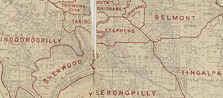
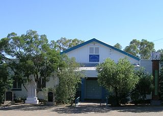
The Shire of Stephens was a local government area in the inner southern suburbs of Brisbane, Queensland, Australia. The shire, administered from Annerley, covered an area of 9 square miles (23 km2), and existed as a local government entity from 1886 until 1925, when it was amalgamated into the City of Brisbane under the City of Brisbane Act 1924.

Bidjara, also spelt Bidyara or Pitjara, is an Australian Aboriginal language. In 1980, it was spoken by twenty elders in Queensland between the towns of Tambo and Augathella, or the Warrego and Langlo Rivers. There are many dialects of the language, including Gayiri and Gunggari. Some of them are being revitalised and is being taught in local schools in the region.

Adavale is a rural town and locality in the Shire of Quilpie, Queensland, Australia. In the 2016 census, the locality of Adavale had a population of 93 people. By 2021, the population was down to 72.

<span class="mw-page-title-main">South West Queensland</span> Region in Queensland, Australia

South West Queensland is a remote region in the Australian state of Queensland which covers 319,808 km2 (123,479 sq mi). The region lies to the south of Central West Queensland and west of the Darling Downs and includes the Maranoa district and parts of the Channel Country. The area is noted for its cattle grazing, cotton farming, opal mining and oil and gas deposits.

<span class="mw-page-title-main">Shire of Adavale</span>

The Shire of Adavale is a former local government area in the south-east of Queensland, Australia, centred on the town of Adavale. It existed from 1879 to 1930.

The Town of Charleville is a former local government area in the Maranoa area of Queensland, Australia. It existed from 1894 to 1960.

Cooladdi is a ghost town and rural locality in the Shire of Murweh, Queensland, Australia. The town is 88.9 kilometres (55.2 mi) south-west of Charleville.

The Kunja (Gunya) were an indigenous Australian people of the state of Queensland.

Redford is a locality split between the Maranoa Region and the Shire of Murweh, both in Queensland, Australia. In the 2016 census, Redford had a population of 7 people.

References

  1. 1 2 3 "3218.0 – Regional Population Growth, Australia, 2017-18: Population Estimates by Local Government Area (ASGS 2018), 2017 to 2018". Australian Bureau of Statistics. 27 March 2019. Archived from the original on 27 March 2019. Retrieved 25 October 2019. Estimated resident population, 30 June 2018.
  2. "Bidjara". State Library of Queensland . Archived from the original on 25 September 2020. Retrieved 15 January 2020.
  3. "Proclamation [Murweh Division]". Queensland Government Gazette . 11 November 1879. p. 25:1000.
  4. "Proclamation [Tambo Division amended]". Queensland Government Gazette . 13 October 1883. p. 33:1018.
  5. "Proclamation [Murweh Division amended]". Queensland Government Gazette . 13 October 1883. p. 33:1018-1019.
  6. "Proclamation [Adavale Division]". Queensland Government Gazette . 9 February 1889. p. 46:469.
  7. "Country News". The Queenslander . Brisbane: National Library of Australia. 2 February 1889. p. 198. Archived from the original on 17 July 2022. Retrieved 4 September 2013.
  8. "Agency ID 287, Adavale Divisional Board". Queensland State Archives . Retrieved 4 September 2013.
  9. "Agency ID 2098, Charleville Municipal Council". Queensland State Archives . Retrieved 10 September 2013.
  10. 1 2 "Agency ID 1435, Murweh Shire Council". Queensland State Archives . Retrieved 10 September 2013.
  11. "Agency ID 560, Charleville Town Council". Queensland State Archives . Retrieved 10 September 2013.
  12. "Murweh Shire Council". Public Libraries Connect. State Library of Queensland. 20 September 2016. Archived from the original on 6 February 2018. Retrieved 6 February 2018.
  13. 1 2 3 4 5 "OFFICIAL OPENING". The Charleville Times . Brisbane: National Library of Australia. 11 February 1938. p. 7. Archived from the original on 17 July 2022. Retrieved 10 January 2014.
  14. "CHARLEVILLE NOTES". Townsville Daily Bulletin . Qld.: National Library of Australia. 28 December 1937. p. 2. Archived from the original on 5 December 2020. Retrieved 10 January 2014.
  15. Pugh, Theophilus Parsons (1927). Pugh's Almanac for 1927. Archived from the original on 4 March 2014. Retrieved 13 June 2014.
  16. "2008 Murweh Shire - Mayoral Election - Election Summary". results.ecq.qld.gov.au. Archived from the original on 5 December 2020. Retrieved 4 December 2017.
  17. "2008 Murweh Shire - Mayoral Election - Election Summary". results.ecq.qld.gov.au. Archived from the original on 5 December 2020. Retrieved 4 December 2017.
  18. "2016 Murweh Shire Council - Mayoral Election - Election Summary". results.ecq.qld.gov.au. Archived from the original on 21 March 2022. Retrieved 4 December 2017.
  19. "2020 Local Government Elections: Saturday, 28 March 2020". Electoral Commission of Queensland. 2020. Retrieved 16 June 2020.[ dead link ]

Coordinates: 26°24′06″S146°14′23″E / 26.40167°S 146.23972°E / -26.40167; 146.23972