
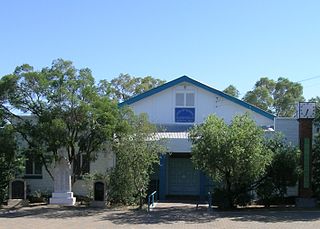
Wallal is a rural town in the Shire of Murweh, Queensland, Australia. [1] The town is within the locality of Bakers Bend. [2]
Wallal is a rural town in the Shire of Murweh, Queensland, Australia. [1] The town is within the locality of Bakers Bend. [2]
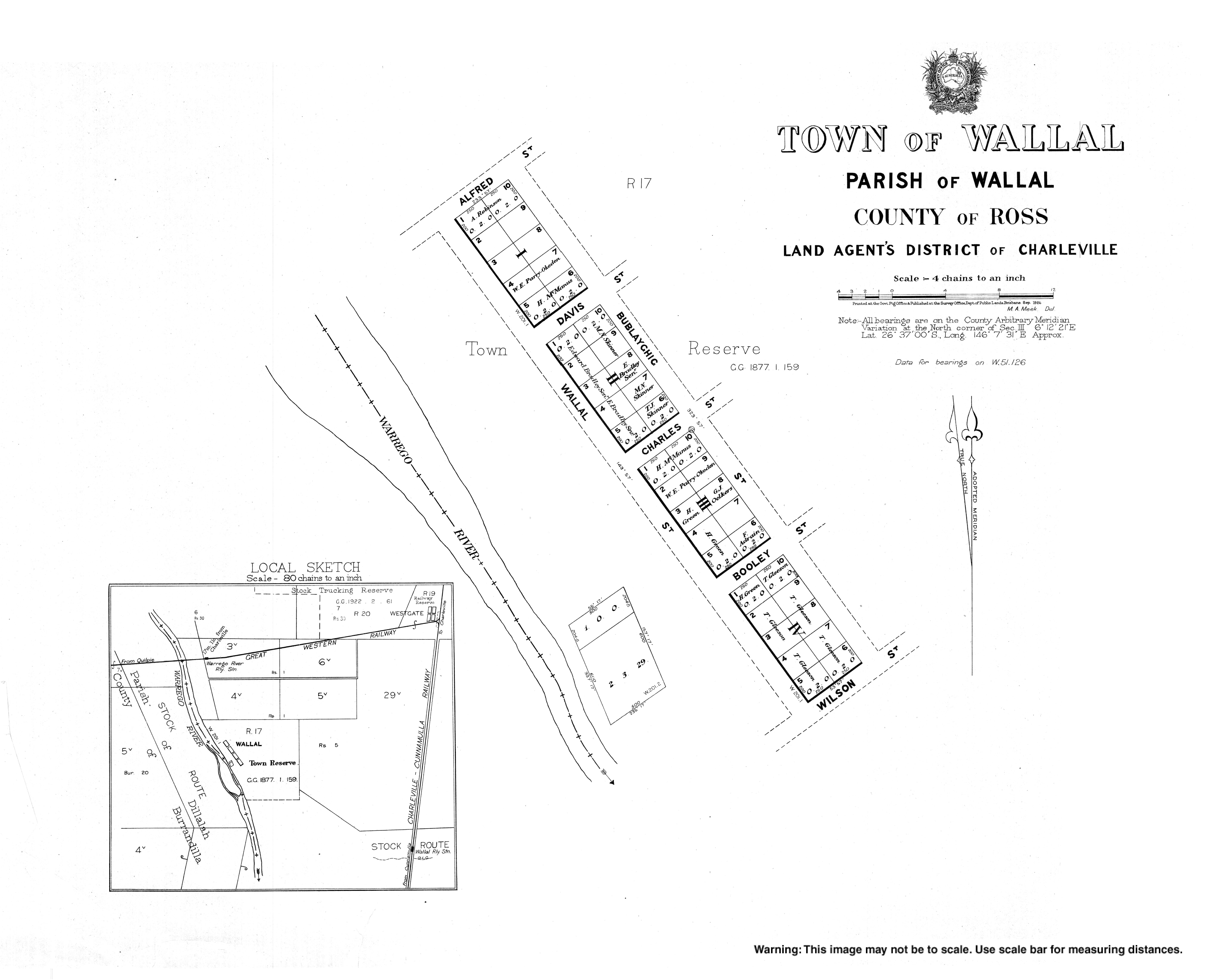
The town of Wallal first appears on an 1877 survey plan. [1]
Wallal Provisional School opened in 1900 and closed in 1907. [3]

Charleville is a rural town and locality in the Shire of Murweh, Queensland, Australia. In the 2016 census, the locality of Charleville had a population of 3,335 people.
Augathella is a rural town and locality in the Shire of Murweh, Queensland, Australia. In the 2021 census, the locality of Augathella had a population of 393 people.

Morven is a rural town and locality in the Shire of Murweh, Queensland, Australia. In the 2016 census, the locality of Morven had a population of 199 people.

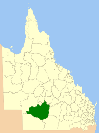
The Shire of Murweh is a local government area in the Maranoa district, which is part of South West Queensland, Australia. The administrative centre and largest town in the shire is Charleville. In June 2018, the Shire of Murweh had a population of 4,318.
The Shire of Quilpie is a local government area in South West Queensland, Australia. It covers an area of 67,415 square kilometres (26,029 sq mi), and its administrative centre is the town of Quilpie.
The Shire of Tambo was a local government area located in central Queensland south-east of the town of Blackall. It covered an area of 14,083.8 square kilometres (5,437.8 sq mi), and existed as a local government entity from 1881 until 2008, when it amalgamated with neighbouring Shire of Blackall to form the Blackall-Tambo Region.

The Shire of Adavale is a former local government area in the south-east of Queensland, Australia, centred on the town of Adavale. It existed from 1879 to 1930.
The Town of Charleville is a former local government area in the Maranoa area of Queensland, Australia. It existed from 1894 to 1960.
Bakers Bend is a rural locality in the Shire of Murweh, Queensland, Australia. In the 2016 census, Bakers Bend had a population of 28 people.
Cooladdi is a rural locality in the Shire of Murweh, Queensland, Australia. The town is 88.9 kilometres (55.2 mi) south-west of Charleville.
Upper Warrego is a rural locality in the Shire of Murweh, Queensland, Australia. In the 2016 census Upper Warrego had a population of 0 people.
Riversleigh is a rural locality in the Shire of Murweh, Queensland, Australia. In the 2016 census, Riversleigh had a population of 16 people.
Langlo is a locality in the Shire of Murweh, Queensland, Australia. In the 2021 census, Langlo had a population of 34 people.
Westgate is an unoccupied town in the locality of Bakers Bend in the Shire of Murweh, Queensland, Australia.
Clara Creek is a locality in the Shire of Murweh, Queensland, Australia. In the 2021 census, Clara Creek had a population of 56 people.
Redford is a locality split between the Maranoa Region and the Shire of Murweh, both in Queensland, Australia. In the 2016 census, Redford had a population of 7 people.

Nive is a rural locality in the Shire of Murweh, Queensland, Australia. It is on the boundary between the Shire of Murweh and the Blackall-Tambo Region. In the 2021 census, Nive had a population of 44 people.
Ward is a rural locality in the Shire of Murweh, Queensland, Australia. In the 2016 census Ward had a population of 74 people.
Tyrconnel is a rural locality split between the Maranoa Region and the Shire of Murweh, both in Queensland, Australia. In the 2021 census, Tyrconnel had a population of 17 people.
Murweh is a rural locality in the Shire of Murweh, Queensland, Australia. In the 2021 census, Murweh had a population of 9 people.