Langlo

Last updated

Langlo
Queensland
Australia Queensland location map.svg
Red pog.svg
Langlo
Coordinates 26°02′22″S145°43′41″E / 26.0394°S 145.7280°E / -26.0394; 145.7280 (Langlo (centre of locality))
Population34 (SAL 2021) [1]
Postcode(s) 4470
Area4,812.4 km2 (1,858.1 sq mi)
Time zone AEST (UTC+10:00)
Location
LGA(s) Shire of Murweh
County Langlo County, Queensland
State electorate(s) Warrego
Federal division(s) Maranoa
Suburbs around Langlo:
Blackall Scrubby Creek Ward
Adavale Langlo Ward
Cooladdi Ward Ward

Langlo is a locality in the Shire of Murweh, Queensland, Australia. [2] In the 2021 census, Langlo had a population of 34 people. [3]

Contents

Geography

The land use is grazing on native vegetation. [4]

History

Langlo Crossing Provisional School opened on 9 September 1907. On 1 January 1914, it became Langlo Crossing State School. It closed on 2 July 1937. [5] The school was on Adavale Road (approx 26°07′32″S145°40′20″E / 26.12557°S 145.67228°E / -26.12557; 145.67228 (Langlo Crossing State School (former)) ). [6] [7]

Demographics

In the 2016 census, Langlo had a population of 56 people. [8]

In the 2021 census, Langlo had a population of 34 people. [3]

Education

There are no schools in Langlo. The nearest government primary and secondary schools are Charleville State School and Charleville State High School in Charleville to the south-east. However, for the more remote parts of Langlo, these schools are too distant for a daily commute and the options are distance education and boarding school. [9]

Related Research Articles

<span class="mw-page-title-main">Charleville, Queensland</span> Town in Queensland, Australia

Charleville is a rural town and locality in the Shire of Murweh, Queensland, Australia. In the 2016 census, the locality of Charleville had a population of 3,335 people.

<span class="mw-page-title-main">Augathella</span> Town in Queensland, Australia

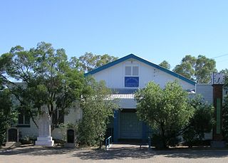
Augathella is a rural town and locality in the Shire of Murweh, Queensland, Australia.

<span class="mw-page-title-main">Morven, Queensland</span> Town in Queensland, Australia

Morven is a rural town and locality in the Shire of Murweh, Queensland, Australia. In the 2016 census, the locality of Morven had a population of 199 people.

<span class="mw-page-title-main">Wyandra, Queensland</span> Town in Queensland, Australia

Wyandra is a rural town and locality in the Shire of Paroo, Queensland, Australia. In the 2021 census, the locality of Wyandra had a population of 78 people.

<span class="mw-page-title-main">Shire of Murweh</span> Local government area in Queensland, Australia

The Shire of Murweh is a local government area in the Maranoa district, which is part of South West Queensland, Australia. The administrative centre and largest town in the shire is Charleville. In June 2018, the Shire of Murweh had a population of 4,318.

<span class="mw-page-title-main">Yuleba</span> Town in Queensland, Australia

Yuleba is a rural town and locality in the Maranoa Region, in the south-west of Queensland, Australia. In the 2021 census, the locality of Yuleba had a population of 271 people.

Adavale is a rural town and locality in the Shire of Quilpie, Queensland, Australia. In the 2016 census, the locality of Adavale had a population of 93 people. By 2021, the population was down to 72.

<span class="mw-page-title-main">Sommariva, Queensland</span> Suburb of Shire of Murweh, Queensland, Australia

Sommariva is a locality in the Shire of Murweh, Queensland, Australia. It is situated 37.9 kilometres (23.5 mi) east of Charleville and 57.4 kilometres (35.7 mi) west of Morven on the Warrego Highway. In the 2021 census, Sommariva had a population of 25 people.

Cooladdi is a rural locality in the Shire of Murweh, Queensland, Australia. The town is 88.9 kilometres (55.2 mi) south-west of Charleville.

Gowrie Station is a rural locality in the Shire of Murweh, Queensland, Australia. In the 2016 census Gowrie Station had a population of 15 people.

<span class="mw-page-title-main">Killaloe, Queensland</span> Suburb of Shire of Douglas, Queensland, Australia

Killaloe is a coastal rural locality in the Shire of Douglas, Queensland, Australia. In the 2021 census, Killaloe had a population of 124 people.

<span class="mw-page-title-main">Diwan, Queensland</span> Suburb of Shire of Douglas, Queensland, Australia

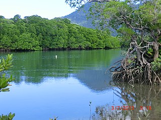
Diwan is a coastal locality in the Shire of Douglas, Queensland, Australia. In the 2021 census, Diwan had a population of 169 people.

Boatman is a locality in the Shire of Murweh, Queensland, Australia. In the 2021 census, Boatman had a population of 18 people.

Clara Creek is a locality in the Shire of Murweh, Queensland, Australia. In the 2021 census, Clara Creek had a population of 56 people.

Redford is a locality split between the Maranoa Region and the Shire of Murweh, both in Queensland, Australia. In the 2016 census, Redford had a population of 7 people.

Caroline Crossing is a rural locality in the Shire of Murweh, Queensland, Australia. In the 2016 census, Caroline Crossing had a population of 13 people.

Nive is a locality in the Shire of Murweh, Queensland, Australia. In the 2016 census, Nive had a population of 34 people. it is situated on the boundary between the Shire of Murweh and the Blackall-Tambo Region.

Ward is a rural locality in the Shire of Murweh, Queensland, Australia. In the 2016 census Ward had a population of 74 people.

Humeburn is a locality in the Shire of Paroo, Queensland, Australia. In the 2021 census, Humeburn had a population of 9 people.

<span class="mw-page-title-main">Forest Creek, Queensland</span> Suburb of Shire of Douglas, Queensland, Australia

Forest Creek is a locality in the Shire of Douglas, Queensland, Australia. In the 2021 census, Forest Creek had a population of 136 people.

References

  1. Australian Bureau of Statistics (28 June 2022). "Langlo (Suburb and Locality)". Australian Census 2021 QuickStats. Retrieved 28 June 2022.  OOjs UI icon edit-ltr-progressive.svg
  2. "Langlo – locality in Shire of Murweh (entry 42927)". Queensland Place Names. Queensland Government . Retrieved 2 January 2019.
  3. 1 2 Australian Bureau of Statistics (28 June 2022). "Langlo (SAL)". 2021 Census QuickStats. Retrieved 28 February 2023. OOjs UI icon edit-ltr-progressive.svg
  4. "Queensland Globe". State of Queensland . Retrieved 8 October 2023.
  5. Queensland Family History Society (2010), Queensland schools past and present (Version 1.01 ed.), Queensland Family History Society, ISBN   978-1-921171-26-0
  6. "Fall From Mail Train". The Week . Vol. LXXXIII, no. 2, 166. Queensland, Australia. 29 June 1917. p. 21. Retrieved 8 October 2023 via National Library of Australia.
  7. "Charleville" (Map). Queensland Government. 1944. Retrieved 8 October 2020.
  8. Australian Bureau of Statistics (27 June 2017). "Langlo (SSC)". 2016 Census QuickStats. Retrieved 20 October 2018. OOjs UI icon edit-ltr-progressive.svg
  9. "Layers: Locality; Schools and school catchments". Queensland Globe. Queensland Government . Retrieved 8 October 2023.