Cooladdi

Last updated

Cooladdi
Queensland
Foxtrap Road House Cooladdi, Queensland, 2024, 02.jpg
Road House Cooladdi, 2024
Australia Queensland location map.svg
Red pog.svg
Cooladdi
Coordinates 26°38′25″S145°27′43″E / 26.6402°S 145.4619°E / -26.6402; 145.4619 (Cooladdi (town centre))
Population7 (2021 census) [1]
 • Density0.00175/km2 (0.0045/sq mi)
Postcode(s) 4479
Elevation300 m (984 ft)
Area3,990.2 km2 (1,540.6 sq mi)
Time zone AEST (UTC+10:00)
Location
LGA(s) Shire of Murweh
State electorate(s) Warrego
Federal division(s) Maranoa
Localities around Cooladdi:
Adavale Langlo Ward
Adavale Cooladdi Bakers Bend
Humeburn Wyandra Murweh

Cooladdi is a rural town and locality in the Shire of Murweh, Queensland, Australia. [2] [3] The town is 88.9 kilometres (55.2 mi) south-west of Charleville. [4]

Contents

Claims have been made that Cooladdi is Australia's smallest town by population. [5] In 2015, the population was 3 (down from 4 in 2013), all of whom lived at the general store. [6] In the 2021 census, the locality of Cooladdi had a population of 7 people. [1]

Geography

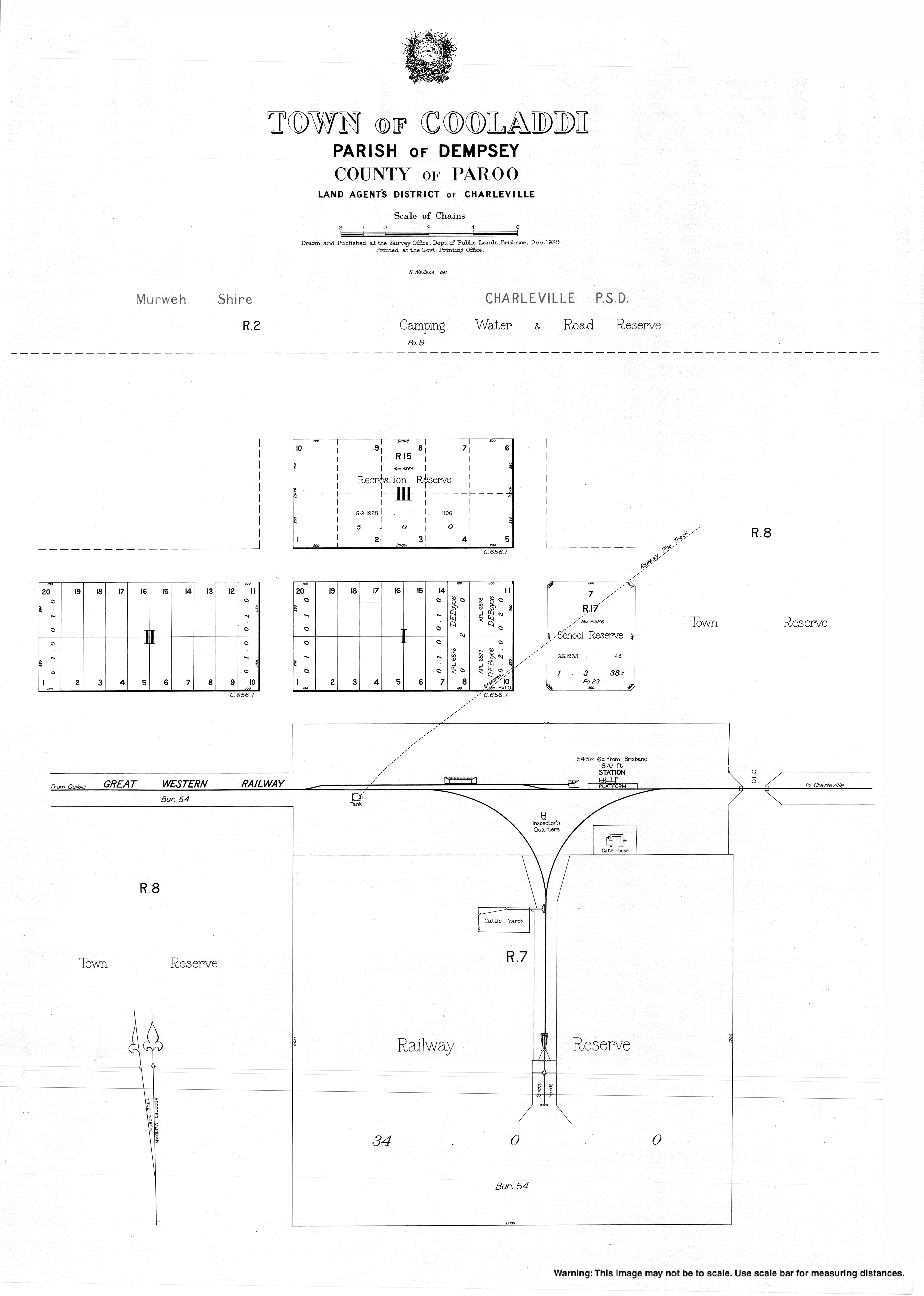
The town is in the centre of the locality. The Western railway line passes from east to west through the town and locality. The locality was served by a number of railway stations (from east to west): [7]

The Diamantina Developmental Road (which forms part of the 1578 kilometre (980 mi) Warrego Way State Strategic Touring Route between Brisbane and Birdsville) also passes from east to west through the town and locality. [7]

History

Gunya (also known as Kunya, Kunja, Kurnja) is an Australian Aboriginal language spoken by the Gunya people. The Gunya language region includes the landscape within the local government boundaries of the Paroo Shire Council, taking in Cunnamulla and extending north towards Augathella, east towards Bollon and west towards Thargomindah. [9]

The railway station was originally called Yarronvale after a local pastoral station with the town taking its name from the railway station. However, it was renamed in 1913 to Cooladdi, an Aboriginal word meaning black duck, to avoid confusion with the pastoral station, which was 15 miles away.[ citation needed ]

Cooladdi was a railhead for the local pastoral community. At one time, Cooladdi had a school, post office, and police station with a population of about 270 people. As the railway line extended further west, Cooladdi's role and population declined. [10]

The Cooladdi State School originally opened on 19 March 1926 as a Provisional School with 9 students under teacher A.W. Marsh. In 1933, a new school building was constructed and the school redesignated as a State School. The school closed on 3 May 1974. [11] [12] [13] It was located opposite the railway station on Cooladdi Access Road ( 26°38′25″S145°27′50″E / 26.6404°S 145.4638°E / -26.6404; 145.4638 (Cooladdi State School (former)) ). [14]

Demographics

In 2015, the population was 3 (down from 4 in 2013), all of whom resided at the general store. [6]

In the 2016 census, the locality of Cooladdi had a population of 16 people. [15]

In the 2021 census, the locality of Cooladdi had a population of 7 people. [1]

Education

There are no schools in Cooladi. The nearest government primary and secondary schools Charleville State School and Charleville State High School respectively both in Charleville to the north-east. However, only those living in the east of the locality would be within daily commuting range. Other options are distance education and boarding schools. [7]

Economy

There are a number of homesteads in the locality: [16]

Related Research Articles

<span class="mw-page-title-main">Blackall, Queensland</span> Town in Queensland, Australia

Blackall is a rural town and locality in the Blackall-Tambo Region, Queensland, Australia. The town is the service centre for the Blackall-Tambo Region. The dominant industry in the area is grazing with over 70 homesteads in the locality. In the 2021 census, the locality of Blackall had a population of 1,365 people.

<span class="mw-page-title-main">Charleville, Queensland</span> Town in Queensland, Australia

Charleville is a rural town and locality in the Shire of Murweh, Queensland, Australia. In the 2021 census, the locality of Charleville had a population of 2,992 people.

<span class="mw-page-title-main">Cunnamulla</span> Town in Queensland, Australia

Cunnamulla is a town and a locality in the Shire of Paroo, Queensland, Australia. It is 206 kilometres (128 mi) south of Charleville, and approximately 750 kilometres (470 mi) west of the state capital, Brisbane. In the 2021 census, the locality of Cunnamulla had a population of 1,233 people.

<span class="mw-page-title-main">Augathella</span> Town in Queensland, Australia

Augathella is a rural town and locality in the Shire of Murweh, Queensland, Australia. In the 2021 census, the locality of Augathella had a population of 328 people.

<span class="mw-page-title-main">Morven, Queensland</span> Town in Queensland, Australia

Morven is a rural town and locality in the Shire of Murweh, Queensland, Australia. In the 2021 census, the locality of Morven had a population of 184 people.

<span class="mw-page-title-main">Shire of Murweh</span> Local government area in Queensland, Australia

The Shire of Murweh is a local government area in the Maranoa district, which is part of South West Queensland, Australia. The administrative centre and largest town in the shire is Charleville.

<span class="mw-page-title-main">Goovigen</span> Town in Queensland, Australia

Goovigen is a rural town and locality in the Shire of Banana, Queensland, Australia. In the 2021 census, the locality of Goovigen had a population of 349 people.

<span class="mw-page-title-main">Brigalow, Queensland</span> Town in Queensland, Australia

Brigalow is a rural town and locality in the Western Downs Region, Queensland, Australia. In the 2021 census, the locality of Brigalow had a population of 181 people.

<span class="mw-page-title-main">Adavale</span> Town in Queensland, Australia

Adavale is a rural town and locality in the Shire of Quilpie, Queensland, Australia. In the 2021 census, the locality of Adavale had a population of 72 people.

<span class="mw-page-title-main">Torrens Creek</span> Town in Queensland, Australia

Torrens Creek is a rural town and locality in the Shire of Flinders, Queensland, Australia. In the 2021 census, the locality of Torrens Creek had a population of 46 people.

<span class="mw-page-title-main">Sommariva, Queensland</span> Suburb of Shire of Murweh, Queensland, Australia

Sommariva is a locality in the Shire of Murweh, Queensland, Australia. It is situated 37.9 kilometres (23.5 mi) east of Charleville and 57.4 kilometres (35.7 mi) west of Morven on the Warrego Highway. In the 2021 census, Sommariva had a population of 25 people.

Bakers Bend is a rural locality in the Shire of Murweh, Queensland, Australia. In the 2021 census, Bakers Bend had a population of 7 people.

Biboohra is a rural town and locality in the Shire of Mareeba, Queensland, Australia. In the 2021 census, the locality of Biboohra had a population of 561 people.

Cheepie is a town in the locality of Adavale in Shire of Quilpie, Queensland, Australia. It has a population of 2 people.

Callide is a rural town and locality in the Shire of Banana, Queensland, Australia. In the 2021 census, the locality of Callide had a population of 80 people.

Gowrie Station is a rural locality in the Shire of Murweh, Queensland, Australia. In the 2021 census, Gowrie Station had a population of 11 people.

Langlo is a locality in the Shire of Murweh, Queensland, Australia. In the 2021 census, Langlo had a population of 34 people.

Boatman is a locality in the Shire of Murweh, Queensland, Australia. In the 2021 census, Boatman had a population of 18 people.

Ward is a rural locality in the Shire of Murweh, Queensland, Australia. In the 2021 census, Ward had a population of 87 people.

Murweh is a rural locality in the Shire of Murweh, Queensland, Australia. In the 2021 census, Murweh had a population of 9 people.

References

  1. 1 2 3 Australian Bureau of Statistics (28 June 2022). "Cooladdi (SAL)". 2021 Census QuickStats. Retrieved 28 February 2023. OOjs UI icon edit-ltr-progressive.svg
  2. "Cooladdi – town in Shire of Murweh (entry 8067)". Queensland Place Names. Queensland Government . Retrieved 28 December 2020.
  3. "Cooladdi – locality in Shire of Murweh (entry 42925)". Queensland Place Names. Queensland Government . Retrieved 28 December 2020.
  4. Google (19 February 2023). "Charleville to Cooladi" (Map). Google Maps . Google. Retrieved 19 February 2023.
  5. "I spent the night in Australia's smallest town. Here's what I saw". Australia: ABC News. 31 August 2019. Retrieved 3 July 2022.
  6. 1 2 Arthur, Chrissy (16 November 2015). "Stories and photos capture vibrant past of Queensland's outback 'ghost town' Cooladdi". Australian Broadcasting Corporation. Archived from the original on 13 October 2016. Retrieved 21 September 2016.
  7. 1 2 3 "Queensland Globe". State of Queensland . Retrieved 19 February 2023.
  8. 1 2 3 4 5 "Railway stations and sidings – Queensland". Queensland Open Data. Queensland Government. 2 October 2020. Archived from the original on 5 October 2020. Retrieved 5 October 2020.
  9. "Gunya". State Library of Queensland . 21 January 2020. Archived from the original on 4 February 2021. Retrieved 21 January 2020.
  10. "Naming Stations—Glass House Mountains". The Brisbane Courier . No. 17, 512. 28 February 1914. p. 4. Archived from the original on 4 February 2021. Retrieved 21 September 2016 via National Library of Australia.
  11. Queensland Family History Society (2010), Queensland schools past and present (Version 1.01 ed.), Queensland Family History Society, ISBN   978-1-921171-26-0
  12. "WESTERN LINE". Daily Mail . No. 7289. Brisbane. 9 July 1925. p. 14. Retrieved 21 September 2016 via National Library of Australia.
  13. "Agency ID 182, Cooladdi State School". Queensland State Archives . Retrieved 21 September 2016.
  14. "Town map of Cooladdi". Queensland Government. 1939. Retrieved 19 February 2023.
  15. Australian Bureau of Statistics (27 June 2017). "Cooladdi (SSC)". 2016 Census QuickStats. Retrieved 20 October 2018. OOjs UI icon edit-ltr-progressive.svg
  16. "Homesteads – Queensland". Queensland Open Data. Queensland Government. 18 November 2020. Archived from the original on 24 November 2020. Retrieved 24 November 2020.

Further reading