Caroline Crossing, Queensland

Last updated

Caroline Crossing
Queensland
Sunrise, Caroline Crossing Road off the Landsborough Highway between Tambo and Augathella, Queensland, 2022.jpg
Caroline Crossing Road, 2022
Australia Queensland location map.svg
Red pog.svg
Caroline Crossing
Coordinates 25°40′35″S146°59′10″E / 25.6764°S 146.9861°E / -25.6764; 146.9861 (Caroline Crossing (centre of locality))
Population44 (2021 census) [1]
 • Density0.02197/km2 (0.0569/sq mi)
Postcode(s) 4477
Area2,003.1 km2 (773.4 sq mi)
Time zone AEST (UTC+10:00)
Location
LGA(s) Shire of Murweh
State electorate(s) Warrego
Federal division(s) Maranoa
Suburbs around Caroline Crossing:
Upper Warrego Upper Warrego Upper Warrego
Nive Caroline Crossing Womblebank
Augathella Clara Creek Redford

Caroline Crossing is a rural locality in the Shire of Murweh, Queensland, Australia. [2] In the 2021 census, Caroline Crossing had a population of 44 people. [1]

Contents

Geography

The Landsborough Highway forms a small part of the south-western boundary of the locality. [3]

The land use is grazing on native vegetation. [4]

History

The locality was named and bounded on 28 March 2002. [2] It is presumably named after the ford across the Warrego River known as Caroline Crossing ( 25°37′00″S146°45′00″E / 25.6166°S 146.75°E / -25.6166; 146.75 (Caroline Crossing) ). [5] [6]

Demographics

In the 2016 census, Caroline Crossing had a population of 13 people. [7]

In the 2021 census, Caroline Crossing had a population of 44 people. [1]

Education

There are no schools in Caroline Crossing. The nearest government primary school is Augathella State School in neighbouring Augathella to the south-west. However, students in some parts of Caroline Crossing would be too distant for a daily commute. There are no secondary schools nearby. The alternatives are distance education and boarding school. [8]

Related Research Articles

<span class="mw-page-title-main">Charleville, Queensland</span> Town in Queensland, Australia

Charleville is a rural town and locality in the Shire of Murweh, Queensland, Australia. In the 2021 census, the locality of Charleville had a population of 2,992 people.

<span class="mw-page-title-main">Augathella</span> Town in Queensland, Australia

Augathella is a rural town and locality in the Shire of Murweh, Queensland, Australia. In the 2021 census, the locality of Augathella had a population of 328 people.

<span class="mw-page-title-main">Morven, Queensland</span> Town in Queensland, Australia

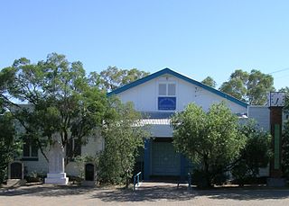
Morven is a rural town and locality in the Shire of Murweh, Queensland, Australia. In the 2021 census, the locality of Morven had a population of 184 people.

<span class="mw-page-title-main">Shire of Murweh</span> Local government area in Queensland, Australia

The Shire of Murweh is a local government area in the Maranoa district, which is part of South West Queensland, Australia. The administrative centre and largest town in the shire is Charleville.

<span class="mw-page-title-main">River Ranch, Queensland</span> Suburb of Gladstone Region, Queensland, Australia

River Ranch is a rural locality in the Gladstone Region, Queensland, Australia. In the 2021 census, River Ranch had a population of 269 people.

<span class="mw-page-title-main">Sommariva, Queensland</span> Suburb of Shire of Murweh, Queensland, Australia

Sommariva is a locality in the Shire of Murweh, Queensland, Australia. It is situated 37.9 kilometres (23.5 mi) east of Charleville and 57.4 kilometres (35.7 mi) west of Morven on the Warrego Highway. In the 2021 census, Sommariva had a population of 25 people.

Bakers Bend is a rural locality in the Shire of Murweh, Queensland, Australia. In the 2021 census, Bakers Bend had a population of 7 people.

<span class="mw-page-title-main">Broadmere, Queensland</span> Suburb of Shire of Banana, Queensland, Australia

Broadmere is a rural locality in the Shire of Banana, Queensland, Australia. In the 2021 census, Broadmere had a population of 38 people.

Yuruga is a rural locality in the Shire of Hinchinbrook, Queensland, Australia. In the 2021 census, Yuruga had a population of 64 people.

Gowrie Station is a rural locality in the Shire of Murweh, Queensland, Australia. In the 2021 census, Gowrie Station had a population of 11 people.

Langlo is a locality in the Shire of Murweh, Queensland, Australia. In the 2021 census, Langlo had a population of 34 people.

Upper Haughton is a rural locality in the Shire of Burdekin, Queensland, Australia. In the 2021 census, Upper Haughton had a population of 34 people.

Clara Creek is a locality in the Shire of Murweh, Queensland, Australia. In the 2021 census, Clara Creek had a population of 56 people.

Redford is a rural locality split between the Maranoa Region and the Shire of Murweh, both in Queensland, Australia. In the 2021 census, Redford had a population of 18 people.

<span class="mw-page-title-main">Nive, Queensland</span> Suburb of Shire of Murweh, Queensland, Australia

Nive is a rural locality in the Shire of Murweh, Queensland, Australia. It is on the boundary between the Shire of Murweh and the Blackall-Tambo Region. In the 2021 census, Nive had a population of 44 people.

Ward is a rural locality in the Shire of Murweh, Queensland, Australia. In the 2021 census, Ward had a population of 87 people.

Tyrconnel is a rural locality split between the Maranoa Region and the Shire of Murweh, both in Queensland, Australia. In the 2021 census, Tyrconnel had a population of 17 people.

Widgee Crossing South is a rural locality in the Gympie Region, Queensland, Australia. In the 2021 census, Widgee Crossing South had a population of 33 people.

Warrubullen is a rural locality in the Cassowary Coast Region, Queensland, Australia. In the 2021 census, Warrubullen had a population of 59 people.

Murweh is a rural locality in the Shire of Murweh, Queensland, Australia. In the 2021 census, Murweh had a population of 9 people.

References

  1. 1 2 3 Australian Bureau of Statistics (28 June 2022). "Caroline Crossing (SAL)". 2021 Census QuickStats. Retrieved 28 February 2023. OOjs UI icon edit-ltr-progressive.svg
  2. 1 2 "Caroline Crossing – locality in Shire of Murweh (entry 42965)". Queensland Place Names. Queensland Government . Retrieved 19 September 2020.
  3. "Caroline Crossing, Queensland" (Map). Google Maps . Retrieved 29 August 2021.
  4. "Layers: Locality; Protected areas and forests; Land use; Sugarcane areas". Queensland Globe. Queensland Government. Archived from the original on 19 December 2017. Retrieved 20 January 2025.
  5. "Caroline Crossing – ford in Shire of Murweh (entry 6312)". Queensland Place Names. Queensland Government . Retrieved 19 September 2020.
  6. "Queensland Globe". State of Queensland . Retrieved 22 October 2020.
  7. Australian Bureau of Statistics (27 June 2017). "Caroline Crossing (SSC)". 2016 Census QuickStats. Retrieved 20 October 2018. OOjs UI icon edit-ltr-progressive.svg
  8. "Layers: Locality; Schools and school catchments". Queensland Globe. Queensland Government. Archived from the original on 19 December 2017. Retrieved 20 January 2025.