Related Research Articles

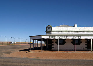
Birdsville is a rural town and locality in the Shire of Diamantina, Queensland, Australia. It is situated 10 kilometres (6 mi) north of the border of South Australia and Queensland. In the 2021 census, the locality of Birdsville had a population of 110 people. It is a popular tourist destination with many people using it as a starting point across the Simpson Desert.

Charleville is a rural town and locality in the Shire of Murweh, Queensland, Australia. In the 2016 census, the locality of Charleville had a population of 3,335 people.

Mitchell Highway is an outback state highway located in the central and south western regions of Queensland and the northern and central western regions of New South Wales in Australia. The southern part of Mitchell Highway forms part of the National Highway A32 corridor, which stretches from Sydney to Adelaide via Dubbo and Broken Hill. Mitchell Highway also forms part of the shortest route between Sydney and Darwin, via Bourke and Mount Isa, making it an important road link for the transport of passengers and freight for regional New South Wales and Queensland. The highway is a part of route Alternative A2 between Augathella and Charleville, route A71 and B71 between Charleville and Nyngan, and part of route A32 between Nyngan and Bathurst.

Cunnamulla is a town and a locality in the Shire of Paroo, Queensland, Australia. It is 206 kilometres (128 mi) south of Charleville, and approximately 750 kilometres (470 mi) west of the state capital, Brisbane. In the 2016 census, Cunnamulla had a population of 1,140 people.

Augathella is a rural town and locality in the Shire of Murweh, Queensland, Australia.

The Warrego Highway is located in southern Queensland, Australia. It connects coastal centres to the south western areas of the state, and is approximately 715 km in length. It takes its name from the Warrego River, which is the endpoint of the highway. The entire highway is part of the National Highway system linking Darwin and Brisbane: formerly National Highway 54, Queensland began to convert to the alphanumeric system much of Australia had adopted in the early-2000s and this road is now designated as National Highway A2.

Morven is a rural town and locality in the Shire of Murweh, Queensland, Australia. In the 2016 census, the locality of Morven had a population of 199 people.

Miles is a rural town and locality in the Western Downs Region, Queensland, Australia. In the 2016 census, the locality of Miles had a population of 1,746 people.

The Shire of Murweh is a local government area in the Maranoa district, which is part of South West Queensland, Australia. The administrative centre and largest town in the shire is Charleville. In June 2018, the Shire of Murweh had a population of 4,318.

Yuleba is a rural town and locality in the Maranoa Region, in the south-west of Queensland, Australia. In the 2016 census, Yuleba had a population of 207 people.
Cooladdi is a ghost town and rural locality in the Shire of Murweh, Queensland, Australia. The town is 88.9 kilometres (55.2 mi) south-west of Charleville.
The Adventure Way is an Australian outback route between Brisbane, Queensland and Innamincka, South Australia. Using the Adventure Way, it is 1,152 kilometres (716 mi) from Brisbane to Innamincka. The recommended journey time, allowing for some sightseeing, food and rest is 96 hours. It has been designated by the Queensland Government as a State Strategic Touring Route.

State Strategic Touring Routes (SSTR) are road routes in Queensland, Australia, which have been identified as significant to motoring tourists. These are the primary routes used by tourists as they provide the connections between popular tourist locations, and consequently have high volumes of tourist traffic. Standardised road signage is used to identify the route itself, with "Welcome to" signage at towns and districts of interest to tourists, as well as "turn off" signage to natural attractions.
The Leichhardt Way is an Australian road route from Melbourne, Victoria to Rockhampton in Queensland. It has been designated by the Queensland Government as a State Strategic Touring Route.
The Great Inland Way is an Australian road route from Sydney, New South Wales to Cairns in Queensland. It has been designated by the Queensland Government as a State Strategic Touring Route.
The Matilda Way is an Australian road route from Bourke, New South Wales to Karumba in Queensland. It has been designated by the Queensland Government as a State Strategic Touring Route.
The Pacific Coast Way is an Australian road route from Sydney, New South Wales to Cairns in Queensland. It has been designated by the Queensland Government as a State Strategic Touring Route.
Gatton–Clifton Road is a continuous 63.1 kilometres (39.2 mi) road route in the Lockyer Valley and Toowoomba regions of Queensland, Australia. Most of the road is signed as State Route 80. Gatton–Clifton Road is a state-controlled road, part regional and part district. The district part is rated as a local road of regional significance (LRRS).
References
- 1 2 "Warrego Way". Queensland Government. Archived from the original on 9 June 2017. Retrieved 9 June 2017.
- ↑ "Driving Experiences (State Strategic Touring Routes and Tourist Drives)" (PDF). Department of Transport and Main Roads. Queensland Government. February 2016. Archived (PDF) from the original on 1 May 2017. Retrieved 27 May 2017. Licensed as CC BY 3.0 AU.