
There are many forms of transport in Australia. Australia is highly dependent on road transport. There are more than 300 airports with paved runways. Passenger rail transport includes widespread commuter networks in the major capital cities with more limited intercity and interstate networks. The Australian mining sector is reliant upon rail to transport its product to Australia's ports for export.

Highways in Australia are generally high capacity roads managed by state and territory government agencies, though Australia's federal government contributes funding for important links between capital cities and major regional centres. Prior to European settlement, the earliest needs for trade and travel were met by narrow bush tracks, used by tribes of Indigenous Australians. The formal construction of roads began in 1788, after the founding of the colony of New South Wales, and a network of three major roads across the colony emerged by the 1820s. Similar road networks were established in the other colonies of Australia. Road construction programs in the early 19th century were generally underfunded, as they were dependent on government budgets, loans, and tolls; while there was a huge increase in road usage, due to the Australian gold rushes. Local government authorities, often known as Road Boards, were therefore established to be primarily responsible for funding and undertaking road construction and maintenance. The early 1900s saw both the increasingly widespread use of motorised transportation, and the creation of state road authorities in each state, between 1913 and 1926. These authorities managed each state's road network, with the main arterial roads controlled and maintained by the state, and other roads remaining the responsibility of local governments. The federal government became involved in road funding in the 1920s, distributing funding to the states. The depression of the 1930s slowed the funding and development of the major road network until the onset on World War II. Supply roads leading to the north of the country were considered vital, resulting in the construction of Barkly, Stuart, and Eyre Highways.

Australia's Highway 1 is a network of highways that circumnavigate the country, joining all mainland capital cities except the national capital of Canberra. At a total length of approximately 14,500 km (9,000 mi) it is the longest national highway in the world, surpassing the Trans-Siberian Highway and the Trans-Canada Highway. Over a million people traverse some part of the highway network every day.
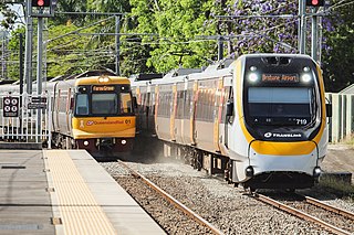
Rail transport in Australia is a component of the Australian transport system. It is to a large extent state-based, as each state largely has its own operations, with the interstate network being developed ever since Australia's federation in 1901. As of 2022, the Australian rail network consists of a total of 32,929 kilometres (20,461 mi) of track built to three major track gauges: 18,007 kilometres (11,189 mi) of standard gauge, 2,685 kilometres (1,668 mi) of broad gauge, and 11,914 kilometres (7,403 mi) of narrow gauge lines. Additionally, about 1,400 kilometres (870 mi) of 610 mm / 2 ft gauge lines support the sugar-cane industry. 3,488 kilometres (2,167 mi), around 11 per cent of the Australian heavy railways network route-kilometres are electrified.

The Tilt Train is the name for two similar high-speed tilting train services, one electric and the other diesel, operated by Queensland Rail. They run on the North Coast line from Brisbane to Bundaberg and Rockhampton (electric) and Cairns (diesel).

The North Coast railway line is a 1,681-kilometre (1,045 mi) 1067 mm railway line in Queensland, Australia. It commences at Roma Street station, Brisbane, and largely parallels the Queensland coast to Cairns in Far North Queensland. The line is electrified between Brisbane and Rockhampton. Along the way, the 1680 km railway passes through the numerous towns and cities of eastern Queensland including Nambour, Bundaberg, Gladstone, Rockhampton, Mackay and Townsville. The line though the centre of Rockhampton runs down the middle of Denison Street.
Air traffic control in Australia is provided by two independent organisations, one civilian and one military. The civilian provider is Airservices Australia, which controls civilian airfields and airspace. The military provider is the Royal Australian Air Force (RAAF), which controls military airfields and adjoining airspace. This includes Australian Army and Royal Australian Navy aviation bases. Some airfields in Australia are categorised as Joint User airfields, where there are both civilian and military operations based at the airfield. Normally, Joint User airfields have air traffic control provided by the RAAF.

Greyhound Australia is an Australian coach operator that ran services in all mainland states and territories until reduction of services in the 2000s.

The rail network in Queensland, Australia, was the first in the world to adopt 1,067 mm narrow gauge for a main line, and now the second largest narrow gauge network in the world, consists of:
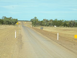
The Savannah Way is a route of highways and major roads across the tropical savannahs of northern Australia, linking Cairns in Queensland with Broome in Western Australia. Promoted as a self-drive tourist route, it joins Cairns, Normanton, Borroloola, Katherine, Kununurra, Fitzroy Crossing, Derby and Broome. It has been designated by the Queensland Government as a State Strategic Touring Route.
The Round Australia Trial was a long distance rally, which was run on multiple occasions between 1953 and 1998, circumnavigating Australia. Its early years were tremendously popular as the roads through large portions of the country, particularly west of Adelaide, were not in good condition. Automobile manufacturers enthused over the event as it provided a particularly severe test event for their products, proving their cars were able to stand up to whatever conditions remote Australia could provide. Early editions of the event were heroic tests and were front-page fodder for the newspapers of the era.
The Adventure Way is an Australian outback route between Brisbane, Queensland and Innamincka, South Australia. Using the Adventure Way, it is 1,152 kilometres (716 mi) from Brisbane to Innamincka. The recommended journey time, allowing for some sightseeing, food and rest is 96 hours. It has been designated by the Queensland Government as a State Strategic Touring Route.
Australia's Country Way is an Australian road route from Rockhampton to Wallangarra in Queensland and then to Sydney, New South Wales. Using Australia's Country Way, it is 1615 km from Rockhampton to Sydney, requiring approx 20 hours of driving. It has been designated by the Queensland Government as a State Strategic Touring Route.
The Capricorn Way is an Australian road route from Rockhampton to Barcaldine in Queensland. Using the Capricorn Way, it is 579.67 km (360.19 mi) from Rockhampton to Barcaldine. The recommended journey time, allowing for some sightseeing, food and rest is 30 hours. It has been designated by the Queensland Government as a State Strategic Touring Route.
The Warrego Way is an Australian road route from Brisbane to Birdsville in Queensland. Using the Warrego Way, it is 1578 km from Brisbane to Birdsville. The recommended journey time, allowing for some sightseeing, food and rest is 48 hours. It has been designated by the Queensland Government as a State Strategic Touring Route.
The Leichhardt Way is an Australian road route from Melbourne, Victoria to Rockhampton in Queensland. It has been designated by the Queensland Government as a State Strategic Touring Route.
The Great Inland Way is an Australian road route from Sydney, New South Wales to Cairns in Queensland. It has been designated by the Queensland Government as a State Strategic Touring Route.
The Pacific Coast Way is an Australian road route from Sydney, New South Wales to Cairns in Queensland. It has been designated by the Queensland Government as a State Strategic Touring Route.
Rockhampton–Yeppoon Road is a non-continuous 39.8 kilometres (24.7 mi) road route in the Rockhampton and Livingstone local government areas of Queensland, Australia. Most of the route is designated as State Route 4 (Regional) and Tourist Drive 10. It is a state-controlled regional road.
