Barringun is bounded to the west by the Warrego River and to the south by the border with New South Wales.[3] The Zero Obelisk marks the first official survey of the border between what were then the separate colonies of New South Wales and Queensland when an accurate definition of the border was important for legal and economic reasons. It illustrates a remarkable feat of surveying in the nineteenth century and is a reminder of the extraordinarily difficult conditions under which many early surveyors worked.[5]
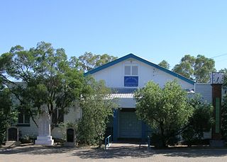
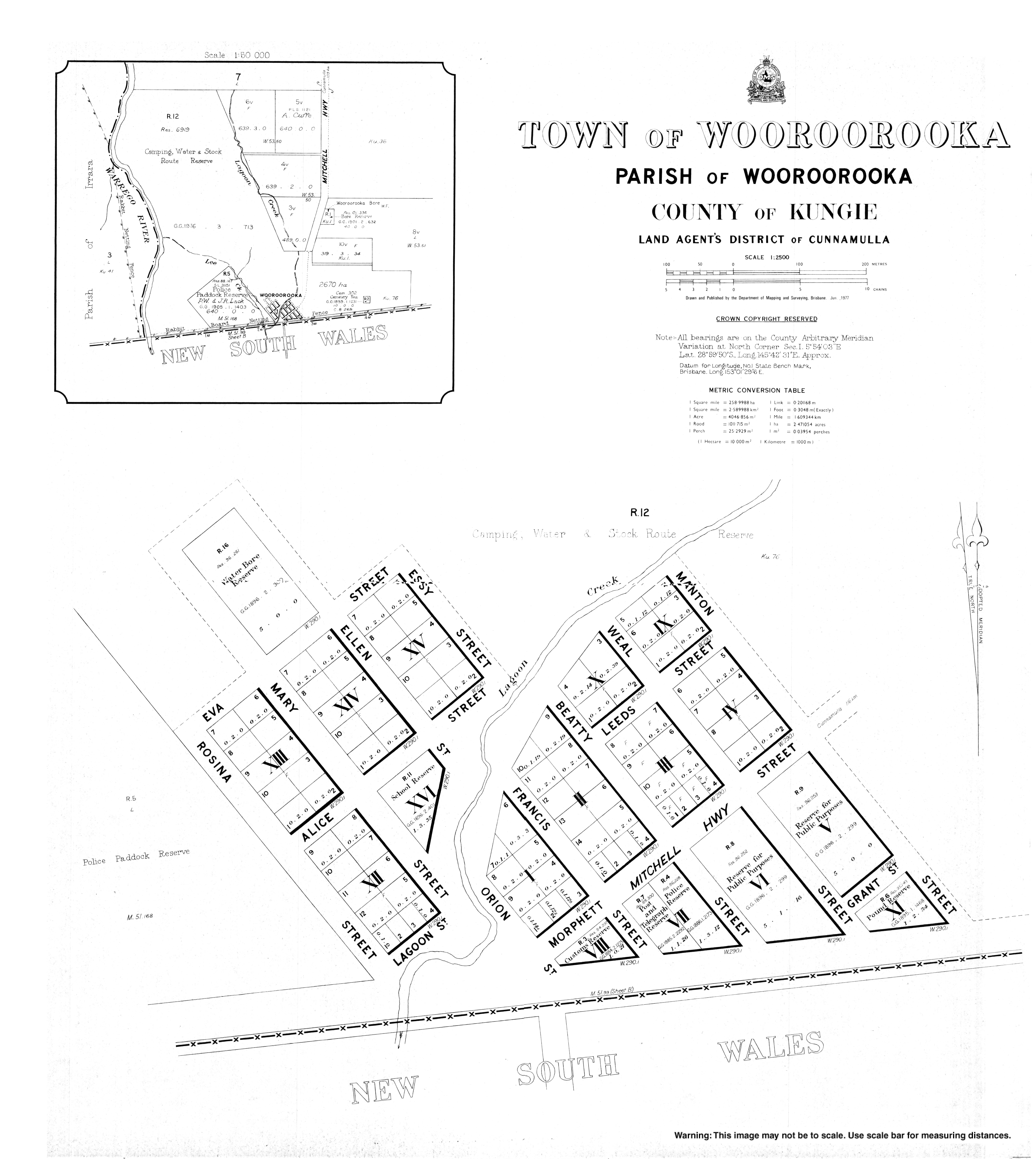
Wooroorooka is located immediately north of the border with New South Wales and is on the Owangowan Creek; it is now abandoned.[3]
History
Architectural drawings of the Barringun Customs Quarters, 1885
The name Barringun is derived from the local Aboriginal word for the lower part of the Warrego River variously transcribed as Barronga, Burringun or Barrongun. The 1859 exploration of the river from its junction with the Darling River by Matthew De Rinzy showed that Aboriginal people lived at all the waterholes along the lower reaches of this river. They were also combative to the European incursion, with De Rinzy being wounded by a spear during one of the skirmishes on his journey.[7][8]
An early British settlement (possibly a pastoral station) on the Warrego River was named Barringun, which can be seen on an 1887 map as being just south of the New South Wales border. Barringun is also possibly an Aboriginal word meaning fish die in the water.[2]
The name Wooroorooka appears to have come from a pastoral run which was owned by Mr Dangar in 1865 but was purchased in 1866 by James Tyson, who also purchased other runs in the area: Rottenrow, Gordonsheet and Teckulman.[9]
In 1885, discussions were being held between the New South Wales and Queensland colonial parliaments about a rabbit-proof fence to prevent the spread of the pest.[11][12]
From 1885 when the railway was constructed to Bourke in New South Wales, farmers in south-western Queensland began to send their wool to markets via Bourke rather than the Charleville, then the terminus of the Western railway line in Queensland, as the New South Wales Government offered more competitive rail freight rates than the Queensland Government. Queensland Railway CommissionerJames Thallon responded by negotiating with the Carrier's Union which carried goods to the Charleville railhead to make the cost of transporting the goods via Charleville more attractive. However, strikes by the carriers in support of the 1891 Australian shearers' strike meant that goods continued to be travel via New South Wales, further encouraged by new lower freight rates in New South Wales announced in June 1893. The Queensland Government responded the following month by introducing the Railway Border Tax Act which taxed wool and sheepskins crossing the border into New South Wales to make it too expensive to freight the wool via New South Wales.[13] However, this could only be a temporary measure as the anticipated Federation of Australia was expected to introduce free trade between the states of Australia removing the ability to tax goods at the border crossing. Therefore, on 3 December 1895, the Queensland Parliament approved the construction of the 121-mile (195km) extension of the Western railway line from Charleville to Cunnamulla.[14] It was opened on 10 October 1898.[15]
A magistrate court operated in Wooroorooka from 12 June 1891 to 11 May 1944.[16]
Until the Federation of Australia in January 1901, Wooroorooka served as the Colony of Queensland border customs office, and across the border, Barringun was the Colony of New South Wales border customs office.[17] At this time, Wooroorooka had one customs officer, three police officers, a school teacher, and a post master.[18] The Wooroorooka customs house, a cottage raised up on stumps, became the Border fence ranger's residence.
Wooroorooka had a police station.[18] Barringun existed to support the surrounding pastoral property needs, and the shearing season provided important employment.[19] The local creek was able to support the town even during periods of low rainfall. Recreational activities including fishing on the Maranoa River and cricket with the nearby Belalie Station.[18]
The 1930s continued the town's interest in sports including horse races.[20][21]
A rail line from Bourke to Barringun was proposed in the late 1920s to the 1940s, to eventually connect with Cunnamulla for freight.[22][23][24] The Queensland Government opposed the New South Wales initiative as it would draw trade (and state revenue) away from the south-west Queensland area.
The road to the New South Wales border from Cunnamulla was sealed in bitumen by 1952.[25] The road was considered part of the 'death knell' to the rail line proposal.[26] The Barringun–Bourke section of the Mitchell Highway was expected to be bitumen sealed by 1971.[27]
Some properties in the area included Rostella,[28] Winrae,[29] Tinnenburra, Thurulgoona,[30] Owengowan,[31] and Amenda.[32]
In the 2016 census, Barringun had a population of 7 people.[1]
During 2020 and 2021, the Queensland border was closed due to the COVID-19 pandemic. Some border crossing points had Queensland Police checkpoints to confirm eligibility to enter Queensland, while other border crossing points were closed. At Barrigun, there was a police border checkpoint on the Mitchell Highway.[33][34]
Heritage listing
Zero Obelisk
Barringun has a heritage-listed site on the east bank of the Warrego River at the border with New South Wales. The Zero Obelisk marks the beginning of the first official survey of the border between the two colonies.[35]
Education
There are no schools in Barringun. The nearest primary and secondary schools are in Cunnamulla, approximately 107 kilometres (66mi) away. Distance education and boarding schools are the alternatives.[36]
Writings
The former town was the subject of a 1917 eight-verse poem of the same name by Scottish-Australian poet and bush balladeer Will H. Ogilvie (1869–1963).[37]
The sandhills north of Barringun stand shimmering in the heat,
The dust is driven dense and dun by forty thousand feet,
And dimly through the clouds that cling, beyond the Border Gate,
The kelpies swing along the wing to keep the leaders straight.
And I remember Barringun of thirty years ago
A few tin roofs that took the sun as white as driven snow;
Two bush hotels where loafers sat, a butcher's shop, a store,
A few goats feeding on the flat – and very little more!
Working on the Belalie property, to the south near Enngonia, in the early 1890s Ogilvie was familiar with the New South Wales–Queensland border area.[27]
The poem Comrades, from his anthology The Australian, and other verses (1916), also made reference to Barringun:[38]
Do the shearers still go riding up the Warrego to work.
Where the Thurulgoona woolshed flashes silver in the sun?
Are the bullock-teams still bending through the cooiibahs to Bourke?
Is there racing at Enngonia? Is Belalie still a run?
Do the Diamantina cattle still come down by Barringun?
Ogilvie also wrote a short story about the mail run to the town entitled His Majesty's mail (1922).[39]
Related Research Articles
Charleville is a rural town and locality in the Shire of Murweh, Queensland, Australia. In the 2016 census, the locality of Charleville had a population of 3,335 people.
Mitchell Highway is an outback state highway located in the central and south western regions of Queensland and the northern and central western regions of New South Wales in Australia. The southern part of Mitchell Highway forms part of the National Highway A32 B71 corridor, which stretches from Sydney to Brisbane via Dubbo. Mitchell Highway also forms part of the shortest route between Sydney and Darwin, via Bourke and Mount Isa, making it an important road link for the transport of passengers and freight for regional New South Wales and Queensland. The highway is a part of route Alternative A2 between Augathella and Charleville, route A71 and B71 between Charleville and Nyngan, and part of route A32 between Nyngan and Bathurst.
Cunnamulla is a town and a locality in the Shire of Paroo, Queensland, Australia. It is 206 kilometres (128 mi) south of Charleville, and approximately 750 kilometres (470 mi) west of the state capital, Brisbane. In the 2021 census, Cunnamulla had a population of 1,233 people.
Bourke is a town in the north-west of New South Wales, Australia. The administrative centre and largest town in Bourke Shire, Bourke is approximately 800 kilometres (500 mi) north-west of the state capital, Sydney, on the south bank of the Darling River. it is also situated:
Augathella is a rural town and locality in the Shire of Murweh, Queensland, Australia.
The Warrego River is an intermittent river that is part of the Darling catchment within the Murray–Darling basin, which is located in South West Queensland and in the Orana region of New South Wales, Australia. The Warrego River is the northernmost tributary of the Darling River.
The Shire of Paroo is a local government area in South West Queensland, Australia. The administrative centre is the town of Cunnamulla. The Paroo Shire covers an area of 47,623 square kilometres (18,387 sq mi). In the 2021 census, the Shire had a population of 1,679.
Warrego is an electoral district of the Legislative Assembly in the Australian state of Queensland.
Wyandra is a rural town and locality in the Shire of Paroo, Queensland, Australia. In the 2021 census, the locality of Wyandra had a population of 78 people.
Bourke Shire is a local government area in the Orana region of New South Wales, Australia. The Shire is located adjacent to the Darling River, which is known as the Barwon River upstream from Bourke; and located adjacent to the Mitchell Highway. The northern boundary of the Shire is located adjacent to the border between New South Wales and Queensland. The shire is a wool and beef producing area.
Irrara County is one of the 141 Cadastral divisions of New South Wales. It is located south of the border with Queensland, east of the Paroo River, and west of the Warrego River.
South West Queensland is a remote region in the Australian state of Queensland which covers 319,808 km2 (123,479 sq mi). The region lies to the south of Central West Queensland and west of the Darling Downs and includes the Maranoa district and parts of the Channel Country. The area is noted for its cattle grazing, cotton farming, opal mining and oil and gas deposits.
Boonarga is a rural locality in the Western Downs Region, Queensland, Australia. In the 2016 census, Boonarga had a population of 36 people.
Elsinora Station most commonly known as Elsinora is a pastoral lease that has operated as both a sheep station and a cattle station in outback New South Wales. It is situated approximately 160 kilometres (99 mi) north of White Cliffs and 240 kilometres (149 mi) north west of Bourke close to the Queensland border.
Cameron's 1 Ton Survey Post is a heritage-listed survey marker at the Barwon River, Mungindi, Shire of Balonne, Queensland, Australia. It was established in 1882. It was added to the Queensland Heritage Register on 21 October 1992.
The Matilda Way is an Australian road route from Bourke, New South Wales to Karumba in Queensland. It has been designated by the Queensland Government as a State Strategic Touring Route.
Tuen is a locality in the Shire of Paroo, Queensland, Australia. In the 2016 census, Tuen had a population of 12 people.
Jobs Gate is a rural locality in the Shire of Paroo, Queensland, Australia. It is on the border of Queensland and New South Wales. In the 2016 census, Jobs Gate had a population of 6 people.
Noorama is a rural locality in the Shire of Paroo, Queensland, Australia. It in on the border of Queensland and New South Wales. In the 2016 census, Noorama had a population of 21 people.
Enngonia, formerly known as Eringonia, is a small town in the north-west of New South Wales, Australia, in Bourke Shire, approximately 98 kilometres (61 mi) north of the regional centre of Bourke. The Warrego River runs just to the west of the town. The central street, Belalie Street, is otherwise the Mitchell Highway running north-south.
↑ "New South Wales". Morning Bulletin. Vol.XXXIV, no.5377. Queensland, Australia. 7 August 1885. p.5. Archived from the original on 24 January 2022. Retrieved 31 January 2018– via National Library of Australia.
↑ "Intercolonial". Morning Bulletin. Vol.XXXVIII, no.6902. Queensland, Australia. 1 June 1887. p.6. Archived from the original on 24 January 2022. Retrieved 31 January 2018– via National Library of Australia.
↑ "PARLIAMENT". The Week (Brisbane). Vol.XXXVI, no.918. Queensland, Australia. 28 July 1893. p.9. Archived from the original on 24 January 2022. Retrieved 24 July 2019– via National Library of Australia.
↑ "PARLIAMENT". The Telegraph. No.7, 217. Queensland, Australia. 4 December 1895. p.6. Archived from the original on 24 January 2022. Retrieved 24 July 2019– via National Library of Australia.
↑ Kerr, John (1990), Triumph of narrow gauge: a history of Queensland Railways, Boolarong Publications, pp.81–82, ISBN978-0-86439-102-5
1 2 3 "Barringun". Wellington Times. No.2063. New South Wales, Australia. 8 April 1909. p.2. Archived from the original on 24 January 2022. Retrieved 31 January 2018– via National Library of Australia.
↑ "Barringun". Western Herald. Vol.III, no.201. New South Wales, Australia. 18 September 1889. p.2. Archived from the original on 12 June 2022. Retrieved 31 January 2018– via National Library of Australia.
↑ "Barringun sports". Western Herald. No.1149. New South Wales, Australia. 8 April 1930. p.2. Archived from the original on 12 June 2022. Retrieved 31 January 2018– via National Library of Australia.
↑ "Barringun sports". Western Herald. No.1273. New South Wales, Australia. 10 July 1931. p.2. Archived from the original on 12 June 2022. Retrieved 31 January 2018– via National Library of Australia.
↑ "Bourke to Barringun". Gilgandra Weekly. New South Wales, Australia. 17 March 1949. p.7. Archived from the original on 12 June 2022. Retrieved 31 January 2018– via National Library of Australia.
↑ "Border link". The Courier-Mail. No.4967. Queensland, Australia. 29 October 1952. p.1. Archived from the original on 12 June 2022. Retrieved 31 January 2018– via National Library of Australia.
1 2 "As it is today". Western Herald. New South Wales, Australia. 28 August 1970. p.24 (Enngonia Centenary Supplement). Archived from the original on 12 June 2022. Retrieved 31 January 2018– via National Library of Australia.
↑ "Obituary". Western Herald. New South Wales, Australia. 6 October 1939. p.4. Archived from the original on 12 June 2022. Retrieved 31 January 2018– via National Library of Australia.
↑ "South-Western District". Worker. Vol.64, no.3448. Queensland, Australia. 17 August 1953. p.8. Archived from the original on 12 June 2022. Retrieved 3 September 2018– via National Library of Australia.
↑ "Gates of the back country". The Land. Vol.XXII, no.1110. New South Wales, Australia. 30 September 1932. p.24. Archived from the original on 12 June 2022. Retrieved 31 January 2018– via National Library of Australia.
↑ "Australian Poems". The World's News. No.1134. New South Wales, Australia. 8 September 1923. p.19. Archived from the original on 12 June 2022. Retrieved 31 January 2018– via National Library of Australia.
↑ "His Majesty's Mails". The World's News. No.1083. New South Wales, Australia. 16 September 1922. p.19. Archived from the original on 12 June 2022. Retrieved 31 January 2018– via National Library of Australia.
This page is based on this Wikipedia article Text is available under the CC BY-SA 4.0 license; additional terms may apply. Images, videos and audio are available under their respective licenses.


