Widgeegoara, Queensland

Last updated

Widgeegoara
Queensland
Australia Queensland location map.svg
Red pog.svg
Widgeegoara
Coordinates 28°20′22″S146°19′02″E / 28.3395°S 146.3172°E / -28.3395; 146.3172 Coordinates: 28°20′22″S146°19′02″E / 28.3395°S 146.3172°E / -28.3395; 146.3172
Population34 (2016 census) [1]
 • Density0.01141/km2 (0.0296/sq mi)
Postcode(s) 4490
Area2,980.0 km2 (1,150.6 sq mi)
LGA(s) Shire of Paroo
State electorate(s) Warrego
Federal Division(s) Maranoa
Suburbs around Widgeegoara:
Cunnamulla Linden Linden
Cunnamulla Widgeegoara Nebine
Tuen Noorama Jobs Gate

Widgeegoara is a rural locality in the Shire of Paroo, Queensland, Australia. [2] In the 2016 census, Widgeegoara had a population of 34 people. [1]

Contents

Geography

Noorama Creek and Widgeegoara Creek flow through the locality from the north-west (Cunnamulla) to the south (Noorama). These creeks are distributaries of the Warrego River. [3] [4]

The predominant land use is grazing of cattle and sheep. [4]

History

The locality's name come from the parish and creek of the same name, which in turn was the name of a pastoral run used since 1867. It is believed to be an Aboriginal word combination meaning turn around quickly. [2] [5] [6]

In 1878 the Widgeegoara Station was described when offered for sale as: [7]

The well-known Widgeegoara Station, in the Warrego district, situate about 180 miles from Bourke, and containing about 180 square miles of magnificent sheep country, consisting of open plains, heavily grassed with blue, barley, and other grasses and herbage, and saltbush in abundance, and is of the most fattening description.The run is abundantly watered, having fifteen miles frontage to the Widgeegoara Creek, with two large dams, and has also two tanks, one of 12,000 yards, with ten miles of drains leading into it, and one of 800 yards, and two fresh-water wells, one of which has been in constant use for five years, and gives a good supply.The tanks and dams are all full at present.The improvements also comprise home paddock, stock and sheep yards, a good dwelling-house, with kitchen, store, outhouses, and stable.The run will be sold without stock.The wethers from this station have averaged 621b. in the Sydney market.

In October 1884 Messrs Bignell of Widgeegoara Station successfully constructed a bore that obtained sub-artesian water, the first in Queensland. [8] [9]

Widgeegoara Provisional School opened circa 1898. From May 1903 it was a half-time school operated in conjunction with Abbadoah Provisional School (presumably at Abbadoah Station at 28°02′59″S145°51′31″E / 28.04983°S 145.85872°E / -28.04983; 145.85872 (Abbadoah Station) ) with a single teacher serving at the two schools, but that arrangement was reversed in June 1903 with the teacher returning to Widgeegoara Provisional School on a full-time basis. However, due to low student numbers, the school was closed in either late 1903 or early 1904. [10]

Related Research Articles

Barcaldine, Queensland Town in Queensland, Australia

Barcaldine is a rural town and locality in the Barcaldine Region in Queensland, Australia. In the 2016 census, Barcaldine had a population of 1,422 people. This is the administrative centre of the Barcaldine Region. Barcaldine played a major role in the Australian labour movement.

Cunnamulla Town in Queensland, Australia

Cunnamulla is a town and a locality in the Shire of Paroo, Queensland, Australia. It is 206 kilometres (128 mi) south of Charleville, and approximately 750 kilometres (470 mi) west of the state capital, Brisbane. In the 2016 census, Cunnamulla had a population of 1,140 people.

Thargomindah Town in Queensland, Australia

Thargomindah is a rural town and locality in the Shire of Bulloo, Queensland, Australia. The town of Thargomindah is the administrative centre for the Shire of Bulloo. In the 2016 census, Thargomindah had a population of 270 people. It was founded on Wongkumara and Kalali territory.

Warrego River river in Australia

The Warrego River, an intermittent river that is part of the Darling catchment within the Murray–Darling basin, is located in the south west of Queensland and in the Orana region of New South Wales, Australia. The Warrego River is northernmost tributary of the Darling River.

Mitchell, Queensland Town in Queensland, Australia

Mitchell is a town and locality in the Western Downs district of the Maranoa Region, Queensland, Australia. The town services the local area, a cattle and sheep farming district. In the 2016 census, Mitchell had a population of 1031 people.

Miles, Queensland Town in Queensland, Australia

Miles is a town and a locality in the Western Downs Region, Queensland, Australia. In the 2016 census, Miles had a population of 1,746 people.

Wyandra, Queensland Town in Queensland, Australia

Wyandra is a town and a locality in the Shire of Paroo, Queensland, Australia. In the 2016 census, Wyandra had a population of 99 people.

Eulo, Queensland Town in Queensland, Australia

Eulo is an outback town and locality in the Shire of Paroo, Queensland, Australia. In the 2016 census, Eulo had a population of 95 people. It is known for its opal mining.

Yuleba Town in Queensland, Australia

Yuleba is a rural town and locality in the Maranoa Region, in the south-west of Queensland, Australia. In the 2016 census, Yuleba had a population of 207 people.

Maxwelton, Queensland Town in Queensland, Australia

Maxwelton is a small rural town and locality in the Shire of Richmond in central north Queensland, Australia. At the 2016 Census the population of the state suburb of Maxwelton was 22.

Corfield, Queensland Town in Queensland, Australia

Corfield is a town and locality in the Shire of Winton in north-western Queensland, Australia. In the 2016 census, Corfield had a population of 183 people.

Barringun, Queensland Suburb of Shire of Paroo, Queensland, Australia

Barringun is a rural locality in the Shire of Paroo, Queensland, Australia. It is on the border of Queensland and New South Wales. In the 2016 census, Barringun had a population of 7 people.

Bloomfield, Queensland Suburb of Shire of Cook, Queensland, Australia

Bloomfield is a town in the Shire of Cook and a coastal locality which is split between the Shire of Cook and the Shire of Douglas in Queensland, Australia. The neighbourhood of Ayton is within the locality. In the 2016 census, Bloomfield had a population of 204 people.

Muckadilla, Queensland Suburb of Maranoa Region, Queensland, Australia

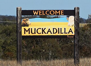
Muckadilla is a town and locality in the Maranoa Region, Queensland, Australia.

Cheepie, Queensland Town in Queensland, Australia

Cheepie is a town in the locality of Adavale in Shire of Quilpie, Queensland, Australia. It has a population of 2 people.

Cuttaburra, Queensland Suburb of Shire of Paroo, Queensland, Australia

Cuttaburra is a rural locality in the Shire of Paroo, Queensland, Australia. In the 2016 census, Cuttaburra had a population of 10 people.

Tuen, Queensland Suburb of Shire of Paroo, Queensland, Australia

Tuen is a locality in the Shire of Paroo, Queensland, Australia. In the 2016 census, Tuen had a population of 12 people.

Humeburn, Queensland Suburb of Shire of Paroo, Queensland, Australia

Humeburn is a locality in the Shire of Paroo, Queensland, Australia. In the 2016 census, Humeburn had a population of 22 people.

Jobs Gate, Queensland Suburb of Shire of Paroo, Queensland, Australia

Jobs Gate is a rural locality in the Shire of Paroo, Queensland, Australia. It is on the border of Queensland and New South Wales. In the 2016 census, Jobs Gate had a population of 6 people.

Noorama, Queensland Suburb of Shire of Paroo, Queensland, Australia

Noorama is a rural locality in the Shire of Paroo, Queensland, Australia. It in on the border of Queensland and New South Wales. In the 2016 census, Noorama had a population of 21 people.

References

  1. 1 2 Australian Bureau of Statistics (27 June 2017). "Widgeegoara (SSC)". 2016 Census QuickStats. Retrieved 20 October 2018. OOjs UI icon edit-ltr-progressive.svg
  2. 1 2 "Widgeegoara - locality in Shire of Paroo (entry 42662)". Queensland Place Names. Queensland Government . Retrieved 9 April 2019.
  3. "Queensland Globe". State of Queensland . Retrieved 18 April 2019.
  4. 1 2 "Warrego". Murray-Darling Basin Authority. Australian Government. Archived from the original on 18 March 2019. Retrieved 19 April 2019.
  5. "Widgeegoara - parish in Paroo Shire (entry 37423)". Queensland Place Names. Queensland Government . Retrieved 19 April 2019.
  6. "Widgeegoara Creek - watercourse in Paroo Shire (entry 37424)". Queensland Place Names. Queensland Government . Retrieved 19 April 2019.
  7. "Classified Advertising". The Queenslander . XIV (175). Queensland, Australia. 21 December 1878. p. 355. Retrieved 19 April 2019 via National Library of Australia.
  8. "Part 4, Chapter 5, Our Asset in Artesian Water" (PDF). Our first half-century : a review of Queensland progress : based upon official information : by authority of the Government of Queensland. Queensland Government. 1909. p. 155.
  9. "The Warrego". The Brisbane Courier (21, 329). Queensland, Australia. 5 June 1926. p. 18. Retrieved 19 April 2019 via National Library of Australia.
  10. Queensland Family History Society (2010), Queensland schools past and present (Version 1.01 ed.), Queensland Family History Society, ISBN   978-1-921171-26-0