Cuttaburra, Queensland

Last updated

Cuttaburra
Queensland
Cuttaburra Creek floodplain woodlands, Binya National Park.tif
Cuttaburra Creek floodplain woodlands
Australia Queensland location map.svg
Red pog.svg
Cuttaburra
Coordinates 28°44′50″S145°22′30″E / 28.7472°S 145.375°E / -28.7472; 145.375 (Cuttaburra (centre of locality))
Population10 (2016 census) [1]
 • Density0.0033/km2 (0.009/sq mi)
Postcode(s) 4490
Area3,036.9 km2 (1,172.6 sq mi)
Time zone AEST (UTC+10:00)
LGA(s) Shire of Paroo
State electorate(s) Warrego
Federal division(s) Maranoa
Suburbs around Cuttaburra:
Eulo Cunnamulla Tuen
Hungerford Cuttaburra Barringun
Yantabulla (NSW) Enngonia (NSW) Enngonia (NSW)

Cuttaburra is a rural locality in the Shire of Paroo, Queensland, Australia. [2] It is on the Queensland border with New South Wales. [3] In the 2016 census, Cuttaburra had a population of 10 people. [1]

Contents

Geography

Cuttaburra Creek is a tributary of the Warrego River, joining it south of Cunnamulla. The creek forms the north-east boundary of the locality. [3]

The southern boundary of the locality is the border of Queensland with New South Wales (latitude 29 South). [3]

The Binya National Park is located within the locality on the south-western boundary. [3]

In 1916, geologist and palaeontologist Robert Etheridge described the area as having "shifting" sand hills and claypans. The shifting sand hills were of colours that varied by colour from a yellowish tint to a deep brick red and were up to 50 feet in height. He observed that the wind drove these shifting sand hills along over time. He said that the claypans were: [4]

"shallow depressions, more or less oval or circular in outline, large or small, distributed throughout the red soil country, treeless, often bearing a copious growth of grass, particularly cane grass and various kinds of salt-bush. These pans are water-bearing in wet seasons, but otherwise dry, and in flood time many of them, no doubt, communicate with one another. Of this nature appears to be the Cuttaburra branch of the Paroo River, an indescribable flat and weird surface of great extent."

History

The Cuttaburra Creek is shown on an 1872 map of Queensland. The locality name is believed to derive from the creek name and is thought to be an Aboriginal word. In some New South Wales Aboriginal languages the word burra means hill ants. [2]

Cuttaburra Provisional School opened in 1899 and closed circa 1906. [5]

In the 2016 census, Cuttaburra had a population of 10 people. [1]

Related Research Articles

<span class="mw-page-title-main">Culgoa Floodplain National Park</span> Protected area in Queensland, Australia

The Culgoa Floodplain National Park is a protected national park that is located in the South West region of Queensland in eastern Australia. The 42,859-hectare (105,910-acre) national park is situated at the western extent of Hebel in the Shire of Balonne and in the east of Jobs Gate in the Paroo Shire, approximately 630 kilometres (390 mi) west of Brisbane. The park occupies the former pastoral and grazing property of Byra Station. The park's southern boundary is defined by part of the state border between Queensland and New South Wales.

<span class="mw-page-title-main">Cunnamulla</span> Town in Queensland, Australia

Cunnamulla is a town and a locality in the Shire of Paroo, Queensland, Australia. It is 206 kilometres (128 mi) south of Charleville, and approximately 750 kilometres (470 mi) west of the state capital, Brisbane. In the 2021 census, Cunnamulla had a population of 1,233 people.

<span class="mw-page-title-main">Thargomindah</span> Town in Queensland, Australia

Thargomindah is a rural town and locality in the Shire of Bulloo, Queensland, Australia. The town of Thargomindah is the administrative centre for the Shire of Bulloo. In the 2016 census, Thargomindah had a population of 270 people. It was founded on Wongkumara and Kalali territory.

<span class="mw-page-title-main">Warrego River</span> River in Australia

The Warrego River is an intermittent river that is part of the Darling catchment within the Murray–Darling basin, which is located in South West Queensland and in the Orana region of New South Wales, Australia. The Warrego River is the northernmost tributary of the Darling River.

<span class="mw-page-title-main">Shire of Paroo</span> Local government area in Queensland, Australia

The Shire of Paroo is a local government area in South West Queensland, Australia. The administrative centre is the town of Cunnamulla. The Paroo Shire covers an area of 47,623 square kilometres (18,387 sq mi). In the 2021 census, the Shire had a population of 1,679.

<span class="mw-page-title-main">Hungerford, Queensland</span> Town in Queensland, Australia

Hungerford is an outback town in the Shire of Bulloo and a locality in the Shire of Bulloo and Shire of Paroo, South West Queensland, Australia. The locality is on the Queensland border with New South Wales.

<span class="mw-page-title-main">Barcaldine Region</span> Local government area in Queensland, Australia

The Barcaldine Region is a local government area in Central West Queensland, Australia. Established in 2008, it was preceded by three previous local government areas which had existed for over a century.

<span class="mw-page-title-main">Jambin, Queensland</span> Town in Queensland, Australia

Jambin is a rural town and locality in the Shire of Banana, Queensland, Australia.

<span class="mw-page-title-main">Paroo Floodplain and Currawinya Important Bird Area</span>

The Paroo Floodplain and Currawinya Important Bird Area is a 7,874 km2 (3,040 sq mi) site comprising the floodplain and the associated wetlands of the Paroo River in north-western New South Wales and south-western Queensland, Australia. It includes extensive areas of the Paroo-Darling and Currawinya National Parks, both of which are listed under the Ramsar Convention as wetland sites of international importance, as well as of the Nocoleche Nature Reserve.

<span class="mw-page-title-main">South West Queensland</span> Region in Queensland, Australia

South West Queensland is a remote region in the Australian state of Queensland which covers 319,808 km2 (123,479 sq mi). The region lies to the south of Central West Queensland and west of the Darling Downs and includes the Maranoa district and parts of the Channel Country. The area is noted for its cattle grazing, cotton farming, opal mining and oil and gas deposits.

Gilberton is a rural locality in the Shire of Etheridge, Queensland, Australia. In the 2016 census, Gilberton had a population of 4 people.

Barringun is a rural locality in the Shire of Paroo, Queensland, Australia. It is on the border of Queensland and New South Wales. In the 2016 census, Barringun had a population of 7 people.

<span class="mw-page-title-main">Bungunya, Queensland</span> Suburb of Goondiwindi Region, Queensland, Australia

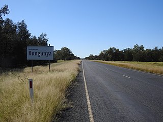
Bungunya is a rural town and locality in the Goondiwindi Region, Queensland, Australia. The locality is on the border of Queensland and New South Wales. In the 2016 census, Bungunya had a population of 75 people.

Dynevor is a former locality in the Shire of Bulloo, Queensland, Australia. In the 2016 census, Dynevor had a population of 21 people.

Toobanna is a rural town and locality in the Shire of Hinchinbrook, Queensland, Australia. In the 2016 census, the locality of Toobanna had a population of 278 people.

<span class="mw-page-title-main">Dutton River</span> Suburb of Shire of Flinders, Queensland, Australia

Dutton River is a rural locality in the Flinders Shire, Queensland, Australia. In the 2016 census, Dutton River had a population of 33 people.

<span class="mw-page-title-main">Nocoleche Nature Reserve</span> Nature reserve in Australia

The Nocoleche Nature Reserve is a conservation area in New South Wales on the Paroo River located 20 kilometres south of the town of Wanaaring, New South Wales. It was created in 1979, and has an area of 711.08 km².

Jobs Gate is a rural locality in the Shire of Paroo, Queensland, Australia. It is on the border of Queensland and New South Wales. In the 2016 census, Jobs Gate had a population of 6 people.

<span class="mw-page-title-main">Noorama, Queensland</span> Suburb of Shire of Paroo, Queensland, Australia

Noorama is a rural locality in the Shire of Paroo, Queensland, Australia. It in on the border of Queensland and New South Wales. In the 2016 census, Noorama had a population of 21 people.

Widgeegoara is a rural locality in the Shire of Paroo, Queensland, Australia. In the 2016 census, Widgeegoara had a population of 34 people.

References

  1. 1 2 3 Australian Bureau of Statistics (27 June 2017). "Cuttaburra (SSC)". 2016 Census QuickStats. Retrieved 20 October 2018. OOjs UI icon edit-ltr-progressive.svg
  2. 1 2 "Cuttaburra – locality in Shire of Paroo (entry 42653)". Queensland Place Names. Queensland Government . Retrieved 10 May 2020.
  3. 1 2 3 4 "Queensland Globe". State of Queensland . Retrieved 28 December 2023.
  4. Etheridge, Robert (1916), The cylindro-conical and cornute stone implements of western New South Wales and their significance : The warrigal, or "dingo", introduced or indigenous?, Dept. of Mines, New South Waales, pp. 18–19, retrieved 26 October 2018
  5. Queensland Family History Society (2010), Queensland schools past and present (Version 1.01 ed.), Queensland Family History Society, ISBN   978-1-921171-26-0

Commons-logo.svg Media related to Cuttaburra, Queensland at Wikimedia Commons