
The Burnett Highway is an inland rural highway located in Queensland, Australia. The highway runs from its junction with the Bruce Highway at Gracemere, just south of Rockhampton, to the D'Aguilar Highway in Nanango. Its length is approximately 542 kilometres. The highway takes its name from the Burnett River, which it crosses in Gayndah. The Burnett Highway provides the most direct link between the northern end of the New England Highway and Rockhampton. It is designated as a State Strategic Road by the Queensland Government.
The Bunya Highway is a state highway of Queensland, Australia. It is a relatively short road, running approximately 173 kilometres in a south-westerly direction from Goomeri to Dalby. The highway connects the Warrego and Burnett Highways.

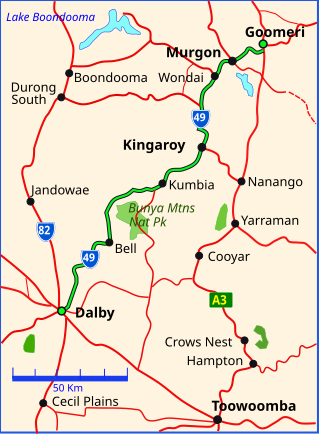
The D'Aguilar Highway is a two-lane highway linking the Bruce Highway near Caboolture with the Bunya Highway in Kingaroy in the state of Queensland, Australia. Major towns along the route include Woodford, Kilcoy, Blackbutt, Yarraman, and Nanango. The highway is approximately 164 km (102 mi) in length. The D'Aguilar Highway's highest elevation along its length is 527 m just north of Yarraman, and the lowest point is at 26.8 m just west of Caboolture.

Kilkivan is a town and locality in the Gympie Region of Queensland, Australia. In the 2021 census, the locality of Kilkivan had a population of 689 people.

Goomeri is a rural town and locality in the Gympie Region, Queensland, Australia. In the 2021 census, the locality of Goomeri had a population of 677 people.

The Shire of Kilkivan was a local government area about 180 kilometres (112 mi) north-northwest of Brisbane, the state capital of Queensland, Australia. The shire covered an area of 3,263.4 square kilometres (1,260.0 sq mi), and existed from 1886 until its merger with several other local government areas to form the Gympie Region on 15 March 2008.

Woolooga is a rural town and locality in the Gympie Region, Queensland, Australia. In the 2021 census, the locality of Woolooga had a population of 310 people.

The Nanango railway line was a narrow-gauge branch railway located in Queensland, Australia. On 31 October 1882, parliament approved the construction of a branch line from Theebine west to Kilkivan after gold and copper were discovered in this region of Queensland, Australia. The section was opened in two stages – to Dickabram on 1 January 1886 after two crossings of the Mary River and to Kilkivan on 6 December 1886.
The Kilkivan to Kingaroy Rail Trail is an 88-kilometre (55 mi) recreation trail from Kilkivan to Kingaroy. The trail follows the old Kingaroy Branch railway and is open to walkers, cyclists and horse riders.

Kinbombi is a rural town and locality in the Gympie Region, Queensland, Australia. In the 2021 census, the locality of Kinbombi had a population of 34 people.

Munna Creek is a locality split between the Fraser Coast Region and the Gympie Region, in Queensland, Australia. In the 2021 census, Munna Creek had a population of 22 people.

Tansey is a rural town and locality in the Gympie Region, Queensland, Australia. In the 2021 census, the locality of Tansey had a population of 154 people.
Maryborough–Biggenden Road is an 83.4 kilometres (51.8 mi) road route in the Fraser Coast and North Burnett regions of Queensland, Australia. The entire route is signed as State Route 86.
Gympie–Brooloo–Kenilworth Road is a continuous 51.6 kilometres (32.1 mi) road route in the Gympie and Sunshine Coast regions of Queensland, Australia. It has two official names, Gympie–Brooloo Road and Kenilworth–Brooloo Road. The entire route is signed as State Route 51.
Maryborough–Hervey Bay Road is a continuous 44.9 kilometres (27.9 mi) road route in the Fraser Coast region of Queensland, Australia. The entire route is signed as State Route 57. It is a state-controlled regional road.
Burpengary–Caboolture Road is a continuous 8.0 kilometres (5.0 mi) road route in the City of Moreton Bay, Queensland, Australia. It is designated as part of State Route 60. It is a state-controlled district road, rated as a local road of regional significance (LRRS).
Beerburrum Road is a continuous 15.2-kilometre (9.4 mi) road route in the Moreton Bay and Sunshine Coast local government areas of Queensland, Australia. It is designated as part of State Route 60. It is a state-controlled district road, rated as a local road of regional significance (LRRS).
Tin Can Bay Road is a continuous 56.1 kilometres (34.9 mi) road route in the Gympie region of Queensland, Australia. Part of it is signed as State Route 15. It is a state-controlled road, part regional and part district, with the district section rated as a local road of regional significance (LRRS). It runs from the Bruce Highway in Monkland to the Esplanade in Tin Can Bay. It intersects with Gympie Connection Road in Victory Heights, Kin Kin Road in Canina, Maryborough–Cooloola Road in Wallu, and Rainbow Beach Road in Wallu.
Bundaberg–Port Road is a state-controlled district road in the Bundaberg region of Queensland, Australia. It runs from the Isis Highway in Bundaberg West to Buss Street in Burnett Heads, a distance of 19.7 kilometres (12.2 mi).
Bruce Highway state-controlled roads presents information about how the Bruce Highway is described for administrative and funding purposes by the Queensland Department of Transport and Main Roads, and about the state-controlled roads that intersect with it.
