Miva, Queensland

Last updated

Miva
Queensland
Miva CWA Rooms.JPG
Country Women's Association rooms
Australia Queensland location map.svg
Red pog.svg
Miva
Coordinates 25°57′28″S152°29′32″E / 25.9578°S 152.4922°E / -25.9578; 152.4922 (Miva (centre of locality))
Population55 (2021 census) [1]
 • Density0.804/km2 (2.083/sq mi)
Postcode(s) 4570
Area68.4 km2 (26.4 sq mi)
Time zone AEST (UTC+10:00)
Location
LGA(s)
State electorate(s) Gympie
Federal division(s) Wide Bay
Localities around Miva:
Munna Creek Munna Creek Paterson
Glen Echo Miva Theebine
Woolooga Sexton Scotchy Pocket

Miva is a rural locality split between the Gympie Region and the Fraser Coast Region in Queensland, Australia. [2] [3] In the 2021 census, the locality of Miva had a population of 55 people. [1]

Contents

Geography

Miva's eastern boundary is the Mary River. Its western boundary is the Bauple-Woolooga Road. Miva is almost entirely within the Gympie Region apart from a small section in the north-east of the locality which is part of the Fraser Coast Region. The lower parts of the locality near the river and along the valleys (elevation 20–70 metres are used for farming). The hilly land to the west rises to peaks of 100 metres and the hilly land to the south-east rises to a peak of 150 metres; the hilly land is undeveloped bushland. [4]

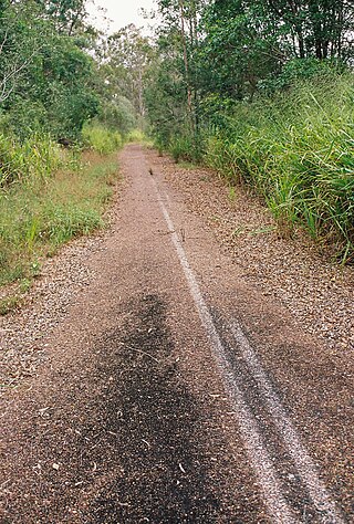
The former Kingaroy branch railway passed through Miva from the east to the south-west; Miva was served by the now-abandoned Miva railway station ( 25°57′30″S152°29′30″E / 25.9584°S 152.4917°E / -25.9584; 152.4917 (Miva railway station (former)) . [5] [6]

History

The name Miva is taken from the name of a pastoral run belonging to Gideon Scott, a pastoralist in March 1851. It is thought to be an Aboriginal word indicating either stony knob or Moreton Bay chestnut . [2] [3] [7]

In 1870, a punt began to operate a river crossing service at Miva. [8]

The Nanango railway line opened in December 1886 as far as Kilkivan.

Munna Creek Cemetery (also known as Miva Cemetery) opened circa 1905-6 on a 3-acre (1.2 ha) site. [9] [10]

Miva Provisional School opened about 1888, becoming Miva State School on 1 January 1909. In March 1922, it became a half-time provisional school, sharing its teacher with the Sexton State School, who taught at each school in alternating weeks. [11] The two schools were closed in September 1924. [12] It reopened in 1926 as a provisional school, but closed finally about 1934. [13] It was on Munna Miva Road beside the Mary River ( 25°57′05″S152°29′37″E / 25.95140°S 152.49366°E / -25.95140; 152.49366 (Miva State School (former)) ). [14] [15] [16]

Dickabram Cemetery opened in 1909 on a 1-acre (0.40 ha) site. [17] [18]

Miva Post Office opened by May 1908 (a receiving office had been open from 1888) and closed in 1976. [19]

Demographics

In the 2016 census, the locality of Miva had a population of 57 people. [20]

In the 2021 census, the locality of Miva had a population of 55 people. [1]

Heritage listings

Dickabram Bridge Dickabram Bridge.jpg
Dickabram Bridge

Miva has a number of heritage-listed sites, including:

Education

There are no schools in Miva. The nearest government primary schools are Theebine State School in neighbouring Theebine to the east, Gundiah State School in Gundiah to the north-east, and Woolooga State School in neighbouring Woolooga to the south-west. The nearest government secondary schools are Kilkivan State School (to Year 10) in Kilkivan to the south-west and James Nash State High School (to Year 12) in Gympie to the south-east. There are also non-government schools in Gympie and its suburbs. [22]

Amenities

The Miva branch of the Queensland Country Women's Association meets at the QCWA Miva Rooms at 1186 Miva Road. [23]

Facilities

Dickabram Cemetery is at 1242 Miva Road ( 25°57′37″S152°29′05″E / 25.9604°S 152.4848°E / -25.9604; 152.4848 (Dickabram Cemetery) ). It is operated by the Dickabram Cemetery Trust and provides options including monumental and lawn graves, the interment of ashes and a columbarium wall. [24] [25]

Despite its name, Munna Creek Cemetery is 1437 Bauple Woolooga Road in Miva ( 25°53′39″S152°28′50″E / 25.8943°S 152.4805°E / -25.8943; 152.4805 (Munna Creek Cemetery) ). [26] It is operated by the Fraser Coast Regional Council and provides options for monumental graves and a columbarium wall in a quiet bushland setting. [27]

Related Research Articles

<span class="mw-page-title-main">Wide Bay Highway</span> Highway in Queensland, Australia

The Wide Bay Highway is a short state highway of Queensland, Australia running between Goomeri on the Burnett Highway and a junction on the Bruce Highway. From the junction it is 12 kilometres south to Gympie or 69 kilometres north to Maryborough. The length of the highway is 62.6 kilometres. It is a state-controlled regional road.

<span class="mw-page-title-main">Kilkivan, Queensland</span> Town in Queensland, Australia

Kilkivan is a rural town and locality in the Gympie Region of Queensland, Australia. In the 2021 census, the locality of Kilkivan had a population of 689 people.

<span class="mw-page-title-main">Goomeri</span> Town in Queensland, Australia

Goomeri is a rural town and locality in the Gympie Region, Queensland, Australia. In the 2021 census, the locality of Goomeri had a population of 677 people.

<span class="mw-page-title-main">Dickabram Bridge</span> Heritage listed road and rail bridge in Queensland, Australia

Dickabram Bridge is a heritage-listed road-and-rail bridge over the Mary River between Miva and Theebine, both in the Gympie Region, Queensland, Australia. It was the major bridge on the Kingaroy railway line. It was designed by Henry Charles Stanley and built from 1885 to 1886 by Messrs Michael McDermott, Owens & Co. It is also known as Mary River Bridge (Miva). The bridge was registered on the former Register of the National Estate in 1988.

<span class="mw-page-title-main">Theebine</span> Town in Queensland, Australia

Theebine is a rural town and locality split between the Gympie Region and the Fraser Coast Region, both in Queensland, Australia.

<span class="mw-page-title-main">Gunalda</span> Town in Queensland, Australia

Gunalda is a rural town in the Gympie Region and a locality split between Gympie Region and Fraser Coast Region in Queensland, Australia. In the 2021 census, the locality of Gunalda had a population of 426 people.

<span class="mw-page-title-main">Woolooga</span> Town in Queensland, Australia

Woolooga is a rural town and locality in the Gympie Region, Queensland, Australia. In the 2021 census, the locality of Woolooga had a population of 310 people.

<span class="mw-page-title-main">Widgee</span> Suburb of Gympie Region, Queensland, Australia

Widgee is a rural locality in the Gympie Region, Queensland, Australia. In the 2021 census, Widgee had a population of 862 people.

<span class="mw-page-title-main">Woolooga Rail Bridge</span> Heritage listed railway bridge in Queensland, Australia

Woolooga Rail Bridge is a heritage-listed railway bridge at Wide Bay Creek on the Theebine - Kilikivan railway line, Woolooga, Gympie Region, Queensland, Australia. It was built in 1884 by Owen McDermott & Co. It was added to the Queensland Heritage Register on 21 October 1992.

<span class="mw-page-title-main">Bauple, Queensland</span> Town in Queensland, Australia

Bauple is a rural town and locality in the Fraser Coast Region, Queensland, Australia. In the 2021 census, the locality of Bauple had a population of 745 people.

<span class="mw-page-title-main">Boonara, Queensland</span> Suburb of Gympie Region, Queensland, Australia

Boonara is a rural locality in the Gympie Region, Queensland, Australia. In the 2021 census, Boonara had a population of 60 people.

<span class="mw-page-title-main">Cinnabar, Queensland</span> Suburb of Gympie Region, Queensland, Australia

Cinnabar is a rural locality in the Gympie Region, Queensland, Australia. In the 2021 census, Cinnabar had a population of 83 people.

Glen Echo is a rural locality in the Gympie Region, Queensland, Australia. In the 2021 census, Glen Echo had a population of 49 people.

Kanigan is a rural locality split between the Fraser Coast Region and the Gympie Region, both in Queensland, Australia. In the 2021 census, Kanigan had a population of 143 people.

<span class="mw-page-title-main">Kinbombi</span> Town in Queensland, Australia

Kinbombi is a rural town and locality in the Gympie Region, Queensland, Australia. In the 2021 census, the locality of Kinbombi had a population of 34 people.

<span class="mw-page-title-main">Munna Creek</span> Suburb of Fraser Coast Region, Queensland, Australia

Munna Creek is a locality split between the Fraser Coast Region and the Gympie Region, in Queensland, Australia. In the 2021 census, Munna Creek had a population of 22 people.

Sexton is a rural locality in the Gympie Region, Queensland, Australia. In the 2021 census, Sexton had a population of 187 people.
<span class="mw-page-title-main">Gootchie, Queensland</span> Suburb of Fraser Coast Region, Queensland, Australia

Gootchie is a rural locality in the Fraser Coast Region, Queensland, Australia. In the 2021 census, Gootchie had a population of 96 people.

<span class="mw-page-title-main">Marodian, Queensland</span> Suburb of Fraser Coast Region, Queensland, Australia

Marodian is a rural locality in the Fraser Coast Region, Queensland, Australia. In the 2021 census, Marodian had "no people or a very low population".

Paterson is a rural locality in the Fraser Coast Region, Queensland, Australia. In the 2021 census, Paterson had a population of 157 people.

References

  1. 1 2 3 Australian Bureau of Statistics (28 June 2022). "Miva (SAL)". 2021 Census QuickStats. Retrieved 28 February 2023. OOjs UI icon edit-ltr-progressive.svg
  2. 1 2 "Miva – Gympie Region (entry 47615)". Queensland Place Names. Queensland Government . Retrieved 2 March 2017.
  3. 1 2 "Miva – Fraser Coast Region (entry 46742)". Queensland Place Names. Queensland Government . Retrieved 2 March 2017.
  4. "Queensland Globe". State of Queensland . Retrieved 2 March 2017.
  5. "Miva – railway station in the Gympie REgion (entry 22398)". Queensland Place Names. Queensland Government . Retrieved 2 March 2017.
  6. "Railway stations and sidings - Queensland". Queensland Open Data. Queensland Government. 2 October 2020. Archived from the original on 5 October 2020. Retrieved 5 October 2020.
  7. "NOMENCLATURE OF QUEENSLAND.—194". The Courier-Mail . Brisbane: National Library of Australia. 14 May 1936. p. 14. Retrieved 8 July 2013.
  8. "LOCAL AND GENERAL NEWS". Gympie Times And Mary River Mining Gazette . Vol. III, no. 272. Queensland, Australia. 6 July 1870. p. 3. Retrieved 5 November 2022 via National Library of Australia.
  9. "Crown Lands". The Telegraph . No. 10304. Queensland, Australia. 25 November 1905. p. 3. Retrieved 13 December 2024 via National Library of Australia.
  10. "OFFICIAL NOTIFICATIONS". The Brisbane Courier . Vol. LXIII, no. 15, 169. Queensland, Australia. 24 August 1906. p. 6. Retrieved 13 December 2024 via National Library of Australia.
  11. "OFFICIAL NOTIFICATIONS". Daily Standard . No. 603. Queensland, Australia. 20 November 1914. p. 2. Retrieved 7 October 2024 via National Library of Australia.
  12. "TIARO". The Brisbane Courier . No. 20, 785. Queensland, Australia. 4 September 1924. p. 13. Archived from the original on 7 October 2024. Retrieved 7 October 2024 via National Library of Australia.
  13. Queensland Family History Society (2010), Queensland schools past and present (Version 1.01 ed.), Queensland Family History Society, ISBN   978-1-921171-26-0
  14. "County of Lennox sheet 1" (Map). Queensland Government. 1921. Archived from the original on 9 August 2023. Retrieved 13 December 2024.
  15. "Queensland Two Mile series sheet 2m113" (Map). Queensland Government. 1936. Archived from the original on 6 October 2024. Retrieved 13 December 2024.
  16. "Layers: Locality; Road and rail; Land parcel; Watercourse". Queensland Globe. Queensland Government. Archived from the original on 19 December 2017. Retrieved 13 December 2024.
  17. "Advertising". Gympie Times And Mary River Mining Gazette . Vol. XLI, no. 5331. Queensland, Australia. 13 February 1909. p. 2. Retrieved 13 December 2024 via National Library of Australia.
  18. "NEW RESERVES". The Brisbane Courier . Vol. LXVI, no. 16, 132. Queensland, Australia. 24 September 1909. p. 3. Retrieved 13 December 2024 via National Library of Australia.
  19. Phoenix Auctions History. "Post Office List". Phoenix Auctions. Retrieved 5 March 2021.
  20. Australian Bureau of Statistics (27 June 2017). "Miva (SSC)". 2016 Census QuickStats. Retrieved 20 October 2018. OOjs UI icon edit-ltr-progressive.svg
  21. "Dickabram Bridge (entry 600836)". Queensland Heritage Register . Queensland Heritage Council. Retrieved 8 July 2013.
  22. "Layers: Locality; Schools and school catchments". Queensland Globe. Queensland Government. Archived from the original on 19 December 2017. Retrieved 13 December 2024.
  23. "Branch Locations". Queensland Country Women's Association. Archived from the original on 26 December 2018. Retrieved 26 December 2018.
  24. "Cemetery Areas - Queensland". Queensland Open Data. Queensland Government. 12 November 2020. Archived from the original on 15 November 2020. Retrieved 12 November 2020.
  25. "Dickabram cemetery". Gympie Regional Council. Archived from the original on 27 October 2024. Retrieved 13 December 2024.
  26. "Cemetery Areas - Queensland". Queensland Open Data. Queensland Government. 12 November 2020. Archived from the original on 15 November 2020. Retrieved 12 November 2020.
  27. "Fraser Coast Cemeteries". Fraser Coast Regional Council . p. 2. Archived from the original on 22 July 2024. Retrieved 13 December 2024.

Further reading