
Tin Can Bay is a coastal town and locality in the Wide Bay–Burnett region in Queensland, Australia. The locality is split between the Fraser Coast Region and the Gympie Region, but the town itself is within Gympie Region. In the 2021 census, the locality of Tin Can Bay had a population of 2,293 people.
The Dawn is a rural residential locality in the Gympie Region, Queensland, Australia. In the 2021 census, The Dawn had a population of 604 people.

Brooloo is a rural town and locality in the Gympie Region, Queensland, Australia. In the 2021 census, the locality of Brooloo had a population of 369 people.

Theebine is a rural town and locality split between the Gympie Region and the Fraser Coast Region, both in Queensland, Australia.

Gunalda is a rural town in the Gympie Region and a locality split between Gympie Region and Fraser Coast Region in Queensland, Australia. In the 2021 census, the locality of Gunalda had a population of 426 people.
Gundiah is a rural town and locality in the Fraser Coast Region, Queensland, Australia. In the 2021 census, the locality of Gundiah had a population of 89 people.
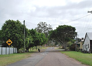
Dagun is a rural town and locality in the Gympie Region, Queensland, Australia. In the 2021 census, the locality of Dagun had a population of 137 people.

Curra is a rural residential locality in the Gympie Region, Queensland, Australia. In the 2021 census, Curra had a population of 2,104 people.

Tinana is a rural town and locality in the Fraser Coast Region, Queensland, Australia. In the 2021 census, the locality of Tinana had a population of 5,872 people.

Torbanlea is a rural town and locality in the Fraser Coast Region, Queensland, Australia. In the 2021 census, the locality of Torbanlea had a population of 841 people.

Antigua is a rural locality in the Fraser Coast Region, Queensland, Australia. In the 2021 census, Antigua had a population of 126 people.

Toolara Forest is a locality split between Gympie Region and Fraser Coast Region, Queensland, Australia. In the 2021 census, Toolara Forest had "no people or a very low population".

Kinbombi is a rural town and locality in the Gympie Region, Queensland, Australia. In the 2021 census, the locality of Kinbombi had a population of 34 people.

Amamoor Creek is a rural locality in the Gympie Region, Queensland, Australia. In the 2021 census, Amamoor Creek had a population of 56 people.
Gootchie is a rural locality in the Fraser Coast Region, Queensland, Australia. In the 2021 census, Gootchie had a population of 96 people.
Tuan is a coastal rural town and locality in the Fraser Coast Region, Queensland, Australia. In the 2021 census, the locality of Tuan had a population of 140 people.
Netherby is a rural locality in the Fraser Coast Region, Queensland, Australia. In the 2021 census, Netherby had a population of 25 people.
Doongul is a rural locality in the Fraser Coast Region, Queensland, Australia. In the 2021 census, Doongul had a population of 35 people.

Scotchy Pocket is a rural locality in the Gympie Region, Queensland, Australia. In the 2021 census, Scotchy Pocket had a population of 55 people.
Long Flat is a rural locality in the Gympie Region, Queensland, Australia. In the 2021 census, Long Flat had a population of 98 people.

