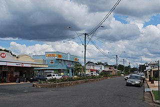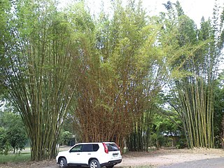
Biggenden is a rural town and locality in the North Burnett Region, Queensland, Australia. In the 2021 census, the locality of Biggenden had a population of 788 people.

Burnett Heads is a coastal town and locality in the Bundaberg Region, Queensland, Australia. In the 2021 census, the locality of Burnett Heads had a population of 2,908 people.

River Heads is a coastal town and locality in the Fraser Coast Region, Queensland, Australia. In the 2021 census, the locality of River Heads had a population of 2,044 people.

Howard is a rural town and locality in the Fraser Coast Region, Queensland, Australia. It is a southern boundary of the Dundaburra peoples of the Northern Kabi Kabi Isis districts and surrounds. It is located 284 kilometres (176 mi) north of Brisbane and 37 kilometres (23 mi) west of Hervey Bay. In the 2021 census, the locality of Howard had a population of 1,394 people.

Theebine is a rural town and locality split between the Gympie Region and the Fraser Coast Region, both in Queensland, Australia.

Tinana is a rural town and locality in the Fraser Coast Region, Queensland, Australia. In the 2021 census, the locality of Tinana had a population of 5,872 people.

Yengarie is a rural locality in the Fraser Coast Region, Queensland, Australia. In the 2021 census, Yengarie had a population of 615 people.

Torbanlea is a rural town and locality in the Fraser Coast Region, Queensland, Australia. In the 2021 census, the locality of Torbanlea had a population of 841 people.

Bauple is a rural town and locality in the Fraser Coast Region, Queensland, Australia. In the 2021 census, the locality of Bauple had a population of 745 people.
Owanyilla is a rural town and locality in the Fraser Coast Region, Queensland, Australia. In the 2021 census, the locality of Owanyilla had a population of 245 people.
Tinana South is a rural locality in the Fraser Coast Region, Queensland, Australia. In the 2021 census, Tinana South had a population of 545 people.
St Helens is a rural locality in the Fraser Coast Region, Queensland, Australia. In the 2021 census, St Helens had a population of 123 people.

Maryborough West is a mixed-use locality in the Fraser Coast Region, Queensland, Australia. In the 2021 census, Maryborough West had a population of 568 people.

Munna Creek is a locality split between the Fraser Coast Region and the Gympie Region, in Queensland, Australia. In the 2021 census, Munna Creek had a population of 22 people.
Pioneers Rest is a rural locality in the Fraser Coast Region, Queensland, Australia. In the 2021 census, Pioneers Rest had a population of 78 people.

Oakhurst is a mixed-use locality in the Fraser Coast Region, Queensland, Australia. In the 2021 census, Oakhurst had a population of 1,717 people.
Bidwill is a locality in the Fraser Coast Region, Queensland, Australia. In the 2021 census, Bidwill had a population of 517 people.

Teddington is a rural locality in the Fraser Coast Region, Queensland, Australia. In the 2021 census, Teddington had a population of 236 people.
Talegalla Weir is a locality in the Fraser Coast Region, Queensland, Australia. In the 2021 census, Talegalla Weir had a population of 127 people.
Mount Lawless is a rural locality in the North Burnett Region, Queensland, Australia. In the 2021 census, Mount Lawless had a population of 9 people.


