Glenwood, Queensland

Last updated

Glenwood
Queensland
Australia Queensland location map.svg
Red pog.svg
Glenwood
Coordinates 25°55′50″S152°38′07″E / 25.9305°S 152.6352°E / -25.9305; 152.6352 (Glenwood (centre of locality))
Population2,137 (2021 census) [1]
 • Density41.58/km2 (107.68/sq mi)
Postcode(s) 4570
Area51.4 km2 (19.8 sq mi)
Time zone AEST (UTC+10:00)
Location
LGA(s)
State electorate(s) Gympie
Federal division(s) Wide Bay
Localities around Glenwood:
Gootchie Bauple Forest Bauple Forest
Kanigan Glenwood Neerdie
Kanigan Gunalda Anderleigh

Glenwood is a locality split between the Fraser Coast Region and the Gympie Region in Queensland, Australia. [2] [3] In the 2021 census, the locality of Glenwood had a population of 2,137 people. [1]

Contents

Geography

Glenwood is located about halfway between Gympie and Maryborough on the Bruce Highway.

History

Glenwood Provisional School opened on 11 November 1918. On 1 December 1927 it became Glenwood State School. [4]

Glenwood was part of the Shire of Tiaro until the local government amalgamations of 2008.

Demographics

In the 2011 census, the locality of Glenwood had a population of 1,259 people. [5]

In the 2016 census, the locality of Glenwood had a population of 1,535 people. [6]

In the 2021 census, the locality of Glenwood had a population of 2,137 people. [1]

Education

Glenwood State School is a government primary (Prep-6) school for boys and girls at 13 Glenwood School Road ( 25°56′59″S152°36′09″E / 25.9496°S 152.6026°E / -25.9496; 152.6026 (Glenwood State School) ). [7] [8] In 2017, the school had an enrolment of 83 students with 8 teachers (5 full-time equivalent) and 8 non-teaching staff (5 full-time equivalent). [9]

There is no secondary school in Glenwood; the nearest ones are in Gympie. [10]

Events

Glenwood is a small town except on the third weekend in August when they hold their Swap Meet which is held at the Glenwood Hall. The Glenwood Community Centre run many events throughout the year at the Glenwood Hall.

Related Research Articles

Veteran is a rural residential locality in the Gympie Region, Queensland, Australia. In the 2021 census, Veteran had a population of 959 people.

Victory Heights is a rural residential locality in the Gympie Region, Queensland, Australia. In the 2021 census, Victory Heights had a population of 486 people.

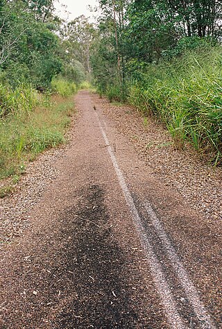
Two Mile is a rural locality in the Gympie Region, Queensland, Australia. In the 2021 census, Two Mile had a population of 69 people.

Tamaree is a rural residential locality in the Gympie Region, Queensland, Australia. In the 2021 census, Tamaree had a population of 1,000 people.

Jones Hill is a rural locality in the Gympie Region, Queensland, Australia. In the 2021 census, Jones Hill had a population of 1,135 people.

The Dawn is a rural residential locality in the Gympie Region, Queensland, Australia. In the 2021 census, The Dawn had a population of 604 people.

<span class="mw-page-title-main">Glanmire, Queensland</span> Suburb of Gympie, Queensland, Australia

Glanmire is an urban industrial locality in Gympie in the Gympie Region, Queensland, Australia. In the 2021 census, Glanmire had a population of 28 people.

Kybong is a rural locality in the Gympie Region, Queensland, Australia. In the 2021 census, Kybong had a population of 363 people.

<span class="mw-page-title-main">Gunalda</span> Town in Queensland, Australia

Gunalda is a rural town in the Gympie Region and a locality split between Gympie Region and Fraser Coast Region in Queensland, Australia. In the 2021 census, the locality of Gunalda had a population of 426 people.

<span class="mw-page-title-main">Tinana, Queensland</span> Town in Queensland, Australia

Tinana is a rural town and locality in the Fraser Coast Region, Queensland, Australia. In the 2021 census, the locality of Tinana had a population of 5,872 people.

<span class="mw-page-title-main">Miva, Queensland</span> Town in Queensland, Australia

Miva is a locality split between the Gympie Region and the Fraser Coast Region in Queensland, Australia. In the 2021 census, the locality of Miva had a population of 55 people.

Cooloola Cove is a coastal locality in the Gympie Region, Queensland, Australia. In the 2021 census, Cooloola Cove had a population of 2,921 people.

Greens Creek is a rural locality in the Gympie Region, Queensland, Australia. In the 2021 census, Greens Creek had a population of 344 people.

Kanigan is a rural locality split between the Fraser Coast Region and the Gympie Region, both in Queensland, Australia. In the 2021 census, Kanigan had a population of 143 people.

<span class="mw-page-title-main">Gootchie, Queensland</span> Suburb of Fraser Coast Region, Queensland, Australia

Gootchie is a rural locality in the Fraser Coast Region, Queensland, Australia. In the 2021 census, Gootchie had a population of 96 people.

Bauple Forest is a rural locality in the Fraser Coast Region, Queensland, Australia. In the 2021 census, Bauple Forest had "no people or a very low population".

Mudlo is a locality in the Gympie Region, Queensland, Australia. In the 2021 census, Mudlo had "no people or a very low population".

<span class="mw-page-title-main">Tuan Forest, Queensland</span> Suburb of Fraser Coast Region, Queensland, Australia

Tuan Forest is a coastal locality split between the Gympie Region and the Fraser Coast Region, both in Queensland, Australia. In the 2021 census, Tuan Forest had "no people or a very low population".

Paterson is a rural locality in the Fraser Coast Region, Queensland, Australia. In the 2021 census, Paterson had a population of 157 people.

Neerdie is a rural locality split between the Gympie Region and the Fraser Coast Region, both in Queensland, Australia. In the 2021 census, Neerdie had a population of 111 people.

References

  1. 1 2 3 Australian Bureau of Statistics (28 June 2022). "Glenwood (SAL)". 2021 Census QuickStats. Retrieved 28 February 2023. OOjs UI icon edit-ltr-progressive.svg
  2. "Glenwood – locality in Fraser Coast Region (entry 46739)". Queensland Place Names. Queensland Government . Retrieved 16 November 2019.
  3. "Glenwood – locality in Gympie Region (entry 46411)". Queensland Place Names. Queensland Government . Retrieved 16 November 2019.
  4. Queensland Family History Society (2010), Queensland schools past and present (Version 1.01 ed.), Queensland Family History Society, ISBN   978-1-921171-26-0
  5. Australian Bureau of Statistics (31 October 2012). "Glenwood (State Suburb)". 2011 Census QuickStats. Retrieved 11 March 2014. OOjs UI icon edit-ltr-progressive.svg
  6. Australian Bureau of Statistics (27 June 2017). "Glenwood (SSC)". 2016 Census QuickStats. Retrieved 20 October 2018. OOjs UI icon edit-ltr-progressive.svg
  7. "State and non-state school details". Queensland Government. 9 July 2018. Archived from the original on 21 November 2018. Retrieved 21 November 2018.
  8. "Glenwood State School". Archived from the original on 24 March 2019. Retrieved 21 November 2018.
  9. "ACARA School Profile 2017". Archived from the original on 22 November 2018. Retrieved 22 November 2018.
  10. "Queensland Globe". State of Queensland . Retrieved 14 November 2019.

Commons-logo.svg Media related to Glenwood, Queensland at Wikimedia Commons