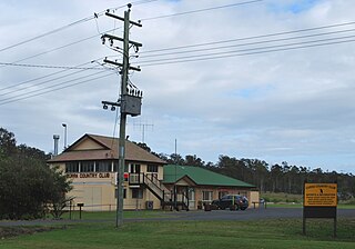
Kilkivan is a rural town and locality in the Gympie Region of Queensland, Australia. In the 2021 census, the locality of Kilkivan had a population of 689 people.

Goomeri is a rural town and locality in the Gympie Region, Queensland, Australia. In the 2021 census, the locality of Goomeri had a population of 677 people.

The Shire of Tiaro was a local government area in the Wide Bay–Burnett region of Queensland, Australia, between the regional cities of Gympie and Hervey Bay about 220 kilometres (137 mi) north of the state capital, Brisbane. The shire covered an area of 2,185.3 square kilometres (843.7 sq mi), and existed as a local government area from 1879 until 2008, when it was dissolved and split between two new local government areas, the Gympie Region and the Fraser Coast Region.
Tamaree is a rural residential locality in the Gympie Region, Queensland, Australia. In the 2021 census, Tamaree had a population of 1,000 people.

Theebine is a rural town and locality split between the Gympie Region and the Fraser Coast Region, both in Queensland, Australia.

Curra is a rural residential locality in the Gympie Region, Queensland, Australia. In the 2021 census, Curra had a population of 2,104 people.

Miva is a rural locality split between the Gympie Region and the Fraser Coast Region in Queensland, Australia. In the 2021 census, the locality of Miva had a population of 55 people.

Widgee is a rural locality in the Gympie Region, Queensland, Australia. In the 2021 census, Widgee had a population of 862 people.

Bauple is a rural town and locality in the Fraser Coast Region, Queensland, Australia. In the 2021 census, the locality of Bauple had a population of 745 people.
Owanyilla is a rural town and locality in the Fraser Coast Region, Queensland, Australia. In the 2021 census, the locality of Owanyilla had a population of 245 people.
Kanigan is a rural locality split between the Fraser Coast Region and the Gympie Region, both in Queensland, Australia. In the 2021 census, Kanigan had a population of 143 people.

Kinbombi is a rural town and locality in the Gympie Region, Queensland, Australia. In the 2021 census, the locality of Kinbombi had a population of 34 people.

Manyung is a rural town in the Gympie Region with the locality split between the Gympie Region and the South Burnett Region, Queensland, Australia. In the 2021 census, Manyung had a population of 83 people.

Munna Creek is a locality split between the Fraser Coast Region and the Gympie Region, in Queensland, Australia. In the 2021 census, Munna Creek had a population of 22 people.

Tansey is a rural town and locality in the Gympie Region, Queensland, Australia. In the 2021 census, the locality of Tansey had a population of 154 people.
Mount Urah is a rural locality in the Fraser Coast Region, Queensland, Australia. In the 2021 census, Mount Urah had a population of 49 people.

Marodian is a rural locality in the Fraser Coast Region, Queensland, Australia. In the 2021 census, Marodian had "no people or a very low population".
Paterson is a rural locality in the Fraser Coast Region, Queensland, Australia. In the 2021 census, Paterson had a population of 157 people.
Maryborough–Biggenden Road is an 83.4 kilometres (51.8 mi) road route in the Fraser Coast and North Burnett regions of Queensland, Australia. The entire route is signed as State Route 86.


