Brooloo, Queensland

Last updated

Brooloo
Queensland
BroolooHall.JPG
Brooloo Public Hall, established 1915
Australia Queensland location map.svg
Red pog.svg
Brooloo
Coordinates 26°29′14″S152°42′03″E / 26.4872°S 152.7008°E / -26.4872; 152.7008 (Brooloo (town centre)) Coordinates: 26°29′14″S152°42′03″E / 26.4872°S 152.7008°E / -26.4872; 152.7008 (Brooloo (town centre))
Population348 (2016 census locality) [1]
 • Density12.52/km2 (32.42/sq mi)
Postcode(s) 4570
Area27.8 km2 (10.7 sq mi)
Time zone AEST (UTC+10:00)
Location
LGA(s) Gympie Region
State electorate(s) Gympie
Federal division(s) Wide Bay
Localities around Brooloo:
Imbil Bollier Bollier
Imbil Brooloo Moy Pocket
Imbil Kenilworth Kenilworth

Brooloo is a rural town and locality in the Gympie Region, Queensland, Australia. [2] [3] In the 2016 census, the locality of Brooloo had a population of 348 people. [1]

Contents

Geography

The town is located in the hinterland behind the Sunshine Coast, 160 kilometres (99 mi) north of the state capital, Brisbane.

Mary Valley Road enters the locality from the north-west (Imbil), passes through the town (in the north of the locality), and then exits to the south-east Kenilworth. [4]

Brooloo railway station is an abandoned railway station on the now-closed Mary Valley railway line ( 26°29′14″S152°41′59″E / 26.4873°S 152.6998°E / -26.4873; 152.6998 (Brooloo railway station) ). [5]

History

The Bluff Provisional School opened in July 1907. On 1 January 1909 it became The Bluff State School. In May 1915 it was renamed Brooloo State School. It closed in 1970. [6]

Brooloo Hall opened in 1915. [7]

Brooloo Post Office opened by June 1915 (a receiving office had been open from March 1914). In 1922 the Brooloo Rail office was renamed Brooloo and replaced the previous office. It closed in 1972. [8]

In the 2006 census census Brooloo and the surrounding area had a population of 333. [9]

In the 2016 census the locality of Brooloo had a population of 348 people. [1]

Heritage listings

Booloo has one heritage-listed site. It is Brooloo Hall at 3726 Mary Valley Road ( 26°29′08″S152°42′13″E / 26.48566°S 152.70356°E / -26.48566; 152.70356 (Brooloo Hall) ). [7]

Related Research Articles

<span class="mw-page-title-main">Kenilworth, Queensland</span> Town in Queensland, Australia

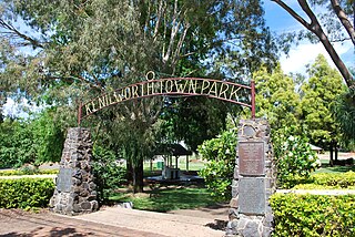
Kenilworth is a rural town and locality in the Sunshine Coast Region, Queensland, Australia. In the 2016 census, the locality of Kenilworth had a population of 558 people.

<span class="mw-page-title-main">Landsborough, Queensland</span> Town in Queensland, Australia

Landsborough is a town and a locality in the Sunshine Coast Region, Queensland, Australia. At the 2021 census, Landsborough had a population of 4,446 people.

<span class="mw-page-title-main">Kandanga, Queensland</span> Town in Queensland, Australia

Kandanga is a town and a locality in the Gympie Region, Queensland, Australia. In the 2016 census, the locality of Kandanga had a population of 665 people.

Kandanga Creek is a rural locality in the Gympie Region, Queensland, Australia. In the 2016 census, Kandanga Creek had a population of 118 people.

<span class="mw-page-title-main">Linville, Queensland</span> Town in Queensland, Australia

Linville is a rural town and locality in the Somerset Region, Queensland, Australia. In the 2016 census, Linville had a population of 156 people.

Carters Ridge is a rural locality in the Gympie Region, Queensland, Australia. In the 2016 census, Carters Ridge had a population of 469 people.

<span class="mw-page-title-main">Monkland, Queensland</span> Suburb of Gympie, Queensland, Australia

Monkland is a rural locality in the Gympie Region, Queensland, Australia. In the 2016 census Monkland had a population of 1,125 people.

<span class="mw-page-title-main">Imbil</span> Town in Queensland, Australia

Imbil is a rural town and locality in the Gympie Region, Queensland, Australia. In the 2016 census, Imbil had a population of 924 people.

<span class="mw-page-title-main">Amamoor</span> Town in Queensland, Australia

Amamoor is a rural town and locality in the Gympie Region, Queensland, Australia. In the 2016 census the locality of Amamoor had a population of 636 people.

Dagun is a rural town and locality in the Gympie Region, Queensland, Australia. In the 2016 census, the locality of Dagun had a population of 150 people.

<span class="mw-page-title-main">Curra, Queensland</span> Suburb of Gympie Region, Queensland, Australia

Curra is a rural residential locality in the Gympie Region, Queensland, Australia. In the 2016 census, Curra had a population of 1,920 people.

<span class="mw-page-title-main">Miva, Queensland</span> Town in Queensland, Australia

Miva is a locality split between the Gympie Region and the Fraser Coast Region in Queensland, Australia. > In the 2016 census Miva had a population of 57 people.

<span class="mw-page-title-main">Traveston</span> Suburb of Gympie Region, Queensland, Australia

Traveston is a rural town and locality in the Gympie Region, Queensland, Australia. In the 2016 census the locality of Traveston had a population of 480 people.

Melawondi is a rural locality in the Gympie Region, Queensland, Australia. It is located 20 kilometres (12 mi) south of Gympie. In the 2016 census Melawondi had a population of 30 people.

<span class="mw-page-title-main">Imbil Railway Bridge</span> Railway bridge over Yabba Creek in Queensland, Australia

Imbil Railway Bridge is a heritage-listed railway bridge over Yabba Creek, Imbil, Gympie Region, Queensland, Australia. It was built circa 1915 by Queensland Railways to facilitate settlement in the Mary River Valley. It was added to the Queensland Heritage Register on 14 October 2011.

<span class="mw-page-title-main">Cinnabar, Queensland</span> Suburb of Gympie Region, Queensland, Australia

Cinnabar is a rural locality in the Gympie Region, Queensland, Australia. In the 2016 census, Cinnabar had a population of 72 people.

Lake Borumba is a rural locality in the Gympie Region, Queensland, Australia. In the 2016 census Lake Borumba had a population of 6 people.

<span class="mw-page-title-main">Bella Creek, Queensland</span> Suburb of Gympie Region, Queensland, Australia

Bella Creek is a rural locality in the Gympie Region, Queensland, Australia. In the 2016 census Bella Creek had a population of 43 people.

Bollier is a rural locality in the Gympie Region, Queensland, Australia. In the 2016 census Bollier had a population of 200 people.

Gympie–Brooloo–Kenilworth Road is a continuous 51.6 kilometres (32.1 mi) road route in the Gympie and Sunshine Coast regions of Queensland, Australia. It has two official names, Gympie–Brooloo Road and Kenilworth–Brooloo Road. The entire route is signed as State Route 51.

References

  1. 1 2 3 Australian Bureau of Statistics (27 June 2017). "Brooloo (SSC)". 2016 Census QuickStats. Retrieved 20 October 2018. OOjs UI icon edit-ltr-progressive.svg
  2. "Brooloo – town in Gympie Region (entry 4688)". Queensland Place Names. Queensland Government . Retrieved 27 December 2020.
  3. "Brooloo – locality in Gympie Region (entry 46310)". Queensland Place Names. Queensland Government . Retrieved 27 December 2020.
  4. "Queensland Globe". State of Queensland . Retrieved 18 January 2021.
  5. "Railway stations and sidings – Queensland". Queensland Open Data. Queensland Government. 2 October 2020. Archived from the original on 5 October 2020. Retrieved 5 October 2020.
  6. Queensland Family History Society (2010), Queensland schools past and present (Version 1.01 ed.), Queensland Family History Society, ISBN   978-1-921171-26-0
  7. 1 2 "Brooloo Hall" (PDF). Local Heritage Register. Gympie Regional Council. Archived (PDF) from the original on 17 January 2021. Retrieved 17 January 2021.
  8. Premier Postal History. "Post Office List". Premier Postal Auctions. Retrieved 10 May 2014.
  9. Australian Bureau of Statistics (25 October 2007). "Brooloo (Cooloola Shire) (State Suburb)". 2006 Census QuickStats. Retrieved 3 April 2009.

Further reading