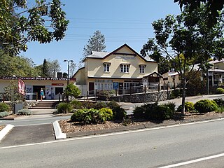
Greens Creek, Queensland

Last updated

Greens Creek
Queensland
Aerial photograph of Gympie East State School, 2020.jpg
Gympie East State School, 2020
Australia Queensland location map.svg
Red pog.svg
Greens Creek
Coordinates 26°10′20″S152°44′55″E / 26.1722°S 152.7486°E / -26.1722; 152.7486 (Greens Creek (centre of locality))
Population344 (2021 census) [1]
 • Density17.82/km2 (46.16/sq mi)
Postcode(s) 4570
Area19.3 km2 (7.5 sq mi)
Time zone AEST (UTC+10:00)
Location
LGA(s) Gympie Region
State electorate(s) Gympie
Federal division(s) Wide Bay
Suburbs around Greens Creek:
Canina Canina Wolvi
Veteran Greens Creek Wolvi
East Deep Creek Cedar Pocket Cedar Pocket

Greens Creek is a rural locality in the Gympie Region, Queensland, Australia. [2] In the 2021 census, Greens Creek had a population of 344 people. [1]

Contents

History

Gympie East State School, shortly after opening Gympie East State School, circa 1965.jpg
Gympie East State School, shortly after opening
Official opening of Gympie East State School by Minister for Public Instruction, Jack Pizzey, 9 October 1965 Official opening of Gympie East State School by Minister for Public Instruction, Jack Pizzey, 9 October 1965.png
Official opening of Gympie East State School by Minister for Public Instruction, Jack Pizzey, 9 October 1965

Cootharaba Road Provisional School opened on 12 February 1894. On 7 June 1899, it became Cootharaba Road State School. It was at 27 Grecian Bends Road ( 26°10′10″S152°43′04″E / 26.16932°S 152.71768°E / -26.16932; 152.71768 (Cootharaba Road State School (former)) ). [3] [4]

In 1961, the parents of Beenam Range State School, Cedar Pocket State School, Cootharaba Road State School, and Neusa Vale State School voted in favour of replacing those schools with a central school in the area. [5] Cootharaba Road State School closed in 1925 when the new Gympie East State School opened in Greens Creek on 25 January 1965. [6] It was officially opened on 9 October 1965 by the Minister for Public Instruction, Jack Pizzey. [5]

As at September 2022, the two school buildings of Cootharaba Road State School are still extant on the site. [7] [8]

Demographics

In the 2016 census, Greens Creek had a population of 326 people. [9]

In the 2021 census, Greens Creek had a population of 344 people. [1]

Education

Gympie East State School is a government primary (Prep-6) school for boys and girls at 219 Cedar Pocket Road ( 26°10′47″S152°43′58″E / 26.1798°S 152.7327°E / -26.1798; 152.7327 (Gympie East State School) ). [10] [11] In 2018, the school had an enrolment of 140 students with 10 teachers (8 full-time equivalent) and 9 non-teaching staff (6 full-time equivalent). [12]

There are no secondary schools in Greens Creek. The nearest government secondary school is Gympie State High School in Gympie to the south-west. [13]

Related Research Articles

<span class="mw-page-title-main">Cooran, Queensland</span> Town in Queensland, Australia

Cooran is a rural hinterland town and locality in the Shire of Noosa, Queensland, Australia. In the 2021 census, the locality of Cooran had a population of 1,756 people.

Ringtail Creek is a rural locality in the Shire of Noosa, Queensland, Australia. In the 2021 census, Ringtail Creek had a population of 203 people.

Cootharaba is a rural locality in the Shire of Noosa, Queensland, Australia. In the 2021 census, Cootharaba had a population of 866 people.

<span class="mw-page-title-main">Como, Queensland</span> Suburb of Sunshine Coast, Queensland, Australia

Como is a rural locality in the Shire of Noosa, Queensland, Australia. In the 2021 census, Como had a population of 54 people.

<span class="mw-page-title-main">Tuchekoi, Queensland</span> Suburb of Gympie Region, Queensland, Australia

Tuchekoi is a rural locality in the Gympie Region, Queensland, Australia. In the 2021 census, Tuchekoi had a population of 199 people.

Veteran is a rural residential locality in the Gympie Region, Queensland, Australia. In the 2021 census, Veteran had a population of 959 people.

Victory Heights is a rural residential locality in the Gympie Region, Queensland, Australia. In the 2021 census, Victory Heights had a population of 486 people.

Jones Hill is a rural locality in the Gympie Region, Queensland, Australia. In the 2021 census, Jones Hill had a population of 1,135 people.

<span class="mw-page-title-main">Glanmire, Queensland</span> Suburb of Gympie, Queensland, Australia

Glanmire is an urban industrial locality in Gympie in the Gympie Region, Queensland, Australia. In the 2021 census, Glanmire had a population of 28 people.

Dagun is a rural town and locality in the Gympie Region, Queensland, Australia. In the 2021 census, the locality of Dagun had a population of 137 people.

<span class="mw-page-title-main">Tinana, Queensland</span> Town in Queensland, Australia

Tinana is a rural town and locality in the Fraser Coast Region, Queensland, Australia. In the 2021 census, the locality of Tinana had a population of 5,872 people.

<span class="mw-page-title-main">Traveston</span> Town in Queensland, Australia

Traveston is a rural town and locality in the Gympie Region, Queensland, Australia. In the 2021 census, the locality of Traveston had a population of 509 people.

<span class="mw-page-title-main">Widgee</span> Suburb of Gympie Region, Queensland, Australia

Widgee is a rural locality in the Gympie Region, Queensland, Australia. In the 2021 census, Widgee had a population of 862 people.

Calico Creek is a rural locality in the Gympie Region, Queensland, Australia. In the 2021 census, Calico Creek had a population of 185 people.

Cedar Pocket is a rural locality in the Gympie Region, Queensland, Australia. In the 2021 census, Cedar Pocket had a population of 332 people.

Kanigan is a rural locality split between the Fraser Coast Region and the Gympie Region, both in Queensland, Australia. In the 2021 census, Kanigan had a population of 143 people.

Neusa Vale is a rural locality in the Gympie Region, Queensland, Australia. In the 2021 census, Neusa Vale had a population of 54 people.

Widgee Crossing South is a rural locality in the Gympie Region, Queensland, Australia. In the 2021 census, Widgee Crossing South had a population of 33 people.

Coles Creek is a rural locality in the Gympie Region, Queensland, Australia. In the 2021 census, Coles Creek had a population of 68 people.

Long Flat is a rural locality in the Gympie Region, Queensland, Australia. In the 2021 census, Long Flat had a population of 98 people.

References

  1. 1 2 3 Australian Bureau of Statistics (28 June 2022). "Greens Creek (SAL)". 2021 Census QuickStats. Retrieved 28 February 2023. OOjs UI icon edit-ltr-progressive.svg
  2. "Greens Creek – locality in Gympie Region (entry 46337)". Queensland Place Names. Queensland Government . Retrieved 27 December 2020.
  3. "Queensland Two Mile series sheet 2m110" (Map). Queensland Government. 1941. Retrieved 3 July 2024.
  4. "Layers: Locality; Roads and rail; Land parcel". Queensland Globe. Queensland Government . Retrieved 3 July 2024.
  5. 1 2 "History". Gympie East State School. 31 January 2020. Retrieved 2 July 2024.
  6. Queensland Family History Society (2010), Queensland schools past and present (Version 1.01 ed.), Queensland Family History Society, ISBN   978-1-921171-26-0
  7. "27 Grecian Bends Road, Greens Creek". Realestate.com.au . 2017. Retrieved 3 July 2024.
  8. Google (September 2022). "Cootharaba Road State School (former)". Google Street View . Google. Retrieved 3 July 2024.
  9. Australian Bureau of Statistics (27 June 2017). "Greens Creek (SSC)". 2016 Census QuickStats. Retrieved 20 October 2018. OOjs UI icon edit-ltr-progressive.svg
  10. "State and non-state school details". Queensland Government. 9 July 2018. Archived from the original on 21 November 2018. Retrieved 21 November 2018.
  11. "Gympie East State School" . Retrieved 21 November 2018.
  12. "ACARA School Profile 2018". Australian Curriculum, Assessment and Reporting Authority. Archived from the original on 27 August 2020. Retrieved 28 January 2020.
  13. "Layers: Locality; Schools and school catchments". Queensland Globe. Queensland Government . Retrieved 2 July 2024.