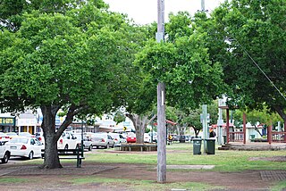
Barambah, Queensland

Last updated

Barambah
Queensland
Barambah Homestead.jpg
Barambah Homestead
Australia Queensland location map.svg
Red pog.svg
Barambah
Coordinates 26°18′59″S152°07′54″E / 26.3163°S 152.1316°E / -26.3163; 152.1316 (Barambah (centre of locality))
Population39 (2021 census) [1]
 • Density0.244/km2 (0.631/sq mi)
Postcode(s) 4601
Area160.0 km2 (61.8 sq mi)
Time zone AEST (UTC+10:00)
Location
LGA(s) Gympie Region
State electorate(s) Nanango
Federal division(s) Wide Bay
Suburbs around Barambah:
Redgate Goomeri Kinbombi
Moffatdale Barambah Manumbar
Charlestown Johnstown Elgin Vale

Barambah is a rural locality in the Gympie Region, Queensland, Australia. [2] In the 2021 census, Barambah had a population of 39 people. [1]

Contents

History

Map of land sales, 1906 Sketch map of portions 61, 62, ..., parish of Murgon, portions 168 & 169, parish of Goomeribong & portions 49, 50 & 53, parish of Barambah ... county of Fitzroy.jpg
Map of land sales, 1906

Land was open for selection on 17 April 1877; 11,000 acres (4,500 ha) were available in Baramba, 18,500 acres (7,500 ha) in Baramba North, 28 square miles (73 km2) in East Baramba and 4,500 acres (1,800 ha) in the Baramba Ranges. [3]

In July 1906, 32 allotments were advertised for selection by the Department of Public Lands Office. The map advertising the land selection states the allotments are portions in the Parishes of Murgon, Goomeribong and Barambah. [4] The portions were left over from 5 April 1906. [5]

Demographics

In the 2016 census, Barambah had a population of 46 people. [6]

In the 2021 census, Barambah had a population of 39 people. [1]

Heritage listings

Barambah has a number of heritage-listed sites, including:

Education

There are no schools in Barambah. The nearest government primary schools are Moffatdale State School in neighbouring Moffatdale to the west and Goomeri State School in neighbouring Goomeri. The nearest government secondary schools are Goomeri State School (to Year 10) and Murgon State High School (to Year 12) in Murgon to the west. [8]

Related Research Articles

<span class="mw-page-title-main">Murgon</span> Town in Queensland, Australia

Murgon is a rural town and locality in the South Burnett Region, Queensland, Australia. In the 2021 census, the locality of Murgon had a population of 2,220 people.

<span class="mw-page-title-main">Booubyjan, Queensland</span> Suburb of Gympie Region, Queensland, Australia

Booubyjan is a rural locality in the Gympie Region, Queensland, Australia. In the 2021 census, Booubyjan had a population of 98 people.

<span class="mw-page-title-main">Kilkivan, Queensland</span> Town in Queensland, Australia

Kilkivan is a rural town and locality in the Gympie Region of Queensland, Australia. In the 2021 census, the locality of Kilkivan had a population of 689 people.

<span class="mw-page-title-main">Goomeri</span> Town in Queensland, Australia

Goomeri is a rural town and locality in the Gympie Region, Queensland, Australia. In the 2021 census, the locality of Goomeri had a population of 677 people.

<span class="mw-page-title-main">Shire of Kilkivan</span> Local government area in Queensland, Australia

The Shire of Kilkivan was a local government area about 180 kilometres (112 mi) north-northwest of Brisbane, the state capital of Queensland, Australia. The shire covered an area of 3,263.4 square kilometres (1,260.0 sq mi), and existed from 1886 until its merger with several other local government areas to form the Gympie Region on 15 March 2008.

Southside is a semi-rural locality in the Gympie Region, Queensland, Australia. In the 2021 census, Southside had a population of 6,312 people.
<span class="mw-page-title-main">Tingoora</span> Town in Queensland, Australia

Tingoora is a rural town and a locality in the South Burnett Region, Queensland, Australia.

<span class="mw-page-title-main">Elgin Vale, Queensland</span> Suburb of Gympie Region, Queensland, Australia

Elgin Vale is a rural locality in the Gympie Region, Queensland, Australia. In the 2021 census, Elgin Vale had "no people or a very low population".

<span class="mw-page-title-main">Barambah Homestead</span> Historic site in Queensland, Australia

Barambah Homestead is a heritage-listed homestead at Goomeri Road, Barambah, Gympie Region, Queensland, Australia. It was designed by Frederic Herbert Faircloth and completed in 1906 by William (Bill) Clarry formerly of Bundaberg. It was added to the Queensland Heritage Register on 21 August 1992.

<span class="mw-page-title-main">Moffatdale, Queensland</span> Suburb of South Burnett Region, Queensland, Australia

Moffatdale is a rural locality in the South Burnett Region, Queensland, Australia. In the 2021 census, Moffatdale had a population of 257 people.

<span class="mw-page-title-main">Boonara, Queensland</span> Suburb of Gympie Region, Queensland, Australia

Boonara is a rural locality in the Gympie Region, Queensland, Australia. In the 2021 census, Boonara had a population of 60 people.

<span class="mw-page-title-main">Cinnabar, Queensland</span> Suburb of Gympie Region, Queensland, Australia

Cinnabar is a rural locality in the Gympie Region, Queensland, Australia. In the 2021 census, Cinnabar had a population of 83 people.

Downsfield is a rural locality in the Gympie Region, Queensland, Australia. In the 2021 census, Downsfield had a population of 86 people.

<span class="mw-page-title-main">Kinbombi</span> Town in Queensland, Australia

Kinbombi is a rural town and locality in the Gympie Region, Queensland, Australia. In the 2021 census, the locality of Kinbombi had a population of 34 people.

<span class="mw-page-title-main">Manumbar</span> Suburb of Gympie Region, Queensland, Australia

Manumbar is a rural locality in the Gympie Region, Queensland, Australia. In the 2021 census, Manumbar had a population of 38 people.

<span class="mw-page-title-main">Manyung</span> Town in Queensland, Australia

Manyung is a rural town in the Gympie Region with the locality split between the Gympie Region and the South Burnett Region, Queensland, Australia. In the 2021 census, Manyung had a population of 83 people.

Redgate is a rural locality in the South Burnett Region, Queensland, Australia. In the 2021 census, Redgate had a population of 94 people.

<span class="mw-page-title-main">Tansey, Queensland</span> Town in Queensland, Australia

Tansey is a rural town and locality in the Gympie Region, Queensland, Australia. In the 2021 census, the locality of Tansey had a population of 154 people.

Goomeribong is a rural locality in the Gympie Region, Queensland, Australia. In the 2021 census, Goomeribong had a population of 49 people.

Moondooner is a rural locality in the South Burnett Region, Queensland, Australia. In the 2021 census, Moondooner had a population of 45 people.

References

  1. 1 2 3 Australian Bureau of Statistics (28 June 2022). "Barambah (SAL)". 2021 Census QuickStats. Retrieved 28 February 2023. OOjs UI icon edit-ltr-progressive.svg
  2. "Barambah – locality in Gympie Region (entry 46302)". Queensland Place Names. Queensland Government . Retrieved 27 December 2020.
  3. "Proclamations under the New Land Acts". The Brisbane Courier . Queensland, Australia. 2 March 1877. p. 3. Archived from the original on 27 August 2020. Retrieved 19 February 2020 via Trove.
  4. "Sketch map of portions 61, 62, ..., parish of Murgon, portions 168 & 169, parish of Goomeribong & portions 49, 50 & 53, parish of Barambah ... county of Fitzroy" (1906) [Map]. Collections. State Library of Queensland.
  5. "Notes and News". Gympie Times And Mary River Mining Gazette . Vol. XXXVIII, no. 5003. Queensland, Australia. 26 June 1906. p. 6. Archived from the original on 25 May 2022. Retrieved 25 March 2019 via National Library of Australia.
  6. Australian Bureau of Statistics (27 June 2017). "Barambah (SSC)". 2016 Census QuickStats. Retrieved 20 October 2018. OOjs UI icon edit-ltr-progressive.svg
  7. "Barambah Homestead (entry 600644)". Queensland Heritage Register . Queensland Heritage Council. Retrieved 8 July 2013.
  8. "Layers: Locality; Schools and school catchments". Queensland Globe. Queensland Government. Archived from the original on 19 December 2017. Retrieved 2 January 2025.

Commons-logo.svg Media related to Barambah, Queensland at Wikimedia Commons