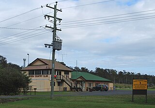
Chatsworth is a rural locality in the Gympie Region, Queensland, Australia. In the 2021 census, Chatsworth had a population of 1,353 people.
Araluen is a residential locality in Gympie in the Gympie Region, Queensland, Australia. In the 2021 census, Araluen had a population of 649 people.
Veteran is a rural residential locality in the Gympie Region, Queensland, Australia. In the 2021 census, Veteran had a population of 959 people.
Victory Heights is a rural residential locality in the Gympie Region, Queensland, Australia. In the 2021 census, Victory Heights had a population of 486 people.
Tamaree is a rural residential locality in the Gympie Region, Queensland, Australia. In the 2021 census, Tamaree had a population of 1,000 people.
The Dawn is a rural residential locality in the Gympie Region, Queensland, Australia. In the 2021 census, The Dawn had a population of 604 people.

Brooloo is a rural town and locality in the Gympie Region, Queensland, Australia. In the 2021 census, the locality of Brooloo had a population of 369 people.

Gunalda is a rural town in the Gympie Region and a locality split between Gympie Region and Fraser Coast Region in Queensland, Australia. In the 2021 census, the locality of Gunalda had a population of 426 people.

Curra is a rural residential locality in the Gympie Region, Queensland, Australia. In the 2021 census, Curra had a population of 2,104 people.
Melawondi is a rural locality in the Gympie Region, Queensland, Australia. It is located 20 kilometres (12 mi) south of Gympie. In the 2021 census, Melawondi had a population of 34 people.
Anderleigh is a rural locality in the Gympie Region, Queensland, Australia. In the 2021 census, Anderleigh had a population of 128 people.
Lower Wonga is a rural locality in the Gympie Region, Queensland, Australia. In the 2021 census, Lower Wonga had a population of 310 people.
Canina is a rural locality in the Gympie Region, Queensland, Australia. In the 2021 census, Canina had a population of 367 people.
Bells Bridge is a rural locality in the Gympie Region, Queensland, Australia. In the 2021 census, Bells Bridge had a population of 226 people.
North Deep Creek is a rural locality in the Gympie Region, Queensland, Australia. In the 2021 census, North Deep Creek had a population of 388 people.
Sexton is a rural locality in the Gympie Region, Queensland, Australia. In the 2021 census, Sexton had a population of 187 people.
Paterson is a rural locality in the Fraser Coast Region, Queensland, Australia. In the 2021 census, Paterson had a population of 157 people.

Scotchy Pocket is a rural locality in the Gympie Region, Queensland, Australia. In the 2021 census, Scotchy Pocket had a population of 55 people.

Gilldora is a rural locality in the Gympie Region, Queensland, Australia. In the 2021 census, Gilldora had a population of 50 people.
East Deep Creek is a rural locality in the Gympie Region, Queensland, Australia. In the 2021 census, East Deep Creek had a population of 698 people.


