Moy Pocket, Queensland

Last updated

Moy Pocket
Queensland
Australia Queensland location map.svg
Red pog.svg
Moy Pocket
Coordinates 26°31′40″S152°44′35″E / 26.5277°S 152.7430°E / -26.5277; 152.7430 (Moy Pocket (centre of locality))
Population120 (2021 census) [1]
 • Density6.63/km2 (17.2/sq mi)
Postcode(s) 4574
Area18.1 km2 (7.0 sq mi)
Time zone AEST (UTC+10:00)
Location
LGA(s) Gympie Region
State electorate(s) Gympie
Federal division(s) Wide Bay
Suburbs around Moy Pocket:
Brooloo Bollier Belli Park
Brooloo Moy Pocket Belli Park
Kenilworth Gheerulla Gheerulla

Moy Pocket is a rural locality in the Gympie Region, Queensland, Australia. [2] In the 2021 census, Moy Pocket had a population of 120 people. [1]

Contents

Geography

The locality is bounded to the north by Spiller Road. [3] The Mary River forms the south-eastern boundary of the locality, then meanders through the centre of the locality, then becomes the north-eastern boundary of the locality. [4]

Moy Pocket has the following mountains: [4]

Moy Pocket Road is the main route through the locality, entering from the south (Gheerulla) and exiting to the north-west (Brooloo). [3]

The land use is a mix of grazing on native vegetation and irrigated modified pastures with some rural residential housing. [8]

History

The locality appears to take its name from a farm operated by Peter Henry Sutton circa 1911 in the pocket of Mary River at the end of Suttons Lane in the south-east of the present locality ( 26°31′58″S152°45′28″E / 26.5327°S 152.7579°E / -26.5327; 152.7579 (Moy Pocket farm (former)) ). [9] [10] [11]

Demographics

In the 2016 census, Moy Pocket had a population of 115 people. [12]

In the 2021 census, Moy Pocket had a population of 120 people. [1]

Education

There are no schools in Moy Pocket. The nearest government primary schools are Mary Valley State College in Imbil to the north-west and Kenilworth State Community College in neighbouring Kenilworth to the south-west. [13]

The nearest government secondary schools are: [13]

Related Research Articles

<span class="mw-page-title-main">Kenilworth, Queensland</span> Town in Queensland, Australia

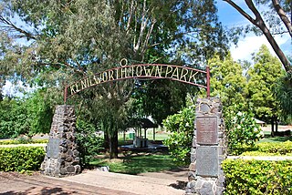
Kenilworth is a rural town and locality in the Sunshine Coast Region, Queensland, Australia. In the 2021 census, the locality of Kenilworth had a population of 604 people.

<span class="mw-page-title-main">Tuchekoi, Queensland</span> Suburb of Gympie Region, Queensland, Australia

Tuchekoi is a rural locality in the Gympie Region, Queensland, Australia. In the 2021 census, Tuchekoi had a population of 199 people.

<span class="mw-page-title-main">Monkland, Queensland</span> Suburb of Gympie, Queensland, Australia

Monkland is a rural locality in the Gympie Region, Queensland, Australia. In the 2021 census, Monkland had a population of 1,135 people.

Kybong is a rural locality in the Gympie Region, Queensland, Australia. In the 2021 census, Kybong had a population of 363 people.

<span class="mw-page-title-main">Brooloo, Queensland</span> Town in Queensland, Australia

Brooloo is a rural town and locality in the Gympie Region, Queensland, Australia. In the 2021 census, the locality of Brooloo had a population of 369 people.

<span class="mw-page-title-main">Imbil</span> Town in Queensland, Australia

Imbil is a rural town and locality in the Gympie Region, Queensland, Australia. In the 2021 census, the locality of Imbil had a population of 1,071 people.

<span class="mw-page-title-main">Amamoor</span> Town in Queensland, Australia

Amamoor is a rural town and locality in the Gympie Region, Queensland, Australia. In the 2021 census, the locality of Amamoor had a population of 720 people.

<span class="mw-page-title-main">Cambroon, Queensland</span> Suburb of Sunshine Coast Region, Queensland, Australia

Cambroon is a rural locality in the Sunshine Coast Region, Queensland, Australia. In the 2021 census, Cambroon had a population of 211 people.

<span class="mw-page-title-main">Coolabine, Queensland</span> Suburb of Sunshine Coast Region, Queensland, Australia

Coolabine is a rural locality in the Sunshine Coast Region, Queensland, Australia. In the 2021 census, Coolabine had a population of 76 people.

Elaman Creek is a rural locality in the Sunshine Coast Region, Queensland, Australia. In the 2021 census, Elaman Creek had a population of 92 people.

<span class="mw-page-title-main">Kidaman Creek, Queensland</span> Suburb of Sunshine Coast Region, Queensland, Australia

Kidaman Creek is a rural locality in the Sunshine Coast Region, Queensland, Australia. In the 2021 census, Kidaman Creek had a population of 125 people.

Curramore is a rural locality in the Sunshine Coast Region, Queensland, Australia. In the 2021 census, Curramore had a population of 198 people.

<span class="mw-page-title-main">Goomboorian</span> Suburb of Gympie Region, Queensland, Australia

Goomboorian is a rural locality in the Gympie Region, Queensland, Australia. In the 2021 census, Goomboorian had a population of 566 people.

Lagoon Pocket is a rural locality in the Gympie Region, Queensland, Australia. In the 2021 census, Lagoon Pocket had a population of 170 people.

Lake Borumba is a rural locality in the Gympie Region, Queensland, Australia. In the 2021 census, Lake Borumba had a population of 12 people.

<span class="mw-page-title-main">Gheerulla</span> Suburb of Sunshine Coast Region, Queensland, Australia

Gheerulla is a rural locality in the Sunshine Coast Region, Queensland, Australia. In the 2021 census, Gheerulla had a population of 291 people.

<span class="mw-page-title-main">Bella Creek, Queensland</span> Suburb of Gympie Region, Queensland, Australia

Bella Creek is a rural locality in the Gympie Region, Queensland, Australia. In the 2021 census, Bella Creek had a population of 50 people.

Bollier is a rural locality in the Gympie Region, Queensland, Australia. In the 2021 census, Bollier had a population of 221 people.

<span class="mw-page-title-main">Scotchy Pocket, Queensland</span> Suburb of Gympie Region, Queensland, Australia

Scotchy Pocket is a rural locality in the Gympie Region, Queensland, Australia. In the 2021 census, Scotchy Pocket had a population of 55 people.

Gympie–Brooloo–Kenilworth Road is a continuous 51.6 kilometres (32.1 mi) road route in the Gympie and Sunshine Coast regions of Queensland, Australia. It has two official names, Gympie–Brooloo Road and Kenilworth–Brooloo Road. The entire route is signed as State Route 51.

References

  1. 1 2 3 Australian Bureau of Statistics (28 June 2022). "Moy Pocket (SAL)". 2021 Census QuickStats. Retrieved 28 February 2023. OOjs UI icon edit-ltr-progressive.svg
  2. "Moy Pocket – locality in Gympie Region (entry 46365)". Queensland Place Names. Queensland Government . Retrieved 11 June 2019.
  3. 1 2 "Layers: Locality; Road and rail; Railways; Railway stations". Queensland Globe. Queensland Government. Archived from the original on 19 December 2017. Retrieved 16 September 2024.
  4. 1 2 "Layers: Locality; Mountains and ranges; Contours; Watercourses". Queensland Globe. Queensland Government. Archived from the original on 19 December 2017. Retrieved 16 September 2024.
  5. "Mountain peaks and capes - Queensland". Queensland Open Data. Queensland Government. 12 November 2020. Archived from the original on 25 November 2020. Retrieved 25 November 2020.
  6. "Bloolou – mountain in Gympie Region (entry 3213)". Queensland Place Names. Queensland Government . Retrieved 25 November 2020.
  7. "Mount Kenilworth – mountain in Gympie Regional (entry 48185)". Queensland Place Names. Queensland Government . Retrieved 20 May 2024.
  8. "Layers: Locality; Protected areas and forests; Land use". Queensland Globe. Queensland Government. Archived from the original on 19 December 2017. Retrieved 17 September 2024.
  9. "MOY POCKET". Gympie Times And Mary River Mining Gazette . Vol. XLIV, no. 5739. Queensland, Australia. 14 October 1911. p. 7. Archived from the original on 17 September 2024. Retrieved 17 September 2024 via National Library of Australia.
  10. "9444-14 Gheerulla Creek" (Map). Queensland Government. 1981. Archived from the original on 17 September 2024. Retrieved 17 September 2024.
  11. "Parish of Kenilworth" (Map). Queensland Government. 1973. Archived from the original on 17 September 2024. Retrieved 17 September 2024.
  12. Australian Bureau of Statistics (27 June 2017). "Moy Pocket (SSC)". 2016 Census QuickStats. Retrieved 20 October 2018. OOjs UI icon edit-ltr-progressive.svg
  13. 1 2 "Layers: Locality; Schools and school catchments". Queensland Globe. Queensland Government. Archived from the original on 19 December 2017. Retrieved 16 September 2024.