Manumbar

Last updated

Manumbar
Queensland
Sawmill at Manumbar.jpg
Sawmill at Manumbar
Australia Queensland location map.svg
Red pog.svg
Manumbar
Coordinates 26°22′24″S152°17′04″E / 26.3733°S 152.2844°E / -26.3733; 152.2844 (Manumbar (centre of locality))
Population53 (2016 census) [1]
 • Density0.2012/km2 (0.521/sq mi)
Established1877
Postcode(s) 4601
Area263.4 km2 (101.7 sq mi)
Time zone AEST (UTC+10:00)
Location
LGA(s) Gympie Region
State electorate(s) Nanango
Federal division(s) Wide Bay
Suburbs around Manumbar:
Kinbombi Cinnabar Wrattens Forest
Barambah Manumbar Upper Kandanga
Elgin Vale Mount Stanley Kingaham

Manumbar is a rural locality in the Gympie Region, Queensland, Australia. [2] In the 2016 census, Manumbar had a population of 53 people. [1]

Contents

Geography

There are a number of state forests in Manumbar: [3]

Apart from the state forests, the predominant land use is grazing on native vegetation. [3]

History

The New South Wales Chief Commissioner of Crown Lands accepted the tender in 1855 by John Mortimer and Andrew Anderson for the run called Manumbar. [4] The 16,000 acres had an estimated grazing capability of 4,000 sheep. The triangular block of land was bounded on the west by the station of Toomcul; on the north and east by a range dividing the Mary and Burnett watersheds; and on the south by a high range dividing the waters of the Brisbane and Burnett Rivers. [5] However Mortimer occupied the land from 1848. [6]

In 1861 the pastoral run of Manumbar was the scene of colonial frontier conflict. [7] [8] [6]

Land in Manumbar was open for selection on 17 April 1877; 25 square miles (65 km2) were available. [9]

Manumbar State School opened on 28 July 1924 with the arrival of its first teacher, Lilian Treacy. By 1946, the school had grown to require three teachers, but the closure of the saw mill led to the departure of many families and the school closed on 25 May 1947. [10] It was on the north-east corner of Manumbar Road and Main Creek Road ( 26°23′50″S152°16′36″E / 26.3973°S 152.2767°E / -26.3973; 152.2767 (Manumbar State School (former)) ). [11] [3] Its buildings were relocated to Manumbar Mill State School in 1949. [12]

Manumbar Mill Provisional School opened on 1 April 1925. In 1943, it became Manumbar Mill State School. Again, the closure of the sawmill resulted in falling student numbers. The school closed on 31 December 1968 with the remaining students being taken by bus to Gallangowan State School. [10] It was on Mill Road (no longer extant, approx 26°24′32″S152°21′41″E / 26.4088°S 152.3615°E / -26.4088; 152.3615 (Manumbar Mill State School (former)) ). [13] [3] The ruins of the mill are to the south of the school site on the other side of Mill Road (approx 26°24′38″S152°21′39″E / 26.4105°S 152.3607°E / -26.4105; 152.3607 (Manumbar Mill ruins) ). [14]

Former Gallangowan State School from Manumbar, now relocated to the Barambah Environmental Education Centre in Wrattens Forest, 2024 Former Gallangowan State School from Manumbar, now relocated to the Barambah Environmental Education Centre in Wrattens Forest, 2024.jpg
Former Gallangowan State School from Manumbar, now relocated to the Barambah Environmental Education Centre in Wrattens Forest, 2024

Gallangowan State School opened on 8 July 1940 and closed on 21 June 1996. [10] [15] It was in the Gallangowan State Forest near Gallangowan Oval Road (approx 26°25′57″S152°19′44″E / 26.4324°S 152.3289°E / -26.4324; 152.3289 (Gallangowan State School (former)) ). [16] [3]

In the 2016 census, Manumbar had a population of 53 people. [1]

Economy

There are a number of homesteads in the locality: [17]

Education

There are no schools in Manumbar. The nearest government primary schools are Goomeri State School in Goomeri to the north-west, Moffatdale State School in Moffatvale to the west, and Kandanga State School in Kandanga to the east. The nearest government secondary schools are Goomeri State School (to Year 10), Mary Valley State College (to Year 10) in Imbil to the south-east, Nanango State High School (to Year 12) in Nanango to the south-west, and Murgon State High School in Murgon to the north-west. [3]

Notable residents

John Mathew, Presbyterian minister and anthropologist, resided at Manumbar with his uncle John Mortimer. He worked there for six years as a stockrider, bookkeeper, and storeman, becoming familiar with the culture and language of two Aboriginal Australian groups, the Kabi and Wakka Wakka people. [18] The State Library of Queensland holds a notebook containing an Aboriginal vocabulary list by John Mathew and other papers including letters from his uncle John Mortimer and cousin G.W. Anderson of Manumbar Station. [19]

Related Research Articles

<span class="mw-page-title-main">Kandanga, Queensland</span> Town in Queensland, Australia

Kandanga is a town and a locality in the Gympie Region, Queensland, Australia. In the 2016 census, the locality of Kandanga had a population of 665 people.

<span class="mw-page-title-main">Goomeri</span> Town in Queensland, Australia

Goomeri is a rural town and locality in the Gympie Region, Queensland, Australia. In the 2016 census, the locality of Goomeri had a population of 664 people.

Kandanga Creek is a rural locality in the Gympie Region, Queensland, Australia. In the 2016 census, Kandanga Creek had a population of 118 people.

<span class="mw-page-title-main">Como, Queensland</span> Suburb of Sunshine Coast, Queensland, Australia

Como is a rural locality in the Shire of Noosa, Queensland, Australia. In the 2021 census, Como had a population of 54 people.

<span class="mw-page-title-main">Amamoor</span> Town in Queensland, Australia

Amamoor is a rural town and locality in the Gympie Region, Queensland, Australia. In the 2016 census the locality of Amamoor had a population of 636 people.

Dagun is a rural town and locality in the Gympie Region, Queensland, Australia. In the 2016 census, the locality of Dagun had a population of 150 people.

<span class="mw-page-title-main">Coochin Creek</span> Suburb of Sunshine Coast, Queensland, Australia

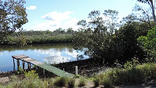
Coochin Creek is a coastal locality in the south of the Sunshine Coast Region, Queensland, Australia. The locality is named for the creek which flows through it.

<span class="mw-page-title-main">Curra, Queensland</span> Suburb of Gympie Region, Queensland, Australia

Curra is a rural residential locality in the Gympie Region, Queensland, Australia. In the 2021 census, Curra had a population of 2,104 people.

<span class="mw-page-title-main">Elgin Vale, Queensland</span> Suburb of Gympie Region, Queensland, Australia

Elgin Vale is a rural locality in the Gympie Region, Queensland, Australia. In the 2016 census, Elgin Vale had a population of 24 people.

<span class="mw-page-title-main">Colinton, Queensland</span> Suburb of Somerset Region, Queensland, Australia

Colinton is a rural locality in the Somerset Region, Queensland, Australia. In the 2016 census, Colinton had a population of 75 people.

<span class="mw-page-title-main">Mount Mort, Queensland</span> Suburb of Ipswich, Queensland, Australia

Mount Mort is a rural locality in the City of Ipswich, Queensland, Australia. In the 2021 census, Mount Mort had a population of 78 people.

<span class="mw-page-title-main">Wyaralong, Queensland</span> Suburb of Scenic Rim Region, Queensland, Australia

Wyaralong is a rural locality in the Scenic Rim Region, Queensland, Australia. In the 2016 census, Wyaralong had a population of 20 people.

<span class="mw-page-title-main">Winya, Queensland</span> Suburb of Somerset Region, Queensland, Australia

Winya is a rural locality in the Somerset Region, Queensland, Australia. In the 2016 census, Winya had a population of 72 people.

<span class="mw-page-title-main">Mount Marshall, Queensland</span> Suburb of Southern Downs Region, Queensland, Australia

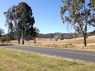
Mount Marshall is a rural locality in the Southern Downs Region, Queensland, Australia. In the 2016 census, Mount Marshall had a population of 243 people.

<span class="mw-page-title-main">Cinnabar, Queensland</span> Suburb of Gympie Region, Queensland, Australia

Cinnabar is a rural locality in the Gympie Region, Queensland, Australia. In the 2016 census, Cinnabar had a population of 72 people.

<span class="mw-page-title-main">Kinbombi</span> Town in Queensland, Australia

Kinbombi is a rural town and locality in the Gympie Region, Queensland, Australia. In the 2016 census, the locality of Kinbombi had a population of 37 people.

<span class="mw-page-title-main">Tansey, Queensland</span> Town in Queensland, Australia

Tansey is a rural town and locality in the Gympie Region, Queensland, Australia. In the 2016 census, Tansey had a population of 144 people.

Gilla is a rural locality in the Toowoomba Region, Queensland, Australia. In the 2016 census Gilla had a population of 32 people.

<span class="mw-page-title-main">Wrattens Forest, Queensland</span> Suburb of Gympie Region, Queensland, Australia

Wrattens Forest is a rural locality in the Gympie Region, Queensland, Australia. In the 2021 census, Wrattens Forest had "no people or a very low population".

Sugarloaf is a rural locality in the Southern Downs Region, Queensland, Australia. In the 2016 census, Sugarloaf had a population of 113 people.

References

  1. 1 2 3 Australian Bureau of Statistics (27 June 2017). "Manumbar (SSC)". 2016 Census QuickStats. Retrieved 20 October 2018. OOjs UI icon edit-ltr-progressive.svg
  2. "Manumbar – locality in Gympie Region (entry 46356)". Queensland Place Names. Queensland Government . Retrieved 27 December 2020.
  3. 1 2 3 4 5 6 "Queensland Globe". State of Queensland . Retrieved 5 May 2022.
  4. "ACCEPTED TENDERS FOR RUNS". New South Wales Government Gazette . No. 64. New South Wales, Australia. 1 May 1855. p. 1251. Retrieved 31 January 2023 via National Library of Australia.
  5. "CROWN LANDS BEYOND THE SETTLED DISTRICTS". New South Wales Government Gazette . No. 84. New South Wales, Australia. 5 June 1856. p. 1601. Retrieved 31 January 2023 via National Library of Australia.
  6. 1 2 Prentis, Malcolm D (14 November 1992). "John Mortimer of Manumbar and the 1861 Native Police Inquiry in Queensland" (PDF). University of Queensland . Retrieved 31 January 2023.
  7. "Classified Advertising". The Moreton Bay Courier . Vol. XV, no. 996. Queensland, Australia. 16 March 1861. p. 3. Retrieved 24 January 2023 via National Library of Australia.
  8. Legislative Assembly, Queensland (1861). "SELECT COMMITTEE ON THE NATIVE POLICE FORCE. 1861" (PDF). AIATSIS . pp. 101–108. Archived (PDF) from the original on 19 July 2020. Retrieved 24 January 2023.
  9. "Proclamations under the New Land Acts". The Brisbane Courier . Queensland, Australia. 2 March 1877. p. 3. Archived from the original on 27 August 2020. Retrieved 19 February 2020 via Trove.
  10. 1 2 3 Queensland Family History Society (2010), Queensland schools past and present (Version 1.01 ed.), Queensland Family History Society, ISBN   978-1-921171-26-0
  11. "Queensland Two Mile series sheet 2m79" (Map). Queensland Government. 1955. Archived from the original on 19 January 2021. Retrieved 5 May 2022.
  12. "Agency ID 9113, Manumbar State School". Queensland State Archives . Retrieved 5 May 2022.
  13. "Manumbar" (Map). Queensland Government. 1943. Archived from the original on 5 May 2022. Retrieved 5 May 2022.
  14. "9345-23 Manumbar" (Map). Queensland Government. 2002. Archived from the original on 5 May 2022. Retrieved 5 May 2022.
  15. "Queensland state school - centre closures" (PDF). Queensland Government . 20 August 2013. Archived (PDF) from the original on 20 March 2022. Retrieved 7 April 2022.
  16. "Parish of Gallangowan" (Map). Queensland Government. 1971. Archived from the original on 5 May 2022. Retrieved 5 May 2022.
  17. "Homesteads - Queensland". Queensland Open Data. Queensland Government. 18 November 2020. Archived from the original on 24 November 2020. Retrieved 24 November 2020.
  18. Prentis, M. D. (1986). "John Mathew". Australian Dictionary of Biography . National Centre of Biography, Australian National University. ISSN   1833-7538 . Retrieved 2 June 2012.
  19. "John Mathew papers". State Library of Queensland . 31 January 2023. Archived from the original on 31 January 2023. Retrieved 31 January 2023.

Further reading