Woondum

Last updated

Woondum
Queensland
Australia Queensland location map.svg
Red pog.svg
Woondum
Coordinates 26°15′15″S152°43′45″E / 26.2541°S 152.7291°E / -26.2541; 152.7291 (Woondum (centre of locality)) Coordinates: 26°15′15″S152°43′45″E / 26.2541°S 152.7291°E / -26.2541; 152.7291 (Woondum (centre of locality))
Population80 (2016 census) [1]
 • Density7.5/km2 (19.4/sq mi)
Postcode(s) 4570
Area10.7 km2 (4.1 sq mi)
Time zone AEST (UTC+10:00)
Location
LGA(s) Gympie Region
State electorate(s) Gympie
Federal Division(s) Wide Bay
Suburbs around Woondum:
Glanmire Mothar Mountain Mothar Mountain
Kybong Woondum Mothar Mountain
Kybong Tandur Tandur

Woondum is a rural locality in the Gympie Region, Queensland, Australia. [2] In the 2016 census Woondum had a population of 80 people. [1]

Contents

Geography

Woondum lies to the south-west of Gympie. The western part of locality is relatively undeveloped land and is mountainous (rising to 150 metres about sea level); most of this land is part of the Woondum State Forest. The eastern part of the locality is flatter land (approx 60–70 metres above sea level) and developed as farmland. There are a number of creeks running through the locality which is part of the Mary River drainage basin. Despite its name, the Woondum National Park is not in Woondum but is further east straddling Mothar Mountain and Kin Kin. [3]

The North Coast railway line travels from south to north roughly separating the developed and undeveloped parts; the locality is served by the Woondum railway station. [4] The Bruce Highway forms a short section of the locality's north-western boundary. [3]

History

Woondum is believed to be a Kabi language word, with wun meaning blue tongue lizard and dan meaning place. [2]

Land in Woondum was offered for selection on 5 January 1890 and by February 1891, ten farms had been established with a further two selected. [5] Further areas were opened by for selection over the following years. Woondum was one of 29 Village Settlements consisting of a centralised region allocated for housing surrounded by larger allotments for farming.

Woondum Provisional school opened about July 1899 and became Woondum State School on 1 January 1909. In 1913 it was renamed Ardonye State School. It closed and reopened in the early 1920s due to low students numbers, finally closing in January 1924. [6]

A rifle club and rifle range were established in Woondum in 1912. Although rifle clubs were not part of the military, the military would often assist rifle clubs with training, supplying equipment and organising competitions, believing that it was beneficial for Australia's defence if local men become skilful at shooting. [7] [8] [9] [10]

In 1915, the Woondum railway station was upgraded to have a permanent staff of a station master and a night officer. [11]

In 1929 it was decided to establish the Woondum State Forest rather than open up the area for banana farms. [12] However in 1933, continued pressure resulted in some of the forest being offered up for banana farming. [13]

In the 2016 census Woondum had a population of 80 people. [1]

Related Research Articles

Gympie City in Queensland, Australia

Gympie is a city and a locality in the Gympie Region, Queensland, Australia. In the Wide Bay-Burnett District, Gympie is about 170.7 kilometres (110 mi) north of the state capital, Brisbane. The city lies on the Mary River, which floods Gympie occasionally. Gympie is the administrative centre for the Gympie Region area. As of June 2018 Gympie had a population of 51,578.

Kenilworth, Queensland Town in Queensland, Australia

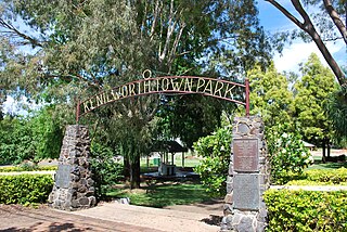
Kenilworth is a small town and locality in the heart of the Mary Valley area of the Sunshine Coast, Queensland, Australia. This is a rural area, about 50 kilometres (31 mi) from the coast, with dairy farming as the major industry. Local visitor attractions include a cheese factory as well as walking, camping and 4-wheel driving in the Kenilworth State Forest.

Kandanga, Queensland Town in Queensland, Australia

Kandanga is a town and a locality in the Gympie Region, Queensland, Australia. In the 2016 census, Kandanga had a population of 665 people.

Kilkivan, Queensland Town in Queensland, Australia

Kilkivan is a town and locality in the Gympie Region of Queensland, Australia. At the 2016 census, Kilkivan had a population of 713. Rossmore is a neighbourhood within the locality to the south-west of the town of Kilkivan.

Shire of Kilkivan Local government area in Queensland, Australia

The Shire of Kilkivan was a local government area about 180 kilometres (112 mi) north-northwest of Brisbane, the state capital of Queensland, Australia. The shire covered an area of 3,263.4 square kilometres (1,260.0 sq mi), and existed from 1886 until its merger with several other local government areas to form the Gympie Region on 15 March 2008.

Coes Creek, Queensland Suburb of Sunshine Coast, Queensland, Australia

Coes Creek is a rural locality in the Sunshine Coast Region, Queensland, Australia. In the 2016 census, Coes Creek had a population of 1,392 people.

Lawnton, Queensland Suburb of Moreton Bay Region, Queensland, Australia

Lawnton is a suburb in the Moreton Bay Region, Queensland, Australia.

Barambah, Queensland Suburb of Gympie Region, Queensland, Australia

Barambah is a rural locality in the Gympie Region, Queensland, Australia. In the 2016 census Barambah had a population of 46 people.

<i>The Gympie Times</i> daily newspaper in Queensland, Australia

The Gympie Times is a daily newspaper serving Gympie in Queensland, Australia. The newspaper is owned by News Corp Australia and is published from Monday to Saturday.

Imbil Town in Queensland, Australia

Imbil is a rural town and locality in the Gympie Region, Queensland, Australia. In the 2016 census, Imbil had a population of 924 people.

Amamoor Town in Queensland, Australia

Amamoor is a rural town and locality in the Gympie Region, Queensland, Australia. In the 2016 census the locality of Amamoor had a population of 636 people.

Hugo William Du Rietz

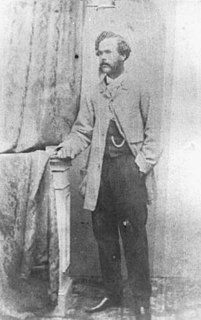
Hugo William Du Rietz was a pioneer gold miner and architect in Gympie, Queensland, Australia. He was the architect of many heritage-listed buildings in Gympie.

John OConnell Bligh

John O'Connell Bligh was a Native Police officer in the British colonies of New South Wales and Queensland. He achieved the rank of Commandant of this colonial paramilitary force from 1861 to 1864. Bligh is probably best known for an incident in Maryborough, where he shot a number of Aboriginal Australians along the main street and into the adjoining Mary River. After retiring from the Native Police, Bligh became a police magistrate in the towns of Gayndah and Gympie.

Wolvi, Queensland Suburb of Gympie Region, Queensland, Australia

Wolvi is a rural locality in the Gympie Region, Queensland, Australia. In the 2016 census, Wolvi had a population of 467 people.

Mondure Town in Queensland, Australia

Mondure is a rural town and locality in the South Burnett Region, Queensland, Australia. In the 2016 census, Mondure had a population of 100 people.

Wilsons Pocket Suburb of Gympie Region, Queensland, Australia

Wilsons Pocket is a rural locality in the Gympie Region, Queensland, Australia. In the 2016 census Wilsons Pocket had a population of 197 people.

Cooroy Post Office

Cooroy Post Office is a heritage-listed post office at 33 Maple Street, Cooroy, Shire of Noosa, Queensland, Australia. It was designed by Thomas Pye and built in 1914 by L. Baldry. It was added to the Australian Commonwealth Heritage List on 22 August 2012.

Goomeribong, Queensland Suburb of Gympie Region, Queensland, Australia

Goomeribong is a locality in the Gympie Region, Queensland, Australia. In the 2016 census, Goomeribong had a population of 41 people.

Heber Hedley Booth

Heber Hedley Booth was a Queensland-based Australian poet who wrote under the nom de plume Opal, known principally for his inaugural anthology Opalodes (1909). His poems made much reference to the locations of northern Australia, although several involved political comment of actions at the time. Booth's writings covered the early Federation of Australia from a Queensland perspective, possibly influenced by the earlier 1890s Central Queensland Territorial Separation League and the ongoing North Queensland separation movements.

References

  1. 1 2 3 Australian Bureau of Statistics (27 June 2017). "Woondum (SSC)". 2016 Census QuickStats. Retrieved 20 October 2018. OOjs UI icon edit-ltr-progressive.svg
  2. 1 2 "Woondum – locality in Gympie Region (entry 46404)". Queensland Place Names. Queensland Government . Retrieved 27 December 2020.
  3. 1 2 "Queensland Globe". State of Queensland . Retrieved 18 March 2018.
  4. "Woondum – railway station in the Gympie Region (entry 38098)". Queensland Place Names. Queensland Government . Retrieved 18 March 2018.
  5. "The Village Settlement Schema". The Queenslander . Queensland, Australia. 14 February 1891. p. 322. Archived from the original on 28 January 2021. Retrieved 18 March 2018 via National Library of Australia.
  6. Queensland Family History Society (2010), Queensland schools past and present (Version 1.01 ed.), Queensland Family History Society, ISBN   978-1-921171-26-0
  7. "Woondum Rifle Club". Gympie Times And Mary River Mining Gazette . XLV (5789). Queensland, Australia. 10 February 1912. p. 3. Archived from the original on 28 January 2021. Retrieved 18 March 2018 via National Library of Australia.
  8. "MILITARY NOTIFICATIONS". The Brisbane Courier (16, 914). Queensland, Australia. 28 March 1912. p. 5. Archived from the original on 28 January 2021. Retrieved 18 March 2018 via National Library of Australia.
  9. "Military Notes". Gympie Times And Mary River Mining Gazette . XLV (5902). Queensland, Australia. 4 April 1912. p. 2. Archived from the original on 28 January 2021. Retrieved 18 March 2018 via National Library of Australia.
  10. "Woondum Rifle Range". Gympie Times And Mary River Mining Gazette . XLV (5906). Queensland, Australia. 13 April 1912. p. 4. Archived from the original on 28 January 2021. Retrieved 18 March 2018 via National Library of Australia.
  11. "Notes and News". Gympie Times And Mary River Mining Gazette . XLVIII (7333). Queensland, Australia. 2 February 1915. p. 3. Archived from the original on 28 January 2021. Retrieved 18 March 2018 via National Library of Australia.
  12. "COORAN". The Brisbane Courier (22, 294). Queensland, Australia. 11 July 1929. p. 11. Archived from the original on 28 January 2021. Retrieved 18 March 2018 via National Library of Australia.
  13. "COORAN". The Brisbane Courier (23, 513). Queensland, Australia. 10 June 1933. p. 16. Archived from the original on 28 January 2021. Retrieved 18 March 2018 via National Library of Australia.

Further reading