Related Research Articles
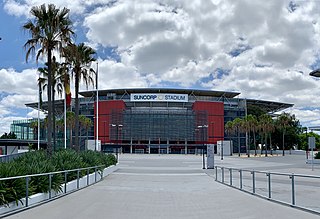
Milton is an inner suburb of the City of Brisbane, Queensland, Australia. In the 2016 census, the population of Milton was 2,274 people.

Ipswich is an urban region in South East Queensland, Australia. Situated on the Bremer River, it is approximately 40 kilometres (25 mi) west of the Brisbane central business district. A local government area, the City of Ipswich has a population of 200,000. The city is renowned for its architectural, natural and cultural heritage. Ipswich preserves and operates from many of its historical buildings, with more than 6000 heritage-listed sites and over 500 parks. Ipswich began in 1827 as a mining settlement.

Sandgate is a northern coastal suburb in the City of Brisbane, Queensland, Australia. In the 2016 census, Sandgate had a population of 4,909 people.

Tarragindi is a southern suburb of the City of Brisbane, Queensland, Australia. It is represented through the Holland Park and Moorooka Ward councillors on the Brisbane City Council. In the 2016 census, Tarragindi had a population of 10,779 people.

Gordon Park is a northern suburb in the City of Brisbane, Queensland, Australia. In the 2016 census, Gordon Park had a population of 4,231 people.
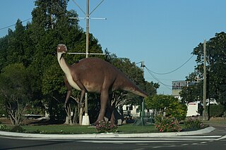
Hughenden is a town and locality in the Shire of Flinders, Queensland, Australia. At the 2016 census, Hughenden had a population of 1,136.

Mission Beach is a small coastal town and locality in the Cassowary Coast Region, Queensland, Australia. In the 2016 census Mission Beach and surrounding villages had a total population of 3,597 people.

Coorparoo is a suburb of Brisbane, Queensland, Australia, 4 kilometres (2.5 mi) south-east of the CBD. It borders Camp Hill, Holland Park, Stones Corner, Greenslopes, East Brisbane and Norman Park.

Toowong is an inner suburb of the City of Brisbane, Queensland, Australia.

Nobby is a rural town and locality on the Darling Downs in the Toowoomba Region, Queensland, Australia. It is located halfway between Toowoomba and Warwick. In the 2016 census, Nobby had a population of 563 people.

Annerley is a suburb in the City of Brisbane, Queensland, Australia. In the 2016 census, Annerley had a population of 11,336 people.
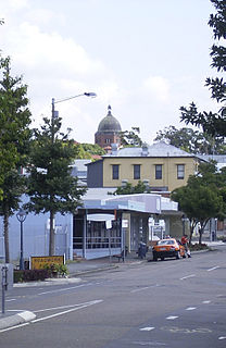
Nundah is an inner suburb in the City of Brisbane, Queensland, Australia. In the 2016 census, Nundah had a population of 12,141 people.

Yeronga is a residential suburb of the City of Brisbane, Queensland, Australia located on the Brisbane River 7 kilometres (4.3 mi) south of the Brisbane central business district.

Bulimba is a suburb in the City of Brisbane, Queensland, Australia. It is located 4 kilometres (2.5 mi) north-east of the CBD, on the southern bank of the Brisbane River, and borders Balmoral, East Brisbane, Hawthorne, and Morningside. The 2011 Australian Census recorded a population of 5,941 increasing rapidly to 6,843 in 2016.

Soldier settlement, also known as the Soldier Settlement Scheme or Soldiers Settlement Scheme, administered by the Soldier Settlement Commission, was the settlement of land throughout parts of Australia by returning discharged soldiers under schemes administered by the state governments after World War I and World War II.

Dugandan is a rural town and locality in the Scenic Rim Region, Queensland, Australia. In the 2016 census, Dugandan had a population of 593 people.
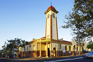
The Town of Sandgate is a former local government area of Queensland, Australia, located in northern Brisbane adjacent to Moreton Bay.

Ravensbourne is a rural locality in the Toowoomba Region, Queensland, Australia. In the 2016 census Ravensbourne had a population of 248 people.
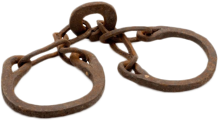
Slavery in Australia has existed in various forms from colonisation in 1788 to the present day. European settlement relied heavily on convicts, sent to Australia as punishment for crimes and forced into labour and often sold to free settlers. Many Indigenous Australians were also forced into various forms of slavery and unfree labour from colonisation and this persisted for some Indigenous Australians until the 1970s. Labourers were also imported from the Pacific Islands, Africa, India, Bangladesh, China and Japan; and employed in various degrees of slavery and unfree labour.

Woondum is a rural locality in the Gympie Region, Queensland, Australia. In the 2016 census Woondum had a population of 80 people.
References
- ↑ Thom Blake. "Wallumbilla – a village settlement" . Retrieved 28 December 2020.
- 1 2 3 4 Queensland.; Queensland. Agent-General, issuing body. (1880), "1 broadside : colour maps ; 43 x 28 cm", Village settlements in Queensland : important to farmers, their sons, working farm men, gardeners, fruit growers, and others wishing to acquire freehold homes and cultivate their own land, London: Agent-General for Queensland, nla.obj-138192194, retrieved 28 December 2020– via Trove
- 1 2 3 "The Village Settlement Schema". The Queenslander . Queensland, Australia. 14 February 1891. p. 321. Retrieved 28 December 2020– via National Library of Australia.
- ↑ "RAVENSBOURNE VILLAGE SETTLEMENT". The Brisbane Courier . XLVII (10, 304). Queensland, Australia. 23 January 1891. p. 4. Retrieved 27 December 2020– via National Library of Australia.
| | This Queensland location article is a stub. You can help Wikipedia by expanding it. |