Kooroongarra, Queensland

Last updated

Kooroongarra
Queensland
Australia Queensland location map.svg
Red pog.svg
Kooroongarra
Coordinates 28°06′02″S151°15′14″E / 28.1005°S 151.2538°E / -28.1005; 151.2538 (Kooroongarra (town centre))
Population45 (2021 census) [1]
 • Density0.386/km2 (1.000/sq mi)
Postcode(s) 4357
Area116.5 km2 (45.0 sq mi)
Time zone AEST (UTC+10:00)
Location
LGA(s) Toowoomba Region
State electorate(s) Southern Downs
Federal division(s) Maranoa
Localities around Kooroongarra:
Millwood Clontarf
Lavelle
Mount Emlyn
Rocky Creek
Bringalily Kooroongarra Stonehenge
Canning Creek Canning Creek Stonehenge

Kooroongarra is a rural town and locality in the Toowoomba Region, Queensland, Australia. [2] [3] In the 2021 census, the locality of Kooroongarra had a population of 45 people. [1]

Contents

History

Kooroongarra South Provisional School opened on 10 August 1891. [4] On 1 January 1909, it became Kooroongarra South State School. It closed in 1967. [5] It was at approx 2325 Kooroongarra Road ( 28°05′58″S151°15′21″E / 28.0995°S 151.2557°E / -28.0995; 151.2557 (Kooroongarra South State School (former)) ). [6] [7]

St Mark's Presbyterian Church opened on 3 September 1897 in Kooroongarra Road ( 28°05′58″S151°15′11″E / 28.0995°S 151.2530°E / -28.0995; 151.2530 (St Mark's Presbyterian/Uniting Church (former)) ). [8] It was consecrated on 5 May 1968. It became St Mark's Uniting Church on 22 June 1977. It was deconsecrated on 5 December 1999. It was later relocated to the Millmerran Museum at 17 Mary Street, Millmerran. [9] [10] [11]

St Alban's Anglican church was dedicated in 1907. Its closure was approved by Assistant Bishop Rob Nolan. [12] It was at 2385 Kooroongarra Road ( 28°06′11″S151°15′11″E / 28.1031°S 151.2531°E / -28.1031; 151.2531 (St Alban's Anglican Church (former)) ); it has been sold and converted into a house. [13] [14]

The town name changed from South Koorongara to Koorongara in 1977 and then the spelling was altered to Kooroongarra in 2000. The name is derived from Aboriginal words, kooroon meaning resting place for birds and garra meaning water. [2]

Demographics

In the 2016 census, the locality of Kooroongarra had a population of 58 people. [15]

In the 2021 census, the locality of Kooroongarra had a population of 45 people. [1]

Education

There are no schools in Kooroongarra. The nearest government primary schools are Leyburn State School in Leyburn to the north-east and Millmerran State School in Millmerran to the north. The nearest government secondary school is Millmerran State School which offers secondary schooling to Year 10. There are no nearby schools offering secondary education to Year 12; distance education and boarding schools are options. [7]

See also

Related Research Articles

<span class="mw-page-title-main">Inglewood, Queensland</span> Town in Queensland, Australia

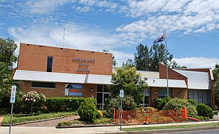
Inglewood is a rural town and locality in the Goondiwindi Region, Queensland, Australia. In the 2021 census, the locality of Inglewood had a population of 936 people.

<span class="mw-page-title-main">Drayton, Queensland</span> Suburb of Toowoomba, Queensland, Australia

Drayton is a rural locality in the Toowoomba Region, Queensland, Australia. In the 2021 census, Drayton had a population of 1,813 people.

<span class="mw-page-title-main">Clifton, Queensland</span> Town in Queensland, Australia

Clifton is a rural town and locality in the Toowoomba Region, Queensland, Australia. In the 2021 census, the locality of Clifton had a population of 1,490 people.

Gowrie Junction is a rural locality in the Toowoomba Region, Queensland, Australia. It is north-west of Toowoomba. The town of Gowrie is in the eastern part of the locality. In the 2021 census, Gowrie Junction had a population of 2,242 people.

<span class="mw-page-title-main">Allora, Queensland</span> Town in Queensland, Australia

Allora is a rural town and locality in the Southern Downs Region, Queensland, Australia. In the 2021 census, the locality of Allora had a population of 1,205 people.

<span class="mw-page-title-main">Millmerran, Queensland</span> Town in Queensland, Australia

Millmerran, known as Domville between 1 June 1889 and 16 November 1894, is a town and a locality in the Toowoomba Region, Queensland, Australia. In the 2021 census, the locality of Millmerran had a population of 1,545 people.

<span class="mw-page-title-main">Cecil Plains, Queensland</span> Town in Queensland, Australia

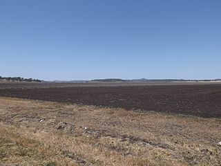
Cecil Plains is a rural town and locality in the Toowoomba Region, Queensland, Australia. In the 2021 census, the locality of Cecil Plains had a population of 380 people.

<span class="mw-page-title-main">Leyburn, Queensland</span> Town in Queensland, Australia

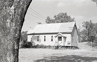
Leyburn is a rural town in the Southern Downs Region and a locality split between the South Downs Region and the Toowoomba Region in Queensland, Australia. In the 2021 census, the locality of Leyburn had a population of 566 people.

<span class="mw-page-title-main">Karara, Queensland</span> Town in Queensland, Australia

Karara is a rural town and locality in the Southern Downs Region, Queensland, Australia. In the 2021 census, the locality of Karara had a population of 128 people.

<span class="mw-page-title-main">Bowenville, Queensland</span> Town in Queensland, Australia

Bowenville is a rural town and locality in the Toowoomba Region, Queensland, Australia. The town's economy rested on the rail industry and with the winding down of the railways the population declined. In the 2021 census, the locality of Bowenville had a population of 219 people.

<span class="mw-page-title-main">Mount Lofty, Queensland</span> Suburb of Toowoomba, Queensland, Australia

Mount Lofty is a residential locality on the north-eastern edge of the suburban area of Toowoomba, in the Toowoomba Region, Queensland, Australia. In the 2021 census, Mount Lofty had a population of 3,825 people.

<span class="mw-page-title-main">Newtown, Queensland (Toowoomba)</span> Suburb of Toowoomba, Queensland, Australia

Newtown is a residential locality in Toowoomba in the Toowoomba Region, Queensland, Australia. In the 2021 census, Newtown had a population of 10,039 people.

<span class="mw-page-title-main">Geham</span> Suburb of Toowoomba Region, Queensland, Australia

Geham is a rural locality in the Toowoomba Region, Queensland, Australia. In the 2021 census, Geham had a population of 470 people.

<span class="mw-page-title-main">Jondaryan, Queensland</span> Town in Queensland, Australia

Jondaryan is a rural town and locality in the Toowoomba Region, Queensland, Australia. In the 2021 census, the locality of Jondaryan had a population of 414 people.

<span class="mw-page-title-main">Mount Tyson, Queensland</span> Town in Queensland, Australia

Mount Tyson is a rural town and locality in the Toowoomba Region, Queensland, Australia. In the 2021 census, the locality of Mount Tyson had a population of 280 people.

<span class="mw-page-title-main">Gowrie Little Plain, Queensland</span> Suburb of Toowoomba Region, Queensland, Australia

Gowrie Little Plain is a rural locality in the Toowoomba Region, Queensland, Australia. In the 2021 census, Gowrie Little Plain had a population of 79 people.

Back Plains is a rural locality in the Toowoomba Region, Queensland, Australia. In the 2021 census, Back Plains had a population of 104 people.

<span class="mw-page-title-main">Bongeen, Queensland</span> Suburb of Toowoomba Region, Queensland, Australia

Bongeen is a rural locality in the Toowoomba Region, Queensland, Australia. In the 2021 census, Bongeen had a population of 71 people.

Ducklo is a locality in the Western Downs Region, Queensland, Australia. In the 2021 census, Ducklo had a population of 306 people.

<span class="mw-page-title-main">Yarranlea, Queensland</span> Suburb of Toowoomba Region, Queensland, Australia

Yarranlea is a rural locality in the Toowoomba Region, Queensland, Australia. In the 2021 census, Yarranlea had a population of 82 people.

References

  1. 1 2 3 Australian Bureau of Statistics (28 June 2022). "Kooroongarra (SAL)". 2021 Census QuickStats. Retrieved 28 February 2023. OOjs UI icon edit-ltr-progressive.svg
  2. 1 2 "Kooroongarra – town in Toowoomba Region (entry 41675)". Queensland Place Names. Queensland Government . Retrieved 29 December 2020.
  3. "Kooroongarra – locality in Toowoomba Region (entry 49211)". Queensland Place Names. Queensland Government . Retrieved 29 December 2020.
  4. "DEPARTMENT OF PUBLIC INSTRUCTION". The Brisbane Courier . Vol. XLIX, no. 10, 745. Queensland, Australia. 22 June 1892. p. 6. Retrieved 4 July 2024 via National Library of Australia.
  5. Queensland Family History Society (2010), Queensland schools past and present (Version 1.01 ed.), Queensland Family History Society, ISBN   978-1-921171-26-0
  6. "Queensland Two Mile series sheet 2m42" (Map). Queensland Government. 1941. Archived from the original on 22 June 2022. Retrieved 22 June 2022.
  7. 1 2 "Queensland Globe". State of Queensland . Retrieved 22 June 2022.
  8. "Opening of the Kooroongarra Presbyterian Church". Toowoomba Chronicle and Darling Downs General Advertiser . No. 5575. Queensland, Australia. 14 September 1897. p. 3. Archived from the original on 22 June 2022. Retrieved 22 June 2022 via National Library of Australia.
  9. Blake, Thom. "St Marks Presbyterian Church". Queensland religious places database. Archived from the original on 22 June 2022. Retrieved 22 June 2022.
  10. Google (22 June 2022). "St Marks Presbyterian Church (formerly at Kooroongarra) at Millmeran Museum" (Map). Google Maps . Google. Retrieved 22 June 2022.
  11. "St Mark's Uniting Church - Former". Churches Australia. Archived from the original on 22 June 2022. Retrieved 22 June 2022.
  12. Anglican Church of Southern Queensland. "Closed Churches". Archived from the original on 3 April 2019. Retrieved 3 July 2020.
  13. Blake, Thom. "St Alban's Anglican Church". Queensland religious places database. Archived from the original on 22 June 2022. Retrieved 22 June 2022.
  14. "St Alban's Anglican Church - Former". Churches Australia. Archived from the original on 22 June 2022. Retrieved 22 June 2022.
  15. Australian Bureau of Statistics (27 June 2017). "Kooroongarra (SSC)". 2016 Census QuickStats. Retrieved 20 October 2018. OOjs UI icon edit-ltr-progressive.svg