Western Creek, Queensland

Last updated

Western Creek
Queensland
Western Creek Station in the Cecil Plains District of Queensland (8677500414).jpg
Homestead, Western Creek Station, circa 1875
Australia Queensland location map.svg
Red pog.svg
Western Creek
Coordinates 27°51′S150°57′E / 27.85°S 150.95°E / -27.85; 150.95 (Western Creek (centre of locality))
Population0 (SAL 2021) [1]
Postcode(s) 4357
Area714.9 km2 (276.0 sq mi)
Time zone AEST (UTC+10:00)
Location
LGA(s) Toowoomba Region
State electorate(s) Southern Downs
Federal division(s) Maranoa
Suburbs around Western Creek:
Cattle Creek Dunmore Kurrowah
Weir River Western Creek Turallin
Boondandilla
Bulli Creek
Wattle Ridge
The Pines
Condamine Farms
Captains Mountain

Western Creek is a locality in the Toowoomba Region, Queensland, Australia. [2] In the 2021 census, Western Creek had "no people or a very low population". [3]

Contents

Geography

The creek of the same name rises in the east of the locality and flows west through the locality into neighbouring locality of Weir River where it becomes a tributary of the river of the same name. [4] [5]

Most of Western Creek is within the Western Creek State Forest with only a few small areas of farmland and undeveloped land in the northern, eastern and southern parts of the locality. [4]

History

Woolshead at Western Creek Station, circa 1875 StateLibQld 1 153323 Woolshed at Western Creek Station, Queensland, ca. 1875.jpg
Woolshead at Western Creek Station, circa 1875

The locality takes its name from the parish, which in turn was named after an early pastoral run Western Creek belonging to James Laidley during the 1840s. In 1849 it was taken over by Captain Frances Durrell Vignoles in 1849, [6] who held it for about thirty years, but problems with grass seed and his sheep ruined him financially. [2] [7] It was taken over in 1883 by The Scottish Australian Investment Company Limited and then by Dalmally Limited in association with W.A. Russell. Following Russell's death, it was taken over by Albert Edward Specht of Wellcamp, the son of pioneering family on the Darling Downs. [8] When Specht died in 1941, the property was taken over by his two brothers William Dougall Specht and Archibald John Specht. After Archibald's death in 1944, William continued to run the property until his death in 1952. [9] [10] The property was then purchased by Thomas Barkla son of J.E.E Barkla who had purchased adjacent Dunmore station in 1916.

The property originally carried over 100,000 head of sheep in addition to cattle and horses, but resumptions of land over the years reduced its capacity. [8]

Demographics

In the 2016 census, Western Creek had a population of 15 people. [11]

In the 2021 census, Western Creek had "no people or a very low population". [3]

Education

There are no schools in Western Creek. The nearest government primary schools are Cecil Plains State School in Cecil Plains to the north-east, Millmerran State School in Millmerran to the east, and Kindon State School in Kindon to the south-west. The nearest government secondary school is Millmerran State School (to Year 10). There are no schools nearby offering secondary schooling to Year 12; the options are distance education or boarding school. [12]

Related Research Articles

<span class="mw-page-title-main">Gore Highway</span> Highway in Queensland, Australia

The Gore Highway is a highway running between Toowoomba and Goondiwindi in Queensland, Australia. Together with Goulburn Valley Highway and Newell Highway, it is a part of the National Highway's Melbourne to Brisbane link. It is signed as National Highway A39.

<span class="mw-page-title-main">Millmerran, Queensland</span> Town in Queensland, Australia

Millmerran, known as Domville between 1 June 1889 and 16 November 1894, is a town and a locality in the Toowoomba Region, Queensland, Australia. In the 2016 census, the locality of Millmerran had a population of 1,563 people.

<span class="mw-page-title-main">Karara, Queensland</span> Town in Queensland, Australia

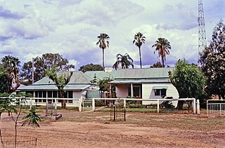
Karara is a rural town and locality in the Southern Downs Region, Queensland, Australia. In the 2016 census, the locality of Karara had a population of 123 people.

Yandilla is a rural locality in the Toowoomba Region, Queensland, Australia. In the 2016 census Yandilla had a population of 46 people.

<span class="mw-page-title-main">Southbrook, Queensland</span> Town in Queensland, Australia

Southbrook is a rural town and locality in the Toowoomba Region, Queensland, Australia. In the 2021 census, the locality of Southbrook had a population of 626 people.

Captains Mountain is a locality in the Toowoomba Region, Queensland, Australia. In the 2021 census, Captains Mountain had a population of 74 people.

<span class="mw-page-title-main">Domville, Queensland</span> Suburb of Toowoomba Region, Queensland, Australia

Domville is a rural locality in the Toowoomba Region, Queensland, Australia. In the 2021 census, Domville had "no people or a very low population".

Kindon is a rural locality in the Goondiwindi Region, Queensland, Australia. In the 2021 census, Kindon had a population of 20 people.

<span class="mw-page-title-main">Brookstead, Queensland</span> Town in Queensland, Australia

Brookstead is a rural town and locality in the Toowoomba Region, Queensland, Australia. In the 2016 census, Brookstead had a population of 217 people.

Kooroongarra is a rural town and locality in the Toowoomba Region, Queensland, Australia. In the 2016 census, the locality of Kooroongarra had a population of 58 people.

Umbiram is a rural locality in the Toowoomba Region, Queensland, Australia. In the 2016 census, Umbiram had a population of 139 people.

Turallin is a rural town and locality in the Toowoomba Region, Queensland, Australia. In the 2021 census, the locality of Turallin had a population of 64 people.

Bulli Creek is a locality in the Toowoomba Region, Queensland, Australia. In the 2016 census, Bulli Creek had a population of 6 people.

Millmerran Woods is a rural locality in the Toowoomba Region, Queensland, Australia. In the 2021 census, Millmerran Woods had a population of 152 people.

Millmerran Downs is a rural locality in the Toowoomba Region, Queensland, Australia. In the 2021 census, Millmerran Downs had a population of 103 people.

Condamine Farms is a rural locality in the Toowoomba Region, Queensland, Australia. In the 2021 census, Condamine Farms had a population of 28 people.

Kurrowah is a rural locality in the Toowoomba Region, Queensland, Australia. In the 2021 census, Kurrowah had a population of 10 people.

Dunmore is a rural locality in the Toowoomba Region, Queensland, Australia. In the 2021 census, Dunmore had a population of 39 people.

Grays Gate is a rural locality in the Toowoomba Region, Queensland, Australia. In the 2021 census, Grays Gate had a population of 28 people.

Chinchilla–Wondai Road is a continuous 151.6 kilometres (94.2 mi) road route in the Western Downs and South Burnett regions of Queensland, Australia. Part of the route is signed as State Route 82. It is a state-controlled part regional and part district road. It provides an alternate route between the Warrego Highway and the South Burnett, bypassing Dalby, Oakey and Toowoomba.

References

  1. Australian Bureau of Statistics (28 June 2022). "Western Creek (Qld) (suburb and locality)". Australian Census 2021 QuickStats. Retrieved 28 June 2022.  OOjs UI icon edit-ltr-progressive.svg
  2. 1 2 "Western Creek – locality in Toowoomba Region (entry 48093)". Queensland Place Names. Queensland Government . Retrieved 30 May 2019.
  3. 1 2 Australian Bureau of Statistics (28 June 2022). "Western Creek (SAL)". 2021 Census QuickStats. Retrieved 28 February 2023. OOjs UI icon edit-ltr-progressive.svg
  4. 1 2 "Queensland Globe". State of Queensland . Retrieved 9 June 2019.
  5. "Weir River – watercourse in Western Downs Region (entry 37113)". Queensland Place Names. Queensland Government . Retrieved 9 June 2019.
  6. "TRANSFER OF RUNS". The Sydney Morning Herald . Vol. XXVI, no. 3816. New South Wales, Australia. 10 August 1849. p. 4. Archived from the original on 26 February 2024. Retrieved 9 June 2019 via National Library of Australia.
  7. "Chinese and Cabbages". Queensland Times, Ipswich Herald And General Advertiser . Vol. XXXIV, no. 4982. Queensland, Australia. 8 June 1893. p. 2. Archived from the original on 26 February 2024. Retrieved 9 June 2019 via National Library of Australia.
  8. 1 2 "WESTERN CREEK STATION". Toowoomba Chronicle and Darling Downs Gazette . Vol. LXXII, no. 270. Queensland, Australia. 11 November 1933. p. 6. Archived from the original on 26 February 2024. Retrieved 9 June 2019 via National Library of Australia.
  9. "OBITUARY". Pittsworth Sentinel . Vol. 52. Queensland, Australia. 11 January 1952. p. 2. Archived from the original on 26 February 2024. Retrieved 9 June 2019 via National Library of Australia.
  10. "Queensland Deaths". Archived from the original on 5 March 2019. Retrieved 9 June 2019.
  11. Australian Bureau of Statistics (27 June 2017). "Western Creek (SSC)". 2016 Census QuickStats. Retrieved 20 October 2018. OOjs UI icon edit-ltr-progressive.svg
  12. "Layers: Locality; Schools and school catchments". Queensland Globe. Queensland Government. Archived from the original on 19 December 2017. Retrieved 26 February 2024.