Redwood, Queensland

Last updated

Redwood
Toowoomba,  Queensland
Warrego Highway from Picnic Point.jpg
Warrego Highway, 2014
Australia Queensland location map.svg
Red pog.svg
Redwood
Coordinates 27°34′05″S151°59′20″E / 27.5680°S 151.9888°E / -27.5680; 151.9888 Coordinates: 27°34′05″S151°59′20″E / 27.5680°S 151.9888°E / -27.5680; 151.9888
Population170 (2016 census) [1]
 • Density39.5/km2 (102/sq mi)
Postcode(s) 4350
Area4.3 km2 (1.7 sq mi)
Time zone AEST (UTC+10:00)
Location5 km (3 mi) E of Toowoomba
LGA(s) Toowoomba Region
State electorate(s) Toowoomba North
Federal division(s) Groom
Suburbs around Redwood:
Mount Lofty Prince Henry Heights Withcott
East Toowoomba Redwood Withcott
Rangeville Rangeville Rangeville

Redwood is a rural locality on the outskirts of Toowoomba in the Toowoomba Region, Queensland, Australia. [2] In the 2016 census, Redwood had a population of 170 people. [1]

Contents

Geography

Redwood is located 5 kilometres (3 mi) east of the Toowoomba city centre. Half of the suburb's area consists of the 2,243-hectare (5,540-acre) bushland Redwood Park, [3] after which the suburb was named in 1981; [2] the rest, to the south of the highway, is mostly crown land. The residents of Redwood live along the suburb's western boundary with East Toowoomba along the ridge line of the Great Dividing Range at approximately 650 metres (2,130 ft) above sea level, while the rest of locality descends to the east to approximately 360 metres (1,180 ft) at the locality's eastern boundary with Withcott. [4] [5]

The Warrego Highway which connects Ipswich to Toowoomba and towns west of Toowoomba passes through Redwood using the Old Tollbar Road and the Toowoomba Connection Road. This was the major road access over the Great Dividing Range to/from Toowoomba until September 2019 when the Toowoomba Bypass Road (informally known as the Toowoomba Second Range Crossing) opened to the north-east of Toowoomba. [5]

History

In 2006, the locality had a SEIFA score of 1171, placing it ahead of all other localities in the district. [6]

In the 2011 census, Redwood had a population of 17 people. [7]

In the 2016 census, Redwood had a population of 170 people. [1]

Heritage listings

Glen Alpine villa, 2014 Glen Alpine.jpg
Glen Alpine villa, 2014

The locality is home to the heritage-listed Glen Alpine villa at 32-36 East Street. [8]

Related Research Articles

Cooyar, Queensland Town in Queensland, Australia

Cooyar is a rural town and locality in the Toowoomba Region, Queensland, Australia. In the 2016 census, Cooyar had a population of 224 people.

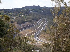
Blue Mountain Heights is a residential locality in the Toowoomba Region, Queensland, Australia. In the 2016 census, Blue Mountain Heights had a population of 929 people.

Ballard, Queensland Suburb of Lockyer Valley Region, Queensland, Australia

Ballard is a rural locality in the Lockyer Valley Region, Queensland, Australia. In the 2016 census Ballard had a population of 151 people.

Cotswold Hills is a rural-residential locality within Toowoomba in the Toowoomba Region, Queensland, Australia. In the 2016 census Cotswold Hills had a population of 1,278 people.

Finnie is a rural locality in the Toowoomba Region, Queensland, Australia. In the 2016 census Finnie had a population of 94 people.

Cranley is a rural locality in the Toowoomba Region, Queensland, Australia. In the 2016 census Cranley had a population of 1,446 people.

Top Camp is a locality in the Toowoomba Region, Queensland, Australia. In the 2016 census, Top Camp had a population of 852 people.

Torrington is a rural locality in Toowoomba in the Toowoomba Region, Queensland, Australia. In the 2016 census, Torrington had a population of 879 people.

Charlton, Queensland Suburb of Toowoomba Region, Queensland, Australia

Charlton is a rural locality in the Toowoomba Region, Queensland, Australia, located 13 kilometres (8 mi) west from the Toowoomba city centre off the Warrego Highway. In the 2016 census, Charlton had a population of 120 people.

Harlaxton, Queensland Suburb of Toowoomba, Queensland, Australia

Harlaxton is a locality in the Toowoomba Region, Queensland, Australia. In the 2016 census, Harlaxton had a population of 2,547 people. Traditionally a rural area, most of the locality is now residential.

Kearneys Spring is a mostly residential locality in Toowoomba in the Toowoomba Region, Queensland, Australia. In the 2016 census, Kearneys Spring had a population of 8,552 people.

Middle Ridge, Queensland Suburb of Toowoomba, Queensland, Australia

Middle Ridge is a residential locality of Toowoomba in the Toowoomba Region, Queensland, Australia. In the 2016 census, Middle Ridge had a population of 7,141 people.

Prince Henry Heights is a residential locality on the outskirts of Toowoomba in the Toowoomba Region, Queensland, Australia. In the 2016 census, Prince Henry Heights had a population of 571 people.

Rockville is a residential locality in the Toowoomba Region, Queensland, Australia. In the 2016 census, Rockville had a population of 3,237 people.

Spring Bluff, Queensland Suburb of Toowoomba, Queensland, Australia

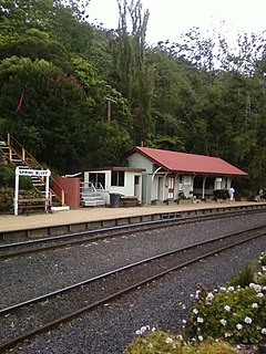
Spring Bluff is a rural locality in the Toowoomba Region, Queensland, Australia. In the 2016 census Spring Bluff had a population of 6 people.

Yandilla is a rural locality in the Toowoomba Region, Queensland, Australia. In the 2016 census Yandilla had a population of 46 people.

Athol, Queensland Suburb of Toowoomba Region, Queensland, Australia

Athol is a rural locality in the Toowoomba Region, Queensland, Australia. In the 2016 census, Athol had a population of 134 people.

Mount Whitestone, Queensland Suburb of Lockyer Valley Region, Queensland, Australia

Mount Whitestone is a locality in the Lockyer Valley Region, Queensland, Australia. In the 2016 census, Mount Whitestone had a population of 154 people.

East Greenmount, Queensland Suburb of Toowoomba Region, Queensland, Australia

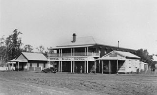
East Greenmount is a rural town and locality in the Toowoomba Region, Queensland, Australia. In the 2016 census, the locality of East Greenmount had a population of 361 people.

Missen Flat is a rural locality in the Toowoomba Region, Queensland, Australia. In the 2016 census, Missen Flat had a population of 20 people.

References

  1. 1 2 3 Australian Bureau of Statistics (27 June 2017). "Redwood (SSC)". 2016 Census QuickStats. Retrieved 20 October 2018. OOjs UI icon edit-ltr-progressive.svg
  2. 1 2 "Redwood – locality in Toowoomba Region (entry 48051)". Queensland Place Names. Queensland Government . Retrieved 1 December 2019.
  3. "Redwood - Redwood Park". Toowoomba Regional Council . Retrieved 27 December 2019.
  4. Brisway Publishing (2008). Brisway: Greater Brisbane, Sunshine Coast, Gold Coast and Toowoomba. p. Map T221, T261. ISBN   978-0-909439-30-9.
  5. 1 2 "Queensland Globe". State of Queensland . Retrieved 27 December 2019.
  6. Australian Bureau of Statistics (25 March 2009). "2033.0.55.001 - Census of Population and Housing: Socio-Economic Indexes for Areas (SEIFA), Australia - Data only, 2006" . Retrieved 5 June 2011.
  7. Australian Bureau of Statistics (31 October 2012). "Redwood (State Suburb)". 2011 Census QuickStats. Retrieved 9 November 2014. OOjs UI icon edit-ltr-progressive.svg
  8. "Glen Alpine (entry 600842)". Queensland Heritage Register . Queensland Heritage Council. Retrieved 1 August 2014.