
Mount Gravatt is a southern suburb of the City of Brisbane, Queensland, Australia and a prominent hill and lookout within this suburb. In the 2021 census, Mount Gravatt had a population of 3,733 people.

Drayton is a rural locality in the Toowoomba Region, Queensland, Australia. In the 2021 census, Drayton had a population of 1,813 people.

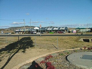
Pittsworth is a rural town and locality in the Toowoomba Region, Queensland, Australia. In the 2021 census, the locality of Pittsworth had a population of 3,300 people.
Gowrie Junction is a rural locality in the Toowoomba Region, Queensland, Australia. It is north-west of Toowoomba. The town of Gowrie is in the eastern part of the locality. In the 2021 census, Gowrie Junction had a population of 2,242 people.

Millmerran, known as Domville between 1 June 1889 and 16 November 1894, is a town and a locality in the Toowoomba Region, Queensland, Australia. In the 2021 census, the locality of Millmerran had a population of 1,545 people.
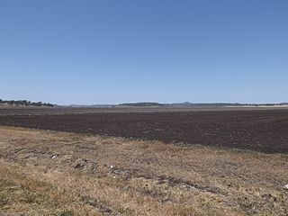
Cecil Plains is a rural town and locality in the Toowoomba Region, Queensland, Australia. In the 2021 census, the locality of Cecil Plains had a population of 380 people.

Cambooya is a rural town and locality in the Toowoomba Region, Queensland, Australia. In the 2021 census, the locality of Cambooya had a population of 2,260 people.

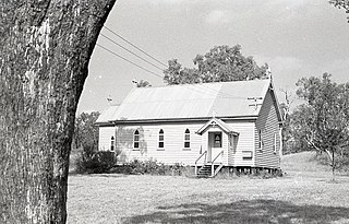
Leyburn is a rural town in the Southern Downs Region and a locality split between the South Downs Region and the Toowoomba Region in Queensland, Australia. In the 2021 census, the locality of Leyburn had a population of 566 people.

Kingsthorpe is a rural town and locality in the Toowoomba Region, Queensland, Australia. In the 2021 census, the locality of Kingsthorpe had a population of 2,159 people.

Cabarlah is a rural town and locality in the Toowoomba Region, Queensland, Australia. In the 2021 census, the locality of Cabarlah had a population of 1,307 people.

Bowenville is a rural town and locality in the Toowoomba Region, Queensland, Australia. The town's economy rested on the rail industry and with the winding down of the railways the population declined. In the 2021 census, the locality of Bowenville had a population of 219 people.

Goombungee is a rural town and locality in the Toowoomba Region, Queensland, Australia. In the 2021 census, the locality of Goombungee had a population of 1,066 people.

Jondaryan is a rural town and locality in the Toowoomba Region, Queensland, Australia. In the 2021 census, the locality of Jondaryan had a population of 414 people.
Westbrook is a rural town and locality in the Toowoomba Region, Queensland, Australia. In the 2021 census, the locality of Westbrook had a population of 4,408 people.
Mount Tyson is a rural town and locality in the Toowoomba Region, Queensland, Australia. In the 2021 census, the locality of Mount Tyson had a population of 280 people.

Southbrook is a rural town and locality in the Toowoomba Region, Queensland, Australia. In the 2021 census, the locality of Southbrook had a population of 626 people.

Broxburn is a rural locality in the Toowoomba Region, Queensland, Australia. In the 2021 census, Broxburn had a population of 115 people.

Brookstead is a rural town and locality in the Toowoomba Region, Queensland, Australia. In the 2021 census, the locality of Brookstead had a population of 182 people.

Bongeen is a rural locality in the Toowoomba Region, Queensland, Australia. In the 2021 census, Bongeen had a population of 71 people.

Yarranlea Primary School is an independent co-educational primary school located in the Mount Gravatt campus of Griffith University in Mount Gravatt, Queensland, Australia.

