Condamine is a town and a locality in the Western Downs Region, Queensland, Australia. At the 2016 census, Condamine had a population of 384.

Cecil Plains is a rural town and locality in the Toowoomba Region, Queensland, Australia. In the 2016 census, Cecil Plains had a population of 429 people.

Pilton is a town and a locality in the Toowoomba Region, Queensland, Australia. It is south of the city of Toowoomba. In the 2016 census, Pilton had a population of 88 people.
Hendon is a rural town and locality in the Southern Downs Region, Queensland, Australia. In the 2016 census, Hendon had a population of 200 people.
Top Camp is a locality in the Toowoomba Region, Queensland, Australia. In the 2016 census, Top Camp had a population of 852 people.
Hodgson Vale is a rural locality in the Toowoomba Region, Queensland, Australia. In the 2016 census, Hodgson Vale had a population of 1,379 people.
Lemontree is a locality in the Toowoomba Region, Queensland, Australia. In the 2016 census, Lemontree had a population of 45 people.

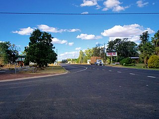
Hirstglen is a rural locality in the Toowoomba Region on the Darling Downs, Queensland, Australia. In the 2016 census, Hirstglen had a population of 83 people.

Ascot is a rural locality in the Toowoomba Region, Queensland, Australia. In the 2016 census, Ascot had a population of 31 people.
Ellangowan is a locality in the Toowoomba Region, Queensland, Australia. In the 2016 census, Ellangowan had a population of 121 people.

Brookstead is a rural town and locality in the Toowoomba Region, Queensland, Australia. In the 2016 census, Brookstead had a population of 217 people.
Greenswamp is a rural locality in the Western Downs Region, Queensland, Australia. In the 2016 census, Greenswamp had a population of 40 people.
North Branch is a locality in the Toowoomba Region, Queensland, Australia. In the 2016 census, North Branch had a population of 39 people.
Wattle Ridge is a locality in the Toowoomba Region, Queensland, Australia. In the 2016 census, Wattle Ridge had a population of 36 people.
Millmerran Woods is a locality in the Toowoomba Region, Queensland, Australia. In the 2016 census, Millmerran Woods had a population of 92 people.
Millmerran Downs is a locality in the Toowoomba Region, Queensland, Australia. In the 2016 census, Millmerran Downs had a population of 89 people.
Cypress Gardens is a rural locality in the Toowoomba Region, Queensland, Australia. In the 2016 census, Cypress Gardens had a population of 92 people.
Forest Ridge is a rural locality in the Toowoomba Region, Queensland, Australia. In the 2016 census, Forest Ridge had a population of 49 people.
The Pines is a locality in the Toowoomba Region, Queensland, Australia. In the 2016 census, The Pines had a population of 48 people.
Condamine Plains is a rural locality in the Toowoomba Region, Queensland, Australia. In the 2016 census, Condamine Plains had a population of 103 people.
