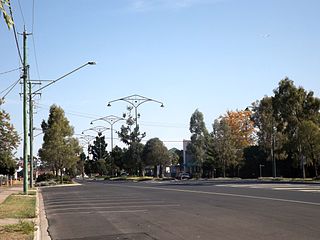
Kelvinhaugh, Queensland

Last updated

Kelvinhaugh
Queensland
Australia Queensland location map.svg
Red pog.svg
Kelvinhaugh
Coordinates 27°23′21″S151°46′07″E / 27.3891°S 151.7686°E / -27.3891; 151.7686 (Kelvinhaugh (centre of locality)) Coordinates: 27°23′21″S151°46′07″E / 27.3891°S 151.7686°E / -27.3891; 151.7686 (Kelvinhaugh (centre of locality))
Population44 (2016 census) [1]
 • Density1.043/km2 (2.70/sq mi)
Postcode(s) 4401
Area42.2 km2 (16.3 sq mi)
Time zone AEST (UTC+10:00)
LGA(s) Toowoomba Region
State electorate(s) Condamine
Federal Division(s) Groom
Suburbs around Kelvinhaugh:
Sabine
Greenwood
Silverleigh Silverleigh
Devon Park Kelvinhaugh Boodua
Oakey Oakey Yalangur

Kelvinhaugh is a rural locality in the Toowoomba Region, Queensland, Australia. [2] In the 2016 census Kelvinhaugh had a population of 44 people. [1]

History

Mayburn Provisional School opened on 20 January 1905. On 1 January 1909 it became Mayburn State School. On 30 July 1926 it was renamed Kelvinhaugh State School. It closed on 30 October 1952. [3] It was at 133 Wilthorn Kelvinhaugh Road ( 27°24′05″S151°46′05″E / 27.4013°S 151.7680°E / -27.4013; 151.7680 (Kelvinhaugh State School) ). [4] [5]

The Wilthorn railway station was on the north-east corner of the Oakey Cooyar Road and the Wilthorn Kelvinhaugh Road ( 27°23′35″S151°43′12″E / 27.3930°S 151.7199°E / -27.3930; 151.7199 (Wilthorn railway station (former)) ). It was on the former Cooyar railway line. [4] [5]

In the 2016 census Kelvinhaugh had a population of 44 people. [1]

Related Research Articles

Gowrie Junction, Queensland Suburb of Toowoomba Region, Queensland, Australia

Gowrie Junction is a rural locality in the Toowoomba Region, Queensland, Australia. It is north-west of Toowoomba. In the 2016 census, Gowrie Junction had a population of 2,120 people. The town of Gowrie is in the eastern part of the locality.

Cecil Plains, Queensland Town in Queensland, Australia

Cecil Plains is a rural town and locality in the Toowoomba Region, Queensland, Australia. In the 2016 census, Cecil Plains had a population of 429 people.

Cooyar, Queensland Town in Queensland, Australia

Cooyar is a rural town and locality in the Toowoomba Region, Queensland, Australia. In the 2016 census, Cooyar had a population of 224 people.

Vale View, Queensland Suburb of Toowoomba, Queensland, Australia

Vale View is a rural locality in the Toowoomba Region, Queensland, Australia. In the 2016 census, Vale View had a population of 472 people.

Haden, Queensland Town in Queensland, Australia

Haden is a rural town and locality in the Toowoomba Region, Queensland, Australia. In the 2016 census, Haden had a population of 195 people.

Aubigny, Queensland Town in Queensland, Australia

Aubigny is a rural town and locality in the Toowoomba Region, Queensland, Australia. In the 2016 census, Aubigny had a population of 254 people.

Boodua, Queensland Suburb of Toowoomba Region, Queensland, Australia

Boodua is a locality in the Toowoomba Region local government area on the Darling Downs in southern Queensland, Australia. At the 2016 Australian census, Boodua had a population of 93.

Ramsay, Queensland Suburb of Toowoomba Region, Queensland, Australia

Ramsay is a rural locality in the Toowoomba Region, Queensland, Australia. In the 2016 census Ramsay had a population of 348 people.

Evanslea, Queensland Suburb of Toowoomba Region, Queensland, Australia

Evanslea is a rural locality in the Toowoomba Region, Queensland, Australia. In the 2016 census Evanslea had a population of 41 people.

Brookstead, Queensland Town in Queensland, Australia

Brookstead is a rural town and locality in the Toowoomba Region, Queensland, Australia. In the 2016 census, Brookstead had a population of 217 people.

Bergen, Queensland Suburb of Toowoomba Region, Queensland, Australia

Bergen is a rural locality in the Toowoomba Region, Queensland, Australia. In the 2016 census, Bergen had a population of 68 people.

Bongeen, Queensland Suburb of Toowoomba Region, Queensland, Australia

Bongeen is a rural locality in the Toowoomba Region, Queensland, Australia. In the 2016 census, Bongeen had a population of 75 people.

Greenwood, Queensland Suburb of Toowoomba Region, Queensland, Australia

Greenwood is a rural locality in the Toowoomba Region, Queensland, Australia. In the 2016 census Greenwood had a population of 40 people.

Kilbirnie, Queensland Suburb of Toowoomba Region, Queensland, Australia

Kilbirnie is a rural locality in the Toowoomba Region, Queensland, Australia. In the 2016 census Kilbirnie had a population of 60 people.

Lavelle, Queensland Suburb of Toowoomba Region, Queensland, Australia

Lavelle is a rural locality in the Toowoomba Region, Queensland, Australia. In the 2016 census Lavelle had a population of 29 people.

Highgrove, Queensland Suburb of Toowoomba Region, Queensland, Australia

Highgrove is a rural locality in the Toowoomba Region, Queensland, Australia. In the 2016 census Highgrove had a population of 29 people.

Gilla, Queensland Suburb of Toowoomba Region, Queensland, Australia

Gilla is a rural locality in the Toowoomba Region, Queensland, Australia. In the 2016 census Gilla had a population of 32 people.

Turallin, Queensland Town in Queensland, Australia

Turallin is a town and a locality in the Toowoomba Region, Queensland, Australia. In the 2016 census, Turallin had a population of 65 people.

Kings Siding, Queensland Suburb of Toowoomba Region, Queensland, Australia

Kings Siding is a rural locality in the Toowoomba Region, Queensland, Australia. In the 2016 census Kings Siding had a population of 16 people.

Mount Darry, Queensland Suburb of Toowoomba Region, Queensland, Australia

Mount Darry is a rural locality in the Toowoomba Region, Queensland, Australia. In the 2016 census Mount Darry had a population of 35 people.

References

  1. 1 2 3 Australian Bureau of Statistics (27 June 2017). "Kelvinhaugh (SSC)". 2016 Census QuickStats. Retrieved 20 October 2018. OOjs UI icon edit-ltr-progressive.svg
  2. "Kelvinhaugh - locality in Toowoomba Region (entry 49181)". Queensland Place Names. Queensland Government . Retrieved 29 December 2020.
  3. Queensland Family History Society (2010), Queensland schools past and present (Version 1.01 ed.), Queensland Family History Society, ISBN   978-1-921171-26-0
  4. 1 2 "Parish of King County of Aubigny" (Map). Queensland Government. 1942. Archived from the original on 17 December 2020. Retrieved 17 December 2020.
  5. 1 2 "Queensland Globe". State of Queensland . Retrieved 16 December 2020.