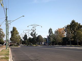
Gowrie Little Plain, Queensland

Last updated

Map all coordinates using: OpenStreetMap
Gowrie Little Plain
Queensland
Farms at Gowrie Little Plains.jpg
Farms along Yalangur Lilyvale Road, 2014
Australia Queensland location map.svg
Red pog.svg
Gowrie Little Plain
Coordinates 27°25′51″S151°50′45″E / 27.4308°S 151.8458°E / -27.4308; 151.8458 (Gowrie Little Plain (centre of locality))
Population79 (SAL 2021) [1]
Postcode(s) 4352
Area11.7 km2 (4.5 sq mi)
Time zone AEST (UTC+10:00)
Location
LGA(s) Toowoomba Region
State electorate(s) Condamine
Federal division(s) Groom
Suburbs around Gowrie Little Plain:
Yalangur Yalangur Meringandan West
Yalangur Gowrie Little Plain Lilyvale
Cutella Glencoe Glencoe

Gowrie Little Plain is a rural locality in the Toowoomba Region, Queensland, Australia. [2] In the 2021 census, Gowrie Little Plain had a population of 79 people. [3]

Contents

Geography

Gowrie Little Plain is on the Darling Downs. In the south of the locality are a series of hills which rise to around 600 metres (2,000 ft) above sea level. [4]

The land use is a mixture of grazing on native vegetation and crop growing. [4]

History

The locality takes its name from the nearby town of Gowrie. The town takes its name from a pastoral run which was named pastoralists Henry Hughes and Frederick N. Isaac, who initially called the property Stanbrook, but renamed it Gowrie in 1847. The name Gowrie is probably a corruption of cowarie, Aboriginal name for Gowrie Creek, which in turn possibly means freshwater mussel . [2]

Gowrie Little Plain State School opened circa 1890 and closed in 1965. [5] It was at approx 125 Gowrie Little Plain Road ( 27°25′43″S151°51′06″E / 27.4285°S 151.8517°E / -27.4285; 151.8517 (Gowrie Little Plain State School (former)) ). [6]

St Jude's Anglican church was dedicated on 20 July 1900 by Bishop William Webber. The church was on the main road overlooking the valley of Glencoe. The church was 30 by 18 feet (9.1 by 5.5 m) with a vestry 8 by 10 feet (2.4 by 3.0 m), and a porch 6 by 6 feet (1.8 by 1.8 m). It was built by L. P. Petersen. [7] Its last service was held on 9 March 1951. [8] It was at 341 Glencoe Yalangar Road ( 27°26′35″S151°51′44″E / 27.4430°S 151.8622°E / -27.4430; 151.8622 (St Jude's Anglican Church (former)) ). [6] [9]

The public hall was officially opened with a dance on 29 October 1932. The building was 60 by 25 feet (18.3 by 7.6 m) and built with volunteer labour supervised by Mr F. Heileg. [10]

Demographics

In the 2016 census, Gowrie Little Plain had a population of 65 people. [11]

In the 2021 census, Gowrie Little Plain had a population of 79 people. [3]

Education

There are no schools in Gowrie Little Plain. The nearest government primary schools are Kingsthorpe State School in Kingsthorpe to the south-west and Meringandan State School in neighbouring Meringandan West to the north-east. The nearest government secondary schools are Oakey State High School in Oakey to the west and Highfields State Secondary College in Highfields to the east. [4]

Amenities

Gowrie Little Plain Hall and School of Arts is at 111 Gowrie Little Plain Road ( 27°25′42″S151°51′02″E / 27.4282°S 151.8506°E / -27.4282; 151.8506 (Gowrie Little Plain Hall & School of Arts) ). [12]

Related Research Articles

<span class="mw-page-title-main">Meringandan</span> Suburb of Toowoomba Region, Queensland, Australia

Meringandan is a rural locality in the Toowoomba Region, Queensland, Australia. In the 2016 census, Meringandan had a population of 487 people.

Gowrie Junction is a rural locality in the Toowoomba Region, Queensland, Australia. It is north-west of Toowoomba. In the 2021 census, Gowrie Junction had a population of 2,030 people. The town of Gowrie is in the eastern part of the locality.

<span class="mw-page-title-main">Kingsthorpe, Queensland</span> Town in Queensland, Australia

Kingsthorpe is a rural town and locality in the Toowoomba Region, Queensland, Australia. In the 2021 census, the locality of Kingsthorpe had a population of 2,159 people.

<span class="mw-page-title-main">Goombungee, Queensland</span> Town in Queensland, Australia

Goombungee is a rural town and locality in the Toowoomba Region, Queensland, Australia. In the 2016 census the locality of Goombungee had a population of 1,026 people.

<span class="mw-page-title-main">Charlton, Queensland</span> Suburb of Toowoomba Region, Queensland, Australia

Charlton is a rural locality in the Toowoomba Region, Queensland, Australia, located 13 kilometres (8 mi) west from the Toowoomba city centre off the Warrego Highway.. In the 2021 census, Charlton had a population of 107 people.

<span class="mw-page-title-main">Jondaryan, Queensland</span> Town in Queensland, Australia

Jondaryan is a rural town and locality in the Toowoomba Region, Queensland, Australia. In the 2016 census, the locality of Jondaryan had a population of 385 people.

<span class="mw-page-title-main">Aubigny, Queensland</span> Town in Queensland, Australia

Aubigny is a rural town and locality in the Toowoomba Region, Queensland, Australia. In the 2016 census, the locality of Aubigny had a population of 254 people.

<span class="mw-page-title-main">Linthorpe, Queensland</span> Suburb of Toowoomba Region, Queensland, Australia

Linthorpe is a rural locality in the Toowoomba Region, Queensland, Australia. In the 2021 census, Linthorpe had a population of 416 people.

<span class="mw-page-title-main">Glencoe, Queensland</span> Suburb of Toowoomba Region, Queensland, Australia

Glencoe is a rural locality in the Toowoomba Region, Queensland, Australia. In the 2016 census, Glencoe had a population of 322 people.

<span class="mw-page-title-main">Boodua, Queensland</span> Suburb of Toowoomba Region, Queensland, Australia

Boodua is a rural locality in the Toowoomba Region, Queensland, Australia. In the 2016 census Boodua had a population of 93 people.

<span class="mw-page-title-main">Meringandan West, Queensland</span> Suburb of Toowoomba Region, Queensland, Australia

Meringandan West is a rural locality in the Toowoomba Region, Queensland, Australia. In the 2021 census, Meringandan West had a population of 2,488 people.

Devon Park is a rural locality in the Toowoomba Region, Queensland, Australia. In the 2016 census, Devon Park had a population of 49 people.

<span class="mw-page-title-main">Gowrie Mountain, Queensland</span> Suburb of Toowoomba Region, Queensland, Australia

Gowrie Mountain is a locality in the Toowoomba Region, Queensland, Australia. In the 2021 census, Gowrie Mountain had a population of 222 people.

Greenwood is a rural locality in the Toowoomba Region, Queensland, Australia. In the 2016 census, Greenwood had a population of 40 people.

Kelvinhaugh is a rural locality in the Toowoomba Region, Queensland, Australia. In the 2016 census, Kelvinhaugh had a population of 44 people.

Silverleigh is a rural locality in the Toowoomba Region, Queensland, Australia. In the 2016 census, Silverleigh had a population of 71 people.

Brymaroo is a rural locality in the Toowoomba Region, Queensland, Australia. In the 2016 census Brymaroo had a population of 140 people.

Muniganeen is a rural locality in the Toowoomba Region, Queensland, Australia. In the 2021 census, Muniganeen had a population of 40 people.

Cutella is a rural locality in the Toowoomba Region, Queensland, Australia. In the 2021 census, Cutella had a population of 45 people.

Kings Siding is a rural locality in the Toowoomba Region, Queensland, Australia. In the 2021 census, Kings Siding had a population of 15 people.

References

  1. Australian Bureau of Statistics (28 June 2022). "Gowrie Little Plain (suburb and locality)". Australian Census 2021 QuickStats. Retrieved 28 June 2022.  OOjs UI icon edit-ltr-progressive.svg
  2. 1 2 "Gowrie Little Plain – locality in Toowoomba Region (entry 47954)". Queensland Place Names. Queensland Government . Retrieved 5 November 2019.
  3. 1 2 Australian Bureau of Statistics (28 June 2022). "Gowrie Little Plain (SAL)". 2021 Census QuickStats. Retrieved 28 February 2023. OOjs UI icon edit-ltr-progressive.svg
  4. 1 2 3 "Queensland Globe". State of Queensland . Retrieved 13 September 2023.
  5. Queensland Family History Society (2010), Queensland schools past and present (Version 1.01 ed.), Queensland Family History Society, ISBN   978-1-921171-26-0
  6. 1 2 "Jondaryan" (Map). Queensland Government. 1943. Archived from the original on 1 September 2023. Retrieved 13 September 2023.
  7. "Gowrie Little Plain". Toowoomba Chronicle and Darling Downs General Advertiser . No. 6016. Queensland, Australia. 31 July 1900. p. 3. Archived from the original on 13 September 2023. Retrieved 28 July 2020 via National Library of Australia.
  8. Anglican Church of Southern Queensland. "Closed Churches". Archived from the original on 3 April 2019. Retrieved 3 July 2020.
  9. "St Jude's Anglican Church | Gowrie Little Plains". Queensland Religious Places Database. Archived from the original on 13 September 2023. Retrieved 13 September 2023.
  10. "GOWRIE LITTLE PLAIN". Toowoomba Chronicle and Darling Downs Gazette . Vol. LXXI, no. 274. Queensland, Australia. 17 November 1932. p. 11. Archived from the original on 13 September 2023. Retrieved 13 September 2023 via National Library of Australia.
  11. Australian Bureau of Statistics (27 June 2017). "Gowrie Little Plain (SSC)". 2016 Census QuickStats. Retrieved 20 October 2018. OOjs UI icon edit-ltr-progressive.svg
  12. Google. "Gowrie Little Plain Hall & School of Arts" (Map). Google Maps . Google.

Further reading