
Pittsworth is a rural town and locality in the Toowoomba Region, Queensland, Australia. In the 2021 census, the locality of Pittsworth had a population of 3,300 people.

Cambooya is a rural town and locality in the Toowoomba Region, Queensland, Australia. In the 2021 census, the locality of Cambooya had a population of 2,260 people.
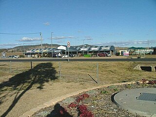
Wyreema is a rural town and locality in the Toowoomba Region, Queensland, Australia. In the 2021 census, the locality of Wyreema had a population of 2,076 people.

Kingsthorpe is a rural town and locality in the Toowoomba Region, Queensland, Australia. In the 2021 census, the locality of Kingsthorpe had a population of 2,159 people.
Westbrook is a rural town and locality in the Toowoomba Region, Queensland, Australia. In the 2021 census, the locality of Westbrook had a population of 4,408 people.
Mount Tyson is a rural town and locality in the Toowoomba Region, Queensland, Australia. In the 2021 census, the locality of Mount Tyson had a population of 280 people.

Aubigny is a rural town and locality in the Toowoomba Region, Queensland, Australia. In the 2021 census, the locality of Aubigny had a population of 283 people.

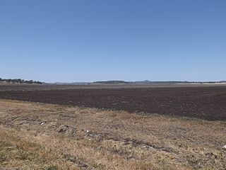
Pampas is a rural locality in the Toowoomba Region, Queensland, Australia. In the 2021 census, Pampas had a population of 78 people.

East Greenmount is a rural town and locality in the Toowoomba Region, Queensland, Australia. In the 2021 census, the locality of East Greenmount had a population of 351 people.

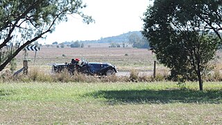
Felton is a rural locality in the Toowoomba Region, Queensland, Australia. In the 2021 census, Felton had a population of 267 people.

Broxburn is a rural locality in the Toowoomba Region, Queensland, Australia. In the 2021 census, Broxburn had a population of 115 people.

Linthorpe is a rural locality in the Toowoomba Region, Queensland, Australia. In the 2021 census, Linthorpe had a population of 416 people.

Boodua is a rural locality in the Toowoomba Region, Queensland, Australia. In the 2021 census, Boodua had a population of 95 people.

Domville is a rural locality in the Toowoomba Region, Queensland, Australia. In the 2021 census, Domville had "no people or a very low population".

Brookstead is a rural town and locality in the Toowoomba Region, Queensland, Australia. In the 2021 census, the locality of Brookstead had a population of 182 people.
North Branch is a locality in the Toowoomba Region, Queensland, Australia. In the 2021 census, North Branch had a population of 48 people.
Rossvale is a rural locality in the Toowoomba Region, Queensland, Australia. In the 2021 census, Rossvale had a population of 85 people.

Umbiram is a rural locality in the Toowoomba Region, Queensland, Australia. In the 2021 census, Umbiram had a population of 146 people.

Yarranlea is a rural locality in the Toowoomba Region, Queensland, Australia. In the 2021 census, Yarranlea had a population of 82 people.
Turallin is a rural town and locality in the Toowoomba Region, Queensland, Australia. In the 2021 census, the locality of Turallin had a population of 64 people.


