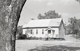
Grassdale, Queensland

Last updated

Grassdale
Queensland
Australia Queensland location map.svg
Red pog.svg
Grassdale
Coordinates 27°24′53″S151°08′19″E / 27.4147°S 151.1386°E / -27.4147; 151.1386 (Grassdale (centre of locality))
Population0 (2021 census) [1]
 • Density0.000/km2 (0.000/sq mi)
Postcode(s) 4405
Area73.6 km2 (28.4 sq mi)
Time zone AEST (UTC+10:00)
Location
LGA(s) Toowoomba Region
State electorate(s) Condamine
Federal division(s) Groom
Suburbs around Grassdale:
Nandi Springvale Springvale
Halliford Grassdale Cecil Plains
Cecil Plains Cecil Plains Cecil Plains

Grassdale is a rural locality in the Toowoomba Region, Queensland, Australia. [2] In the 2021 census, Grassdale had "no people or a very low population". [1]

Contents

Geography

The land use is a mixture of grazing on native vegetation in the west of the locality and irrigated and dry crop growing in the east of the locality. [3]

History

The locality was officially named and bounded on 25 February 2000. [2]

Demographics

In the 2016 census, Grassdale had a population of 4 people. [4]

In the 2021 census, Grassdale had "no people or a very low population". [1]

Economy

In the centre of the locality is Grassdale Feedlot which processes over 70,000 cattle each year and claims to be Australia's largest feedlot. It is operated by Mort & Co. [5]

Education

There are no schools in Grassdale. The nearest government primary schools are Cecil Plains State School in neighbouring Cecil Plains to the south and Dalby State School in Dalby to the north-east. The nearest government secondary schools are Cecil Plains State School (to Year 9) and Dalby State High School (to Year 12) in Dalby. [3]

Related Research Articles

<span class="mw-page-title-main">Cecil Plains, Queensland</span> Town in Queensland, Australia

Cecil Plains is a rural town and locality in the Toowoomba Region, Queensland, Australia. In the 2016 census, the locality of Cecil Plains had a population of 429 people.

<span class="mw-page-title-main">Purrawunda, Queensland</span> Suburb of Toowoomba Region, Queensland, Australia

Purrawunda is a rural locality in the Toowoomba Region, Queensland, Australia. In the 2021 census, Purrawunda had a population of 12 people.

<span class="mw-page-title-main">Mount Irving, Queensland</span> Suburb of Toowoomba Region, Queensland, Australia

Mount Irving is a rural locality in the Toowoomba Region, Queensland, Australia. In the 2021 census, Mount Irving had a population of 34 people.

Ellangowan is a rural locality in the Toowoomba Region, Queensland, Australia. In the 2021 census, Ellangowan had a population of 95 people.

Branchview is a rural locality in the Toowoomba Region, Queensland, Australia. In the 2021 census, Branchview had a population of 37 people.

<span class="mw-page-title-main">Bongeen, Queensland</span> Suburb of Toowoomba Region, Queensland, Australia

Bongeen is a rural locality in the Toowoomba Region, Queensland, Australia. In the 2021 census, Bongeen had a population of 71 people.

Formartin is a rural locality in the Toowoomba Region, Queensland, Australia. In the 2021 census, Formartin had a population of 89 people.

Malling is a rural locality in the Toowoomba Region, Queensland, Australia. In the 2021 census, Malling had a population of 40 people.
<span class="mw-page-title-main">North Branch, Queensland (Toowoomba Region)</span> Suburb of Toowoomba Region, Queensland, Australia

North Branch is a locality in the Toowoomba Region, Queensland, Australia. In the 2021 census, North Branch had a population of 48 people.

Norwin is a rural locality in the Toowoomba Region, Queensland, Australia. In the 2016 census, Norwin had a population of 94 people.

St Ruth is a locality split between the Western Downs Region and the Toowoomba Region in Queensland, Australia. In the 2016 census St Ruth had a population of 139 people.
<span class="mw-page-title-main">Muniganeen, Queensland</span> Suburb of Toowoomba Region, Queensland, Australia

Muniganeen is a rural locality in the Toowoomba Region, Queensland, Australia. In the 2021 census, Muniganeen had a population of 40 people.

Irvingdale is a locality split between the Toowoomba Region and the Western Downs Region, both in Queensland, Australia. In the 2021 census, Irvingdale had a population of 163 people.

Turallin is a rural town and locality in the Toowoomba Region, Queensland, Australia. In the 2021 census, the locality of Turallin had a population of 64 people.

<span class="mw-page-title-main">Western Creek, Queensland</span> Suburb of Toowoomba Region, Queensland, Australia

Western Creek is a locality in the Toowoomba Region, Queensland, Australia. In the 2021 census, Western Creek had "no people or a very low population".

Condamine Farms is a rural locality in the Toowoomba Region, Queensland, Australia. In the 2021 census, Condamine Farms had a population of 28 people.

Condamine Plains is a rural locality in the Toowoomba Region, Queensland, Australia. In the 2021 census, Condamine Plains had a population of 101 people.

Kurrowah is a rural locality in the Toowoomba Region, Queensland, Australia. In the 2021 census, Kurrowah had a population of 10 people.

Dunmore is a rural locality in the Toowoomba Region, Queensland, Australia. In the 2021 census, Dunmore had a population of 39 people.

Rosalie Plains is a rural locality in the Toowoomba Region, Queensland, Australia. In the 2021 census, Rosalie Plains had a population of 54 people.

References

  1. 1 2 3 Australian Bureau of Statistics (28 June 2022). "Grassdale (SAL)". 2021 Census QuickStats. Retrieved 28 February 2023. OOjs UI icon edit-ltr-progressive.svg
  2. 1 2 "Grassdale – locality in Toowoomba Region (entry 47957)". Queensland Place Names. Queensland Government . Retrieved 25 October 2019.
  3. 1 2 "Queensland Globe". State of Queensland . Retrieved 29 May 2023.
  4. Australian Bureau of Statistics (27 June 2017). "Grassdale (SSC)". 2016 Census QuickStats. Retrieved 20 October 2018. OOjs UI icon edit-ltr-progressive.svg
  5. "Grassdale Feedlot". mortco.com.au. Retrieved 29 May 2023.