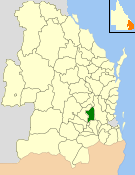
Grapetree, Queensland

Last updated

Grapetree
Queensland
Field at Grapetree.jpg
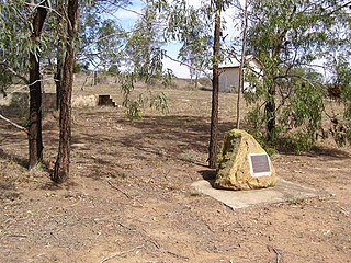
Grapetree landscape, 2014
Australia Queensland location map.svg
Red pog.svg
Grapetree
Coordinates 27°19′18″S152°05′58″E / 27.3216°S 152.0994°E / -27.3216; 152.0994 (Grapetree (centre of locality))
Population42 (2021 census) [1]
 • Density1.818/km2 (4.71/sq mi)
Postcode(s) 4352
Area23.1 km2 (8.9 sq mi)
Time zone AEST (UTC+10:00)
LGA(s) Toowoomba Region
State electorate(s) Condamine
Federal division(s) Maranoa
Suburbs around Grapetree:
Pechey Crows Nest Crows Nest
Pechey Grapetree Ravensbourne
Hampton Perseverance Ravensbourne

Grapetree is a rural locality in the Toowoomba Region, Queensland, Australia. [2] In the 2021 census, Grapetree had a population of 42 people. [1]

Contents

Geography

The southern extent of Crows Nest National Park occupies the eastern half of Grapetree. Upper Cressbrook Creek forms part of the eastern boundary of Grapetree. A small section of Pechey State Forest lies adjacent to the New England Highway which forms part of the western boundary.

History

The locality was originally called Grape Tree, presumably after Grape Tree Creek ( 27°20′05″S152°06′53″E / 27.3347°S 152.1147°E / -27.3347; 152.1147 (Grape Tree Creek) ) which flows through the locality. [3] The locality was officially named Grapetree in 2005. [2] It was part of the Shire of Crows Nest until 2008 when the local government area was amalgamated into the Toowoomba Region. [4]

Demographics

In the 2016 census Grapetree had a population of 32 people. [5]

In the 2021 census, Grapetree had a population of 42 people. [1]

Related Research Articles

<span class="mw-page-title-main">Shire of Crows Nest</span> Local government area in Queensland, Australia

The Shire of Crows Nest was a local government area in the Darling Downs region of Queensland, Australia, immediately northeast of the regional city of Toowoomba. The shire, administered from the town of Crows Nest, covered an area of 1,629.9 square kilometres (629.3 sq mi), and existed as a local government entity from 1913 until 2008, when it amalgamated with several other councils in the Toowoomba area to form the Toowoomba Region. Its growth in later years has been fuelled by the expansion of Toowoomba, particularly the suburbs of Highfields and Blue Mountain Heights which, with a combined population of 7,333 in 2006, were home to over half the shire's population.

<span class="mw-page-title-main">Crows Nest, Queensland</span> Town in Queensland, Australia

Crows Nest is a rural town and locality in the Toowoomba Region, Queensland, Australia. The town is located in the Darling Downs on the New England Highway, 158 kilometres (98 mi) from the state capital, Brisbane and 43 kilometres (27 mi) from the nearby city of Toowoomba. In the 2016 census, Crows Nest had a population of 2160 people.
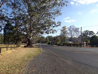
<span class="mw-page-title-main">Hampton, Queensland</span> Town in Queensland, Australia

Hampton is a rural town and locality in the Toowoomba Region, Queensland, Australia. In the 2016 census, the locality of Hampton had a population of 356 people.

Blue Mountain Heights is a residential locality in the Toowoomba Region, Queensland, Australia. In the 2016 census, Blue Mountain Heights had a population of 929 people.

Mount Rascal is a rural locality in the Toowoomba Region, Queensland, Australia. In the 2021 census, Mount Rascal had a population of 393 people.

<span class="mw-page-title-main">Atkinsons Dam, Queensland</span> Suburb of Somerset Region, Queensland, Australia

Atkinsons Dam is a rural locality in the Somerset Region, Queensland, Australia. In the 2021 census, Atkinsons Dam had a population of 191 people.

<span class="mw-page-title-main">Perseverance, Queensland</span> Suburb of Toowoomba Region, Queensland, Australia

Perseverance is a rural locality in the Toowoomba Region, Queensland, Australia. In the 2021 census, Perseverance had a population of 72 people.
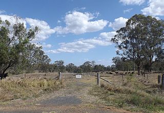
<span class="mw-page-title-main">Whichello, Queensland</span> Suburb of Toowoomba Region, Queensland, Australia

Whichello is a rural locality in the Toowoomba Region, Queensland, Australia. In the 2021 census, Whichello had a population of 31 people.

<span class="mw-page-title-main">Groomsville, Queensland</span> Suburb of Toowoomba Region, Queensland, Australia

Groomsville is a rural locality in the Toowoomba Region on the Darling Downs, Queensland, Australia. In the 2021 census, Groomsville had a population of 132 people.

<span class="mw-page-title-main">Meringandan West, Queensland</span> Suburb of Toowoomba Region, Queensland, Australia

Meringandan West is a rural locality in the Toowoomba Region, Queensland, Australia. In the 2021 census, Meringandan West had a population of 2,488 people.

Anduramba is a rural locality in the Toowoomba Region, Queensland, Australia. In the 2016 census, Anduramba had a population of 77 people.

Buaraba is a rural locality in the Somerset Region, Queensland, Australia. In the 2021 census, Buaraba had a population of 170 people.
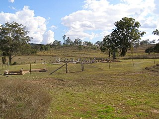
<span class="mw-page-title-main">Bergen, Queensland</span> Suburb of Toowoomba Region, Queensland, Australia

Bergen is a rural locality in the Toowoomba Region, Queensland, Australia. In the 2021 census, Bergen had a population of 85 people.

Pierces Creek is a rural locality in the Toowoomba Region, Queensland, Australia. It was formerly known as Virginia. In the 2016 census, Pierces Creek had a population of 70 people.

Pinelands is a rural locality in the Toowoomba Region, Queensland, Australia. In the 2016 census, Pinelands had a population of 86 people.
<span class="mw-page-title-main">Douglas, Queensland (Toowoomba Region)</span> Suburb of Toowoomba Region, Queensland, Australia

Douglas is a rural locality in the Toowoomba Region, Queensland, Australia. In the 2021 census, Douglas had a population of 152 people.

<span class="mw-page-title-main">Biarra, Queensland</span> Suburb of Somerset Region, Queensland, Australia

Biarra is a rural locality in the Somerset Region, Queensland, Australia. In the 2021 census, Biarra had a population of 270 people.

Eskdale is a rural locality in the Somerset Region, Queensland, Australia. In the 2021 census, Eskdale had a population of 34 people.

Emu Creek is a rural locality in the Toowoomba Region, Queensland, Australia. In the 2021 census, Emu Creek had a population of 113 people.

Glenaven is a rural locality in the Toowoomba Region, Queensland, Australia. In the 2021 census, Glenaven had a population of 68 people.

References

  1. 1 2 3 Australian Bureau of Statistics (28 June 2022). "Grapetree (SAL)". 2021 Census QuickStats. Retrieved 28 February 2023. OOjs UI icon edit-ltr-progressive.svg
  2. 1 2 "Grapetree – locality in Toowoomba Region (entry 47956)". Queensland Place Names. Queensland Government . Retrieved 29 December 2020.
  3. "Grape Tree Creek – watercourse in Toowoomba Regional (entry 14621)". Queensland Place Names. Queensland Government . Retrieved 29 December 2020.
  4. "Crows Nest Shire Bush Fire Zone Mapping Index" (PDF). Crows Nest Shire Council. 30 May 2007. Archived from the original on 8 January 2008. Retrieved 12 November 2014.{{cite web}}: CS1 maint: bot: original URL status unknown (link)
  5. Australian Bureau of Statistics (27 June 2017). "Grapetree (SSC)". 2016 Census QuickStats. Retrieved 20 October 2018. OOjs UI icon edit-ltr-progressive.svg