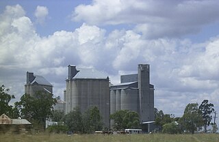
Darling Heights is a rural residential locality in the Toowoomba Region, Queensland, Australia. In the 2016 census, Darling Heights had a population of 5,192 people.

Gowrie Junction is a rural locality in the Toowoomba Region, Queensland, Australia. It is north-west of Toowoomba. In the 2016 census, Gowrie Junction had a population of 2,120 people. The town of Gowrie is in the eastern part of the locality.

Rockville is a residential locality in the Toowoomba Region, Queensland, Australia. In the 2016 census, Rockville had a population of 3,237 people.

Motley is a rural locality in the Toowoomba Region, Queensland, Australia. In the 2016 census, Motley had a population of 9 people.

Spring Creek is a locality split between the Toowoomba Region and the Southern Downs Region, Queensland, Australia.

Balgowan is a rural locality in the Toowoomba Region, Queensland, Australia. In the 2016 census Balgowan had a population of 14 people.

Brookstead is a rural town and locality in the Toowoomba Region, Queensland, Australia. In the 2016 census, Brookstead had a population of 217 people.

Manapouri is a rural locality in the Toowoomba Region, Queensland, Australia. In the 2016 census Manapouri had a population of 52 people.

Evergreen is a rural town and locality in the Toowoomba Region, Queensland, Australia. In the 2016 census the locality of Evergreen had a population of 45 people.

Coalbank is a rural locality in the Toowoomba Region, Queensland, Australia. In the 2016 census Coalbank had a population of 30 people.

Devon Park is a rural locality in the Toowoomba Region, Queensland, Australia. In the 2016 census Devon Park had a population of 49 people.

Djuan is a rural locality in the Toowoomba Region, Queensland, Australia. In the 2016 census Djuan had a population of 100 people.

Jones Gully is a rural locality in the Toowoomba Region, Queensland, Australia. In the 2016 census Jones Gully had a population of 14 people.

Kilbirnie is a rural locality in the Toowoomba Region, Queensland, Australia. In the 2016 census Kilbirnie had a population of 60 people.

Kincora is a rural locality in the Toowoomba Region, Queensland, Australia. In the 2016 census Kincora had a population of 57 people.

Kooroongarra is a rural town and locality in the Toowoomba Region, Queensland, Australia. In the 2016 census the locality of Kooroongarra had a population of 58 people.

Muldu is a rural locality in the Toowoomba Region, Queensland, Australia. In the 2016 census Muldu had a population of 3 people.

Nangwee is a rural town and locality in the Toowoomba Region, Queensland, Australia. In the 2016 census the locality of Nangwee had a population of 52 people.

Nevilton is a rural locality in the Toowoomba Region, Queensland, Australia. In the 2016 census Nevilton had a population of 33 people.

Googa Creek is a rural locality in the Toowoomba Region, Queensland, Australia. In the 2016 census Googa Creek had a population of 43 people.


