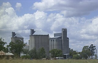
The Shire of Millmerran was a local government area in the Darling Downs region of Queensland, Australia, about 80 kilometres (50 mi) southwest of the regional city of Toowoomba. The shire covered an area of 4,520.8 square kilometres (1,745.5 sq mi), and existed as a local government entity from 1913 until 2008, when it amalgamated with several other councils in the Toowoomba area to become the Toowoomba Region.

Millmerran, known as Domville between 1 June 1889 and 16 November 1894, is a town and a locality in the Toowoomba Region, Queensland, Australia. In the 2016 census, the locality of Millmerran had a population of 1,563 people.

Karara is a rural town and locality in the Southern Downs Region, Queensland, Australia. In the 2016 census, the locality of Karara had a population of 123 people.
Top Camp is a locality in the Toowoomba Region, Queensland, Australia. In the 2021 census, Top Camp had a population of 902 people.
Prince Henry Heights is a residential locality on the outskirts of Toowoomba in the Toowoomba Region, Queensland, Australia. In the 2021 census, Prince Henry Heights had a population of 600 people.
Yandilla is a rural locality in the Toowoomba Region, Queensland, Australia. In the 2016 census Yandilla had a population of 46 people.

Pampas is a rural locality in the Toowoomba Region, Queensland, Australia. In the 2016 census, Pampas had a population of 62 people.

Southbrook is a rural town and locality in the Toowoomba Region, Queensland, Australia. In the 2021 census, the locality of Southbrook had a population of 626 people.

Broxburn is a rural locality in the Toowoomba Region, Queensland, Australia. In the 2016 census Broxburn had a population of 153 people.
Captains Mountain is a locality in the Toowoomba Region, Queensland, Australia. In the 2021 census, Captains Mountain had a population of 74 people.
Clontarf is a rural locality in the Toowoomba Region, Queensland, Australia. In the 2021 census, Clontarf had a population of 28 people.

Brookstead is a rural town and locality in the Toowoomba Region, Queensland, Australia. In the 2016 census, Brookstead had a population of 217 people.

Bongeen is a rural locality in the Toowoomba Region, Queensland, Australia. In the 2016 census, Bongeen had a population of 75 people.
Turallin is a rural town and locality in the Toowoomba Region, Queensland, Australia. In the 2021 census, the locality of Turallin had a population of 64 people.
Millmerran Woods is a locality in the Toowoomba Region, Queensland, Australia. In the 2016 census, Millmerran Woods had a population of 92 people.
Millmerran Downs is a locality in the Toowoomba Region, Queensland, Australia. In the 2016 census, Millmerran Downs had a population of 89 people.
Forest Ridge is a rural locality in the Toowoomba Region, Queensland, Australia. In the 2016 census, Forest Ridge had a population of 49 people.
Condamine Farms is a rural locality in the Toowoomba Region, Queensland, Australia. In the 2021 census, Condamine Farms had a population of 28 people.
The Pines is a locality in the Toowoomba Region, Queensland, Australia. In the 2016 census, The Pines had a population of 48 people.
Condamine Plains is a rural locality in the Toowoomba Region, Queensland, Australia. In the 2021 census, Condamine Plains had a population of 101 people.


