Douglas Queensland | |||||||||||||||
---|---|---|---|---|---|---|---|---|---|---|---|---|---|---|---|
Coordinates | 27°19′54″S151°55′03″E / 27.3316°S 151.9175°E | ||||||||||||||
Population | 112 (2016 census) [1] | ||||||||||||||
• Density | 2.276/km2 (5.90/sq mi) | ||||||||||||||
Postcode(s) | 4354 | ||||||||||||||
Area | 49.2 km2 (19.0 sq mi) | ||||||||||||||
Time zone | AEST (UTC+10:00) | ||||||||||||||
Location |
| ||||||||||||||
LGA(s) | Toowoomba Region | ||||||||||||||
State electorate(s) | Condamine | ||||||||||||||
Federal division(s) | |||||||||||||||
|
Douglas is a rural locality in the Toowoomba Region, Queensland, Australia. [2] In the 2016 census, Douglas had a population of 112 people. [1]
The Pechey-Maclagan Road runs through the locality from east to west. [3]
The predominant land use is grazing on native vegetation and crop growing. [4]
German settlers arrived in the district in 1875. A Lutheran congregation formed and worshipped in private homes, until the Jesus Lutheran Church was opened on 24 July 1882 on the Douglas Plainby Road ( 27°18′30″S151°55′08″E / 27.3084°S 151.9190°E ). The church was enlarged in 1938. [5]
On 21 December 1886, the Queensland Government reserved a 10-acre (4.0 ha) site for a cemetery. A section for Lutheran burials was created in the north-west of the site and a section for Catholic burials in the south. [6]
Gomoron Provisional School opened on 28 February 1889 under head teacher Mary Ann Frawley. It was most likely named after Gomaren Creek which flows through the area. [7] It became Goromon State School in 1890. In 1911, its name was changed to Douglas State School, [8] to avoid post office confusion as there was another place called Gomaren. [2] The school closed on 29 March 1959 with the remaining students transferred to Goombungee State School. [8] It was at Douglas Plainby Road (corner Guy Road, 27°19′16″S151°54′38″E / 27.3212°S 151.9106°E ). The building was relocated to becomes to Girl Guides building in Crows Nest. [9] [4] [10]
Pastor Wilhelm Georg Friedrich Poland was the Lutheran minister in Douglas from 1910 until his retirement in 1933. [5] During World War I, he was interned at Trial Bay Gaol as an enemy alien. [11]
In 1992, the Jesus Lutheran church building was relocated to be the chapel at the Ballon Outdoor Education Centre in the Barakula State Forest in Durah (Western Downs Region), operated by Concordia Lutheran College in Toowoomba. [12] In 2019, it was relocated to the Googa Outdoor Education Centre, operated by a number of Lutheran organisations, in the Googa State Forest on Nukku Road at Googa Creek (Townsville Region). [13] [14] The site of the church in Douglas is marked with a small monument. [15]
In the 2016 census, Douglas had a population of 112 people. [1]
There are a number of homesteads in the locality, including: [16]
There are no schools in Douglas. The nearest government primary school is Goombungee State School in neighbouring Goombungee to the west and Haden State School in Haden to the north-west. [4] The nearest government secondary schools are Crows Nest State School (to Year 10) in Crows Nest to the north-east and Highfields State Secondary College (to Year 12) in Highfields to the south-east. [4]
Douglas Cemetery is on Douglas Plainby Road ( 27°19′06″S151°54′44″E / 27.3182°S 151.9121°E ). [17] It is operated by the Toowoomba Regional Council. [6]
Cambooya is a rural town and locality in the Toowoomba Region, Queensland, Australia. In the 2016 census the locality of Cambooya had a population of 1,584 people.
Goombungee is a rural town and locality in the Toowoomba Region, Queensland, Australia. In the 2016 census the locality of Goombungee had a population of 1,026 people.
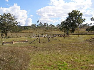
Haden is a rural town and locality in the Toowoomba Region, Queensland, Australia. In the 2016 census, the locality of Haden had a population of 195 people.
Geham is a rural locality in the Toowoomba Region, Queensland, Australia. In the 2021 census, Geham had a population of 470 people.
Aubigny is a rural town and locality in the Toowoomba Region, Queensland, Australia. In the 2016 census, the locality of Aubigny had a population of 254 people.
Maclagan is a rural town and locality in the Toowoomba Region, Queensland, Australia. In the 2016 census the locality of Maclagan had a population of 195 people.
Groomsville is a rural locality in the Toowoomba Region on the Darling Downs, Queensland, Australia. In the 2021 census, Groomsville had a population of 132 people.
Glencoe is a rural locality in the Toowoomba Region, Queensland, Australia. In the 2016 census, Glencoe had a population of 322 people.
Boodua is a rural locality in the Toowoomba Region, Queensland, Australia. In the 2016 census Boodua had a population of 93 people.
Bergen is a rural locality in the Toowoomba Region, Queensland, Australia. In the 2016 census, Bergen had a population of 68 people.
Greenwood is a rural locality in the Toowoomba Region, Queensland, Australia. In the 2016 census, Greenwood had a population of 40 people.
Norwin is a rural locality in the Toowoomba Region, Queensland, Australia. In the 2016 census, Norwin had a population of 94 people.
Silverleigh is a rural locality in the Toowoomba Region, Queensland, Australia. In the 2016 census, Silverleigh had a population of 71 people.
Gilla is a rural locality in the Toowoomba Region, Queensland, Australia. In the 2016 census Gilla had a population of 32 people.
Muniganeen is a rural locality in the Toowoomba Region, Queensland, Australia. In the 2021 census, Muniganeen had a population of 40 people.
Highland Plains is a rural locality in the Toowoomba Region, Queensland, Australia. In the 2021 census, Highland Plains had a population of 60 people.
Doctor Creek is a rural locality in the Toowoomba Region, Queensland, Australia. In the 2016 census, Doctor Creek had a population of 37 people.
Mount Darry is a rural locality in the Toowoomba Region, Queensland, Australia. In the 2016 census Mount Darry had a population of 35 people.
Glenaven is a rural locality in the Toowoomba Region, Queensland, Australia. In the 2016 census, Glenaven had a population of 79 people.
The roads that join the towns of Dalby, Toowoomba and Cooyar form a triangle that encloses some of the most fertile land on the Darling Downs in Queensland, Australia. These roads are the Warrego Highway, New England Highway and Dalby–Cooyar Road. Pechey–Maclagan Road forms a large part of a group of roads that bisect the triangle from east to west, and is also part of one of the groups of roads that bisect from south to north.