Highland Plains, Queensland (Toowoomba Region)

Last updated

Highland Plains
Queensland
Highland Plains School (1918-1945).jpg
Highland Plains School (1918-1945)
Australia Queensland location map.svg
Red pog.svg
Highland Plains
Coordinates 27°16′28″S151°45′35″E / 27.2744°S 151.7597°E / -27.2744; 151.7597 (Highland Plains (centre of locality))
Population60 (2021 census) [1]
 • Density1.03/km2 (2.68/sq mi)
Postcode(s) 4401
Area58.0 km2 (22.4 sq mi)
Time zone AEST (UTC+10:00)
Location
LGA(s) Toowoomba Region
State electorate(s) Condamine
Federal division(s) Groom
Suburbs around Highland Plains:
Rosalie Plains Mount Darry Kilbirnie
Balgowan
Muldu
Highland Plains Goombungee
Acland Silverleigh Goombungee

Highland Plains is a rural locality in the Toowoomba Region, Queensland, Australia. [2] In the 2021 census, Highland Plains had a population of 60 people. [1]

Contents

Geography

The Oakey–Cooyar Road runs through from south to west, locally known as Pechey - Maclagan Road from where it turns west. Pechey - Maclagan Road enters from the south-east and joins Oakey–Cooyar Road. [3]

There are coal mines in the south-west of the locality operated by New Acland Coal Pty Ltd. Apart from these, the rest of the locality is a mix of grazing on native vegetation and crop growing. [4]

History

Local residents applied for a school on 5 July 1916. Highland Plains State School opened on 3 July 1918 under head teacher Alice Rose Randall. It was without a teacher from 10 October 1944, officially closing on 14 May 1945, with the remaining students transferred to Goombungee State School. [5] [6] It was at 622 Highland Plain Road ( 27°17′08″S151°46′59″E / 27.28550°S 151.78319°E / -27.28550; 151.78319 (Highland Plains State School (former)) ). [7] [8] [9]

Demographics

In the 2016 census, Highland Plains had a population of 41 people. [10]

In the 2021 census, Highland Plains had a population of 60 people. [1]

Education

There are no schools in Highland Plains. The nearest government primary schools are Goombungee State School in neighbouring Goombungee to the east, Kulpi State School in Kulpi to the north-west, and Haden State School in Haden to the north-east. The nearest government secondary schools are Quinalow State School (to Year 10) in Quinalow to the north-west, Oakey State High School (to Year 12) in Oakey to the south. [11]

Related Research Articles

Peranga is a rural town and locality in the Toowoomba Region, Queensland, Australia. In the 2016 census the locality of Peranga had a population of 85 people.

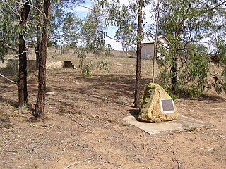
The Cooyar railway line was a branch line in the Darling Downs region of Queensland, Australia. The small town of Cooyar is about halfway to Kingaroy in the South Burnett Region. A plan to connect Kingaroy to the south via Cooyar did not eventuate and left Cooyar at the terminus of a branch line running from Oakey west of Toowoomba.

<span class="mw-page-title-main">Goombungee, Queensland</span> Town in Queensland, Australia

Goombungee is a rural town and locality in the Toowoomba Region, Queensland, Australia. In the 2016 census the locality of Goombungee had a population of 1,026 people.

<span class="mw-page-title-main">Quinalow</span> Town in Queensland, Australia

Quinalow is a rural town and locality in the Toowoomba Region, Queensland, Australia. In the 2016 census the locality of Quinalow had a population of 173 people.

<span class="mw-page-title-main">Maclagan, Queensland</span> Town in Queensland, Australia

Maclagan is a rural town and locality in the Toowoomba Region, Queensland, Australia. In the 2016 census the locality of Maclagan had a population of 195 people.

Kulpi is a rural town and locality in the Toowoomba Region, Queensland, Australia. In the 2016 census, the locality of Kulpi had a population of 77 people.

Evergreen is a rural town and locality in the Toowoomba Region, Queensland, Australia. In the 2016 census, the locality of Evergreen had a population of 45 people.

Greenwood is a rural locality in the Toowoomba Region, Queensland, Australia. In the 2021 census, Greenwood had a population of 34 people.

Nutgrove is a rural locality in the Toowoomba Region, Queensland, Australia. In the 2016 census Nutgrove had a population of 32 people.

<span class="mw-page-title-main">Silverleigh, Queensland</span> Suburb of Toowoomba Region, Queensland, Australia

Silverleigh is a rural locality in the Toowoomba Region, Queensland, Australia. In the 2016 census, Silverleigh had a population of 71 people.

<span class="mw-page-title-main">Douglas, Queensland (Toowoomba Region)</span> Suburb of Toowoomba Region, Queensland, Australia

Douglas is a rural locality in the Toowoomba Region, Queensland, Australia. In the 2021 census, Douglas had a population of 152 people.

<span class="mw-page-title-main">Muniganeen, Queensland</span> Suburb of Toowoomba Region, Queensland, Australia

Muniganeen is a rural locality in the Toowoomba Region, Queensland, Australia. In the 2021 census, Muniganeen had a population of 40 people.

Sabine is a rural locality in the Toowoomba Region, Queensland, Australia. In the 2021 census, Sabine had a population of 3 people.

Rosalie Plains is a rural locality in the Toowoomba Region, Queensland, Australia. In the 2021 census, Rosalie Plains had a population of 54 people.

Cutella is a rural locality in the Toowoomba Region, Queensland, Australia. In the 2021 census, Cutella had a population of 45 people.

Mount Darry is a rural locality in the Toowoomba Region, Queensland, Australia. In the 2016 census Mount Darry had a population of 35 people.

Narko is a rural locality in the Toowoomba Region, Queensland, Australia. In the 2021 census, Narko had a population of 16 people.

Oakey–Cooyar Road is a continuous 58.8 kilometres (36.5 mi) road route in the Darling Downs and Toowoomba regions of Queensland, Australia. The entire route is signed as State Route 68. It is a state-controlled part regional and part district road. It provides an alternate route between the Warrego Highway and the New England Highway, bypassing Toowoomba.

The roads that join the towns of Dalby, Oakey and Cooyar form a triangle that encloses some of the most fertile land on the Darling Downs in Queensland, Australia. These roads are the Warrego Highway, Oakey–Cooyar Road and Dalby–Cooyar Road. Several of the more significant internal roads intersect with Dalby–Cooyar Road, and these are briefly described in this article, along with some significant external roads.

The roads that join the towns of Dalby, Toowoomba and Cooyar form a triangle that encloses some of the most fertile land on the Darling Downs in Queensland, Australia. These roads are the Warrego Highway, New England Highway and Dalby–Cooyar Road. Pechey–Maclagan Road forms a large part of a group of roads that bisect the triangle from east to west, and is also part of one of the groups of roads that bisect from south to north.

References

  1. 1 2 3 Australian Bureau of Statistics (28 June 2022). "Highland Plains (SAL)". 2021 Census QuickStats. Retrieved 28 February 2023. OOjs UI icon edit-ltr-progressive.svg
  2. "Highland Plains – locality in Toowoomba Region (entry 47969)". Queensland Place Names. Queensland Government . Retrieved 11 June 2019.
  3. Highland Plains, Queensland (Map). OpenStreetMap. Archived from the original on 18 January 2022. Retrieved 18 January 2022.
  4. "Queensland Globe". State of Queensland . Retrieved 24 September 2023.
  5. Queensland Family History Society (2010), Queensland schools past and present (Version 1.01 ed.), Queensland Family History Society, ISBN   978-1-921171-26-0
  6. Ledwidge, Jean (1981), The centenary of Goombungee State School : 1881-1981 : souvenir booklet, Goombungee State School, pp. 50–53, archived from the original on 23 January 2024 via State Library of Queensland
  7. "Jondaryan" (Map). Queensland Government. 1943. Archived from the original on 1 September 2023. Retrieved 24 September 2023.
  8. "Parish of King, County of Aubigny" (Map). Queensland Government. 1942. Archived from the original on 24 September 2023. Retrieved 24 September 2023.
  9. "Queensland Globe". State of Queensland . Retrieved 24 September 2023.
  10. Australian Bureau of Statistics (27 June 2017). "Highland Plains (SSC)". 2016 Census QuickStats. Retrieved 20 October 2018. OOjs UI icon edit-ltr-progressive.svg
  11. "Layers: Locality; Schools and school catchments". Queensland Globe. Queensland Government. Archived from the original on 19 December 2017. Retrieved 24 September 2023.

Further reading