Meringandan West, Queensland

Last updated

Meringandan West
Queensland
Clifford Street Meringandan West.jpg
Clifford Street, 2014
Australia Queensland location map.svg
Red pog.svg
Meringandan West
Coordinates 27°25′00″S151°53′32″E / 27.4166°S 151.8922°E / -27.4166; 151.8922 Coordinates: 27°25′00″S151°53′32″E / 27.4166°S 151.8922°E / -27.4166; 151.8922
Population2,211 (2016 census) [1]
 • Density133.2/km2 (345.0/sq mi)
Postcode(s) 4352
Area16.6 km2 (6.4 sq mi)
Time zone AEST (UTC+10:00)
LGA(s) Toowoomba Region
State electorate(s) Condamine
Federal division(s) Groom
Suburbs around Meringandan West:
Muniganeen Muniganeen Meringandan
Yalangur
Gowrie Little Plain
Meringandan West Meringandan
Lilyvale Glencoe
Cawdor
Woolmer

Meringandan West is a rural locality in the Toowoomba Region, Queensland, Australia. [2] In the 2016 census, Meringandan West had a population of 2211 people. [1]

Contents

Geography

Meringandan West is on Darling Downs in southern Queensland.[ citation needed ]

The majority of the eastern boundary is aligned with Meringandan Creek[ citation needed ]

Mount Muniganeen is in the north of Meringandan West and rises to heights greater than 600 metres (2,000 ft) above sea level.[ citation needed ]

Central parts of the area have been developed into a residential estate. Meringandan West was part of a local planning scheme developed and adopted by the Toowoomba Region Council in August 2013. [3]

Meringandan cemetery is located in Peters Road.[ citation needed ]

History

The name Meringandan is taken from the former railway station, which in turn is a Gooneburra word meaning red soil or broken clay. [2]

Meringandan State School opened on 24 January 1876. [4] It was built during 1875 by Jack Maag. Isaac John Thomas was appointed the first head teacher of the school,. The enrolment for that year was 80 pupils.[ citation needed ] It is now within the suburb boundaries of Meringandan West. [5]

Facilities

There are several scattered parks. The most notable park is Lilyvale Oval, which has an unlit sporting field (cricket pitch), which is used for a radio controlled model aircraft flying field on occasion by the local inhabitants and visitors also, probably, operates as a flood basic, a playground, a picnic table, and a community shed, as well as a BBQ and toilet block for public use.[ citation needed ]

Next to this park, is a shed, from which operates the local rural fire brigade.[ citation needed ]

Lilyvale Oval, was once used for an annual rodeo hosted by the P&C of Meringandan State School. The P&C also used to run Christmas Carols in the park, but they were also cancelled for lack of funding. Small church groups still used the park for annual carols nights. [6]

In the east of Meringandan West, there is a small cemetery.[ citation needed ]

Education

Meringandan State School is a government primary (Prep-6) school for boys and girls at 10 School Road ( 27°25′49″S151°54′18″E / 27.4303°S 151.9050°E / -27.4303; 151.9050 (Meringandan State School) ). [7] [8] In 2017, the school had an enrolment of 240 students with 20 teachers (15 full-time equivalent) and 14 non-teaching staff (8 full-time equivalent). [9]

Related Research Articles

Clifton, Queensland Town in Queensland, Australia

Clifton is a rural town and locality in the Toowoomba Region, Queensland, Australia. In the 2016 census, Clifton had a population of 1,456 people.

Glenvale, Queensland Suburb of Toowoomba, Queensland, Australia

Glenvale is a rural locality in the Toowoomba Region, Queensland, Australia. It is a suburb of Toowoomba. In the 2016 census, Glenvale had a population of 6,353 people.

Meringandan Suburb of Toowoomba Region, Queensland, Australia

Meringandan is a rural locality in the Toowoomba Region, Queensland, Australia. In the 2016 census, Meringandan had a population of 487 people.

Highfields, Queensland Town in Queensland, Australia

Highfields is a rural town and locality in the Toowoomba Region, Queensland, Australia. In the 2016 census, the locality of Highfields had a population of 8,131 people. In 2017, it was the fastest growing area in Toowoomba. At 30 June 2019, the estimated resident population for the Highfields was 14,298.

Gowrie Junction, Queensland Suburb of Toowoomba Region, Queensland, Australia

Gowrie Junction is a rural locality in the Toowoomba Region, Queensland, Australia. It is north-west of Toowoomba. In the 2016 census, Gowrie Junction had a population of 2,120 people. The town of Gowrie is in the eastern part of the locality.

Greenmount, Queensland (Toowoomba Region) Town in Queensland, Australia

Greenmount is a rural town and locality in the Toowoomba Region, Queensland, Australia. In the 2016 census the locality of Greenmount had a population of 699 people.

Bell, Queensland Town in Queensland, Australia

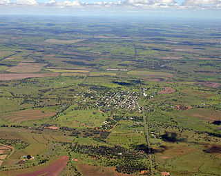
Bell is a rural town and locality in the Western Downs Region, Queensland, Australia. In the 2016 census the locality of Bell had a population of 502 people.

Millmerran, Queensland Town in Queensland, Australia

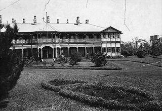
Millmerran, known as Domville between 1 June 1889 and 16 November 1894, is a town and a locality in the Toowoomba Region, Queensland, Australia. In the 2016 census, Millmerran had a population of 1,563 people.

Kingsthorpe, Queensland Town in Queensland, Australia

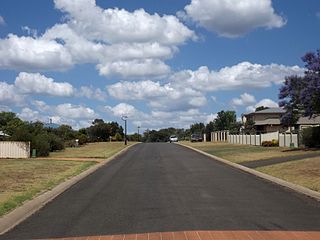
Kingsthorpe is a rural town and locality in the Toowoomba Region, Queensland, Australia. In the 2016 census, the locality of Kingsthorpe had a population of 1,867 people.

Centenary Heights, Queensland Suburb of Toowoomba, Queensland, Australia

Centenary Heights is a residential locality in Toowoomba within the Toowoomba Region, Queensland, Australia. In the 2016 census, Centenary Heights had a population of 6,063 people.

East Toowoomba, Queensland Suburb of Toowoomba, Queensland, Australia

East Toowoomba is a residential locality in Toowoomba in the Toowoomba Region, Queensland, Australia. In the 2016 census, East Toowoomba had a population of 5,244 people.

Wilsonton Heights, Queensland Suburb of Toowoomba, Queensland, Australia

Wilsonton Heights is a residential locality of Toowoomba in the Toowoomba Region, Queensland, Australia. In the 2016 census, Wilsonton Heights had a population of 2,669 people.

Middle Ridge, Queensland Suburb of Toowoomba, Queensland, Australia

Middle Ridge is a residential locality of Toowoomba in the Toowoomba Region, Queensland, Australia. In the 2016 census, Middle Ridge had a population of 7,141 people.

Newtown, Queensland (Toowoomba) Suburb of Toowoomba, Queensland, Australia

Newtown is a residential locality in Toowoomba in the Toowoomba Region, Queensland, Australia. In the 2016 census, Newtown had a population of 9,596 people.

Rangeville, Queensland Suburb of Toowoomba, Queensland, Australia

Rangeville is a residential locality in Toowoomba in the Toowoomba Region, Queensland, Australia. In the 2016 census, Rangeville had a population of 8,312 people.

Jondaryan, Queensland Town in Queensland, Australia

Jondaryan is a rural town and locality in the Toowoomba Region, Queensland, Australia. In the 2016 census the locality of Jondaryan had a population of 385 people.

East Greenmount, Queensland Suburb of Toowoomba Region, Queensland, Australia

East Greenmount is a rural town and locality in the Toowoomba Region, Queensland, Australia. In the 2016 census the locality of East Greenmount had a population of 361 people.

Kulpi, Queensland Suburb of Toowoomba Region, Queensland, Australia

Kulpi is a rural town and locality in the Toowoomba Region, Queensland, Australia. In the 2016 census, Kulpi had a population of 77 people.

Kleinton, Queensland Suburb of Toowoomba Region, Queensland, Australia

Kleinton is a rural locality in the Toowoomba Region, Queensland, Australia. In the 2016 census, Kleinton had a population of 1,617 people.

Brookstead, Queensland Town in Queensland, Australia

Brookstead is a rural town and locality in the Toowoomba Region, Queensland, Australia. In the 2016 census, Brookstead had a population of 217 people.

References

  1. 1 2 Australian Bureau of Statistics (27 June 2017). "Meringandan West (SSC)". 2016 Census QuickStats. Retrieved 20 October 2018. OOjs UI icon edit-ltr-progressive.svg
  2. 1 2 "Meringandan West – locality in Toowoomba Region (entry 49183)". Queensland Place Names. Queensland Government . Retrieved 17 November 2019.
  3. "Highfields, Meringandan and Meringandan West Local Plan". Local plans. Toowoomba Regional Council. 22 August 2013. Archived from the original on 27 November 2014. Retrieved 16 November 2014.
  4. Queensland Family History Society (2010), Queensland schools past and present (Version 1.01 ed.), Queensland Family History Society, ISBN   978-1-921171-26-0
  5. "Queensland Globe". State of Queensland . Retrieved 30 December 2021.
  6. A Meringandan Resident
  7. "State and non-state school details". Queensland Government. 9 July 2018. Archived from the original on 21 November 2018. Retrieved 21 November 2018.
  8. "Meringandan State School". Archived from the original on 12 July 2012. Retrieved 21 November 2018.
  9. "ACARA School Profile 2017". Archived from the original on 22 November 2018. Retrieved 22 November 2018.